Freeburg is a village in St. Clair County, Illinois, United States. Located within Greater St. Louis, it is a southeastern exurb with many residents commuting to Downtown St. Louis or the Belleville area for employment. As of 2010, Freeburg had a population of 4,354.
| Name: | Freeburg village |
|---|---|
| LSAD Code: | 47 |
| LSAD Description: | village (suffix) |
| State: | Illinois |
| County: | St. Clair County |
| Elevation: | 518 ft (158 m) |
| Total Area: | 7.10 sq mi (18.39 km²) |
| Land Area: | 6.84 sq mi (17.73 km²) |
| Water Area: | 0.26 sq mi (0.66 km²) |
| Total Population: | 4,582 |
| Population Density: | 669.49/sq mi (258.47/km²) |
| Area code: | 618 |
| FIPS code: | 1727806 |
| GNISfeature ID: | 2398923 |
| Website: | http://www.freeburg.com |
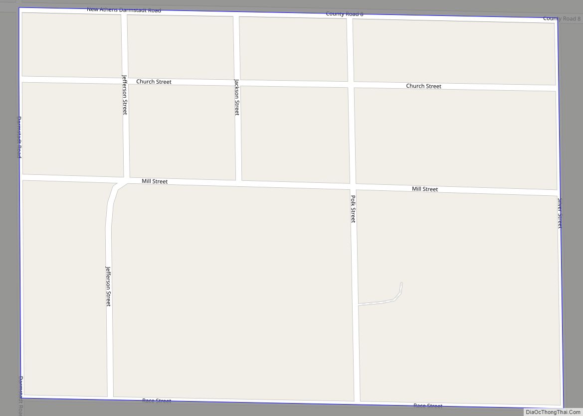
Online Interactive Map
Click on ![]() to view map in "full screen" mode.
to view map in "full screen" mode.
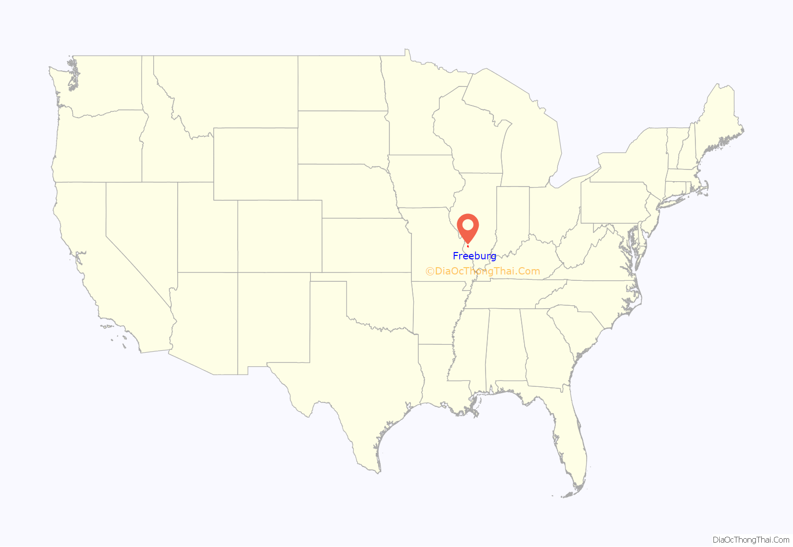
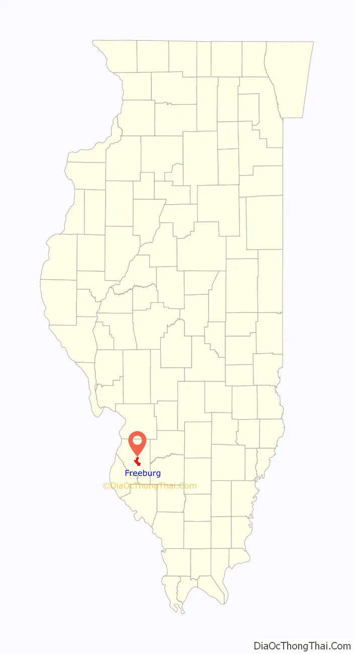
Freeburg location map. Where is Freeburg village?
History
Freeburg lies in the fertile and rolling southern Illinois plains between the Kaskaskia and Mississippi Rivers. It was platted in 1836 as the town of Urbana by immigrants to this area from Virginia around 1800. The first European settlers of Freeburg were of English and Irish ancestry.
There were five migratory Native American tribes that crisscrossed each other in Illinois; the Peorias, Cahokias, Kaskaskias, Tamaroas, and Michiganics. It is said that Turkey Hill to the north of town was a popular Native campground that also attracted many early settlers because of the view it provided of the surrounding countryside. The last Indian tribes left this area by 1820.
Attracted by the abundance of coal, the availability of cheap and fertile farmland, as well as the proximity to the frontier city of St. Louis, which was located only 20 miles to the northwest of the area, large-scale German migrations to the area began around 1830 and continued at a consistent rate for the rest of the century.
The old “Plank Road” was built in the 1850s, and, for 35 cents, travelers could ride from Belleville to Freeburg in “comfort” without potholes on what is now known as the old Freeburg Road. Abraham Lincoln is said to have used this road on at least one occasion.
In 1851, the post office came, and when it was found that there was another town of Urbana in Illinois, the city fathers changed the name in 1859 to Freeburg after the city of Freiburg in the region of Baden, Germany, from which some of the early settlers had come.
The town was incorporated in 1867 with 808 residents. The railroad came in 1869 and exchanged owners several times before being sold to the Illinois Central.
In the heyday of independent coal mines, as many as 1500 miners lived here, and in 1874, there were 10 hotels for them to choose from if they could not find more permanent lodging. With the closing of the Peabody River King Mine just east of Freeburg in 1989, coal no longer played a dominant role in the local economy.
The River King Mine Train at Six Flags St. Louis was named for the River King Coal Mine located in Freeburg. The 2,000-acre mine site was operated by Peabody Coal (now named Peabody Energy) from 1957 to 1989. After the closure of the large mine in 1989, Peabody donated some 1,800 acres of the 2,000-acre site to the Illinois Department of Natural Resources in 1994. The site is now the state owned and managed Peabody-River King State Fish and Wildlife Area and is open to the public for use by anglers, hunters, and other outdoor enthusiasts for recreational opportunities in the southeastern portion of Greater St. Louis.
Today, Freeburg remains a community with a highly diversified business economy that also serves as a bedroom community for Belleville and the St. Louis metroplex, while still providing essential services needed in any small community.
Freeburg Road Map
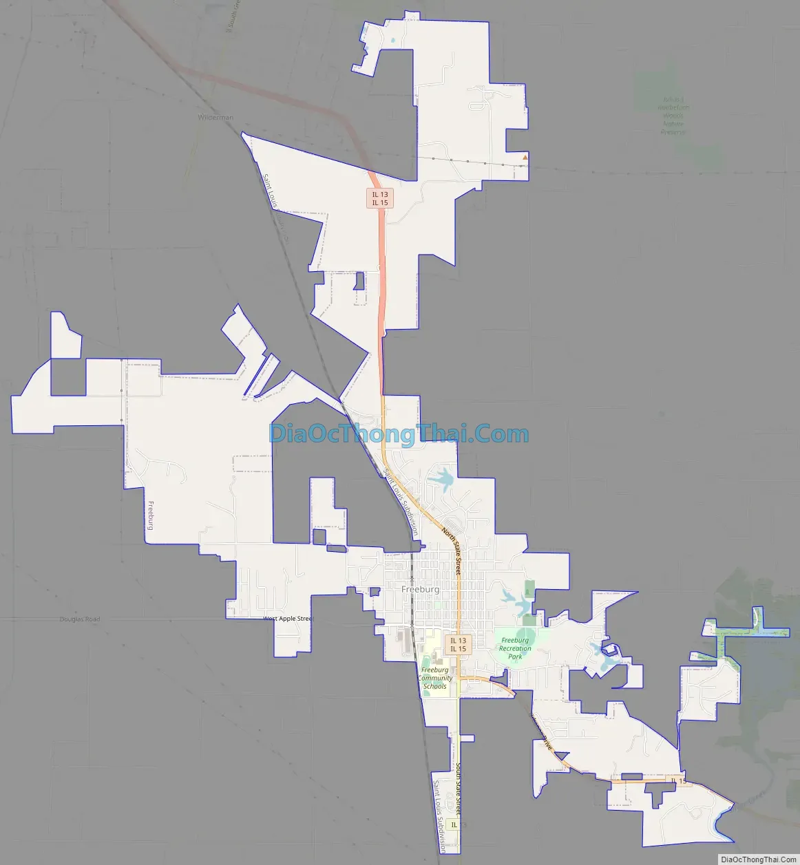
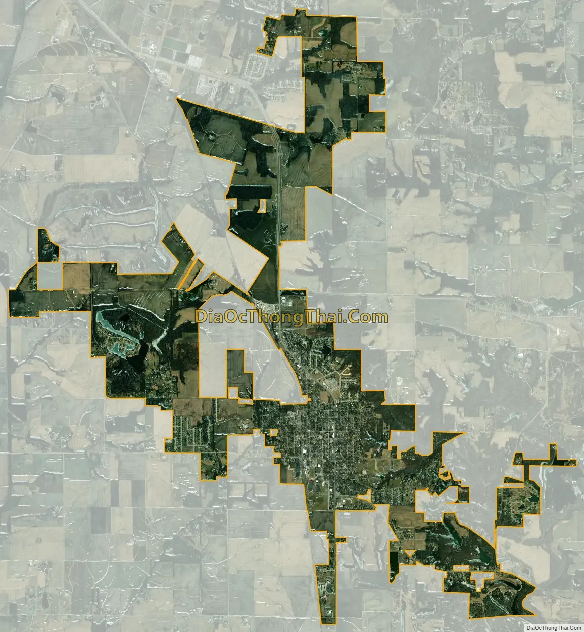
Freeburg city Satellite Map
Geography
Freeburg is located at 38°25′37″N 89°54′38″W / 38.42694°N 89.91056°W / 38.42694; -89.91056 (38.426949, -89.910451).
According to the 2010 census, Freeburg has a total area of 7.025 square miles (18.19 km), of which 6.77 square miles (17.53 km) (or 96.37%) is land and 0.255 square miles (0.66 km) (or 3.63%) is water.
Freeburg has historically been a farming community, but as the nearby cities of Belleville and Fairview Heights have grown, parts of Freeburg have been developed with subdivisions that resemble a suburb.
Freeburg enjoys a low crime rate, particularly compared to the cities immediately to its north, and land values have attracted some commuters who live in Freeburg and work the short distance to St. Louis, Missouri.
See also
Map of Illinois State and its subdivision:- Adams
- Alexander
- Bond
- Boone
- Brown
- Bureau
- Calhoun
- Carroll
- Cass
- Champaign
- Christian
- Clark
- Clay
- Clinton
- Coles
- Cook
- Crawford
- Cumberland
- De Kalb
- De Witt
- Douglas
- Dupage
- Edgar
- Edwards
- Effingham
- Fayette
- Ford
- Franklin
- Fulton
- Gallatin
- Greene
- Grundy
- Hamilton
- Hancock
- Hardin
- Henderson
- Henry
- Iroquois
- Jackson
- Jasper
- Jefferson
- Jersey
- Jo Daviess
- Johnson
- Kane
- Kankakee
- Kendall
- Knox
- La Salle
- Lake
- Lake Michigan
- Lawrence
- Lee
- Livingston
- Logan
- Macon
- Macoupin
- Madison
- Marion
- Marshall
- Mason
- Massac
- McDonough
- McHenry
- McLean
- Menard
- Mercer
- Monroe
- Montgomery
- Morgan
- Moultrie
- Ogle
- Peoria
- Perry
- Piatt
- Pike
- Pope
- Pulaski
- Putnam
- Randolph
- Richland
- Rock Island
- Saint Clair
- Saline
- Sangamon
- Schuyler
- Scott
- Shelby
- Stark
- Stephenson
- Tazewell
- Union
- Vermilion
- Wabash
- Warren
- Washington
- Wayne
- White
- Whiteside
- Will
- Williamson
- Winnebago
- Woodford
- Alabama
- Alaska
- Arizona
- Arkansas
- California
- Colorado
- Connecticut
- Delaware
- District of Columbia
- Florida
- Georgia
- Hawaii
- Idaho
- Illinois
- Indiana
- Iowa
- Kansas
- Kentucky
- Louisiana
- Maine
- Maryland
- Massachusetts
- Michigan
- Minnesota
- Mississippi
- Missouri
- Montana
- Nebraska
- Nevada
- New Hampshire
- New Jersey
- New Mexico
- New York
- North Carolina
- North Dakota
- Ohio
- Oklahoma
- Oregon
- Pennsylvania
- Rhode Island
- South Carolina
- South Dakota
- Tennessee
- Texas
- Utah
- Vermont
- Virginia
- Washington
- West Virginia
- Wisconsin
- Wyoming