Glencoe (/ˈɡlɛnˌkoʊ/) is a lakefront village in northeastern Cook County, Illinois, United States. As of the 2020 census, the population was 8,849. Glencoe is part of Chicago’s North Shore and is located within the New Trier High School District. Glencoe has the eighth highest income per household among municipalities in the U.S. with greater than 2,000 homes.
| Name: | Glencoe village |
|---|---|
| LSAD Code: | 47 |
| LSAD Description: | village (suffix) |
| State: | Illinois |
| County: | Cook County |
| Incorporated: | 1869 |
| Total Area: | 3.78 sq mi (9.79 km²) |
| Land Area: | 3.72 sq mi (9.63 km²) |
| Water Area: | 0.06 sq mi (0.16 km²) 1.59% |
| Total Population: | 8,849 |
| Population Density: | 2,378.76/sq mi (918.9/km²) |
| Area code: | 847 and 224 |
| FIPS code: | 1729652 |
| Website: | www.villageofglencoe.org |
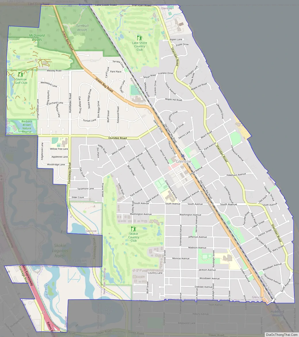
Online Interactive Map
Click on ![]() to view map in "full screen" mode.
to view map in "full screen" mode.
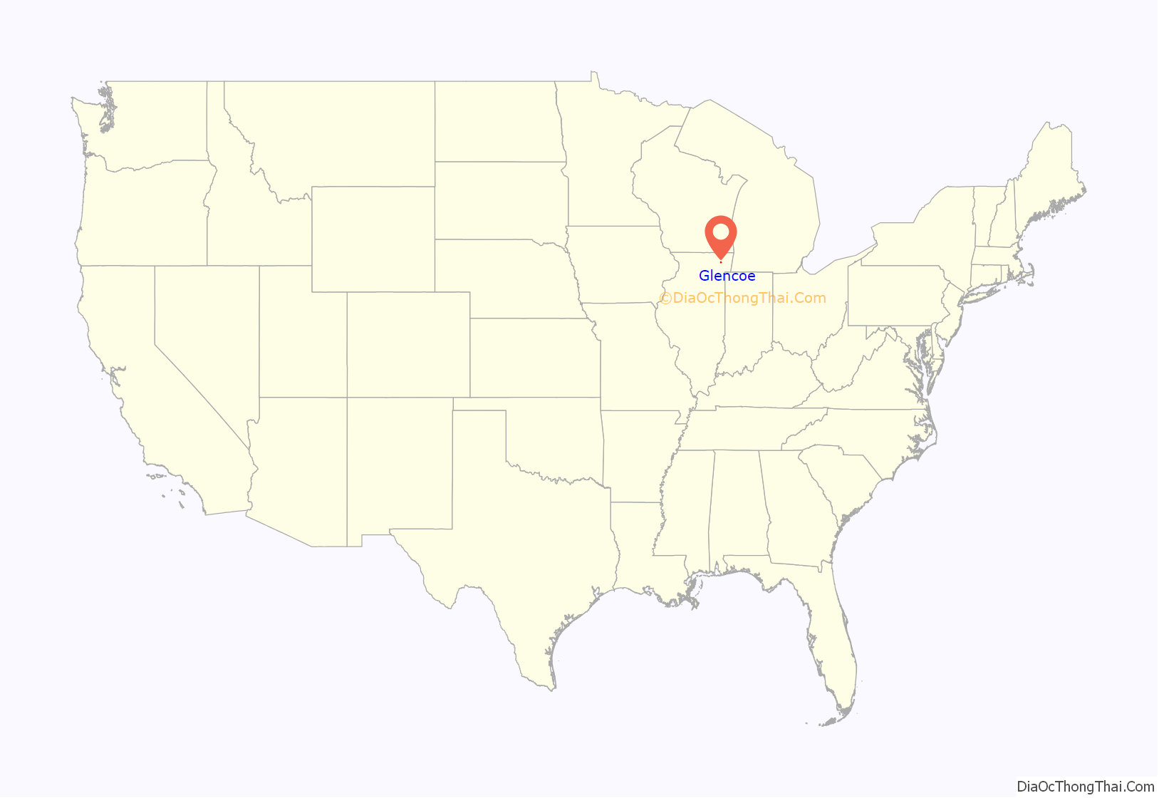
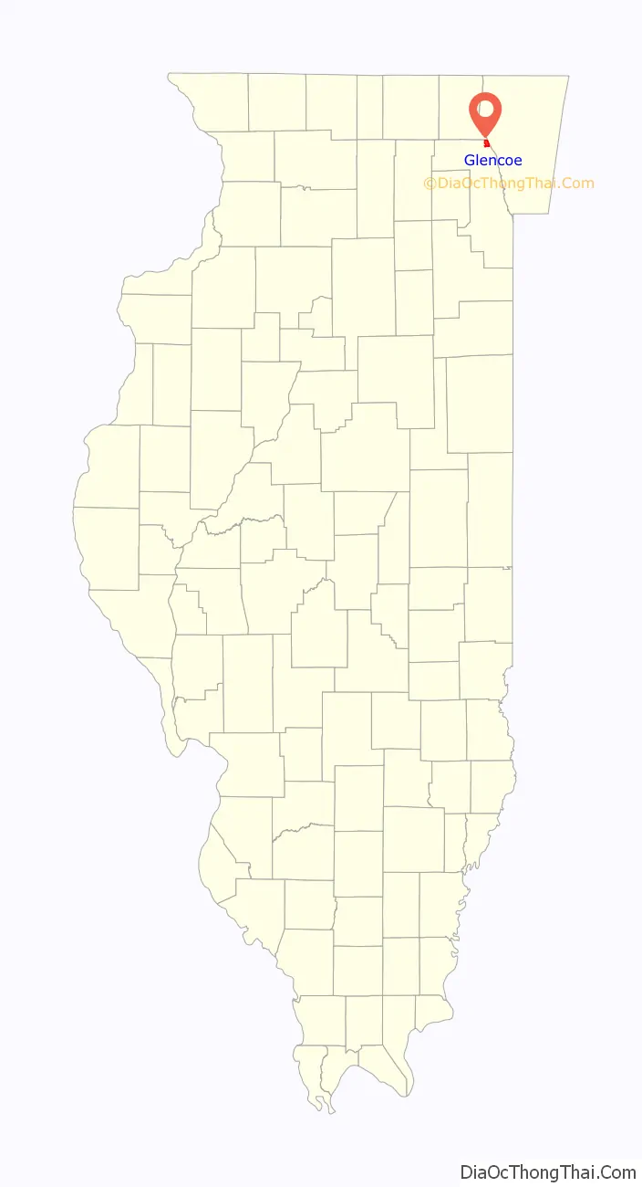
Glencoe location map. Where is Glencoe village?
History
Opinions differ about the origins of the village’s name. Some attribute it to an early resident, Matthew Coe. Others say it is named for the area of Scotland of the same name. It developed in the late 19th century around a railroad stop. Former Chicago mayor Walter S. Gurnee had become president of the line connecting Chicago and Milwaukee, and often bought up and developed land around railroad stops. Thus, one historian believes the name derives from the maiden name of Gurnee’s wife, since Gurnee bought the land in 1867 and began subdivision, although financial problems prevented him from building a home there and he returned to New York for his final years. The village’s first seal was based on the seal of Glencoe, Scotland.
During the late 19th and early 20th centuries, many elegant homes were built in Glencoe. Most notably, the village is home to the world’s third largest collection of Frank Lloyd Wright structures: the Ravine Bluff subdivision contains seven houses, a concrete bridge and three sculptural markers. There are also two larger, individually built homes, located nearby Ravine Bluffs. In addition to Wright, there are houses designed by Howard Van Doren Shaw, David Adler, Robert E. Seyfarth and George Washington Maher, among others.
Glencoe has a Village Manager form of government. It had one of the first public safety departments (combined police/fire/paramedic). In 1921 it adopted the first zoning code in Illinois. Its land-use plan, adopted in 1940, has been adhered to with minor changes since then. Most all nonconforming uses have been eliminated through attrition and it has developed to the allowed uses outlined on the 1940 zoning map. It is predominantly a single-family residential area, with no industrial uses. It has a small cohesive central business district that provides most basic services, including post office, library, Village Hall, performing arts theatre, train station (to Chicago), and other shopping needs.
Since the late 20th century, for 20 years the village has had redevelopment of smaller homes. They have been torn down and replaced by larger homes, spurring debate on historic preservation, the effects of an increasingly wealthy demographic, and rising property taxes.
In addition to such private development, during this time, the village has completed major reconstruction of its street and sidewalk network. The village installed brick sidewalks and period street lights in the business district. Many public buildings have been or are being remodelled or expanded, including the public schools, Village Hall, library, Park District Community Center, and refrigerated outdoor ice rink. The building housing the Glencoe Woman’s Club (formerly Woman’s Library Club) was torn down. It was replaced by a new building, designed by Jeanne Gang, that houses Writers Theatre. The new building opened to the public in 2016. The private golf clubs (Lake Shore Country Club and Skokie Country Club) have also conducted major remodeling, additions, and reconstruction.
Glencoe Road Map
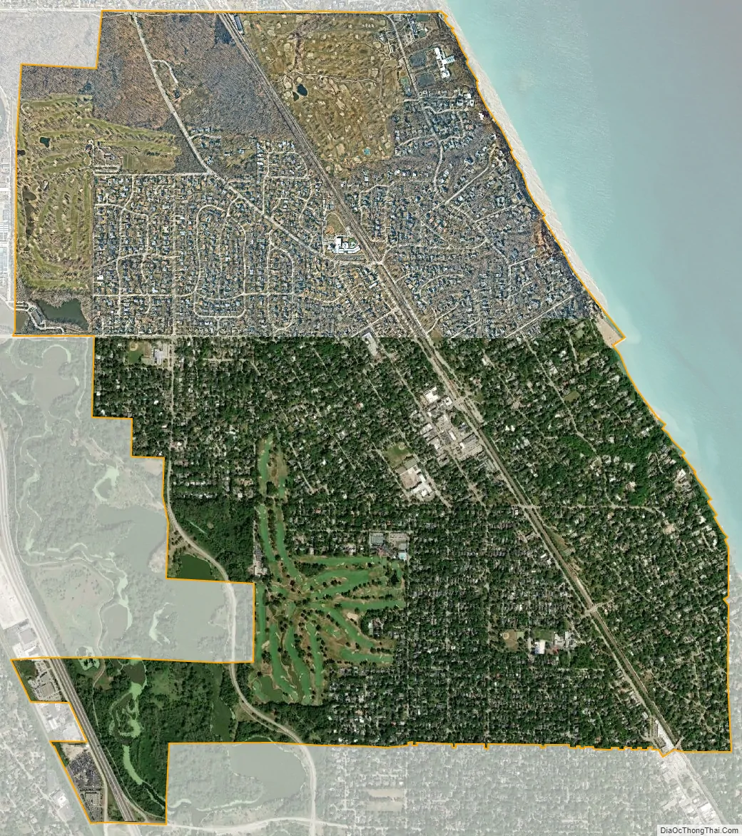
Glencoe city Satellite Map
Geography
Glencoe is located at 42°7′53″N 87°45′39″W / 42.13139°N 87.76083°W / 42.13139; -87.76083 (42.131602, -87.761026).
According to the 2021 census gazetteer files, Glencoe has a total area of 3.78 square miles (9.79 km), of which 3.72 square miles (9.63 km) (or 98.39%) is land and 0.06 square miles (0.16 km) (or 1.61%) is water.
Glencoe is located on the west side of Lake Michigan. It is separated from suburbs to the north and west by more than 1,200 acres (490 ha) of the Cook County Forest Preserve natural forest area. Three golf clubs also buffer it, with the private Lake Shore Country Club on the north, the public Glencoe Golf Club (operated by the village of Glencoe) on the northwest, and the private Skokie Country Club on the west.
The village is surrounded on three sides by upper-income communities, with Highland Park on the north, Northbrook on the west, and Winnetka to the south. The Skokie Lagoons are located in the forest preserve to the immediate west of the village. The same forest preserve has a bicycle trail that connects to other forest preserves to the south. In the village, the Greenbay Trail allows bicyclists to travel as far south as Wilmette and north past Lake Forest. The highest point of elevation in Glencoe is 690 feet (210 m) above sea level along Green Bay Road in the northern part of the village.
See also
Map of Illinois State and its subdivision:- Adams
- Alexander
- Bond
- Boone
- Brown
- Bureau
- Calhoun
- Carroll
- Cass
- Champaign
- Christian
- Clark
- Clay
- Clinton
- Coles
- Cook
- Crawford
- Cumberland
- De Kalb
- De Witt
- Douglas
- Dupage
- Edgar
- Edwards
- Effingham
- Fayette
- Ford
- Franklin
- Fulton
- Gallatin
- Greene
- Grundy
- Hamilton
- Hancock
- Hardin
- Henderson
- Henry
- Iroquois
- Jackson
- Jasper
- Jefferson
- Jersey
- Jo Daviess
- Johnson
- Kane
- Kankakee
- Kendall
- Knox
- La Salle
- Lake
- Lake Michigan
- Lawrence
- Lee
- Livingston
- Logan
- Macon
- Macoupin
- Madison
- Marion
- Marshall
- Mason
- Massac
- McDonough
- McHenry
- McLean
- Menard
- Mercer
- Monroe
- Montgomery
- Morgan
- Moultrie
- Ogle
- Peoria
- Perry
- Piatt
- Pike
- Pope
- Pulaski
- Putnam
- Randolph
- Richland
- Rock Island
- Saint Clair
- Saline
- Sangamon
- Schuyler
- Scott
- Shelby
- Stark
- Stephenson
- Tazewell
- Union
- Vermilion
- Wabash
- Warren
- Washington
- Wayne
- White
- Whiteside
- Will
- Williamson
- Winnebago
- Woodford
- Alabama
- Alaska
- Arizona
- Arkansas
- California
- Colorado
- Connecticut
- Delaware
- District of Columbia
- Florida
- Georgia
- Hawaii
- Idaho
- Illinois
- Indiana
- Iowa
- Kansas
- Kentucky
- Louisiana
- Maine
- Maryland
- Massachusetts
- Michigan
- Minnesota
- Mississippi
- Missouri
- Montana
- Nebraska
- Nevada
- New Hampshire
- New Jersey
- New Mexico
- New York
- North Carolina
- North Dakota
- Ohio
- Oklahoma
- Oregon
- Pennsylvania
- Rhode Island
- South Carolina
- South Dakota
- Tennessee
- Texas
- Utah
- Vermont
- Virginia
- Washington
- West Virginia
- Wisconsin
- Wyoming


