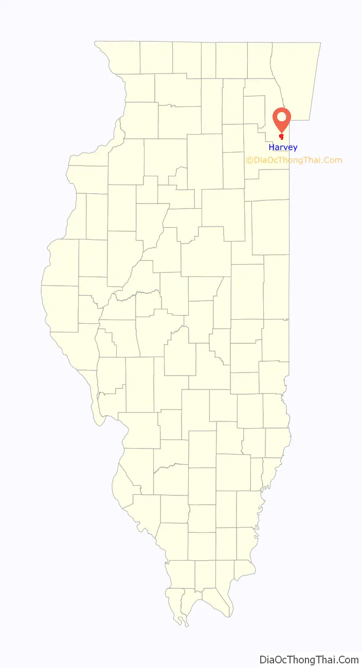
Harvey is a city in Cook County, Illinois, United States. The population was 20,324 at the 2020 census.
Harvey is bordered by the villages of Dixmoor and Riverdale to the north; Dolton, Phoenix, and South Holland to the east; East Hazel Crest to the south; and Hazel Crest, Markham and Posen to the west.
| Name: | Harvey city |
|---|---|
| LSAD Code: | 25 |
| LSAD Description: | city (suffix) |
| State: | Illinois |
| County: | Cook County |
| Founded: | May 1891 |
| Elevation: | 604 ft (184 m) |
| Total Area: | 6.21 sq mi (16.07 km²) |
| Land Area: | 6.21 sq mi (16.07 km²) |
| Water Area: | 0.00 sq mi (0.00 km²) |
| Total Population: | 20,324 |
| Population Density: | 3,274.90/sq mi (1,264.41/km²) |
| Area code: | 708 |
| FIPS code: | 1733383 |
| Website: | www.cityofharvey.org |
Online Interactive Map
Click on ![]() to view map in "full screen" mode.
to view map in "full screen" mode.
Harvey location map. Where is Harvey city?
History
Harvey was founded in 1891 by Turlington W. Harvey, a close associate of Dwight Moody, the founder of the Moody Bible Institute in Chicago. Harvey was originally intended as a model town for Christian values and was one of the Temperance Towns. It was closely modeled after the company town of Pullman, which eventually was annexed into the city of Chicago.
The city had its greatest growth in the prosperous postwar years, when it was home to the Buda Engine Co., which was acquired by Allis-Chalmers in 1953. The city reached its peak population in 1980. By this time, it was beginning to suffer losses in jobs and population through restructuring of steel and similar industries. The Dixie Square Mall closed in November 1978.
In the 2000s and 2010s, Mayor Eric Kellogg attempted to boost Harvey’s economy, with little success. Kellogg offered developers millions of dollars in incentives to revive the long-vacant Dixie Square Mall, but trends in retail adversely affected malls around the country. The city granted a developer $10 million in incentives to redevelop the Chicago Park Hotel, but he abandoned the project before completion, leaving the building gutted.
In February 2018, Harvey became the first city in Illinois to have its revenue garnished by the State in order to fund the city’s pension liabilities. The city laid off employees in order to deal with the changes.
Harvey Road Map
Harvey city Satellite Map
Geography
Harvey has a total area of 6.21 square miles (16.08 km), all land.
See also
Map of Illinois State and its subdivision:- Adams
- Alexander
- Bond
- Boone
- Brown
- Bureau
- Calhoun
- Carroll
- Cass
- Champaign
- Christian
- Clark
- Clay
- Clinton
- Coles
- Cook
- Crawford
- Cumberland
- De Kalb
- De Witt
- Douglas
- Dupage
- Edgar
- Edwards
- Effingham
- Fayette
- Ford
- Franklin
- Fulton
- Gallatin
- Greene
- Grundy
- Hamilton
- Hancock
- Hardin
- Henderson
- Henry
- Iroquois
- Jackson
- Jasper
- Jefferson
- Jersey
- Jo Daviess
- Johnson
- Kane
- Kankakee
- Kendall
- Knox
- La Salle
- Lake
- Lake Michigan
- Lawrence
- Lee
- Livingston
- Logan
- Macon
- Macoupin
- Madison
- Marion
- Marshall
- Mason
- Massac
- McDonough
- McHenry
- McLean
- Menard
- Mercer
- Monroe
- Montgomery
- Morgan
- Moultrie
- Ogle
- Peoria
- Perry
- Piatt
- Pike
- Pope
- Pulaski
- Putnam
- Randolph
- Richland
- Rock Island
- Saint Clair
- Saline
- Sangamon
- Schuyler
- Scott
- Shelby
- Stark
- Stephenson
- Tazewell
- Union
- Vermilion
- Wabash
- Warren
- Washington
- Wayne
- White
- Whiteside
- Will
- Williamson
- Winnebago
- Woodford
- Alabama
- Alaska
- Arizona
- Arkansas
- California
- Colorado
- Connecticut
- Delaware
- District of Columbia
- Florida
- Georgia
- Hawaii
- Idaho
- Illinois
- Indiana
- Iowa
- Kansas
- Kentucky
- Louisiana
- Maine
- Maryland
- Massachusetts
- Michigan
- Minnesota
- Mississippi
- Missouri
- Montana
- Nebraska
- Nevada
- New Hampshire
- New Jersey
- New Mexico
- New York
- North Carolina
- North Dakota
- Ohio
- Oklahoma
- Oregon
- Pennsylvania
- Rhode Island
- South Carolina
- South Dakota
- Tennessee
- Texas
- Utah
- Vermont
- Virginia
- Washington
- West Virginia
- Wisconsin
- Wyoming


