Henry is a city in Marshall County, Illinois, United States. The population was 2,320 at the 2020 census. It is part of the Peoria Metropolitan Statistical Area.
| Name: | Henry city |
|---|---|
| LSAD Code: | 25 |
| LSAD Description: | city (suffix) |
| State: | Illinois |
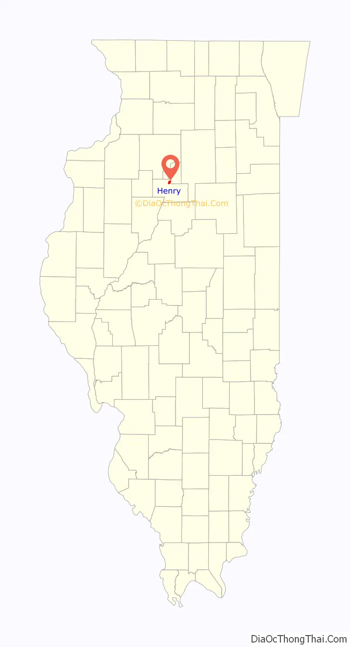
| County: | Marshall County |
| Elevation: | 487 ft (148 m) |
| Total Area: | 1.87 sq mi (4.84 km²) |
| Land Area: | 1.80 sq mi (4.65 km²) |
| Water Area: | 0.07 sq mi (0.19 km²) |
| Total Population: | 2,320 |
| Population Density: | 1,291.04/sq mi (498.44/km²) |
| ZIP code: | 61537 |
| Area code: | 309 |
| FIPS code: | 1734163 |
| Website: | www.cityofhenryil.org |
Online Interactive Map
Click on ![]() to view map in "full screen" mode.
to view map in "full screen" mode.
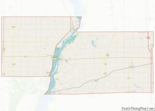
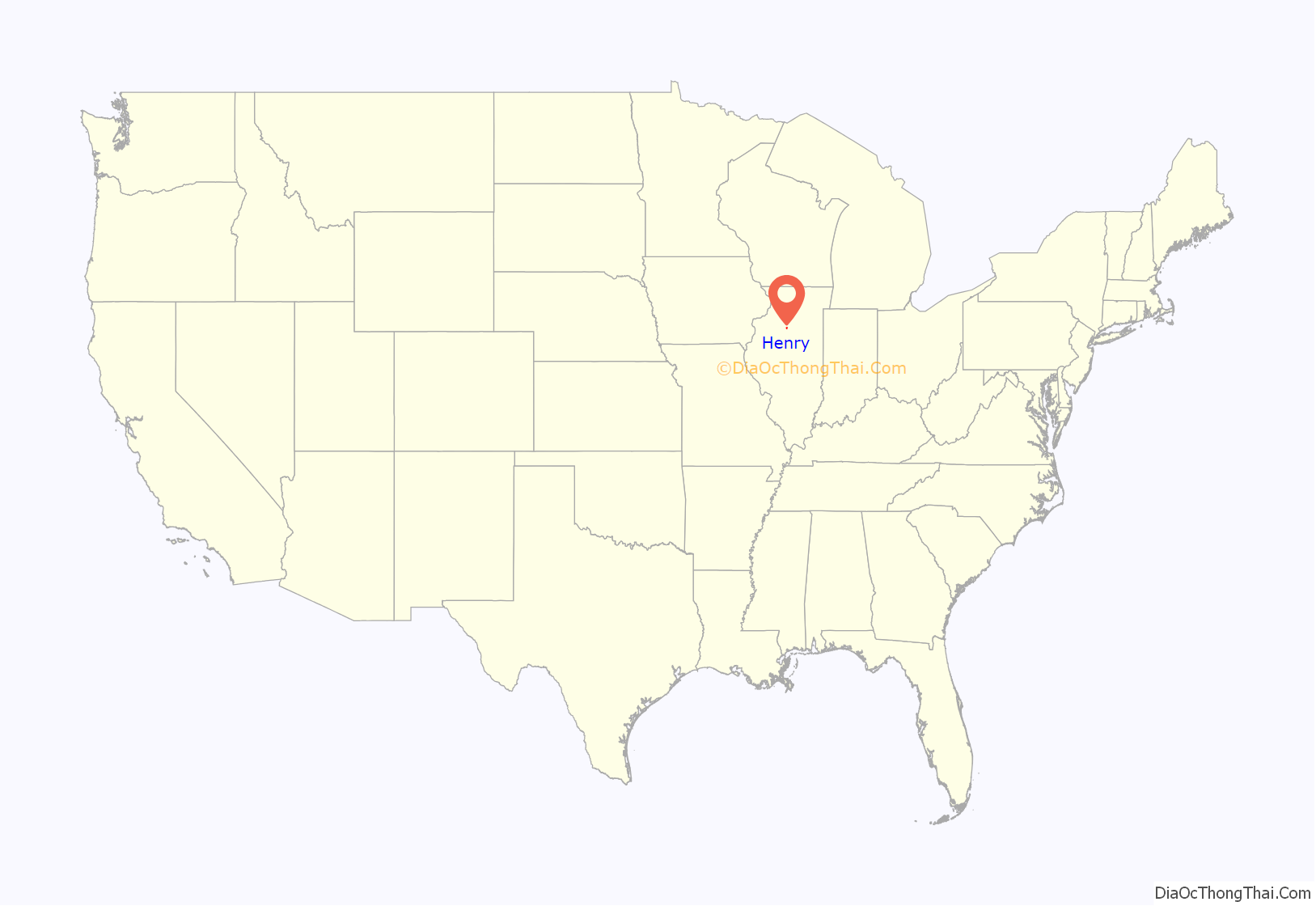
Henry location map. Where is Henry city?
History
Henry is named after General James D. Henry and was initially surveyed in 1834. The topography of the land on the west side of the Illinois River, with relatively steep banks rising well above river level, assured early settlers that their homes would not flood.
Its slogan, “Best Town in Illinois by a Dam Site”, is derived from the city’s distinction of having the first lock and dam built on the Illinois River. It was completed in 1870 at a cost of $400,000.
The retreat house of the Roman Catholic Diocese of Peoria (Nazareth Retreat House, formerly King’s House) is located here.
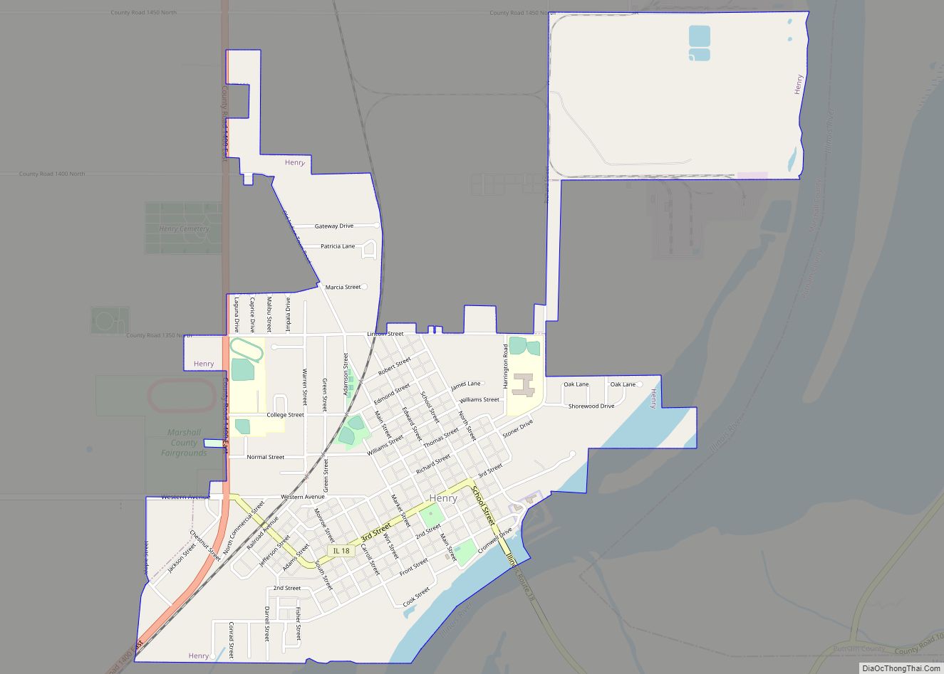
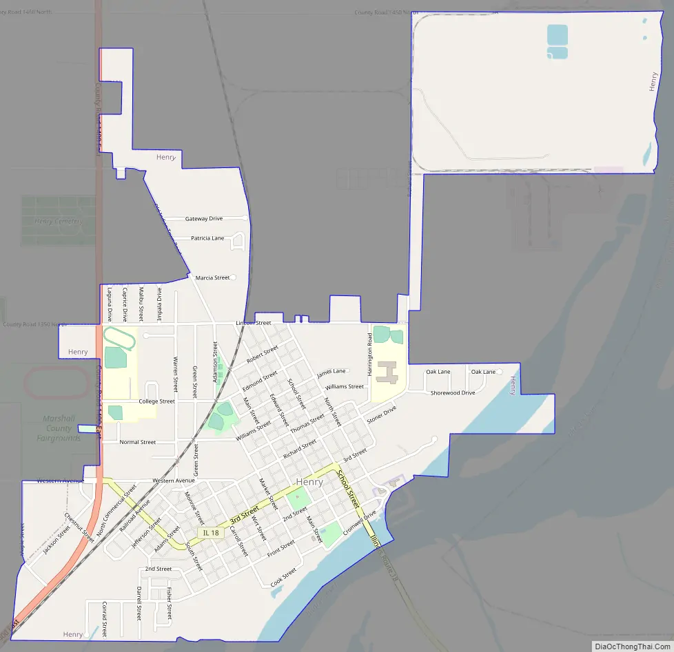
Henry Road Map
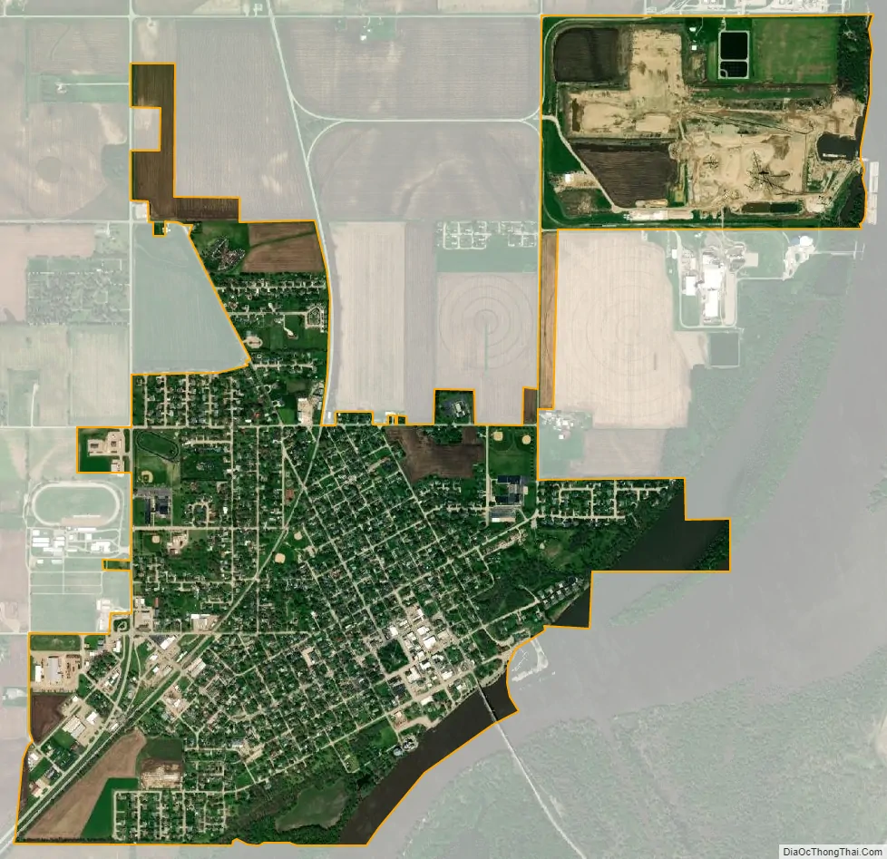
Henry city Satellite Map
Geography
Henry is located in northern Marshall County at 41°6′47″N 89°21′37″W / 41.11306°N 89.36028°W / 41.11306; -89.36028 (41.113152, -89.360218). It is bordered to the east by the Illinois River, which forms the boundary with Putnam County. Illinois Route 18 passes through the center of Henry as Third Street and School Street, leading southwest across the Illinois River on the Henry Bridge, then east 28 miles (45 km) to Streator. Illinois Route 29 passes through the west side of the city, leading north and east 24 miles (39 km) to Spring Valley and southwest 33 miles (53 km) to Peoria.
According to the U.S. Census Bureau, Henry has a total area of 1.87 square miles (4.84 km), of which 1.80 square miles (4.66 km) are land and 0.07 square miles (0.18 km), or 3.85%, are water, consisting of the Illinois River and its inlets.
See also
Map of Illinois State and its subdivision:- Adams
- Alexander
- Bond
- Boone
- Brown
- Bureau
- Calhoun
- Carroll
- Cass
- Champaign
- Christian
- Clark
- Clay
- Clinton
- Coles
- Cook
- Crawford
- Cumberland
- De Kalb
- De Witt
- Douglas
- Dupage
- Edgar
- Edwards
- Effingham
- Fayette
- Ford
- Franklin
- Fulton
- Gallatin
- Greene
- Grundy
- Hamilton
- Hancock
- Hardin
- Henderson
- Henry
- Iroquois
- Jackson
- Jasper
- Jefferson
- Jersey
- Jo Daviess
- Johnson
- Kane
- Kankakee
- Kendall
- Knox
- La Salle
- Lake
- Lake Michigan
- Lawrence
- Lee
- Livingston
- Logan
- Macon
- Macoupin
- Madison
- Marion
- Marshall
- Mason
- Massac
- McDonough
- McHenry
- McLean
- Menard
- Mercer
- Monroe
- Montgomery
- Morgan
- Moultrie
- Ogle
- Peoria
- Perry
- Piatt
- Pike
- Pope
- Pulaski
- Putnam
- Randolph
- Richland
- Rock Island
- Saint Clair
- Saline
- Sangamon
- Schuyler
- Scott
- Shelby
- Stark
- Stephenson
- Tazewell
- Union
- Vermilion
- Wabash
- Warren
- Washington
- Wayne
- White
- Whiteside
- Will
- Williamson
- Winnebago
- Woodford
- Alabama
- Alaska
- Arizona
- Arkansas
- California
- Colorado
- Connecticut
- Delaware
- District of Columbia
- Florida
- Georgia
- Hawaii
- Idaho
- Illinois
- Indiana
- Iowa
- Kansas
- Kentucky
- Louisiana
- Maine
- Maryland
- Massachusetts
- Michigan
- Minnesota
- Mississippi
- Missouri
- Montana
- Nebraska
- Nevada
- New Hampshire
- New Jersey
- New Mexico
- New York
- North Carolina
- North Dakota
- Ohio
- Oklahoma
- Oregon
- Pennsylvania
- Rhode Island
- South Carolina
- South Dakota
- Tennessee
- Texas
- Utah
- Vermont
- Virginia
- Washington
- West Virginia
- Wisconsin
- Wyoming