Indian Creek is a village in Vernon Township, Lake County, Illinois, United States. It is part of the Chicago metropolitan area. Per the 2020 census, the population was 536. Police services are provided by Lake County Sheriff and fire/EMS services by the Countryside Fire Protection District.
| Name: | Indian Creek village |
|---|---|
| LSAD Code: | 47 |
| LSAD Description: | village (suffix) |
| State: | Illinois |
| County: | Lake County |
| Total Area: | 0.27 sq mi (0.69 km²) |
| Land Area: | 0.27 sq mi (0.69 km²) |
| Water Area: | 0.00 sq mi (0.00 km²) |
| Total Population: | 536 |
| Population Density: | 2,007.49/sq mi (775.20/km²) |
| FIPS code: | 1737218 |
Online Interactive Map
Click on ![]() to view map in "full screen" mode.
to view map in "full screen" mode.
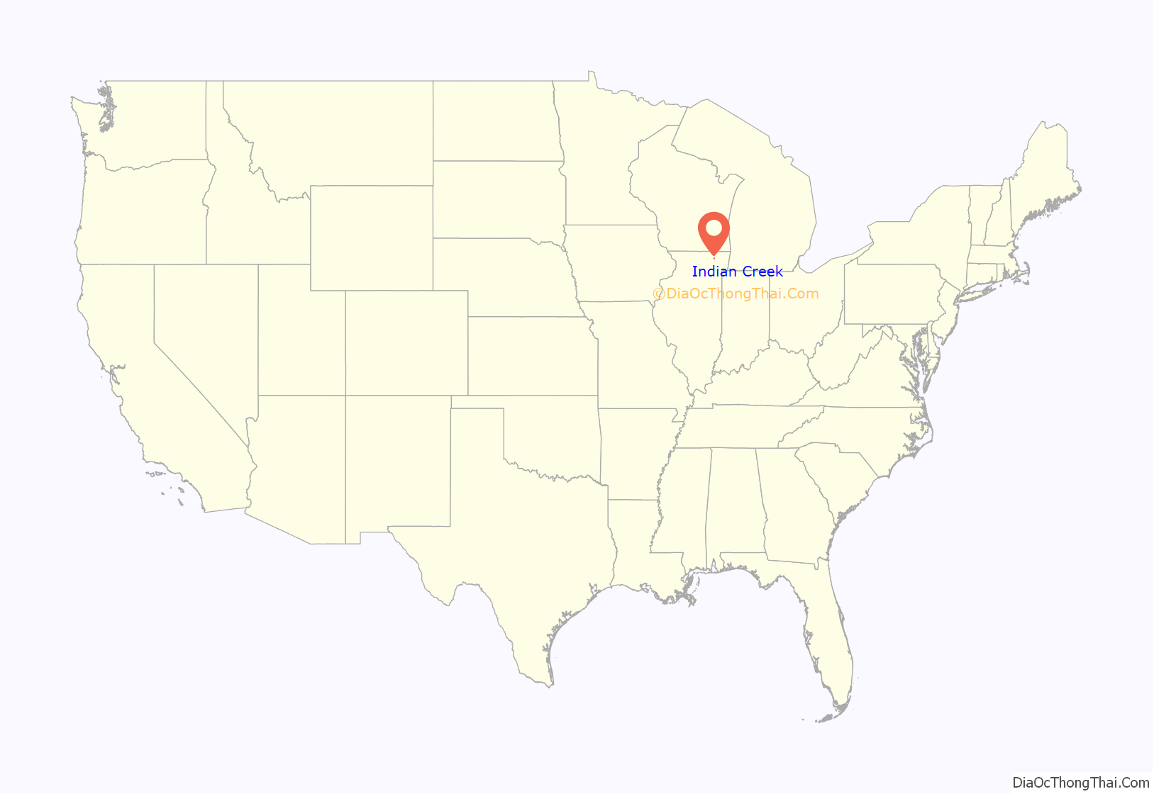
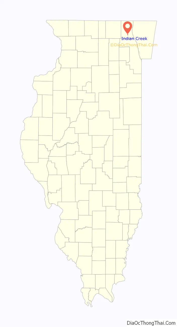
Indian Creek location map. Where is Indian Creek village?
History
Indian Creek was originally incorporated in 1958 as a response to the threat of annexation by neighboring Vernon Hills.
This location may be confused with the Indian Creek Massacre, detailed below, which actually occurred in LaSalle County near Ottawa, IL. During the Black Hawk War of 1832, which was the last Indian war in Illinois, Indian Creek, was the scene of an attack, by a renegade band of 40-80 Potawatomi and Sauk, on the Davis Settlement, where 15 white settlers were killed and scalped.
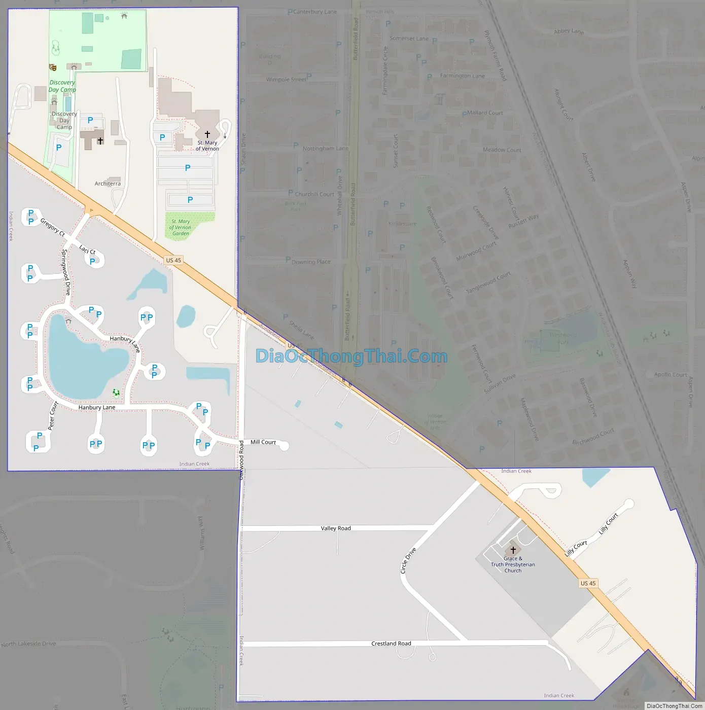
Indian Creek Road Map
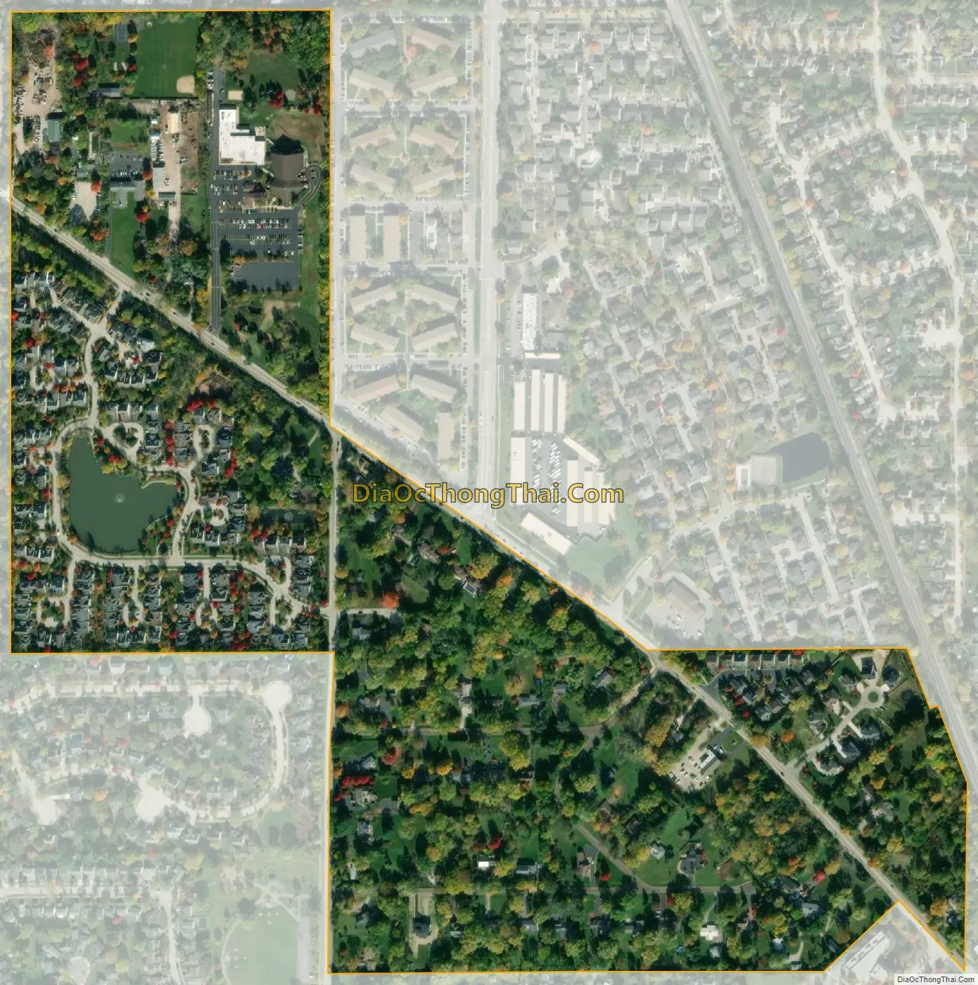
Indian Creek city Satellite Map
Geography
Indian Creek is located at 42°13′33″N 87°58′37″W / 42.22583°N 87.97694°W / 42.22583; -87.97694 (42.225876, -87.976843).
According to the 2010 census, Indian Creek has a total area of 0.26 square miles (0.67 km), all land. It has the smallest area of any incorporated place in Lake County.
See also
Map of Illinois State and its subdivision:- Adams
- Alexander
- Bond
- Boone
- Brown
- Bureau
- Calhoun
- Carroll
- Cass
- Champaign
- Christian
- Clark
- Clay
- Clinton
- Coles
- Cook
- Crawford
- Cumberland
- De Kalb
- De Witt
- Douglas
- Dupage
- Edgar
- Edwards
- Effingham
- Fayette
- Ford
- Franklin
- Fulton
- Gallatin
- Greene
- Grundy
- Hamilton
- Hancock
- Hardin
- Henderson
- Henry
- Iroquois
- Jackson
- Jasper
- Jefferson
- Jersey
- Jo Daviess
- Johnson
- Kane
- Kankakee
- Kendall
- Knox
- La Salle
- Lake
- Lake Michigan
- Lawrence
- Lee
- Livingston
- Logan
- Macon
- Macoupin
- Madison
- Marion
- Marshall
- Mason
- Massac
- McDonough
- McHenry
- McLean
- Menard
- Mercer
- Monroe
- Montgomery
- Morgan
- Moultrie
- Ogle
- Peoria
- Perry
- Piatt
- Pike
- Pope
- Pulaski
- Putnam
- Randolph
- Richland
- Rock Island
- Saint Clair
- Saline
- Sangamon
- Schuyler
- Scott
- Shelby
- Stark
- Stephenson
- Tazewell
- Union
- Vermilion
- Wabash
- Warren
- Washington
- Wayne
- White
- Whiteside
- Will
- Williamson
- Winnebago
- Woodford
- Alabama
- Alaska
- Arizona
- Arkansas
- California
- Colorado
- Connecticut
- Delaware
- District of Columbia
- Florida
- Georgia
- Hawaii
- Idaho
- Illinois
- Indiana
- Iowa
- Kansas
- Kentucky
- Louisiana
- Maine
- Maryland
- Massachusetts
- Michigan
- Minnesota
- Mississippi
- Missouri
- Montana
- Nebraska
- Nevada
- New Hampshire
- New Jersey
- New Mexico
- New York
- North Carolina
- North Dakota
- Ohio
- Oklahoma
- Oregon
- Pennsylvania
- Rhode Island
- South Carolina
- South Dakota
- Tennessee
- Texas
- Utah
- Vermont
- Virginia
- Washington
- West Virginia
- Wisconsin
- Wyoming


