Junction is a village in Gallatin County, Illinois, United States. The population was 56 at the 2020 census.
| Name: | Junction village |
|---|---|
| LSAD Code: | 47 |
| LSAD Description: | village (suffix) |
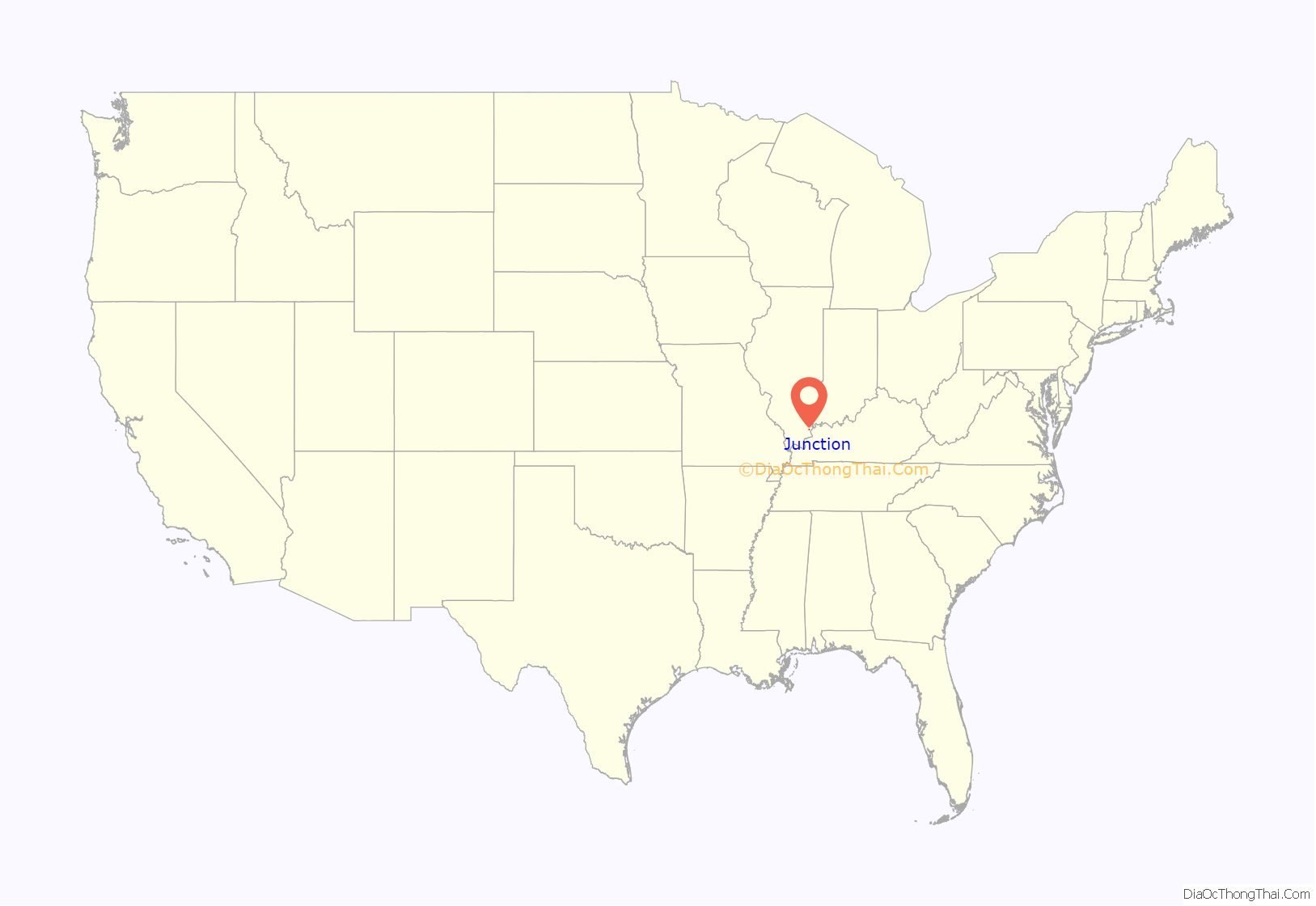
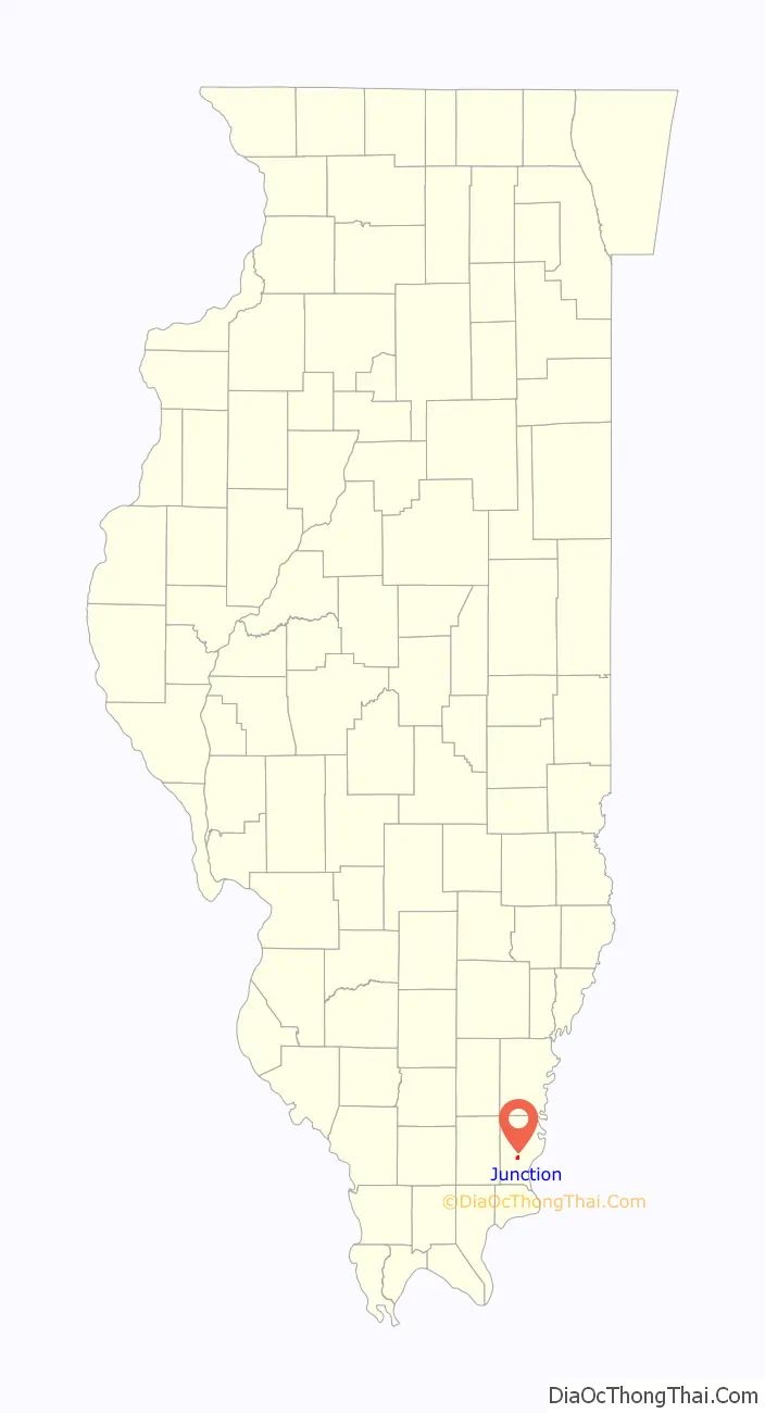
| State: | Illinois |
| County: | Gallatin County |
| Elevation: | 367 ft (112 m) |
| Total Area: | 0.83 sq mi (2.14 km²) |
| Land Area: | 0.83 sq mi (2.14 km²) |
| Water Area: | 0.00 sq mi (0.00 km²) |
| Total Population: | 56 |
| Population Density: | 67.80/sq mi (26.17/km²) |
| Area code: | 618 |
| FIPS code: | 1738778 |
Online Interactive Map
Click on ![]() to view map in "full screen" mode.
to view map in "full screen" mode.
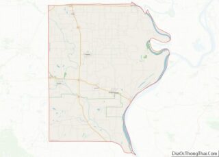
Junction location map. Where is Junction village?
History
Junction was named for its location at the junction of the L&N and B&O railroads. When a post office was established in 1884, it was named “Cypress Junction.” The name was changed to “Junction City” in 1888, and shortened to “Junction” in 1894.
Junction’s location in a relatively flat area leaves it prone to flooding along the Ohio River, which can cause waters in the nearby Saline River to back up. A major flood in March 1997 displaced several area residents and blocked all but one road leading into the village. On June 1, 2022 Junction General Baptist Church burned down due to a lightning strike that hit the steeple.
Crenshaw House
The Hickory Hill mansion, about four miles west of Junction, is the 19th-century home of illegal slave trader and slave breeder John Hart Crenshaw. It was infamously known as the “Old Slave House,” as it was used as a criminal front for the kidnapping of free blacks who were illegally sold into the Southern slave trade on the Reverse Underground Railroad, as well as a farm for slave breeding.
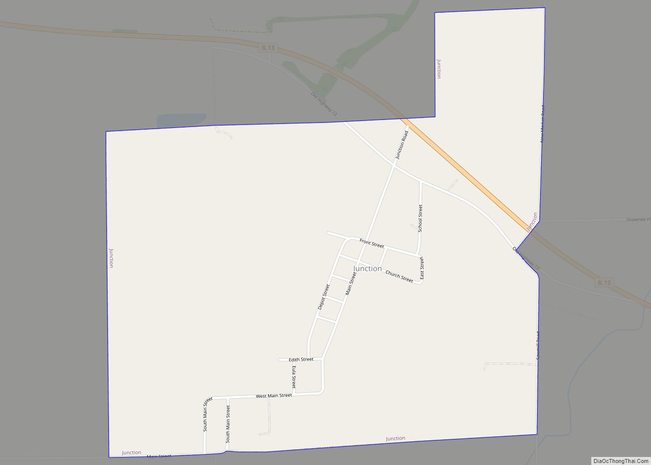
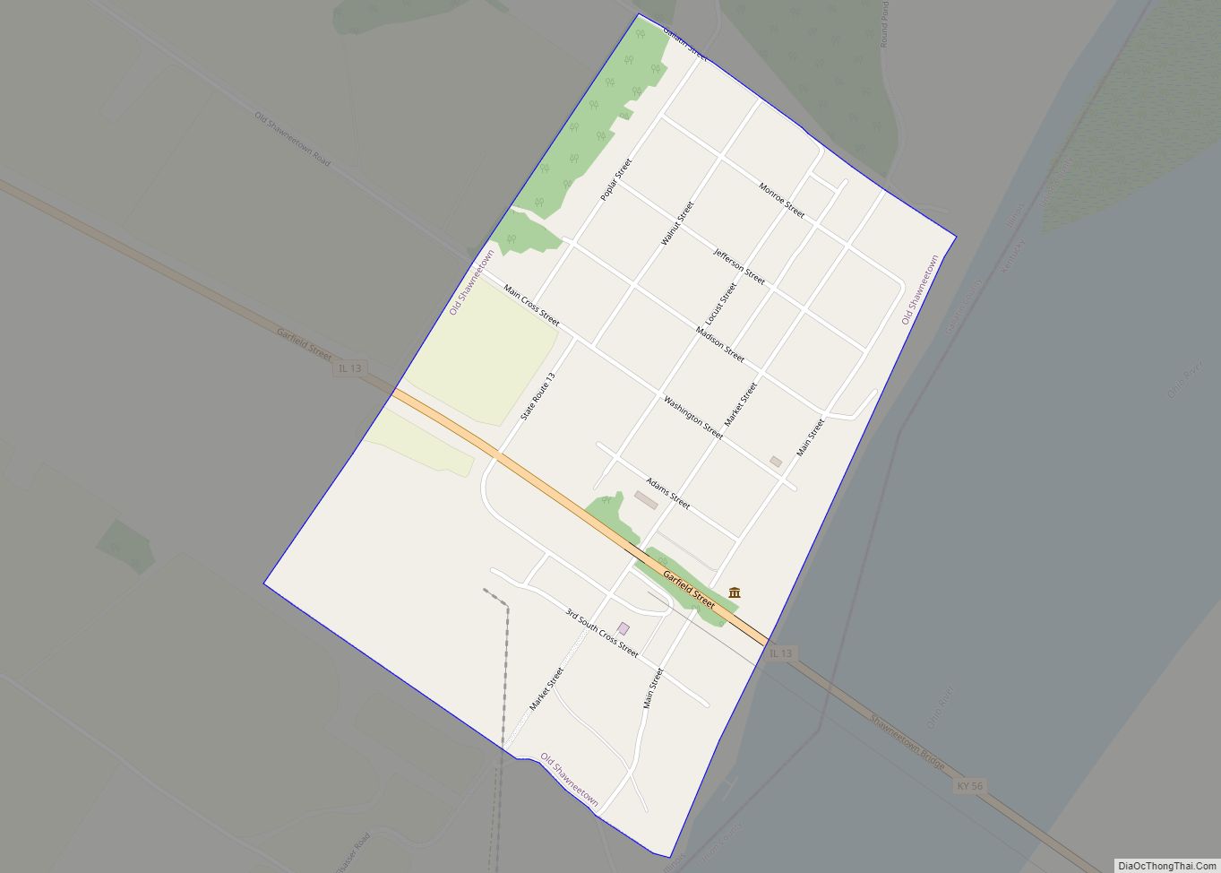
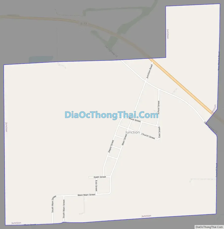
Junction Road Map
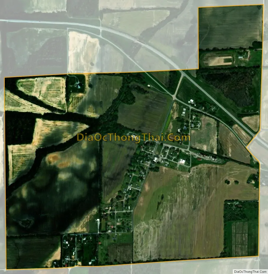
Junction city Satellite Map
Geography
Junction is located at the center of Gallatin County at 37°43′22″N 88°14′17″W / 37.72278°N 88.23806°W / 37.72278; -88.23806. The village lies along Illinois Route 13, 5.6 miles or 9 Kilometers west of the Ohio River, and north of the Shawnee National Forest. The Saline River, a tributary of the Ohio, passes just to the south.
According to the 2020 census, Junction has a total area of 0.883 square miles (2.29 km), of which 0.88 square miles (2.28 km) (or 99.66%) is land and 0.003 square miles (0.01 km) (or 0.34%) is water.
See also
Map of Illinois State and its subdivision:- Adams
- Alexander
- Bond
- Boone
- Brown
- Bureau
- Calhoun
- Carroll
- Cass
- Champaign
- Christian
- Clark
- Clay
- Clinton
- Coles
- Cook
- Crawford
- Cumberland
- De Kalb
- De Witt
- Douglas
- Dupage
- Edgar
- Edwards
- Effingham
- Fayette
- Ford
- Franklin
- Fulton
- Gallatin
- Greene
- Grundy
- Hamilton
- Hancock
- Hardin
- Henderson
- Henry
- Iroquois
- Jackson
- Jasper
- Jefferson
- Jersey
- Jo Daviess
- Johnson
- Kane
- Kankakee
- Kendall
- Knox
- La Salle
- Lake
- Lake Michigan
- Lawrence
- Lee
- Livingston
- Logan
- Macon
- Macoupin
- Madison
- Marion
- Marshall
- Mason
- Massac
- McDonough
- McHenry
- McLean
- Menard
- Mercer
- Monroe
- Montgomery
- Morgan
- Moultrie
- Ogle
- Peoria
- Perry
- Piatt
- Pike
- Pope
- Pulaski
- Putnam
- Randolph
- Richland
- Rock Island
- Saint Clair
- Saline
- Sangamon
- Schuyler
- Scott
- Shelby
- Stark
- Stephenson
- Tazewell
- Union
- Vermilion
- Wabash
- Warren
- Washington
- Wayne
- White
- Whiteside
- Will
- Williamson
- Winnebago
- Woodford
- Alabama
- Alaska
- Arizona
- Arkansas
- California
- Colorado
- Connecticut
- Delaware
- District of Columbia
- Florida
- Georgia
- Hawaii
- Idaho
- Illinois
- Indiana
- Iowa
- Kansas
- Kentucky
- Louisiana
- Maine
- Maryland
- Massachusetts
- Michigan
- Minnesota
- Mississippi
- Missouri
- Montana
- Nebraska
- Nevada
- New Hampshire
- New Jersey
- New Mexico
- New York
- North Carolina
- North Dakota
- Ohio
- Oklahoma
- Oregon
- Pennsylvania
- Rhode Island
- South Carolina
- South Dakota
- Tennessee
- Texas
- Utah
- Vermont
- Virginia
- Washington
- West Virginia
- Wisconsin
- Wyoming