Milledgeville is a village in Carroll County, Illinois, United States. The population of the village was 1,026 at the 2020 census. The town was named for the mill at the edge of the village, which was torn down in 1908.
| Name: | Milledgeville village |
|---|---|
| LSAD Code: | 47 |
| LSAD Description: | village (suffix) |
| State: | Illinois |
| County: | Carroll County |
| Elevation: | 761 ft (232 m) |
| Total Area: | 0.69 sq mi (1.79 km²) |
| Land Area: | 0.69 sq mi (1.79 km²) |
| Water Area: | 0.00 sq mi (0.00 km²) |
| Total Population: | 1,026 |
| Population Density: | 1,486.96/sq mi (574.06/km²) |
| Area code: | 815 |
| FIPS code: | 1749191 |
| Website: | http://www.milledgevilleil.net/ |
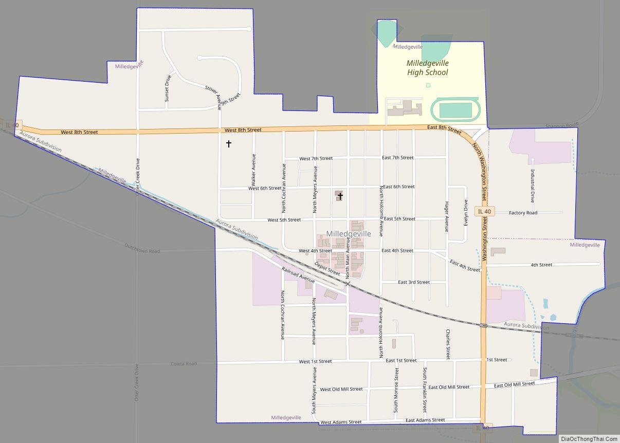
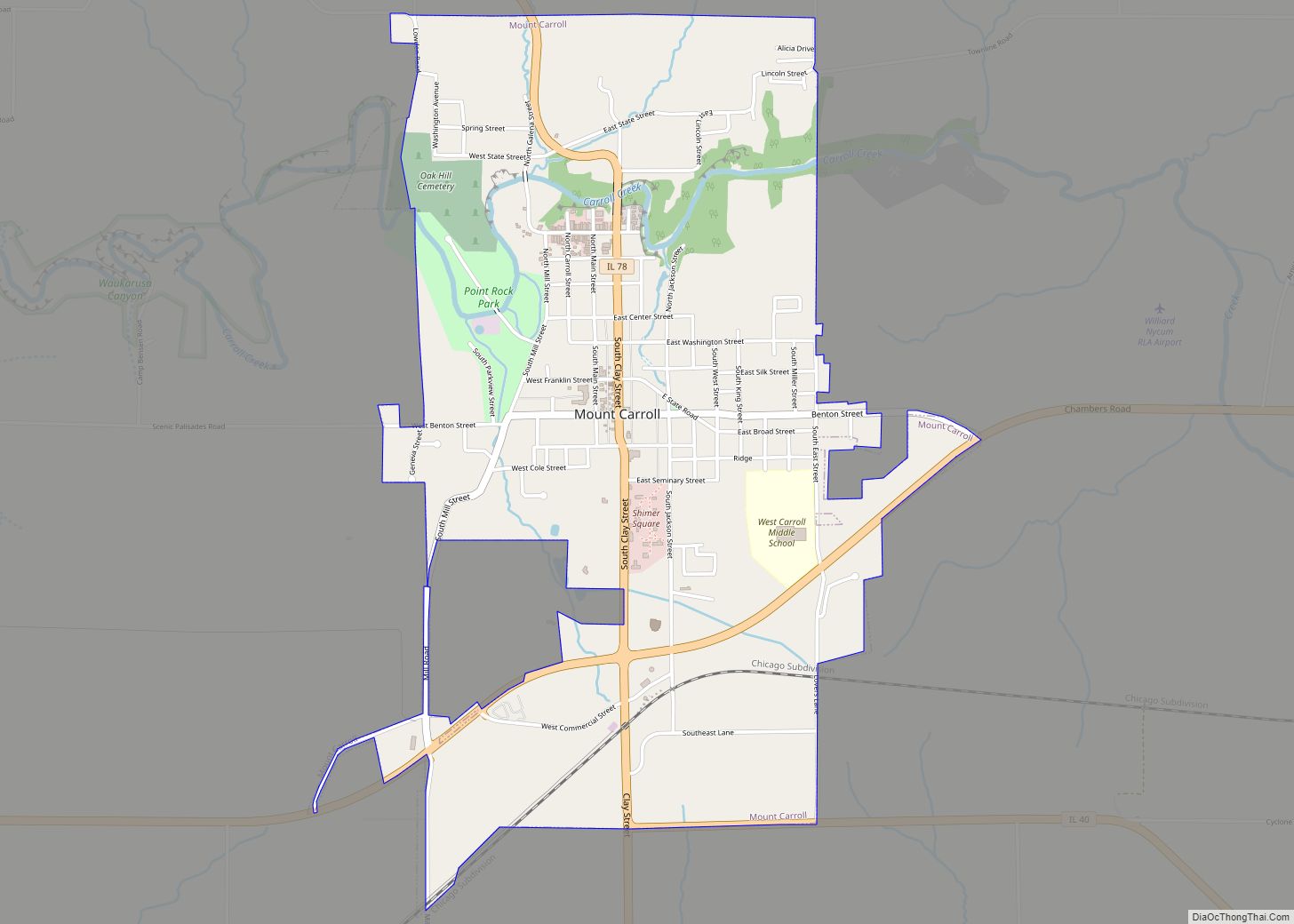
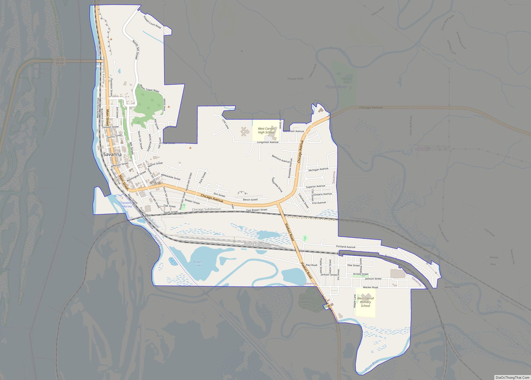
Online Interactive Map
Click on ![]() to view map in "full screen" mode.
to view map in "full screen" mode.
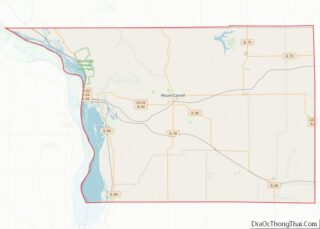
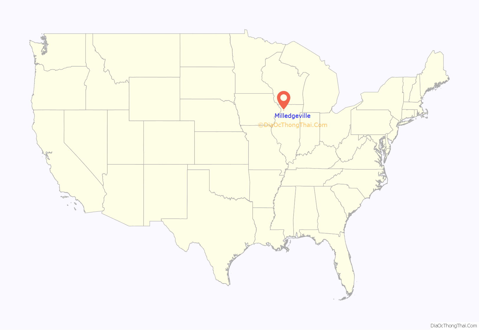
Milledgeville location map. Where is Milledgeville village?
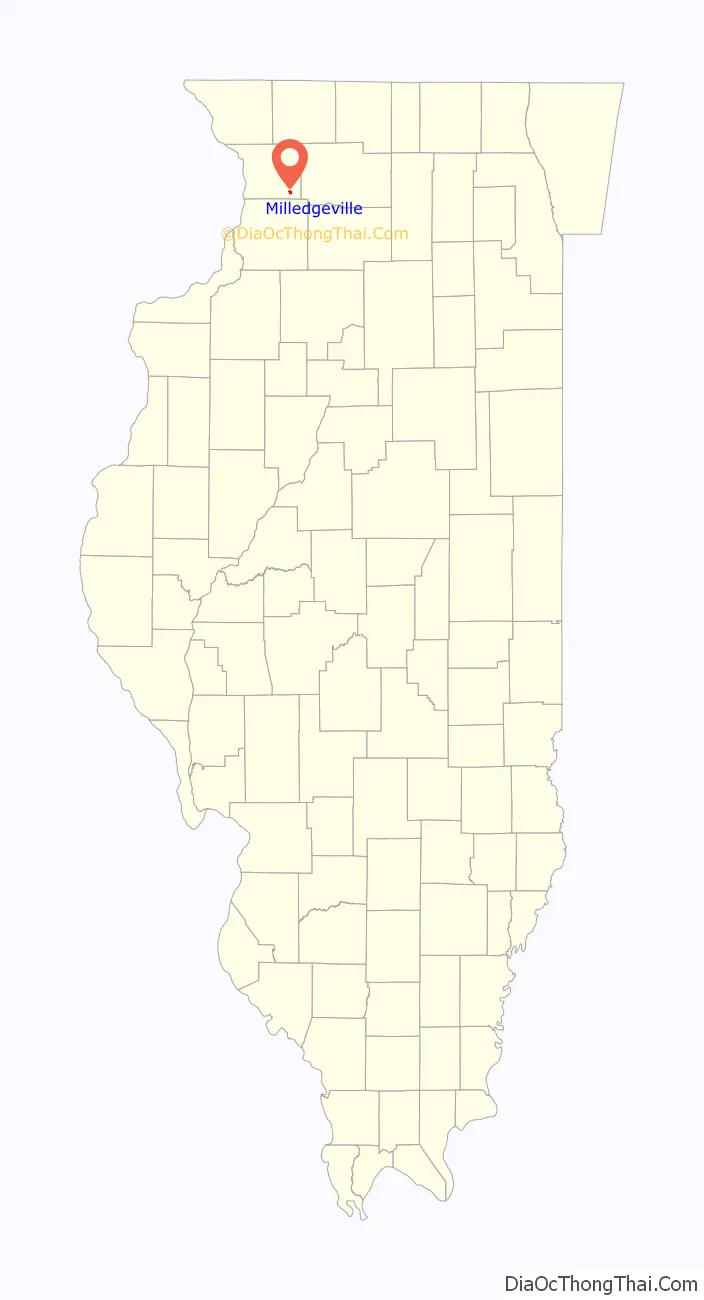
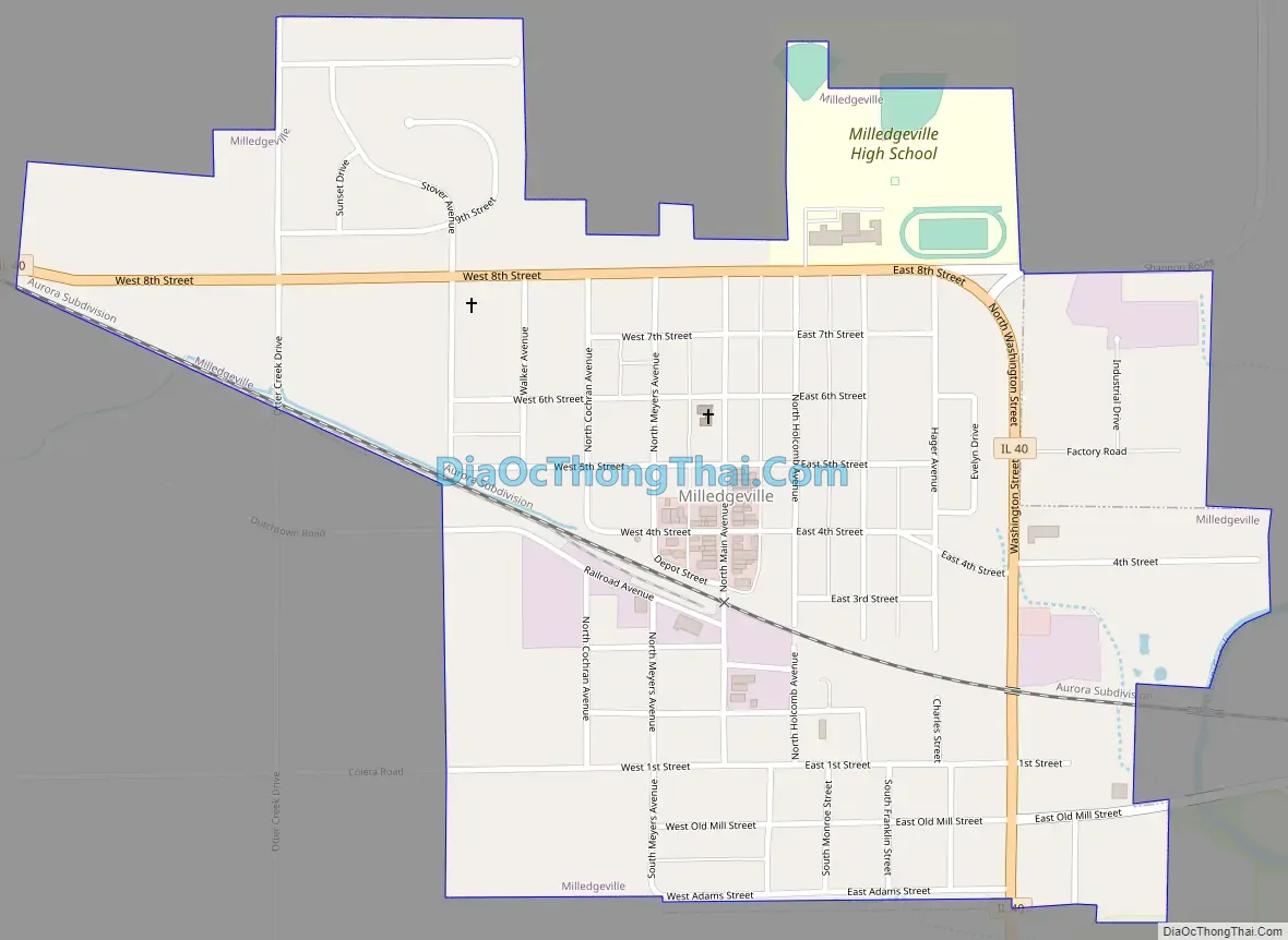
Milledgeville Road Map
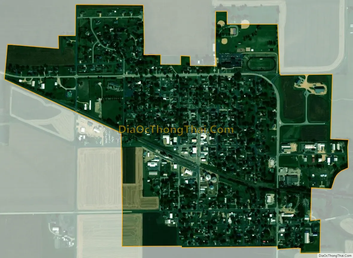
Milledgeville city Satellite Map
Geography
Milledgeville is located at 41°57′50″N 89°46′28″W / 41.96389°N 89.77444°W / 41.96389; -89.77444 (41.963763, -89.774372).
According to the 2021 census gazetteer files, Milledgeville has a total area of 0.69 square miles (1.79 km), all land.
The nearest shopping and commerce area to the village is in the towns of Sterling and Rock Falls, about 12 miles south of downtown Milledgeville, while the closest major shopping, entertainment, and city amenities are in Rockford, which is about 45 miles to the northeast of downtown Milledgeville.
The village is located 110 miles from downtown Chicago (2.5 hour drive) and about 85 miles away (1.5 hour drive) from the nearest Chicago suburbs of Sugar Grove/Aurora.
See also
Map of Illinois State and its subdivision:- Adams
- Alexander
- Bond
- Boone
- Brown
- Bureau
- Calhoun
- Carroll
- Cass
- Champaign
- Christian
- Clark
- Clay
- Clinton
- Coles
- Cook
- Crawford
- Cumberland
- De Kalb
- De Witt
- Douglas
- Dupage
- Edgar
- Edwards
- Effingham
- Fayette
- Ford
- Franklin
- Fulton
- Gallatin
- Greene
- Grundy
- Hamilton
- Hancock
- Hardin
- Henderson
- Henry
- Iroquois
- Jackson
- Jasper
- Jefferson
- Jersey
- Jo Daviess
- Johnson
- Kane
- Kankakee
- Kendall
- Knox
- La Salle
- Lake
- Lake Michigan
- Lawrence
- Lee
- Livingston
- Logan
- Macon
- Macoupin
- Madison
- Marion
- Marshall
- Mason
- Massac
- McDonough
- McHenry
- McLean
- Menard
- Mercer
- Monroe
- Montgomery
- Morgan
- Moultrie
- Ogle
- Peoria
- Perry
- Piatt
- Pike
- Pope
- Pulaski
- Putnam
- Randolph
- Richland
- Rock Island
- Saint Clair
- Saline
- Sangamon
- Schuyler
- Scott
- Shelby
- Stark
- Stephenson
- Tazewell
- Union
- Vermilion
- Wabash
- Warren
- Washington
- Wayne
- White
- Whiteside
- Will
- Williamson
- Winnebago
- Woodford
- Alabama
- Alaska
- Arizona
- Arkansas
- California
- Colorado
- Connecticut
- Delaware
- District of Columbia
- Florida
- Georgia
- Hawaii
- Idaho
- Illinois
- Indiana
- Iowa
- Kansas
- Kentucky
- Louisiana
- Maine
- Maryland
- Massachusetts
- Michigan
- Minnesota
- Mississippi
- Missouri
- Montana
- Nebraska
- Nevada
- New Hampshire
- New Jersey
- New Mexico
- New York
- North Carolina
- North Dakota
- Ohio
- Oklahoma
- Oregon
- Pennsylvania
- Rhode Island
- South Carolina
- South Dakota
- Tennessee
- Texas
- Utah
- Vermont
- Virginia
- Washington
- West Virginia
- Wisconsin
- Wyoming