Mount Carroll is a city in Carroll County, Illinois, United States. It is the Carroll County seat. The population was 1479 at the 2020 census.
Due to its elevation and northwesterly location, Mount Carroll is subject to unusually cold winter weather. From 1930 to 1999, Mount Carroll held the record for the lowest temperature ever recorded in Illinois, −35 °F (−37 °C), recorded on January 22, 1930. The record was beaten by Congerville in 1999, by one degree Fahrenheit. 20 years later, on January 31, 2019 during an extreme cold snap, Mount Carroll regained the title of coldest city in Illinois when a new Illinois state record low temperature of −38 °F (−39 °C) was officially recorded.
| Name: | Mount Carroll city |
|---|---|
| LSAD Code: | 25 |
| LSAD Description: | city (suffix) |
| State: | Illinois |
| County: | Carroll County |
| Elevation: | 810 ft (250 m) |
| Total Area: | 2.00 sq mi (5.19 km²) |
| Land Area: | 2.00 sq mi (5.19 km²) |
| Water Area: | 0.00 sq mi (0.00 km²) |
| Total Population: | 1,479 |
| Population Density: | 738.39/sq mi (285.04/km²) |
| Area code: | 815 |
| FIPS code: | 1750881 |
| Website: | www.mtcarrollil.org |
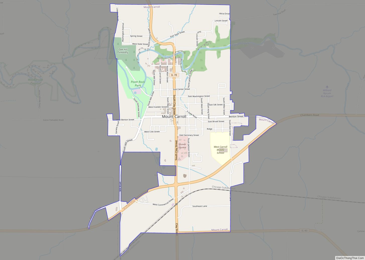
Online Interactive Map
Click on ![]() to view map in "full screen" mode.
to view map in "full screen" mode.
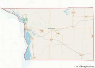
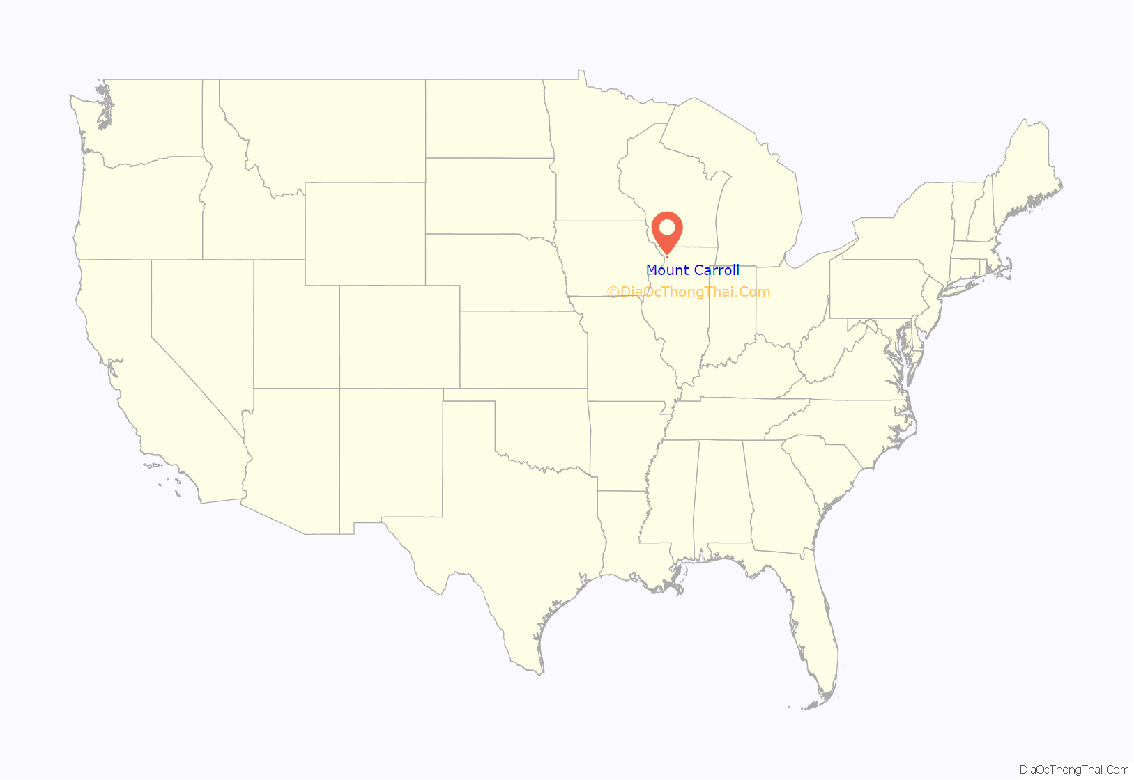
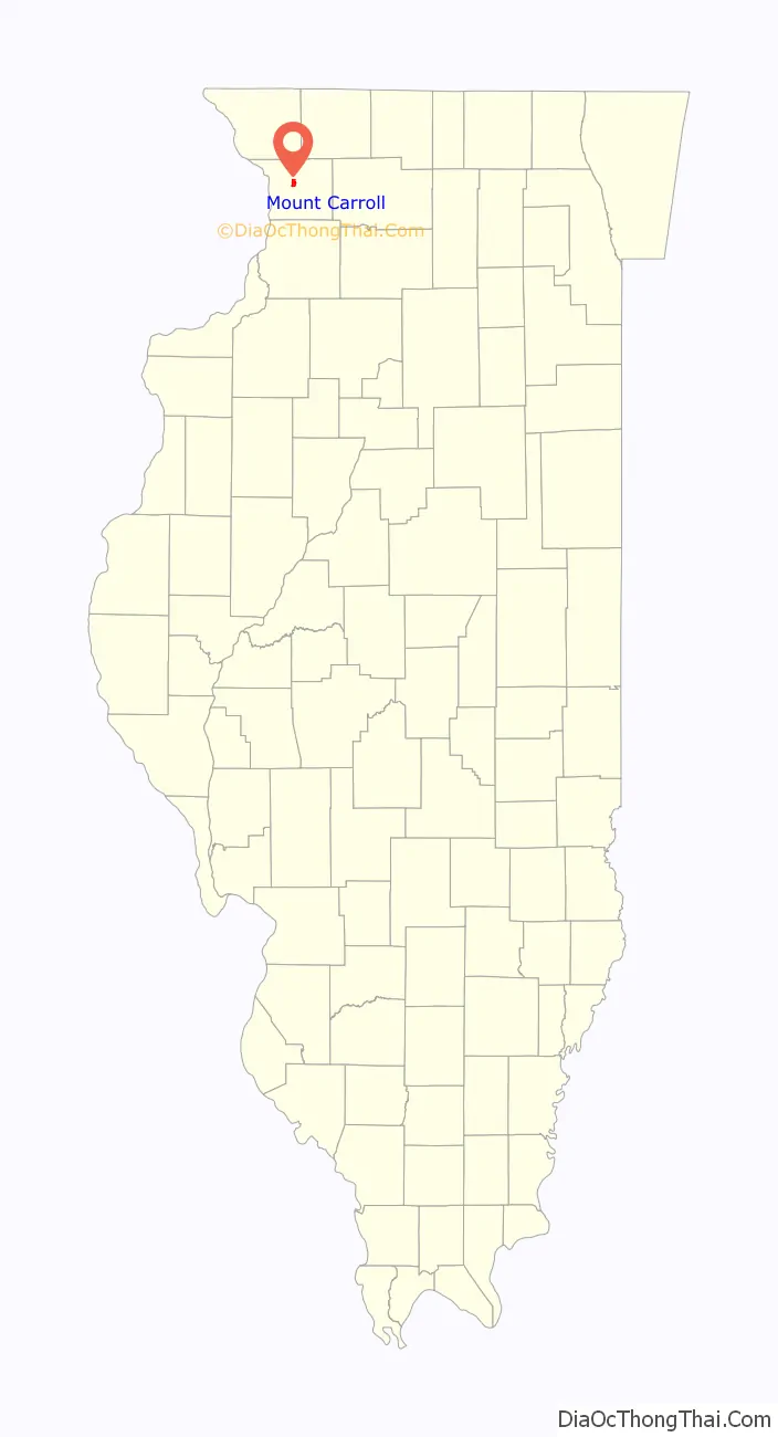
Mount Carroll location map. Where is Mount Carroll city?
History
Mount Carroll began life as a mill town around 1841. In 1843, a referendum moved the county seat from nearby Savanna to Mount Carroll. The town was incorporated in 1855 and became a city in 1867; the first mayor was Nathaniel Halderman, a prominent local businessman and co-founder of the mill.
Shimer College was established in Mt. Carroll in 1853, but mounting debts forced a move to Waukegan in 1979 and subsequently to Chicago in 2006. The campus now is home to several organizations, most notably the Campbell Center for Historic Preservation Studies.
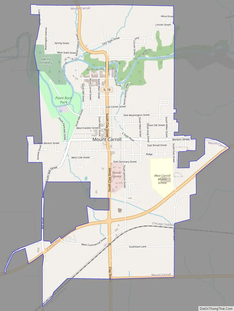
Mount Carroll Road Map
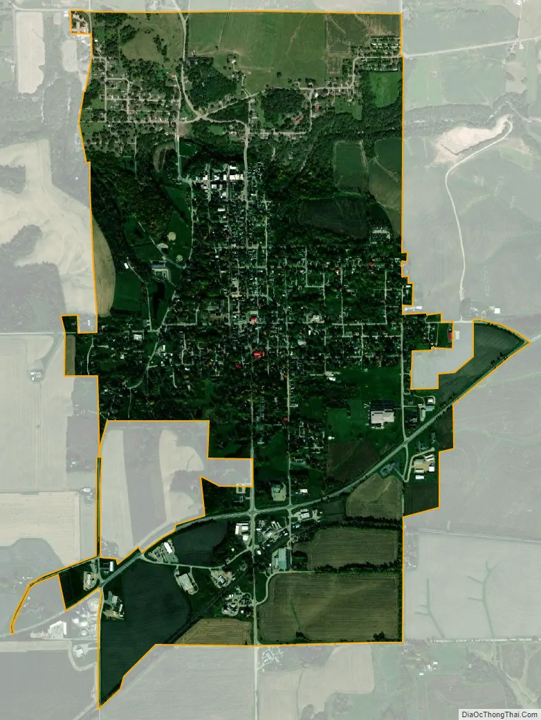
Mount Carroll city Satellite Map
Geography
Mount Carroll is located slightly northwest of the center of Carroll County at 42°5′44″N 89°58′37″W / 42.09556°N 89.97694°W / 42.09556; -89.97694 (42.095473, -89.977042). U.S. Route 52 passes through the southern part of the city, leading east 7 miles (11 km) to Lanark and west 10 miles (16 km) to Savanna on the Mississippi River.
According to the 2021 census gazetteer files, Mount Carroll has a total area of 2.00 square miles (5.18 km), all land.
Climate
Mt. Carroll has a humid continental climate (Köppen climate classification: Dfa), with cold winters, hot summers, and four seasons. Annual precipitation is about 40 inches.
Major highways
- U.S. Route 52 and Illinois Route 64 (concurrent with US 52), east towards Lanark, west towards Savanna and the Mississippi River.
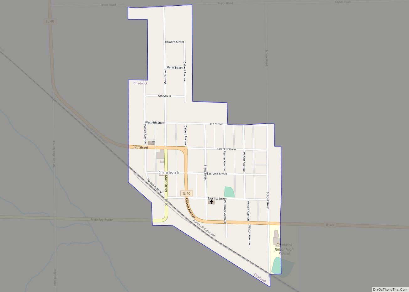
- Illinois Route 40, south towards Chadwick, Milledgeville and Sterling–Rock Falls.
- Illinois Route 78, north towards Stockton, south towards Morrison.
See also
Map of Illinois State and its subdivision:- Adams
- Alexander
- Bond
- Boone
- Brown
- Bureau
- Calhoun
- Carroll
- Cass
- Champaign
- Christian
- Clark
- Clay
- Clinton
- Coles
- Cook
- Crawford
- Cumberland
- De Kalb
- De Witt
- Douglas
- Dupage
- Edgar
- Edwards
- Effingham
- Fayette
- Ford
- Franklin
- Fulton
- Gallatin
- Greene
- Grundy
- Hamilton
- Hancock
- Hardin
- Henderson
- Henry
- Iroquois
- Jackson
- Jasper
- Jefferson
- Jersey
- Jo Daviess
- Johnson
- Kane
- Kankakee
- Kendall
- Knox
- La Salle
- Lake
- Lake Michigan
- Lawrence
- Lee
- Livingston
- Logan
- Macon
- Macoupin
- Madison
- Marion
- Marshall
- Mason
- Massac
- McDonough
- McHenry
- McLean
- Menard
- Mercer
- Monroe
- Montgomery
- Morgan
- Moultrie
- Ogle
- Peoria
- Perry
- Piatt
- Pike
- Pope
- Pulaski
- Putnam
- Randolph
- Richland
- Rock Island
- Saint Clair
- Saline
- Sangamon
- Schuyler
- Scott
- Shelby
- Stark
- Stephenson
- Tazewell
- Union
- Vermilion
- Wabash
- Warren
- Washington
- Wayne
- White
- Whiteside
- Will
- Williamson
- Winnebago
- Woodford
- Alabama
- Alaska
- Arizona
- Arkansas
- California
- Colorado
- Connecticut
- Delaware
- District of Columbia
- Florida
- Georgia
- Hawaii
- Idaho
- Illinois
- Indiana
- Iowa
- Kansas
- Kentucky
- Louisiana
- Maine
- Maryland
- Massachusetts
- Michigan
- Minnesota
- Mississippi
- Missouri
- Montana
- Nebraska
- Nevada
- New Hampshire
- New Jersey
- New Mexico
- New York
- North Carolina
- North Dakota
- Ohio
- Oklahoma
- Oregon
- Pennsylvania
- Rhode Island
- South Carolina
- South Dakota
- Tennessee
- Texas
- Utah
- Vermont
- Virginia
- Washington
- West Virginia
- Wisconsin
- Wyoming