Park City is a small city located in the Warren and Waukegan townships of Lake County, Illinois, United States, on the northern end of the Chicago metropolitan area. Per the 2020 census, the population was 7,885.
| Name: | Park City city |
|---|---|
| LSAD Code: | 25 |
| LSAD Description: | city (suffix) |
| State: | Illinois |
| County: | Lake County |
| Total Area: | 1.16 sq mi (3.00 km²) |
| Land Area: | 1.16 sq mi (3.00 km²) |
| Water Area: | 0.00 sq mi (0.01 km²) |
| Total Population: | 7,885 |
| Population Density: | 6,815.04/sq mi (2,631.19/km²) |
| Area code: | 847 |
| FIPS code: | 1757654 |
| Website: | http://parkcityil.org/ |
Online Interactive Map
Click on ![]() to view map in "full screen" mode.
to view map in "full screen" mode.
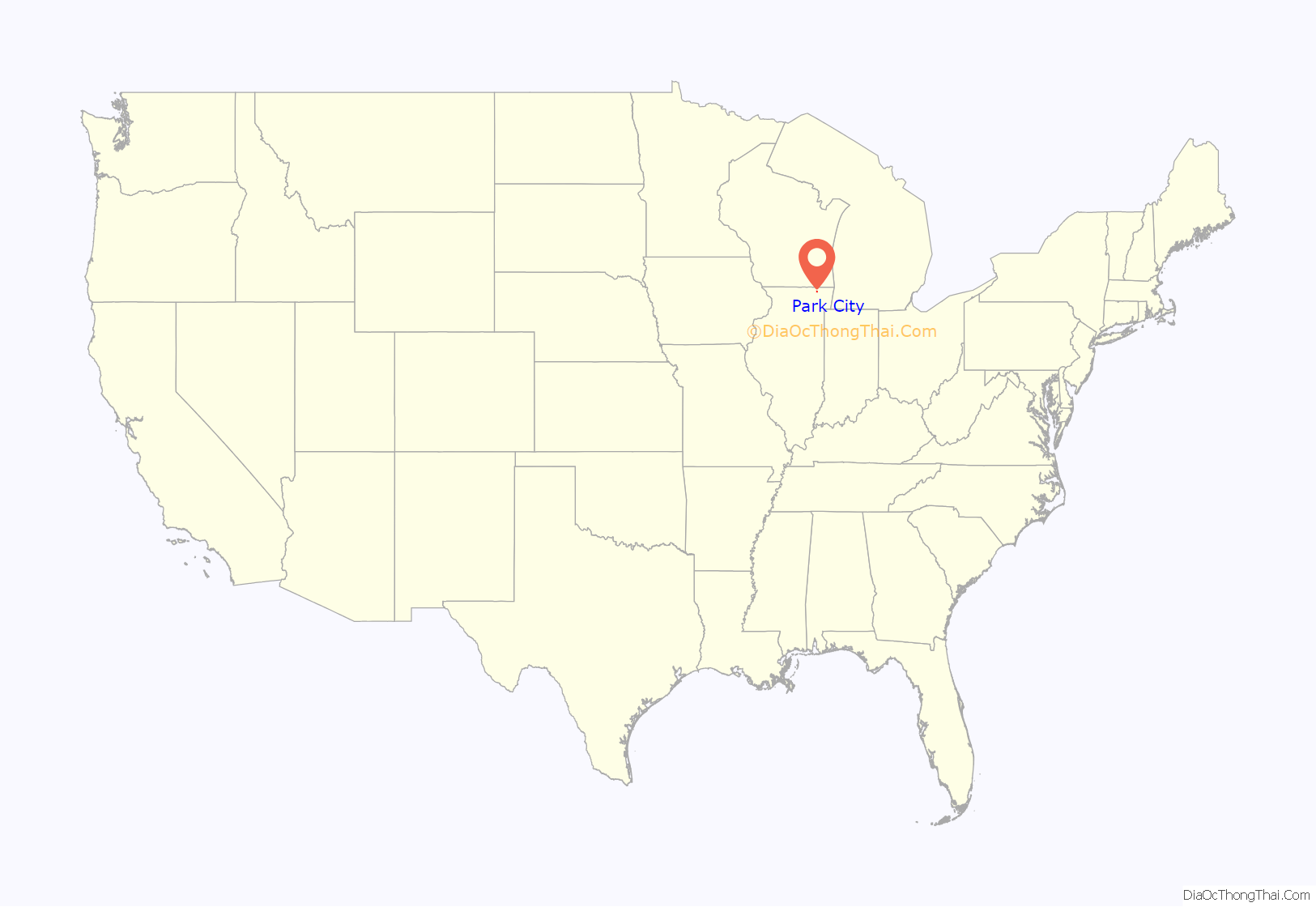
Park City location map. Where is Park City city?
History
Park City was incorporated in 1958 through the approval of a referendum by Park City residents. The incorporation was spearheaded by the owners of four trailer parks in the community who wanted to avoid annexation by the neighboring city of Waukegan. In the late 1970s, a federal lawsuit was filed against Park City, alleging that the city was engaging in housing discrimination against non-whites. Since that time, the City has become a multi-cultural community, accepting a wide diversity of people from different backgrounds and ethnicities.
Of the city’s residential uses, two-thirds are manufactured residential housing and apartments, and one third is single-family housing. The city is split into residential, commercial and industrial zones. Park City sponsors a Chamber of Commerce to promote its growing business base.
Park City Road Map
Park City city Satellite Map
Geography
Park City is located at 42°21′6″N 87°53′18″W / 42.35167°N 87.88833°W / 42.35167; -87.88833 (42.351668, -87.888437).
According to the 2010 census, Park City has a total area of 1.192 square miles (3.09 km), of which 1.19 square miles (3.08 km) (or 99.83%) is land and 0.002 square miles (0.01 km) (or 0.17%) is water.
Major streets
- Skokie Highway
- Belvidere Road
- Greenleaf Avenue
- Washington Street
- Old Skokie Road
See also
Map of Illinois State and its subdivision:- Adams
- Alexander
- Bond
- Boone
- Brown
- Bureau
- Calhoun
- Carroll
- Cass
- Champaign
- Christian
- Clark
- Clay
- Clinton
- Coles
- Cook
- Crawford
- Cumberland
- De Kalb
- De Witt
- Douglas
- Dupage
- Edgar
- Edwards
- Effingham
- Fayette
- Ford
- Franklin
- Fulton
- Gallatin
- Greene
- Grundy
- Hamilton
- Hancock
- Hardin
- Henderson
- Henry
- Iroquois
- Jackson
- Jasper
- Jefferson
- Jersey
- Jo Daviess
- Johnson
- Kane
- Kankakee
- Kendall
- Knox
- La Salle
- Lake
- Lake Michigan
- Lawrence
- Lee
- Livingston
- Logan
- Macon
- Macoupin
- Madison
- Marion
- Marshall
- Mason
- Massac
- McDonough
- McHenry
- McLean
- Menard
- Mercer
- Monroe
- Montgomery
- Morgan
- Moultrie
- Ogle
- Peoria
- Perry
- Piatt
- Pike
- Pope
- Pulaski
- Putnam
- Randolph
- Richland
- Rock Island
- Saint Clair
- Saline
- Sangamon
- Schuyler
- Scott
- Shelby
- Stark
- Stephenson
- Tazewell
- Union
- Vermilion
- Wabash
- Warren
- Washington
- Wayne
- White
- Whiteside
- Will
- Williamson
- Winnebago
- Woodford
- Alabama
- Alaska
- Arizona
- Arkansas
- California
- Colorado
- Connecticut
- Delaware
- District of Columbia
- Florida
- Georgia
- Hawaii
- Idaho
- Illinois
- Indiana
- Iowa
- Kansas
- Kentucky
- Louisiana
- Maine
- Maryland
- Massachusetts
- Michigan
- Minnesota
- Mississippi
- Missouri
- Montana
- Nebraska
- Nevada
- New Hampshire
- New Jersey
- New Mexico
- New York
- North Carolina
- North Dakota
- Ohio
- Oklahoma
- Oregon
- Pennsylvania
- Rhode Island
- South Carolina
- South Dakota
- Tennessee
- Texas
- Utah
- Vermont
- Virginia
- Washington
- West Virginia
- Wisconsin
- Wyoming
