Pearl City is an incorporated village in Stephenson County, Illinois, with a population of 838 at the 2010 census, up from 780 in 2000.
| Name: | Pearl City village |
|---|---|
| LSAD Code: | 47 |
| LSAD Description: | village (suffix) |
| State: | Illinois |
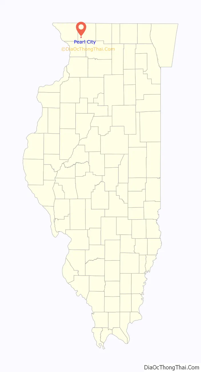
| County: | Stephenson County |
| Founded: | March 21, 1893 |
| Elevation: | 833 ft (254 m) |
| Total Area: | 0.65 sq mi (1.68 km²) |
| Land Area: | 0.64 sq mi (1.66 km²) |
| Water Area: | 0.01 sq mi (0.02 km²) |
| Total Population: | 790 |
| Population Density: | 1,232.45/sq mi (475.80/km²) |
| Area code: | 815 |
| FIPS code: | 1758369 |
| Website: | villageofpearlcity.com |
Online Interactive Map
Click on ![]() to view map in "full screen" mode.
to view map in "full screen" mode.
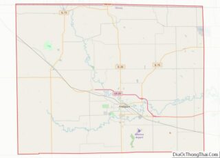
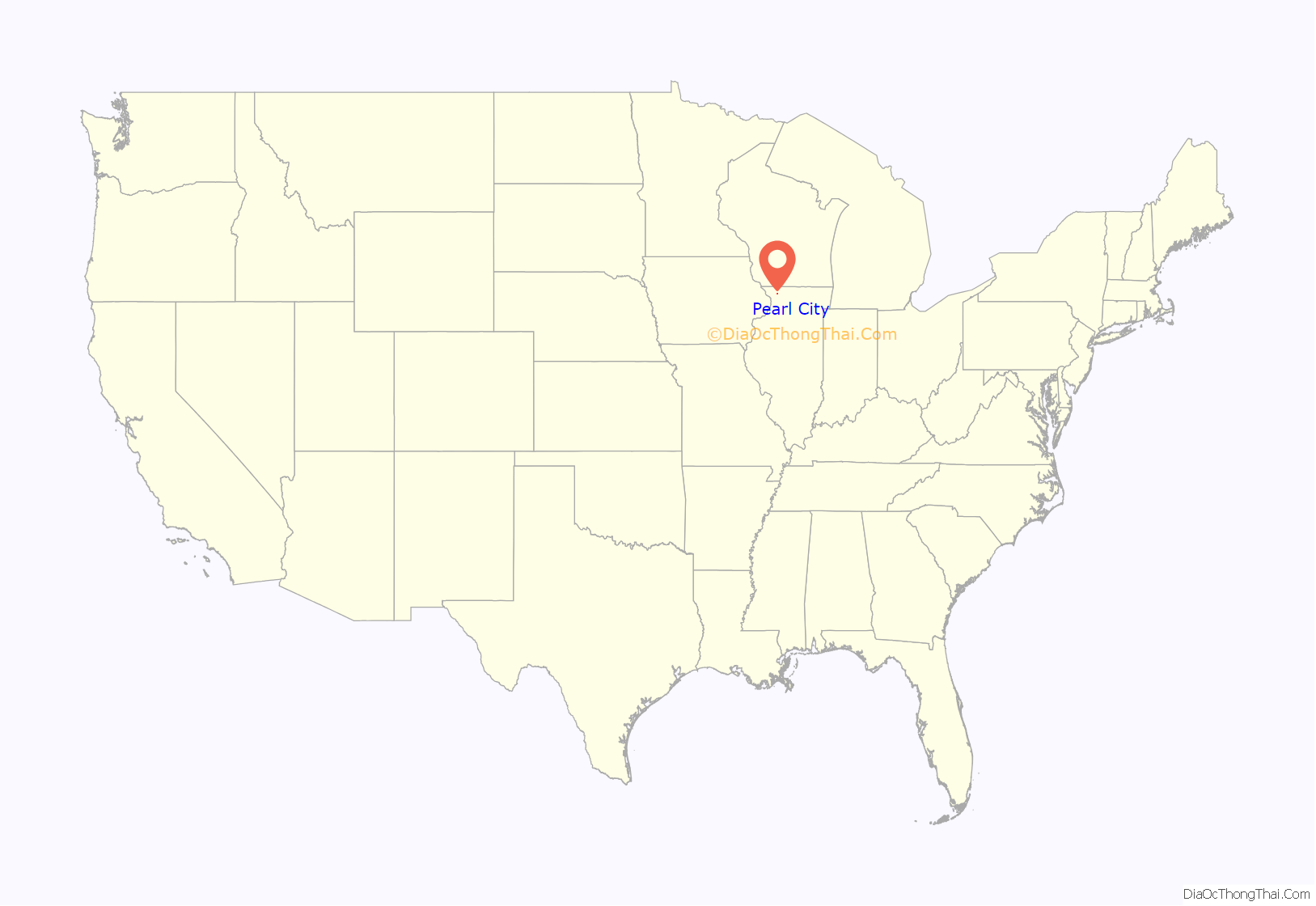
Pearl City location map. Where is Pearl City village?
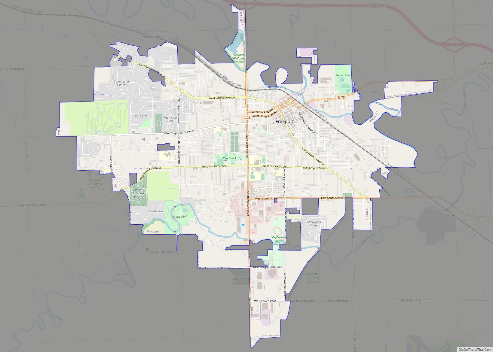
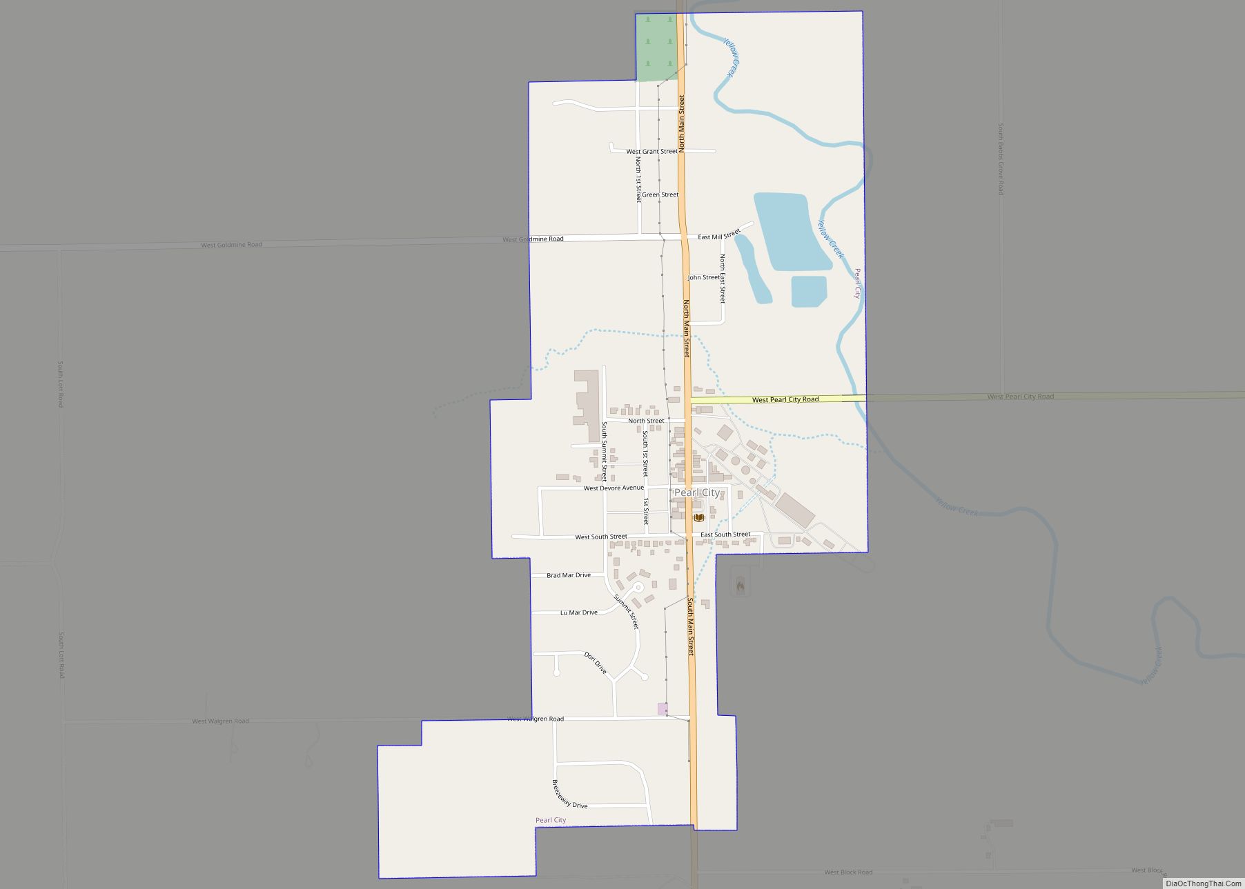
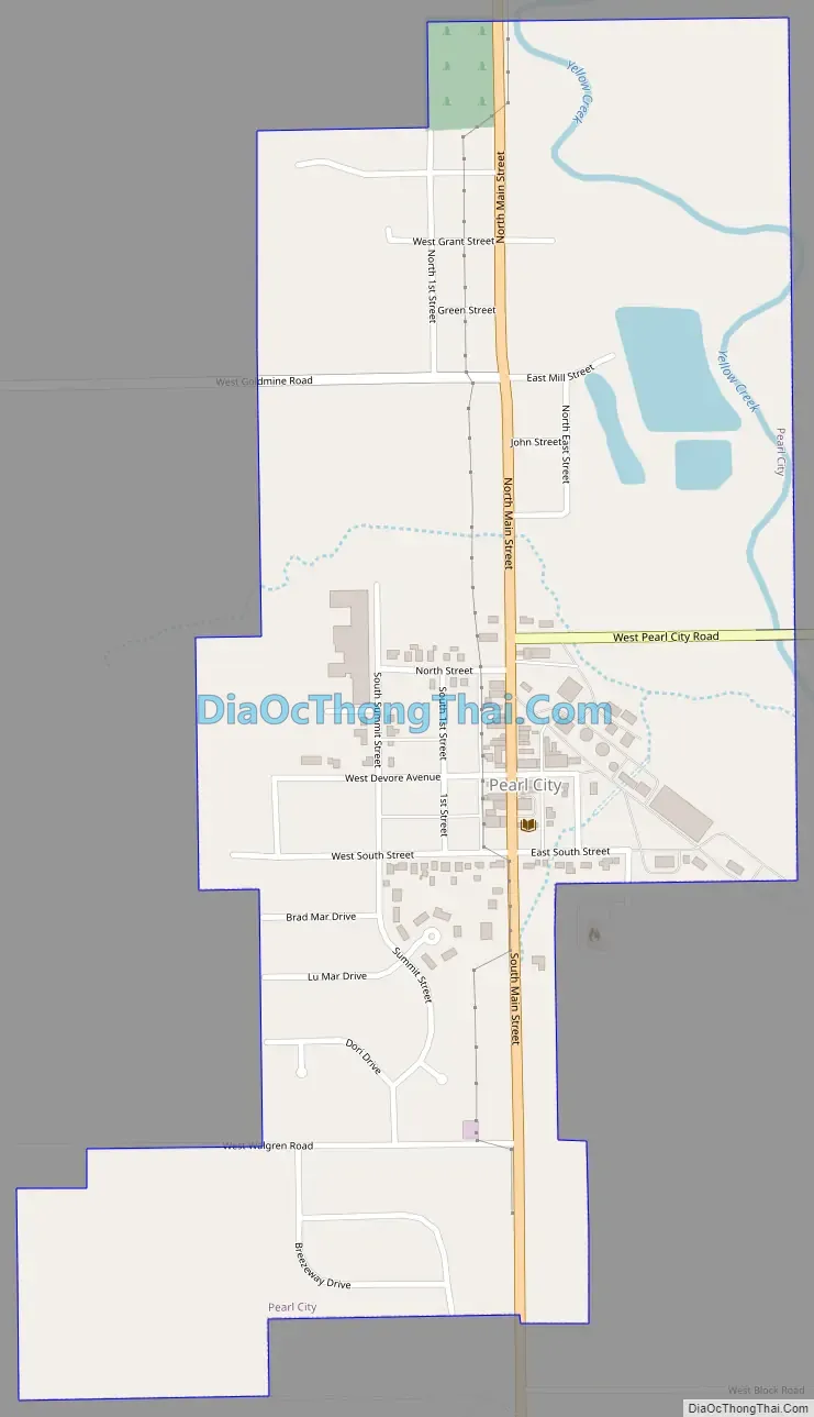
Pearl City Road Map
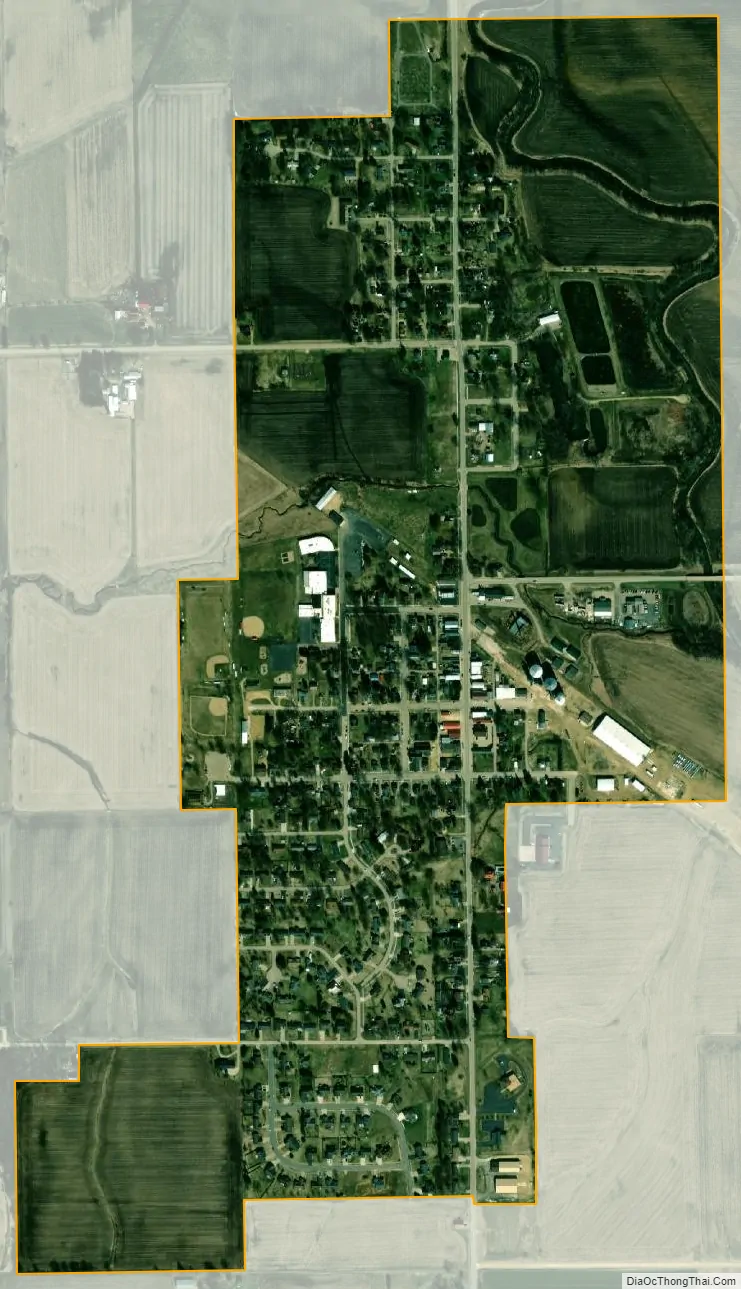
Pearl City city Satellite Map
Geography
Pearl City is located at 42°15′59″N 89°49′38″W / 42.26639°N 89.82722°W / 42.26639; -89.82722 (42.266179, -89.827185). It is located approximately 12 miles (19 km) west of Freeport and 40 miles (64 km) east of Galena. It is a part of the Freeport Micropolitan Statistical Area, which includes all of Stephenson County.
According to the 2010 census, Pearl City has a total area of 0.649 square miles (1.68 km), of which 0.64 square miles (1.66 km) (or 98.61%) is land and 0.009 square miles (0.02 km) (or 1.39%) is water.
The village is situated on Illinois Route 73, which runs south to Lanark and north to the Wisconsin border through Lena and Winslow.
Pearl City is located approximately six miles south of U.S. Route 20, which traverses the US from Boston in the east to Newport, Oregon in the west.
Climate
See also
Map of Illinois State and its subdivision:- Adams
- Alexander
- Bond
- Boone
- Brown
- Bureau
- Calhoun
- Carroll
- Cass
- Champaign
- Christian
- Clark
- Clay
- Clinton
- Coles
- Cook
- Crawford
- Cumberland
- De Kalb
- De Witt
- Douglas
- Dupage
- Edgar
- Edwards
- Effingham
- Fayette
- Ford
- Franklin
- Fulton
- Gallatin
- Greene
- Grundy
- Hamilton
- Hancock
- Hardin
- Henderson
- Henry
- Iroquois
- Jackson
- Jasper
- Jefferson
- Jersey
- Jo Daviess
- Johnson
- Kane
- Kankakee
- Kendall
- Knox
- La Salle
- Lake
- Lake Michigan
- Lawrence
- Lee
- Livingston
- Logan
- Macon
- Macoupin
- Madison
- Marion
- Marshall
- Mason
- Massac
- McDonough
- McHenry
- McLean
- Menard
- Mercer
- Monroe
- Montgomery
- Morgan
- Moultrie
- Ogle
- Peoria
- Perry
- Piatt
- Pike
- Pope
- Pulaski
- Putnam
- Randolph
- Richland
- Rock Island
- Saint Clair
- Saline
- Sangamon
- Schuyler
- Scott
- Shelby
- Stark
- Stephenson
- Tazewell
- Union
- Vermilion
- Wabash
- Warren
- Washington
- Wayne
- White
- Whiteside
- Will
- Williamson
- Winnebago
- Woodford
- Alabama
- Alaska
- Arizona
- Arkansas
- California
- Colorado
- Connecticut
- Delaware
- District of Columbia
- Florida
- Georgia
- Hawaii
- Idaho
- Illinois
- Indiana
- Iowa
- Kansas
- Kentucky
- Louisiana
- Maine
- Maryland
- Massachusetts
- Michigan
- Minnesota
- Mississippi
- Missouri
- Montana
- Nebraska
- Nevada
- New Hampshire
- New Jersey
- New Mexico
- New York
- North Carolina
- North Dakota
- Ohio
- Oklahoma
- Oregon
- Pennsylvania
- Rhode Island
- South Carolina
- South Dakota
- Tennessee
- Texas
- Utah
- Vermont
- Virginia
- Washington
- West Virginia
- Wisconsin
- Wyoming