Sauget (/sɔːˈʒeɪ/ saw-ZHAY) is a village in St. Clair County, Illinois, United States. It is part of Greater St. Louis. The population was 141 at the 2020 census, down from 159 in 2010.
| Name: | Sauget village |
|---|---|
| LSAD Code: | 47 |
| LSAD Description: | village (suffix) |
| State: | Illinois |
| County: | St. Clair County |
| Elevation: | 410 ft (120 m) |
| Total Area: | 4.94 sq mi (12.79 km²) |
| Land Area: | 4.58 sq mi (11.87 km²) |
| Water Area: | 0.35 sq mi (0.92 km²) |
| Total Population: | 141 |
| Population Density: | 30.78/sq mi (11.88/km²) |
| Area code: | 618 |
| FIPS code: | 1767756 |
| GNISfeature ID: | 2399187 |
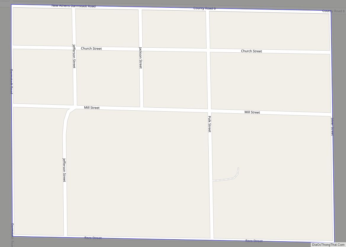
Online Interactive Map
Click on ![]() to view map in "full screen" mode.
to view map in "full screen" mode.
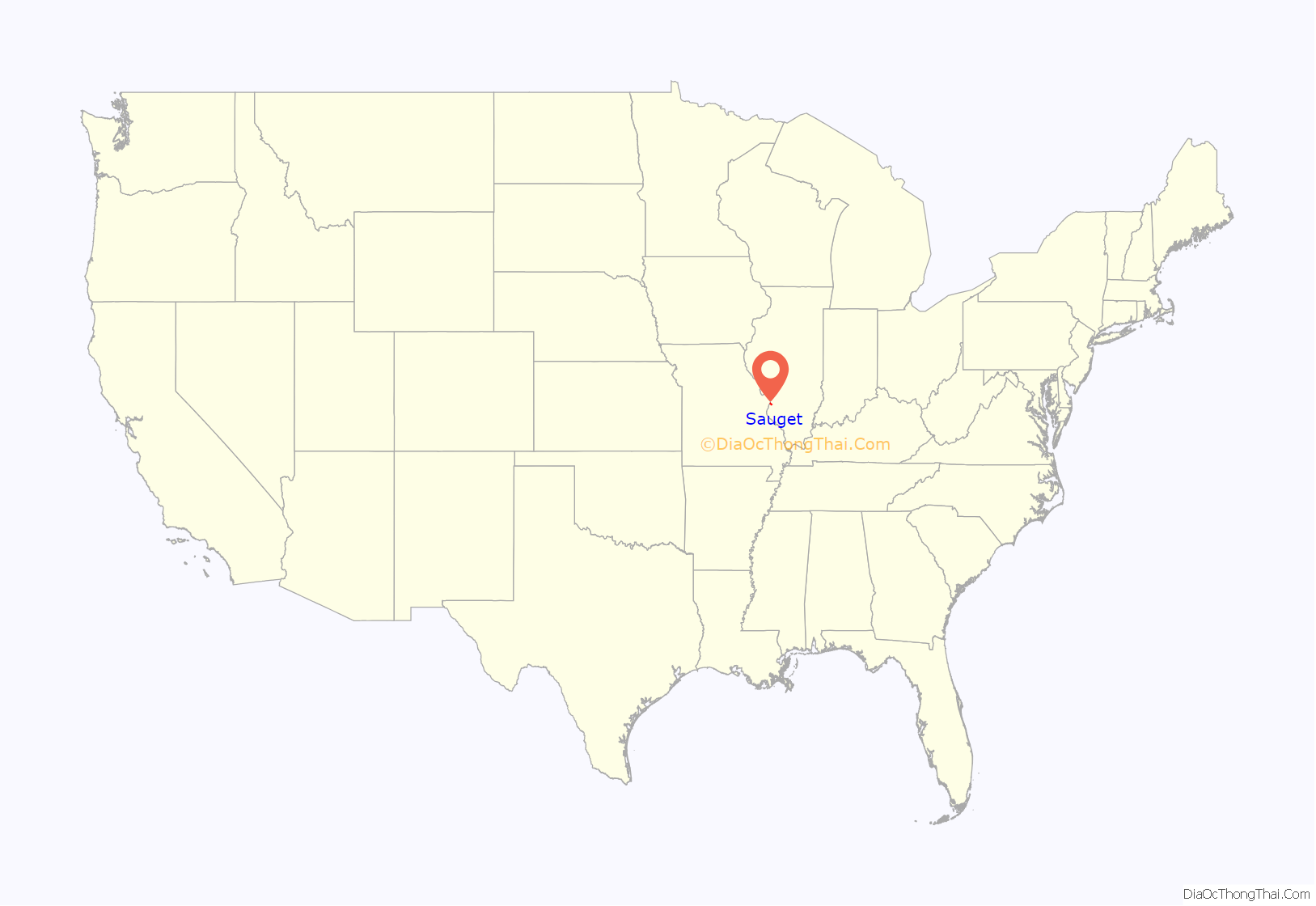
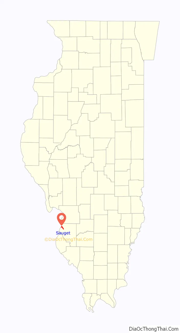
Sauget location map. Where is Sauget village?
History
Sauget was incorporated as “Monsanto” in 1926. It was formed to provide a lighter regulatory environment and low taxes for Monsanto chemical plants at a time when local jurisdictions had most of the responsibility for environmental rules. It was renamed in honor of Leo Sauget, its first Village President.
The village was incorporated in part in response to the failure of government in adjacent East St. Louis, Illinois to deliver essential services, and in part to take advantage of federal grant funding programs available only to governmental units, as opposed to private industry.
The village of Sauget operates the American Bottoms Treatment Plant, a large sewage treatment plant that serves much of the Illinois side of the St. Louis metropolitan area. In addition, the village operates a municipal physical/chemical treatment plant that receives industrial wastewater from its factories. This has been cited as one of only three municipal treatment plants of this type in the United States.
The Monsanto plant in Sauget was the nation’s largest producer of PCBs before a 1977 ban, and the EPA has designated the plant site along Dead Creek as a Superfund site.
Sauget has its own 16-member fire department and 16-member police department; this is despite having a population below 250 people. There is roughly one officer and firefighter for every 15 residents in Sauget. Sauget supplies municipal water and wastewater services.
Sauget is also home to minor league baseball: the Gateway Grizzlies of the Frontier League, which are controlled by the Sauget family.
Located in Sauget is the National Building Arts Center, a historic preservationist and salvage organization which holds one of the largest collections of significant architectural and industrial elements in the US.
Sauget Road Map
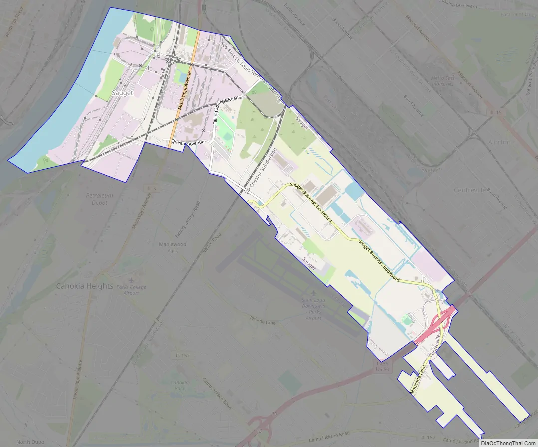
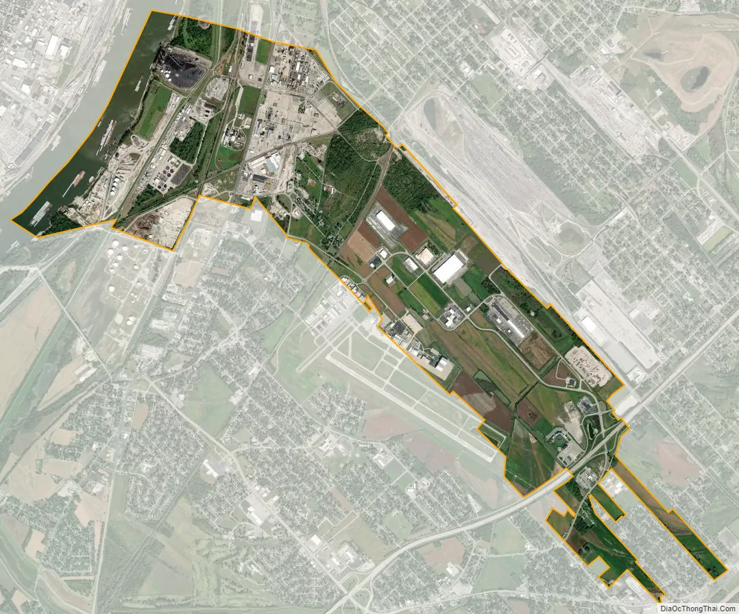
Sauget city Satellite Map
Geography
Sauget is located at 38°35′13″N 90°10′0″W / 38.58694°N 90.16667°W / 38.58694; -90.16667 (38.587013, -90.166690).
According to the 2010 census, Sauget has a total area of 4.594 square miles (11.90 km), of which 4.23 square miles (10.96 km) (or 92.08%) is land and 0.364 square miles (0.94 km) (or 7.92%) is water.
Sauget is located in the American Bottom, the floodplain of the Mississippi River opposite St. Louis, Missouri.
See also
Map of Illinois State and its subdivision:- Adams
- Alexander
- Bond
- Boone
- Brown
- Bureau
- Calhoun
- Carroll
- Cass
- Champaign
- Christian
- Clark
- Clay
- Clinton
- Coles
- Cook
- Crawford
- Cumberland
- De Kalb
- De Witt
- Douglas
- Dupage
- Edgar
- Edwards
- Effingham
- Fayette
- Ford
- Franklin
- Fulton
- Gallatin
- Greene
- Grundy
- Hamilton
- Hancock
- Hardin
- Henderson
- Henry
- Iroquois
- Jackson
- Jasper
- Jefferson
- Jersey
- Jo Daviess
- Johnson
- Kane
- Kankakee
- Kendall
- Knox
- La Salle
- Lake
- Lake Michigan
- Lawrence
- Lee
- Livingston
- Logan
- Macon
- Macoupin
- Madison
- Marion
- Marshall
- Mason
- Massac
- McDonough
- McHenry
- McLean
- Menard
- Mercer
- Monroe
- Montgomery
- Morgan
- Moultrie
- Ogle
- Peoria
- Perry
- Piatt
- Pike
- Pope
- Pulaski
- Putnam
- Randolph
- Richland
- Rock Island
- Saint Clair
- Saline
- Sangamon
- Schuyler
- Scott
- Shelby
- Stark
- Stephenson
- Tazewell
- Union
- Vermilion
- Wabash
- Warren
- Washington
- Wayne
- White
- Whiteside
- Will
- Williamson
- Winnebago
- Woodford
- Alabama
- Alaska
- Arizona
- Arkansas
- California
- Colorado
- Connecticut
- Delaware
- District of Columbia
- Florida
- Georgia
- Hawaii
- Idaho
- Illinois
- Indiana
- Iowa
- Kansas
- Kentucky
- Louisiana
- Maine
- Maryland
- Massachusetts
- Michigan
- Minnesota
- Mississippi
- Missouri
- Montana
- Nebraska
- Nevada
- New Hampshire
- New Jersey
- New Mexico
- New York
- North Carolina
- North Dakota
- Ohio
- Oklahoma
- Oregon
- Pennsylvania
- Rhode Island
- South Carolina
- South Dakota
- Tennessee
- Texas
- Utah
- Vermont
- Virginia
- Washington
- West Virginia
- Wisconsin
- Wyoming