Shiloh is a village in St. Clair County, Illinois, United States. The 2010 census recorded a population of 12,651. Shiloh is located within the St. Louis metropolitan area
| Name: | Shiloh village |
|---|---|
| LSAD Code: | 47 |
| LSAD Description: | village (suffix) |
| State: | Illinois |
| County: | St. Clair County |
| Elevation: | 561 ft (171 m) |
| Total Area: | 11.13 sq mi (28.84 km²) |
| Land Area: | 11.05 sq mi (28.61 km²) |
| Water Area: | 0.09 sq mi (0.23 km²) |
| Total Population: | 14,098 |
| Population Density: | 1,276.18/sq mi (492.73/km²) |
| FIPS code: | 1769524 |
| GNISfeature ID: | 2399809 |
| Website: | http://www.shilohil.org/ |
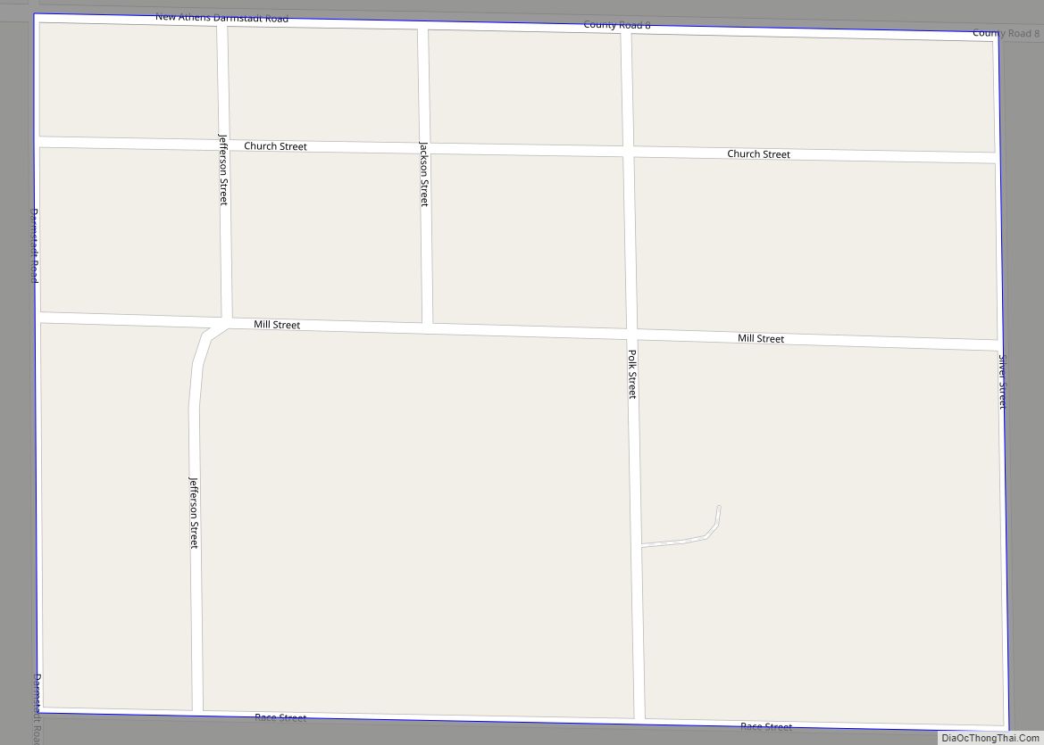
Online Interactive Map
Click on ![]() to view map in "full screen" mode.
to view map in "full screen" mode.
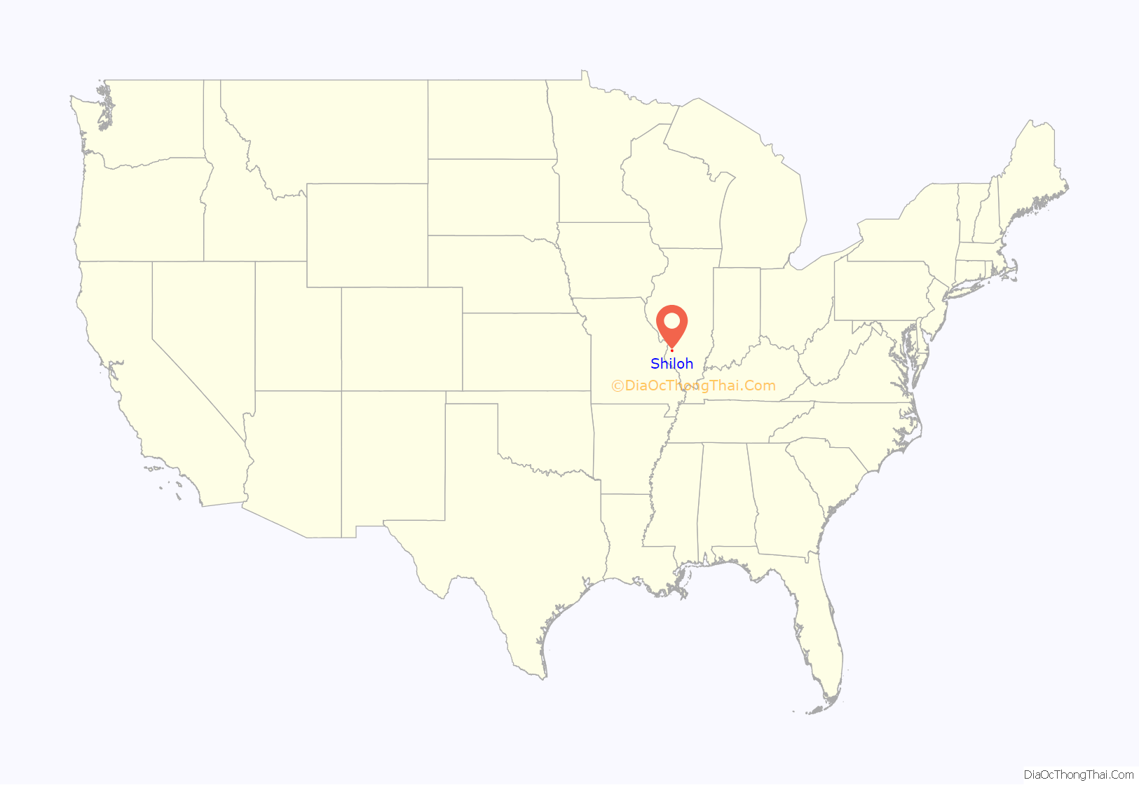
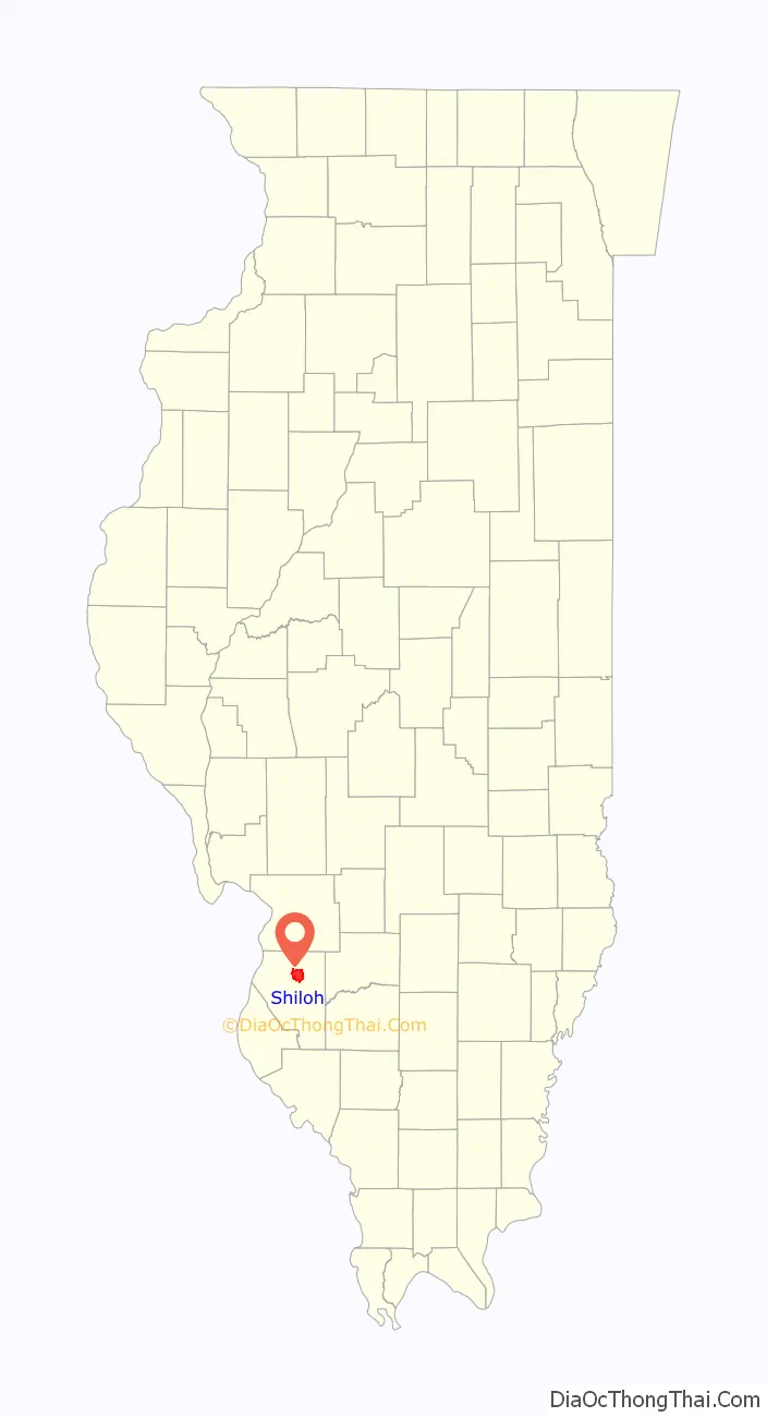
Shiloh location map. Where is Shiloh village?
History
A site known as “Three Springs” for its geological characteristics hosted an 11-day revival camp meeting in April 1807, which was the first in St. Clair County and possibly the second in Illinois Country, which was then part of Indiana Territory. It was organized by the Rev. William McKendree, Presiding Elder of the Western Conference and 4th Bishop of the Methodist Episcopal Church.
This assembly inspired construction of the log Shiloh Meeting House on the site shortly afterward, being the first Methodist church in the county and second in the Illinois Country. This meeting house came to be the longest-organized United Methodist church in the state of Illinois, bequeathing its name to the village and township which grew up around it. Three members of this church played significant roles in state government in the effort to prevent slaveholding from gaining a foothold in Illinois.
Shiloh Road Map
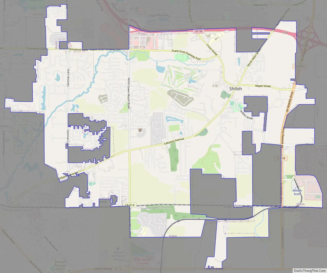
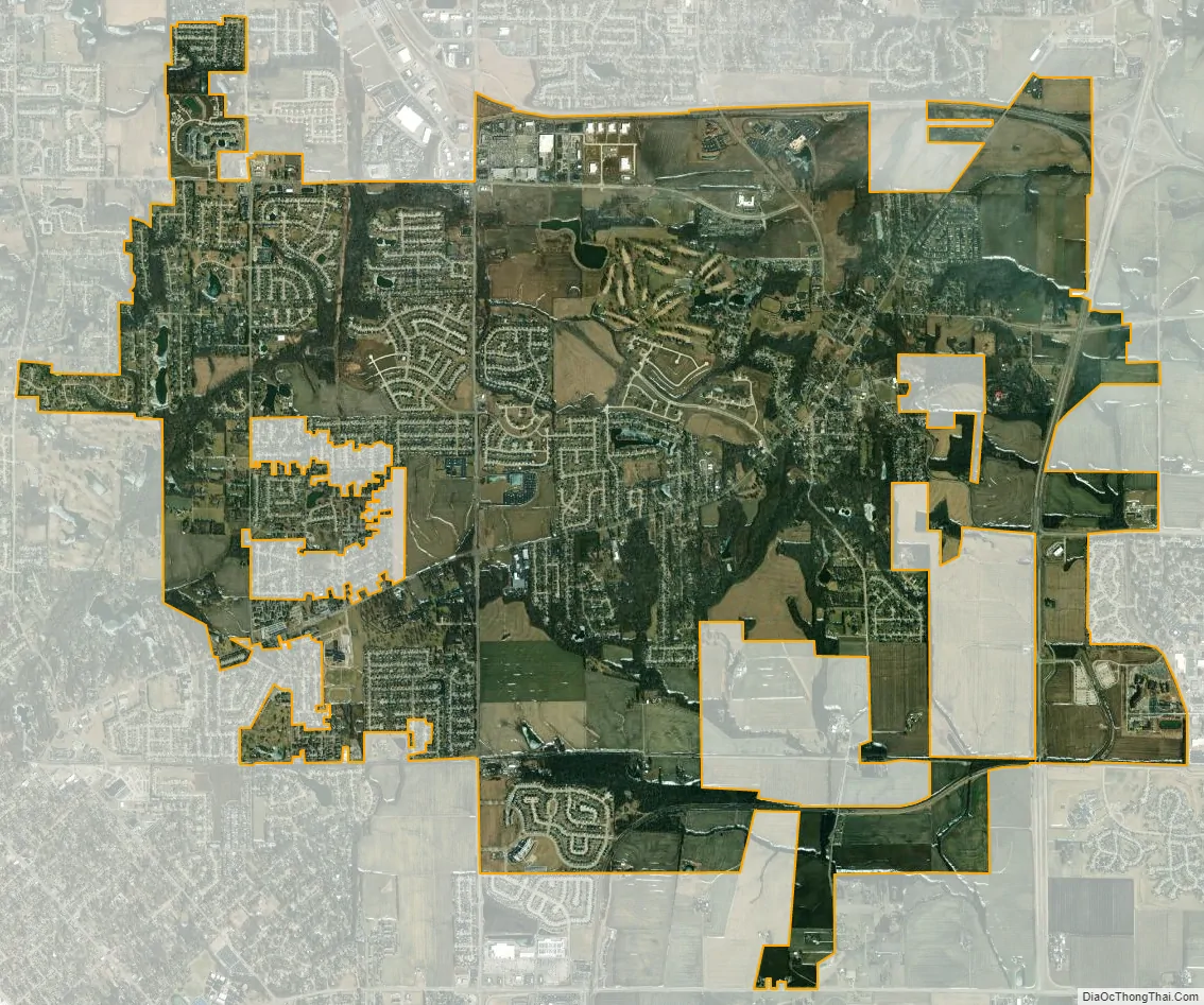
Shiloh city Satellite Map
Geography
Shiloh is located at 38°33′N 89°55′W / 38.550°N 89.917°W / 38.550; -89.917 (38.5501, -89.9149).
According to the 2010 census, Shiloh has a total area of 10.95 square miles (28.36 km), of which 10.86 square miles (28.13 km) (or 99.18%) is land and 0.09 square miles (0.23 km) (or 0.82%) is water.
Shiloh is the site of Scott Air Force Base and is also the present eastern terminus of the Saint Louis area electric interurban Metrolink Red Line.
See also
Map of Illinois State and its subdivision:- Adams
- Alexander
- Bond
- Boone
- Brown
- Bureau
- Calhoun
- Carroll
- Cass
- Champaign
- Christian
- Clark
- Clay
- Clinton
- Coles
- Cook
- Crawford
- Cumberland
- De Kalb
- De Witt
- Douglas
- Dupage
- Edgar
- Edwards
- Effingham
- Fayette
- Ford
- Franklin
- Fulton
- Gallatin
- Greene
- Grundy
- Hamilton
- Hancock
- Hardin
- Henderson
- Henry
- Iroquois
- Jackson
- Jasper
- Jefferson
- Jersey
- Jo Daviess
- Johnson
- Kane
- Kankakee
- Kendall
- Knox
- La Salle
- Lake
- Lake Michigan
- Lawrence
- Lee
- Livingston
- Logan
- Macon
- Macoupin
- Madison
- Marion
- Marshall
- Mason
- Massac
- McDonough
- McHenry
- McLean
- Menard
- Mercer
- Monroe
- Montgomery
- Morgan
- Moultrie
- Ogle
- Peoria
- Perry
- Piatt
- Pike
- Pope
- Pulaski
- Putnam
- Randolph
- Richland
- Rock Island
- Saint Clair
- Saline
- Sangamon
- Schuyler
- Scott
- Shelby
- Stark
- Stephenson
- Tazewell
- Union
- Vermilion
- Wabash
- Warren
- Washington
- Wayne
- White
- Whiteside
- Will
- Williamson
- Winnebago
- Woodford
- Alabama
- Alaska
- Arizona
- Arkansas
- California
- Colorado
- Connecticut
- Delaware
- District of Columbia
- Florida
- Georgia
- Hawaii
- Idaho
- Illinois
- Indiana
- Iowa
- Kansas
- Kentucky
- Louisiana
- Maine
- Maryland
- Massachusetts
- Michigan
- Minnesota
- Mississippi
- Missouri
- Montana
- Nebraska
- Nevada
- New Hampshire
- New Jersey
- New Mexico
- New York
- North Carolina
- North Dakota
- Ohio
- Oklahoma
- Oregon
- Pennsylvania
- Rhode Island
- South Carolina
- South Dakota
- Tennessee
- Texas
- Utah
- Vermont
- Virginia
- Washington
- West Virginia
- Wisconsin
- Wyoming