Sullivan is a city in Moultrie County, Illinois, United States. The population was 4,413 at the time of the 2020 census. It is the county seat and largest city of Moultrie County. Sullivan is named after Sullivan’s Island, South Carolina, where Fort Moultrie is located.
| Name: | Sullivan city |
|---|---|
| LSAD Code: | 25 |
| LSAD Description: | city (suffix) |
| State: | Illinois |
| County: | Moultrie County |
| Founded: | 1845 |
| Elevation: | 676 ft (206 m) |
| Total Area: | 2.78 sq mi (7.19 km²) |
| Land Area: | 2.77 sq mi (7.17 km²) |
| Water Area: | 0.01 sq mi (0.02 km²) |
| Total Population: | 4,413 |
| Population Density: | 1,593.72/sq mi (615.44/km²) |
| ZIP code: | 61951 |
| Area code: | 217 |
| FIPS code: | 1773495 |
| Website: | sullivanil.us |
Online Interactive Map
Click on ![]() to view map in "full screen" mode.
to view map in "full screen" mode.
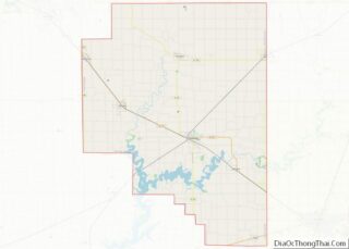
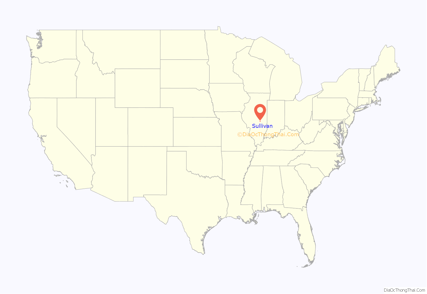
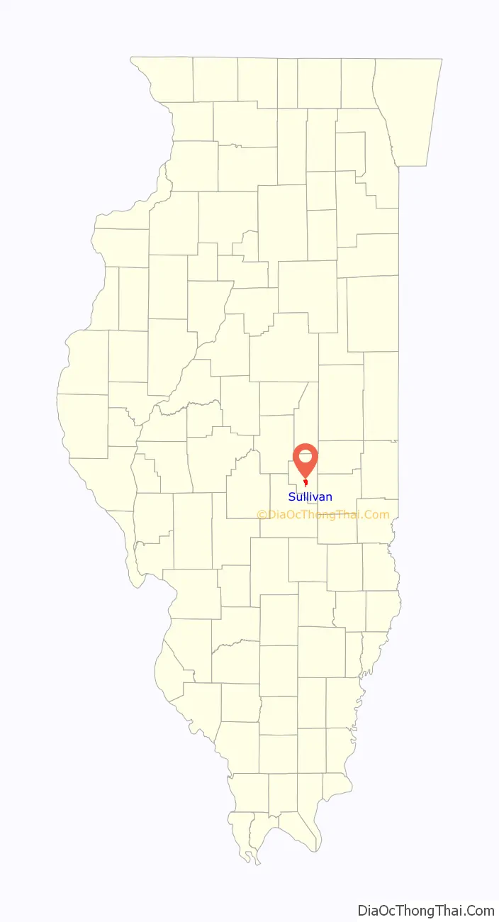
Sullivan location map. Where is Sullivan city?
History
Sullivan was founded in 1845 as Asa’s Point. Two years after Sullivan was founded, the first official courthouse of the county was built. It was a simple two-story brick building with a hipped roof, and the county jail was housed in the basement. The village would come alive with gossip when court was in session. Abraham Lincoln passed through this first courthouse many times from 1849 to 1852, as he practiced law in the Moultrie County circuit court. The present courthouse (the county’s third) contains a mural depicting this first courthouse.
In the opinion of early local leaders, Sullivan was not a logical site for a county seat. The village of Nelson (which no longer exists) had already been developed, and the prairie on which Sullivan would be built lacked proper drainage and was a breeding ground for malaria-carrying mosquitoes. In 1844, however, it was determined that centrally-located Sullivan was to be the county seat.
The original village consisted of 40 acres (16 ha) (25 city blocks) bounded by Jackson Street on the north, Water Street on the south, Douglas (now Worth) Street on the east, and Hamilton Street on the west. Sullivan’s first school was built in 1846, with the first church being built in 1848.
When Abraham Lincoln was campaigning for the state senate against Stephen A. Douglas, he gave a speech in Freeland Grove (now the Sullivan Civic Center parking lot). Freeland Grove was bounded by Wyman Park, Main Street, Strain Street, and Worth Street. A small monument facing Wyman Park near Main Street commemorates Lincoln’s 1858 speech. During this campaign, a riot broke out on the town square between the supporters of Lincoln and the supporters of Douglas.
In 1864, a fire destroyed the first courthouse and a second, larger one was built that was in use until 1904, when it was demolished and the third, present-day courthouse was built. Along with the first courthouse building, hundreds of county records were lost.
Sullivan was home to the Titus Opera House, built in 1871, which was located on the north side of the town square. On the second and third floors of the building, the large auditorium, balcony, and box seats could accommodate up to 800 patrons. The opera house was among the finest in the area, and it hosted a concert given by the great Venezuelan pianist Teresa Carreño. The opera house was built by a businessman and Civil War veteran named Joseph Titus as both an attraction for high society and a “playground” for his young daughter, Winifred, who grew up to become a talented pianist and singer. She toured Europe during her career, even performing at the legendary Palais Garnier in Paris. In the early morning of February 20, 1910, the Titus Opera House caught fire and tragically burned to the ground. This marked the end of a live entertainment era in Sullivan until Guy S. Little Jr. founded The Little Theatre on the Square decades later.
Wyman Park, one of two parks on the north side of Sullivan, has an intriguing past. Albert Wyman, a man who immigrated to the United States from Germany, owned a shoe repair and sales shop on the west end of the town square. During the time Wyman was alive, Sullivan lacked a public park, so in his will he endowed much of his business profit to the city in order to purchase land for a park. While Wyman’s will prohibited any kind of sales from occurring on the grounds of the new park, concession stands were built next to the baseball diamonds in the 1960s.
The Moultrie County Historical and Genealogical Society, formerly located in downtown Sullivan, now on the southern end of town on South Hamilton Street, houses a small museum of the county’s past.
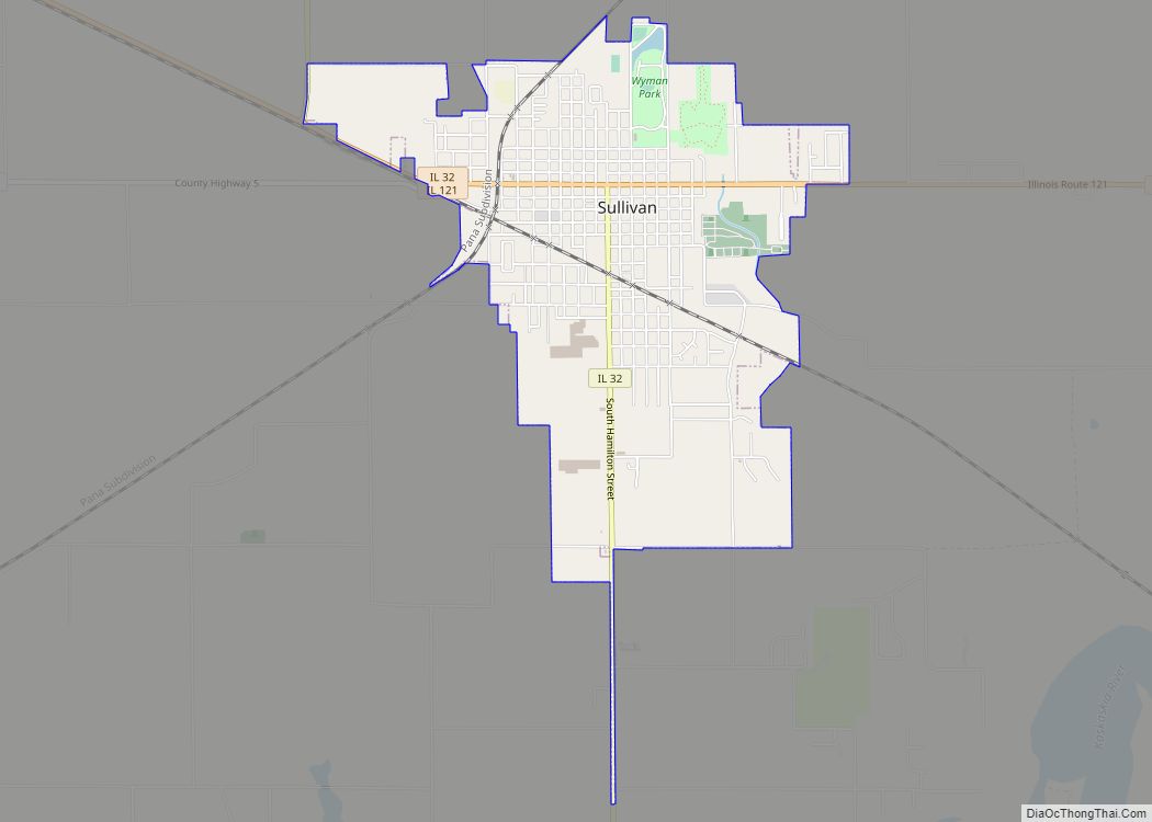
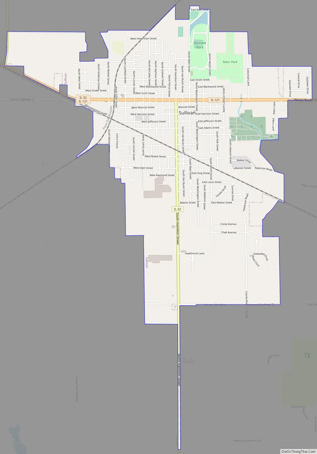
Sullivan Road Map
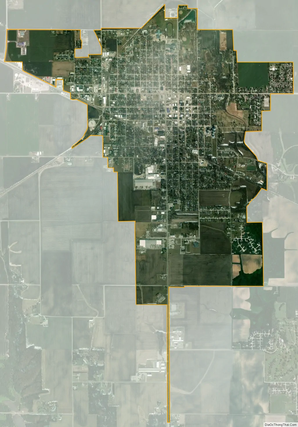
Sullivan city Satellite Map
Geography
Sullivan is located south of the center of Moultrie County. Illinois Routes 32 and 121 pass through the city center. IL 121 leads northwest 28 miles (45 km) to Decatur and southeast 17 miles (27 km) to Mattoon, while IL 32 leads north 9 miles (14 km) to Lovington and south 11 miles (18 km) to Windsor.
According to the U.S. Census Bureau, Sullivan has a total area of 2.78 square miles (7.2 km), of which 0.01 square miles (0.026 km), or 0.29%, are water. Asa Creek crosses the east side of the city, flowing south to the Kaskaskia River in Lake Shelbyville.
See also
Map of Illinois State and its subdivision:- Adams
- Alexander
- Bond
- Boone
- Brown
- Bureau
- Calhoun
- Carroll
- Cass
- Champaign
- Christian
- Clark
- Clay
- Clinton
- Coles
- Cook
- Crawford
- Cumberland
- De Kalb
- De Witt
- Douglas
- Dupage
- Edgar
- Edwards
- Effingham
- Fayette
- Ford
- Franklin
- Fulton
- Gallatin
- Greene
- Grundy
- Hamilton
- Hancock
- Hardin
- Henderson
- Henry
- Iroquois
- Jackson
- Jasper
- Jefferson
- Jersey
- Jo Daviess
- Johnson
- Kane
- Kankakee
- Kendall
- Knox
- La Salle
- Lake
- Lake Michigan
- Lawrence
- Lee
- Livingston
- Logan
- Macon
- Macoupin
- Madison
- Marion
- Marshall
- Mason
- Massac
- McDonough
- McHenry
- McLean
- Menard
- Mercer
- Monroe
- Montgomery
- Morgan
- Moultrie
- Ogle
- Peoria
- Perry
- Piatt
- Pike
- Pope
- Pulaski
- Putnam
- Randolph
- Richland
- Rock Island
- Saint Clair
- Saline
- Sangamon
- Schuyler
- Scott
- Shelby
- Stark
- Stephenson
- Tazewell
- Union
- Vermilion
- Wabash
- Warren
- Washington
- Wayne
- White
- Whiteside
- Will
- Williamson
- Winnebago
- Woodford
- Alabama
- Alaska
- Arizona
- Arkansas
- California
- Colorado
- Connecticut
- Delaware
- District of Columbia
- Florida
- Georgia
- Hawaii
- Idaho
- Illinois
- Indiana
- Iowa
- Kansas
- Kentucky
- Louisiana
- Maine
- Maryland
- Massachusetts
- Michigan
- Minnesota
- Mississippi
- Missouri
- Montana
- Nebraska
- Nevada
- New Hampshire
- New Jersey
- New Mexico
- New York
- North Carolina
- North Dakota
- Ohio
- Oklahoma
- Oregon
- Pennsylvania
- Rhode Island
- South Carolina
- South Dakota
- Tennessee
- Texas
- Utah
- Vermont
- Virginia
- Washington
- West Virginia
- Wisconsin
- Wyoming