Tamms is a village in Alexander County, Illinois, United States. The population was 430 at the 2020 census, down from 632 at the 2010 census. It is part of the Cape Girardeau–Jackson, MO-IL Metropolitan Statistical Area.
| Name: | Tamms village |
|---|---|
| LSAD Code: | 47 |
| LSAD Description: | village (suffix) |
| State: | Illinois |
| County: | Alexander County |
| Elevation: | 341 ft (104 m) |
| Total Area: | 2.33 sq mi (6.04 km²) |
| Land Area: | 2.33 sq mi (6.04 km²) |
| Water Area: | 0.00 sq mi (0.00 km²) 0% |
| Total Population: | 430 |
| Population Density: | 184.39/sq mi (71.21/km²) |
| Area code: | 618 |
| FIPS code: | 1774457 |
| GNISfeature ID: | 2399951 |
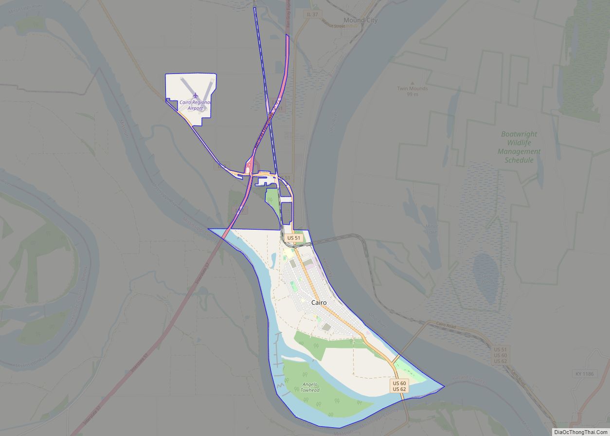
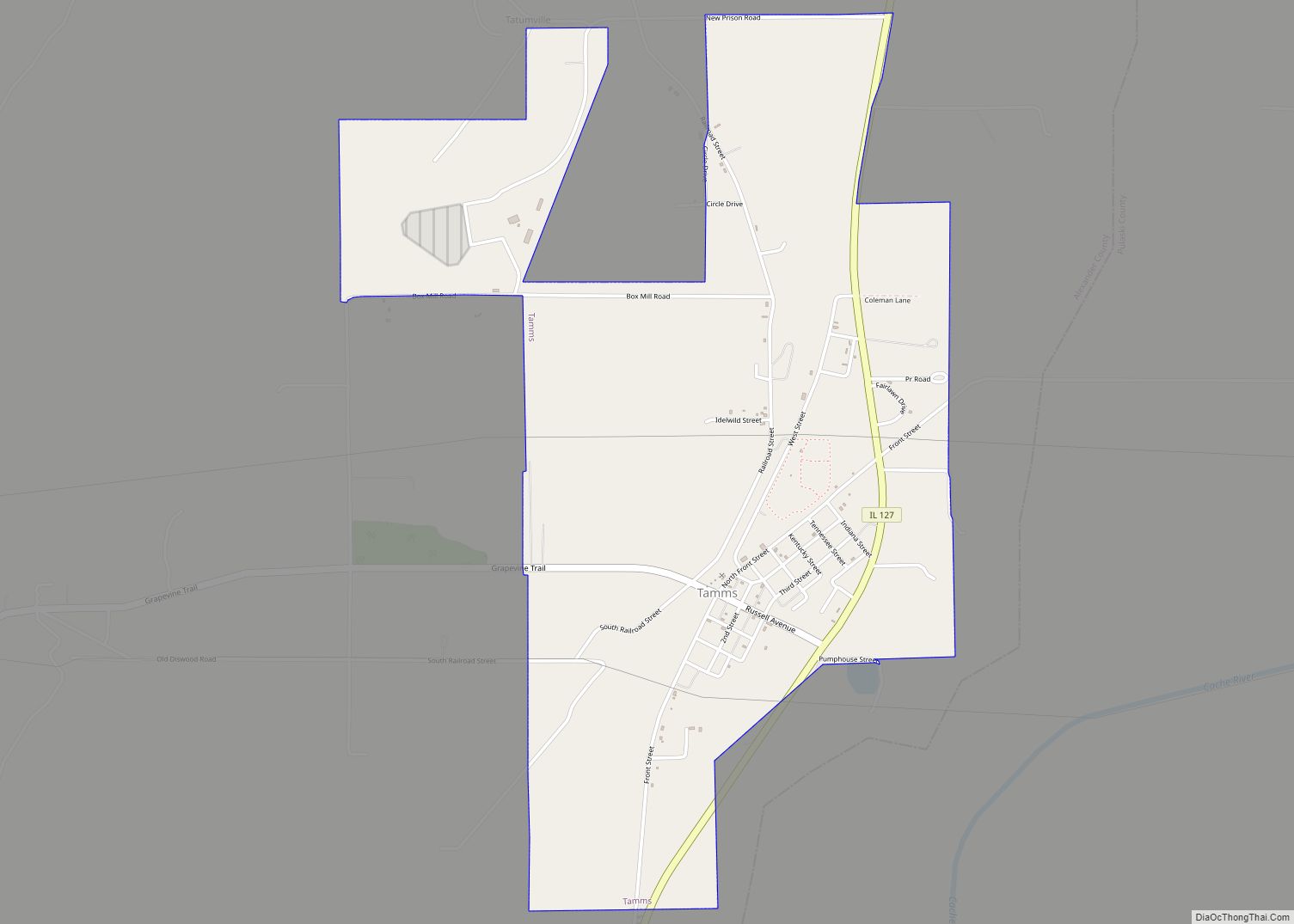
Online Interactive Map
Click on ![]() to view map in "full screen" mode.
to view map in "full screen" mode.
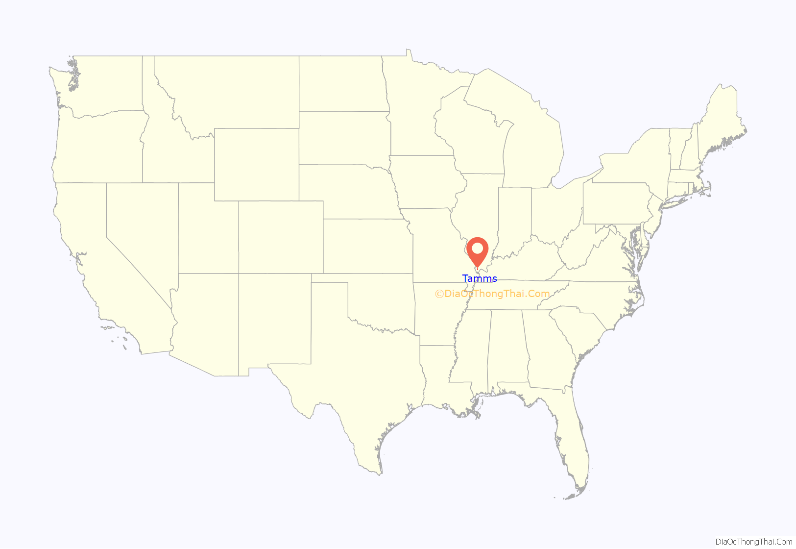
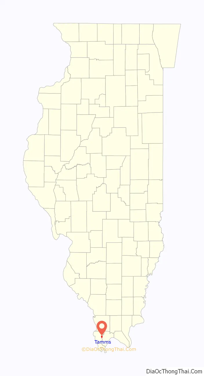
Tamms location map. Where is Tamms village?
History
Tamms was established under the name of Idlewild in 1883.
The railroad service ended in the 1970s and therefore the economy declined.
Tamms is the location of the Tamms Correctional Center, a super-maximum correctional facility that was operated by the Illinois Department of Corrections and housed the State of Illinois execution chamber. Illinois abolished the death penalty in 2011. This prison was closed in 2013.
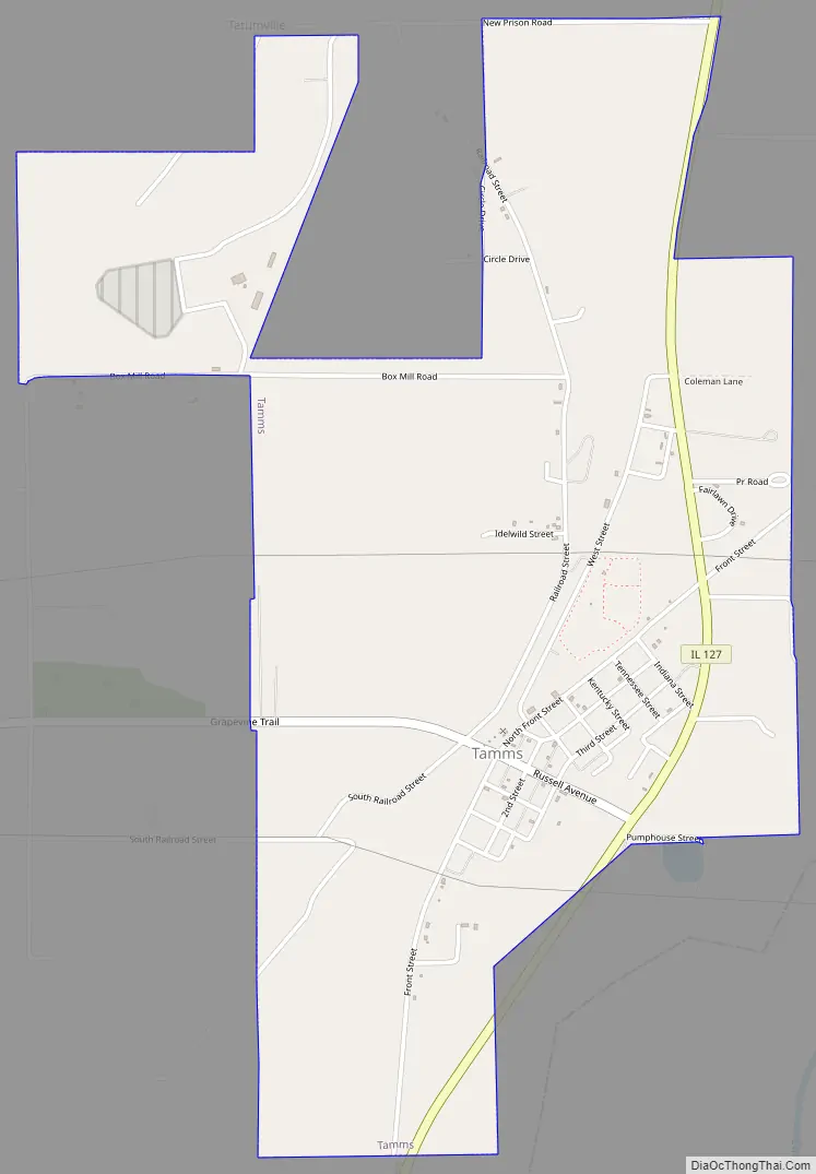
Tamms Road Map
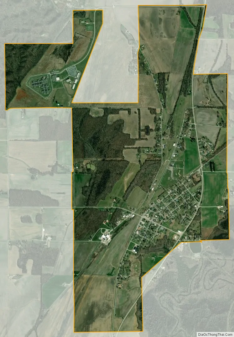
Tamms city Satellite Map
Geography
Tamms is located at 37°14′25″N 89°15′53″W / 37.24028°N 89.26472°W / 37.24028; -89.26472 (37.240207, -89.264822).
According to the 2021 census gazetteer files, Tamms has a total area of 2.33 square miles (6.03 km), all land.
See also
Map of Illinois State and its subdivision:- Adams
- Alexander
- Bond
- Boone
- Brown
- Bureau
- Calhoun
- Carroll
- Cass
- Champaign
- Christian
- Clark
- Clay
- Clinton
- Coles
- Cook
- Crawford
- Cumberland
- De Kalb
- De Witt
- Douglas
- Dupage
- Edgar
- Edwards
- Effingham
- Fayette
- Ford
- Franklin
- Fulton
- Gallatin
- Greene
- Grundy
- Hamilton
- Hancock
- Hardin
- Henderson
- Henry
- Iroquois
- Jackson
- Jasper
- Jefferson
- Jersey
- Jo Daviess
- Johnson
- Kane
- Kankakee
- Kendall
- Knox
- La Salle
- Lake
- Lake Michigan
- Lawrence
- Lee
- Livingston
- Logan
- Macon
- Macoupin
- Madison
- Marion
- Marshall
- Mason
- Massac
- McDonough
- McHenry
- McLean
- Menard
- Mercer
- Monroe
- Montgomery
- Morgan
- Moultrie
- Ogle
- Peoria
- Perry
- Piatt
- Pike
- Pope
- Pulaski
- Putnam
- Randolph
- Richland
- Rock Island
- Saint Clair
- Saline
- Sangamon
- Schuyler
- Scott
- Shelby
- Stark
- Stephenson
- Tazewell
- Union
- Vermilion
- Wabash
- Warren
- Washington
- Wayne
- White
- Whiteside
- Will
- Williamson
- Winnebago
- Woodford
- Alabama
- Alaska
- Arizona
- Arkansas
- California
- Colorado
- Connecticut
- Delaware
- District of Columbia
- Florida
- Georgia
- Hawaii
- Idaho
- Illinois
- Indiana
- Iowa
- Kansas
- Kentucky
- Louisiana
- Maine
- Maryland
- Massachusetts
- Michigan
- Minnesota
- Mississippi
- Missouri
- Montana
- Nebraska
- Nevada
- New Hampshire
- New Jersey
- New Mexico
- New York
- North Carolina
- North Dakota
- Ohio
- Oklahoma
- Oregon
- Pennsylvania
- Rhode Island
- South Carolina
- South Dakota
- Tennessee
- Texas
- Utah
- Vermont
- Virginia
- Washington
- West Virginia
- Wisconsin
- Wyoming