Wauconda (/ˌwɔːˈkɒndə/ or /wəˈkɒndə/) is a village in Lake County, Illinois, United States. Per the 2020 census, the population was 14,084. It is the site of the Wauconda Bog Nature Preserve, a National Natural Landmark. Wauconda Community Unit School District 118 serves students from Pre-K through 12th grade who live in Wauconda and surrounding communities (Island Lake, Lakemoor, Volo, and unincorporated sections of McHenry County). Fremont School District 79 also serves students from communities from northern part of Wauconda.
| Name: | Wauconda village |
|---|---|
| LSAD Code: | 47 |
| LSAD Description: | village (suffix) |
| State: | Illinois |
| County: | Lake County |
| Incorporated: | 1872 |
| Total Area: | 5.76 sq mi (14.93 km²) |
| Land Area: | 5.07 sq mi (13.14 km²) |
| Water Area: | 0.69 sq mi (1.79 km²) |
| Total Population: | 14,084 |
| Population Density: | 2,776.81/sq mi (1,072.05/km²) |
| Area code: | 847 and 224 |
| FIPS code: | 1779267 |
| Website: | wauconda-il.gov |
Online Interactive Map
Click on ![]() to view map in "full screen" mode.
to view map in "full screen" mode.
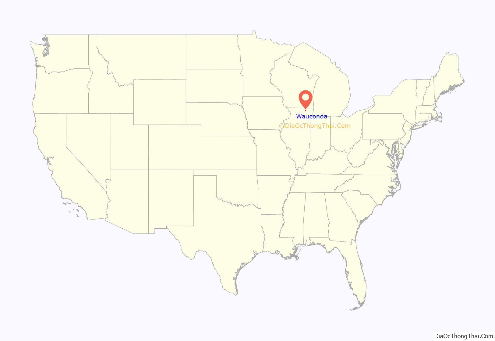
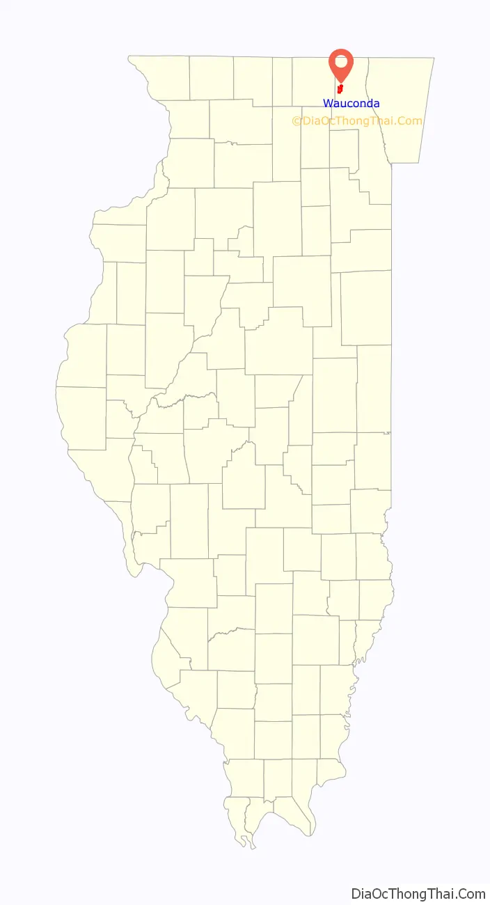
Wauconda location map. Where is Wauconda village?
History
1800’s
According to local legend, Wauconda was named after an indigenous chief whose name translated as “spirit water”.
Many early settlers of Wauconda came from New England and New York by covered wagon or through the Erie Canal and the Great Lakes.
Elihu Hubbard built the first log cabin on the bank of Bangs Lake in 1836. Justus Bangs, the first settler in Wauconda, built a house next to the lake in 1848 and the lake was later named after him. In 1840, members of the Winnebago tribe who did not leave the shores of the Fox River often went to the area to trade. In 1849, Wauconda was organized into a town by a vote of the people of Lake County to divide Lake County into towns. There were 1,695 votes cast and all except three were in favor of the division. The first town meeting was held on the 1st Tuesday in April, 1850 where the first officers were elected and appointed. I.
Wauconda’s first school was built in 1839 and the area’s post office was moved to Wauconda on June 27, 1849, with Hazard Green becoming its first postmaster.
Elder Joel Wheeler of McHenry built the first Baptist church in Wauconda in the autumn of 1838. A Methodist church was organized on September 3, 1852, by Reverend C. French, and built in 1856 on the Commons. Both Methodists and Baptists attended prayer at the church until February 1870, when the Baptists reorganized and built a new church on October 30, 1870. A Roman Catholic church was built in 1877 and its first trustees were James S. Murray, Charles Davlin, Felix Givens, John Givens, Hugh Davlin, and Owen McMahon. Its first priest was Father O’Neil.
In 1850, Wauconda had a population of around 200 residents, and the town had three goods stores, two public houses and various mechanics.
The Village of Wauconda was incorporated on August 18th, 1877.
1900’s
By the early 1900s, Wauconda was a popular resort village for Chicago residents and Bangs Lake was made suitable for beaches. The Palatine, Lake Zurich and Wauconda Railroad was completed and hauled agricultural products, delivered mail, transported local passengers, and brought vacationers and day-trippers out from Chicago. Although the railroad did not help develop Wauconda, which remained a small town, it flourished as a resort, and residents depended on it for supplies and for mail.
The railroad closed in 1920 due to lack of business. Later in the decade, Phil’s Beach was opened by Phil Froehlke and the right-of way was purchased for Route 176 (Liberty Street) through the center of town.
By the end of the 1930s, Wauconda’s population exceeded 500 residents. At the end of the 1960s Wauconda had three elementary schools, a junior high, and a high school; an adequate water system, a modern and efficient sewage-treatment plant, and established local industries. By the end of the 1970s there were more than 5,600 residents living in Wauconda.
Throughout the 1980s most of the beaches on Bangs Lake gradually closed down to be replaced by houses, townhomes, and other development. Development continued into the 1990s and 2000s as individuals from the outlying Chicago suburbs sought cheaper land. Large new subdivisions were developed north of town and small suburbs established in the surrounding area.
2000’s
In 2000, Wauconda’s population was 9,386. By 2020, it had grown to 14,084 residents.
The village completed a switch to Lake Michigan water in October 2019. This was the largest infrastructure project in village history, costing $48 million.
On April 4, 2023, a referendum was held in the village to determine Home rule status. The result of the referendum was to reject home rule status.
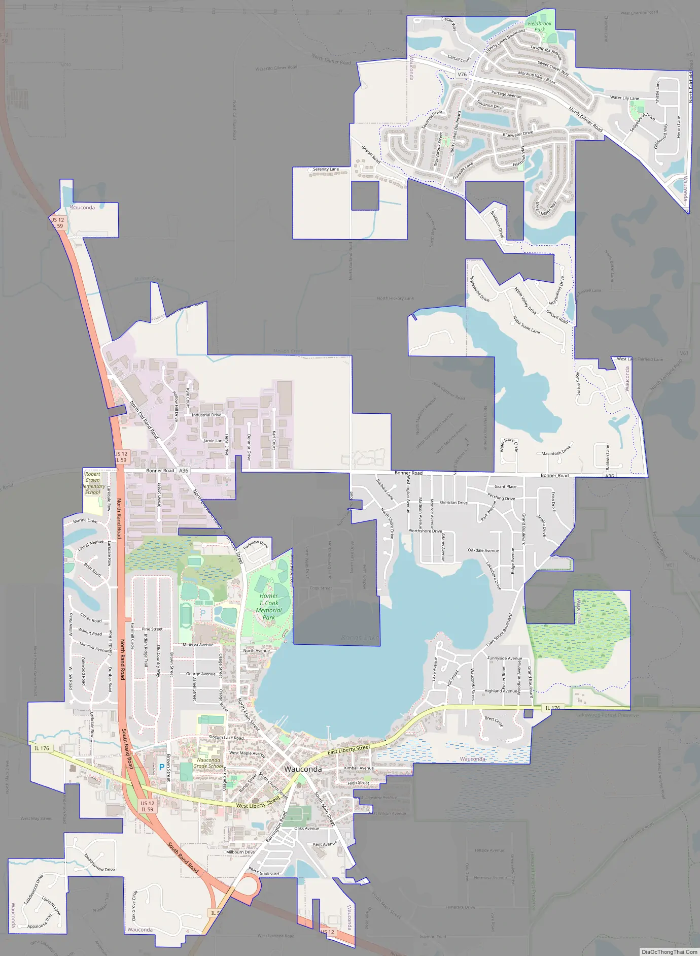
Wauconda Road Map
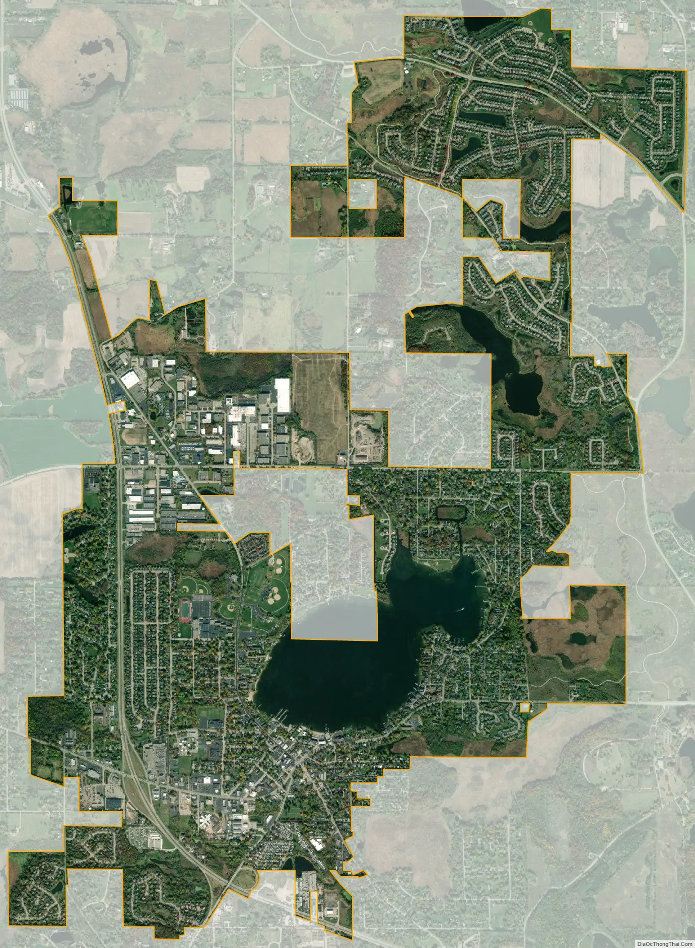
Wauconda city Satellite Map
Geography
Wauconda is located at 42°16′1″N 88°8′34″W / 42.26694°N 88.14278°W / 42.26694; -88.14278 (42.266910, -88.142657).
According to the 2010 census, Wauconda has a total area of 5.732 square miles (14.85 km), of which 5.05 square miles (13.08 km) (or 88.1%) is land and 0.682 square miles (1.77 km) (or 11.9%) is water.
See also
Map of Illinois State and its subdivision:- Adams
- Alexander
- Bond
- Boone
- Brown
- Bureau
- Calhoun
- Carroll
- Cass
- Champaign
- Christian
- Clark
- Clay
- Clinton
- Coles
- Cook
- Crawford
- Cumberland
- De Kalb
- De Witt
- Douglas
- Dupage
- Edgar
- Edwards
- Effingham
- Fayette
- Ford
- Franklin
- Fulton
- Gallatin
- Greene
- Grundy
- Hamilton
- Hancock
- Hardin
- Henderson
- Henry
- Iroquois
- Jackson
- Jasper
- Jefferson
- Jersey
- Jo Daviess
- Johnson
- Kane
- Kankakee
- Kendall
- Knox
- La Salle
- Lake
- Lake Michigan
- Lawrence
- Lee
- Livingston
- Logan
- Macon
- Macoupin
- Madison
- Marion
- Marshall
- Mason
- Massac
- McDonough
- McHenry
- McLean
- Menard
- Mercer
- Monroe
- Montgomery
- Morgan
- Moultrie
- Ogle
- Peoria
- Perry
- Piatt
- Pike
- Pope
- Pulaski
- Putnam
- Randolph
- Richland
- Rock Island
- Saint Clair
- Saline
- Sangamon
- Schuyler
- Scott
- Shelby
- Stark
- Stephenson
- Tazewell
- Union
- Vermilion
- Wabash
- Warren
- Washington
- Wayne
- White
- Whiteside
- Will
- Williamson
- Winnebago
- Woodford
- Alabama
- Alaska
- Arizona
- Arkansas
- California
- Colorado
- Connecticut
- Delaware
- District of Columbia
- Florida
- Georgia
- Hawaii
- Idaho
- Illinois
- Indiana
- Iowa
- Kansas
- Kentucky
- Louisiana
- Maine
- Maryland
- Massachusetts
- Michigan
- Minnesota
- Mississippi
- Missouri
- Montana
- Nebraska
- Nevada
- New Hampshire
- New Jersey
- New Mexico
- New York
- North Carolina
- North Dakota
- Ohio
- Oklahoma
- Oregon
- Pennsylvania
- Rhode Island
- South Carolina
- South Dakota
- Tennessee
- Texas
- Utah
- Vermont
- Virginia
- Washington
- West Virginia
- Wisconsin
- Wyoming


