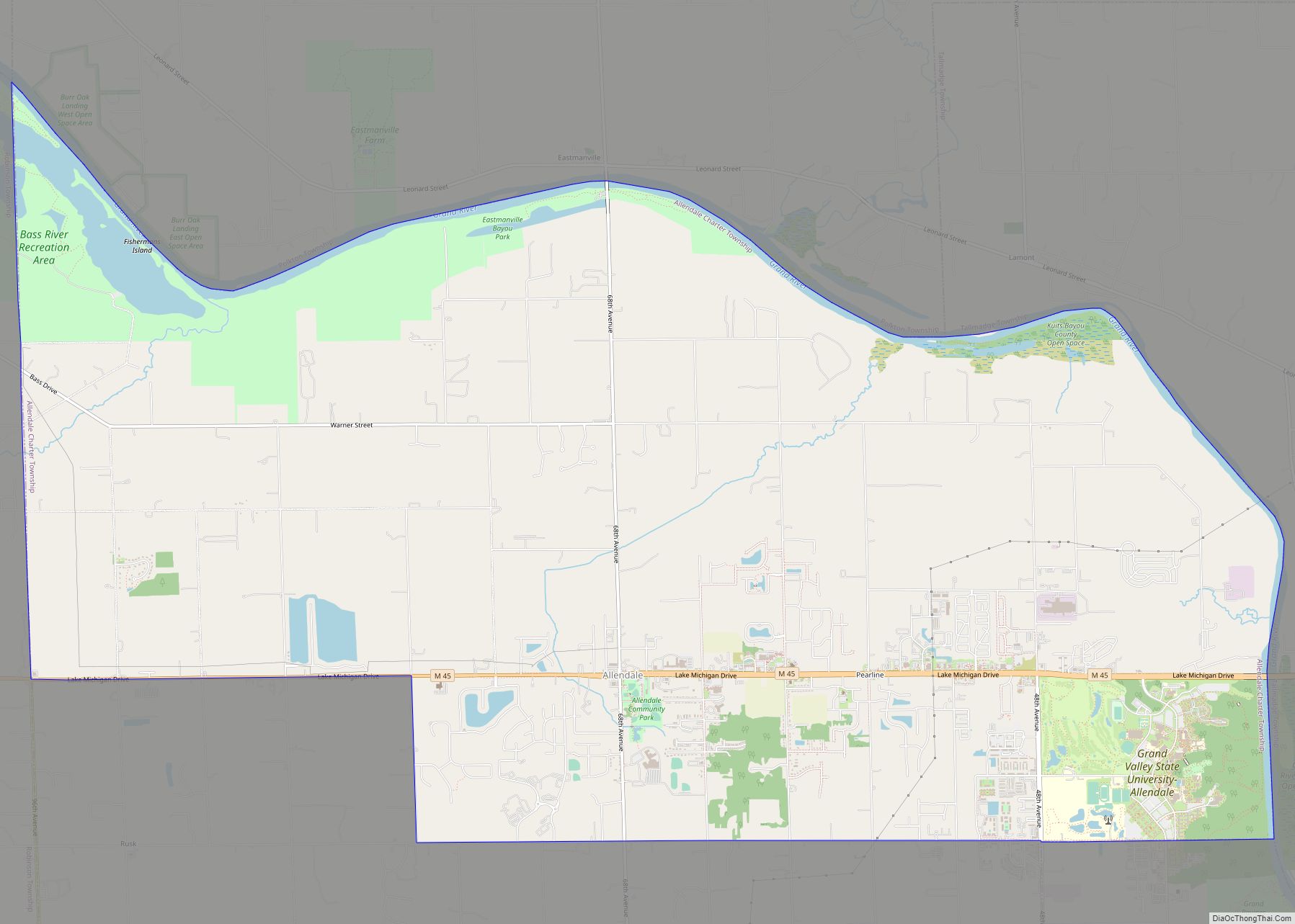
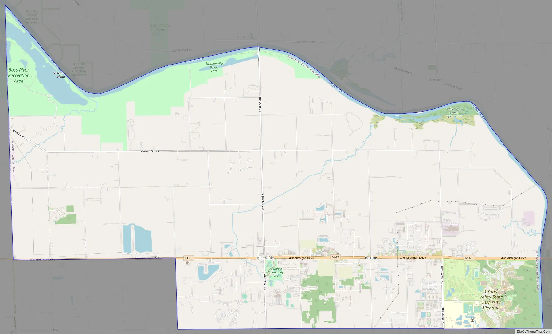
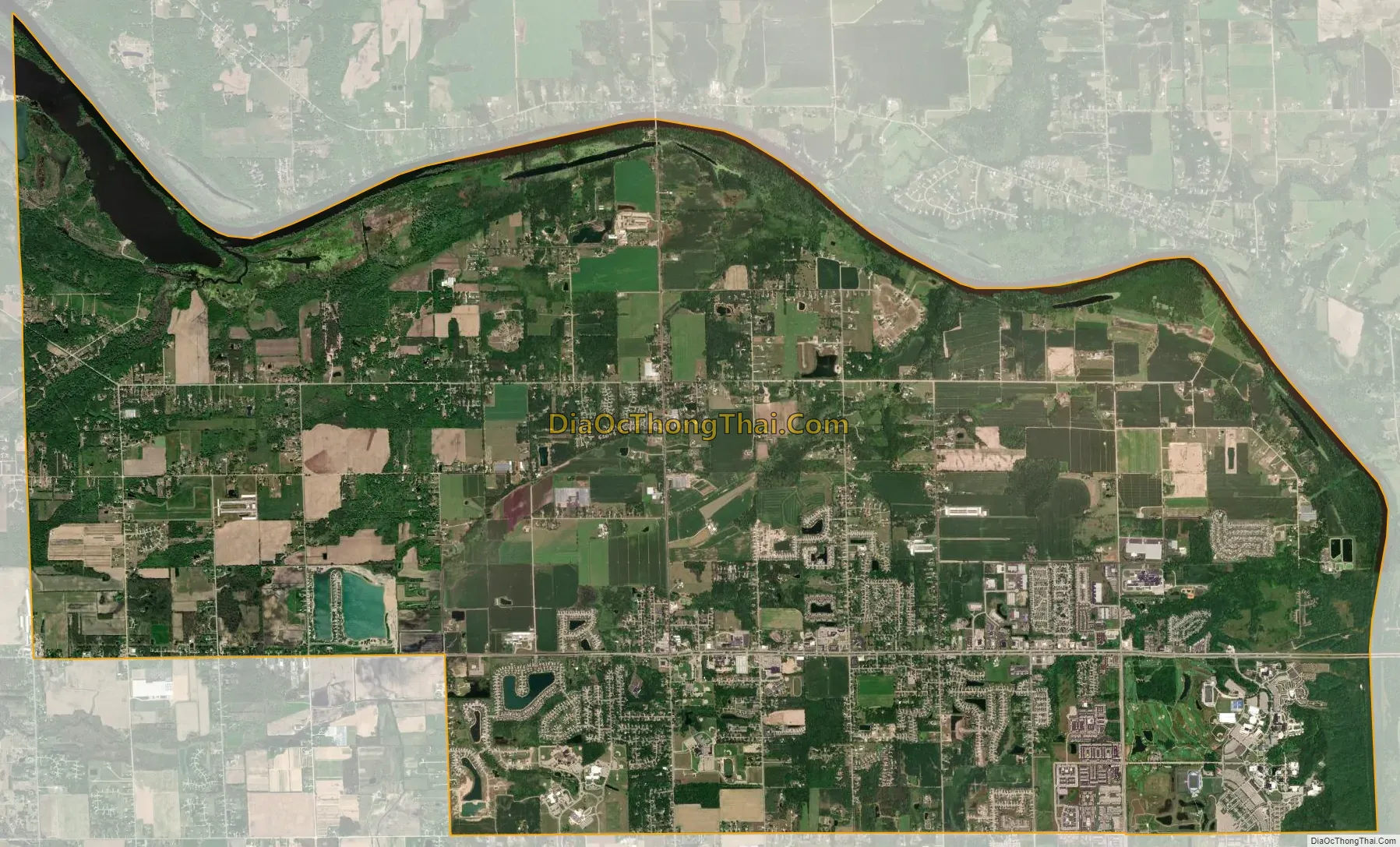
Allendale is a census-designated place (CDP) in Ottawa County in the U.S. state of Michigan. The population was 17,579 at the 2010 census. It is located within Allendale Charter Township, occupying approximately the northern two-thirds of the township, from the eastern boundary with the Grand River west along Pierce St., north along 75th Ave., then west along Lake Michigan Drive (M-45) to the western boundary of the township. It is a part of the Grand Rapids-Muskegon-Holland, Michigan combined statistical area, and is an exurb of Grand Rapids, due to its major commuter routes into the city (M-45 and I-96).
The ZIP code 49401 serves all of Allendale and many of the remnant portions of the township, as well as portions of Blendon Township to the south and Georgetown Township to the southeast.
Allendale is named for the township. The township was organized in 1849, state senator Pennoyer changed the name to Allendale, after Agnes Allen, the first person on the tax roll in the area and the widow of Hannibal Allen, who was the son of Revolutionary War hero Ethan Allen.
Allendale is home to the main campus of Grand Valley State University.
| Name: | Allendale CDP |
|---|---|
| LSAD Code: | 57 |
| LSAD Description: | CDP (suffix) |
| State: | Michigan |
| County: | Ottawa County |
| Elevation: | 653 ft (199 m) |
| Total Area: | 24.15 sq mi (62.54 km²) |
| Land Area: | 23.23 sq mi (60.18 km²) |
| Water Area: | 0.91 sq mi (2.36 km²) |
| Total Population: | 27,073 |
| Population Density: | 1,165.18/sq mi (449.88/km²) |
| ZIP code: | 49401 (Allendale) |
| Area code: | 616 |
| FIPS code: | 2601340 |
| GNISfeature ID: | 1626370 |
Online Interactive Map
Click on ![]() to view map in "full screen" mode.
to view map in "full screen" mode.
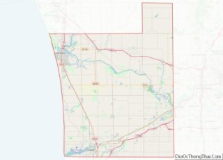
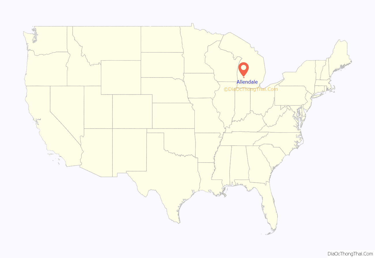
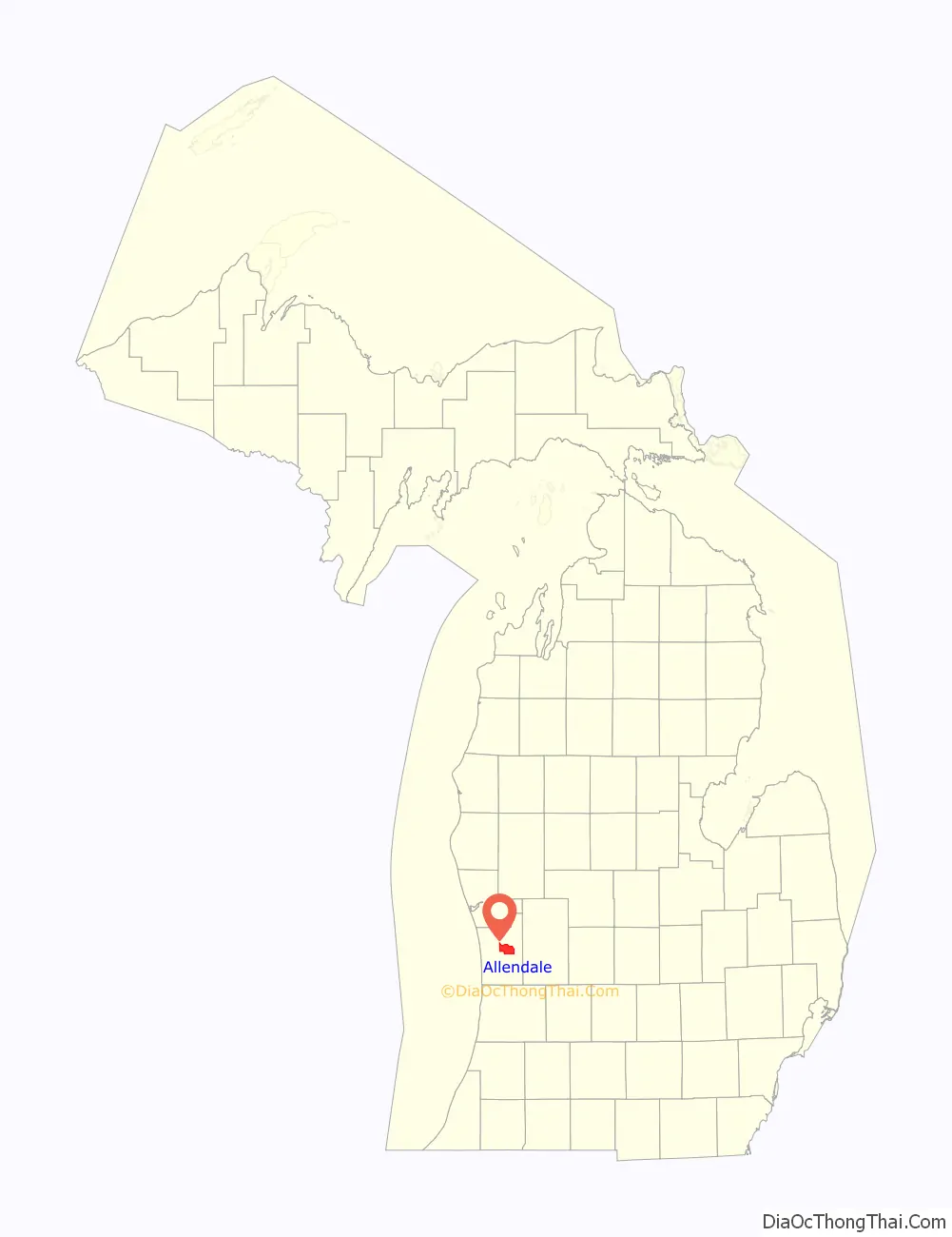
Allendale location map. Where is Allendale CDP?
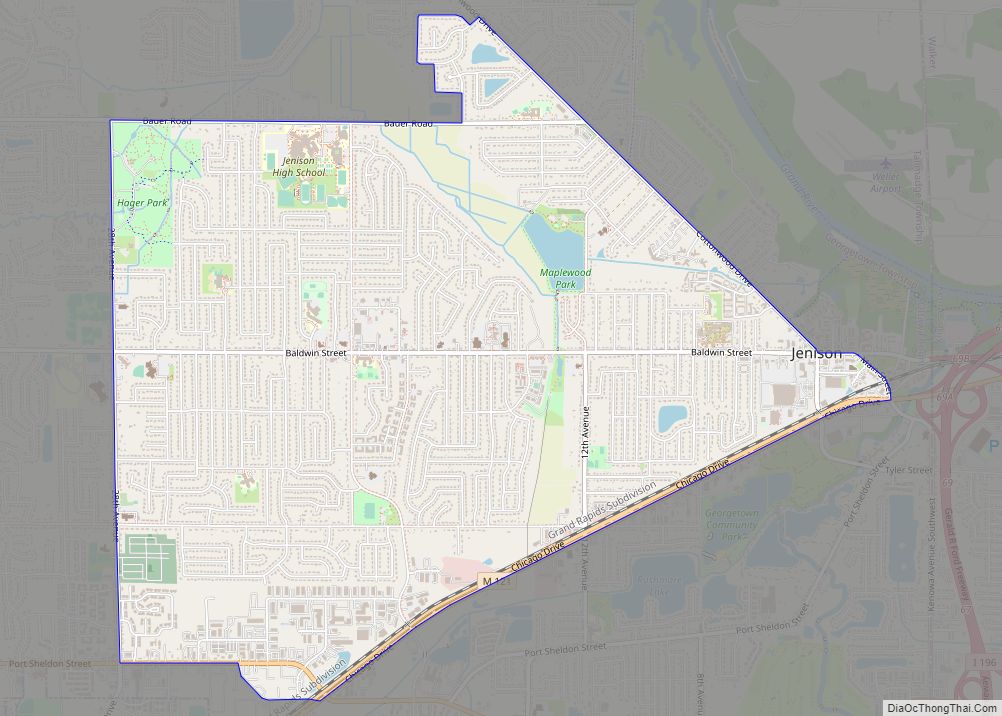
Allendale Road Map
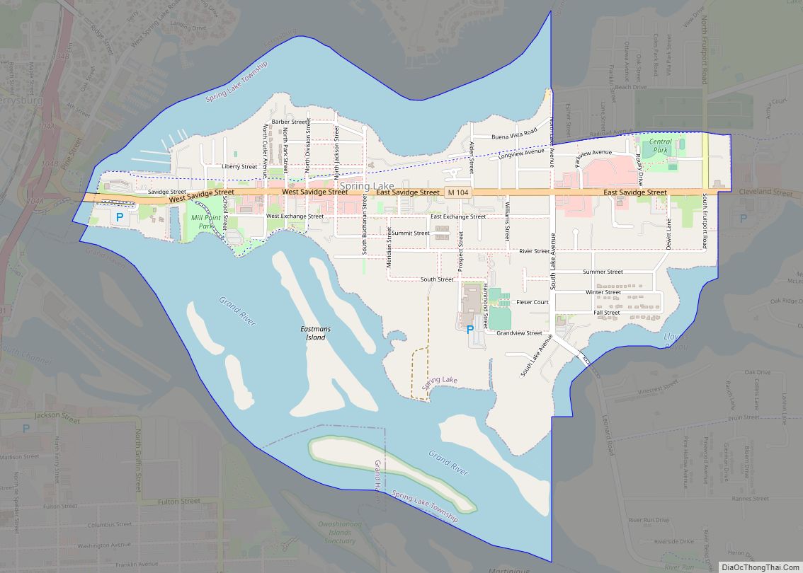
Allendale city Satellite Map
Geography
According to the United States Census Bureau, the CDP has a total area of 23.7 square miles (61.4 km), of which 22.8 square miles (59.1 km) is land and 0.9 square miles (2.3 km) (3.79%) is water.
Geographic features
- Grand River (Michigan)
See also
Map of Michigan State and its subdivision:- Alcona
- Alger
- Allegan
- Alpena
- Antrim
- Arenac
- Baraga
- Barry
- Bay
- Benzie
- Berrien
- Branch
- Calhoun
- Cass
- Charlevoix
- Cheboygan
- Chippewa
- Clare
- Clinton
- Crawford
- Delta
- Dickinson
- Eaton
- Emmet
- Genesee
- Gladwin
- Gogebic
- Grand Traverse
- Gratiot
- Hillsdale
- Houghton
- Huron
- Ingham
- Ionia
- Iosco
- Iron
- Isabella
- Jackson
- Kalamazoo
- Kalkaska
- Kent
- Keweenaw
- Lake
- Lake Hurron
- Lake Michigan
- Lake St. Clair
- Lake Superior
- Lapeer
- Leelanau
- Lenawee
- Livingston
- Luce
- Mackinac
- Macomb
- Manistee
- Marquette
- Mason
- Mecosta
- Menominee
- Midland
- Missaukee
- Monroe
- Montcalm
- Montmorency
- Muskegon
- Newaygo
- Oakland
- Oceana
- Ogemaw
- Ontonagon
- Osceola
- Oscoda
- Otsego
- Ottawa
- Presque Isle
- Roscommon
- Saginaw
- Saint Clair
- Saint Joseph
- Sanilac
- Schoolcraft
- Shiawassee
- Tuscola
- Van Buren
- Washtenaw
- Wayne
- Wexford
- Alabama
- Alaska
- Arizona
- Arkansas
- California
- Colorado
- Connecticut
- Delaware
- District of Columbia
- Florida
- Georgia
- Hawaii
- Idaho
- Illinois
- Indiana
- Iowa
- Kansas
- Kentucky
- Louisiana
- Maine
- Maryland
- Massachusetts
- Michigan
- Minnesota
- Mississippi
- Missouri
- Montana
- Nebraska
- Nevada
- New Hampshire
- New Jersey
- New Mexico
- New York
- North Carolina
- North Dakota
- Ohio
- Oklahoma
- Oregon
- Pennsylvania
- Rhode Island
- South Carolina
- South Dakota
- Tennessee
- Texas
- Utah
- Vermont
- Virginia
- Washington
- West Virginia
- Wisconsin
- Wyoming