Boyne City (/bɔɪn/) is a city in Charlevoix County in the U.S. state of Michigan. The population was 3,816 at the 2020 census, making it the largest city in Charlevoix County. Boyne City is located at the eastern end of Lake Charlevoix, Michigan’s third largest inland lake. The city is also the site of the mouth of the Boyne River, named for the River Boyne in Leinster, Ireland.
| Name: | Boyne City city |
|---|---|
| LSAD Code: | 25 |
| LSAD Description: | city (suffix) |
| State: | Michigan |
| County: | Charlevoix County |
| Incorporated: | 1885 (village) 1907 (city) |
| Elevation: | 594 ft (181 m) |
| Total Area: | 5.34 sq mi (13.82 km²) |
| Land Area: | 3.98 sq mi (10.32 km²) |
| Water Area: | 1.35 sq mi (3.50 km²) |
| Total Population: | 3,816 |
| Population Density: | 957.59/sq mi (369.77/km²) |
| Area code: | 231 |
| FIPS code: | 2609820 |
| GNISfeature ID: | 0621826 |
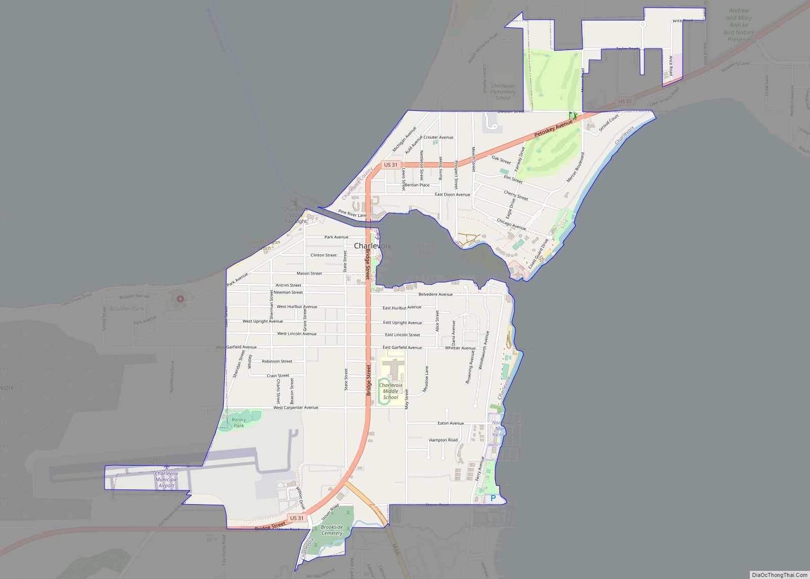
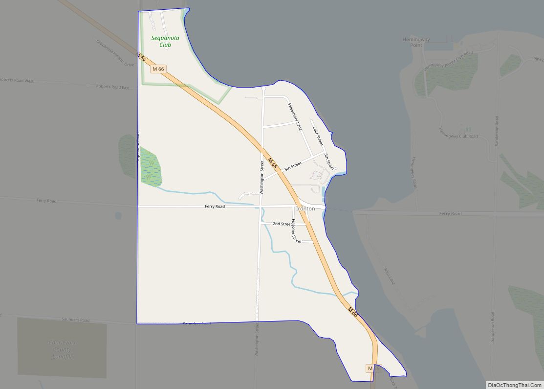
Online Interactive Map
Click on ![]() to view map in "full screen" mode.
to view map in "full screen" mode.
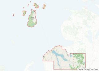
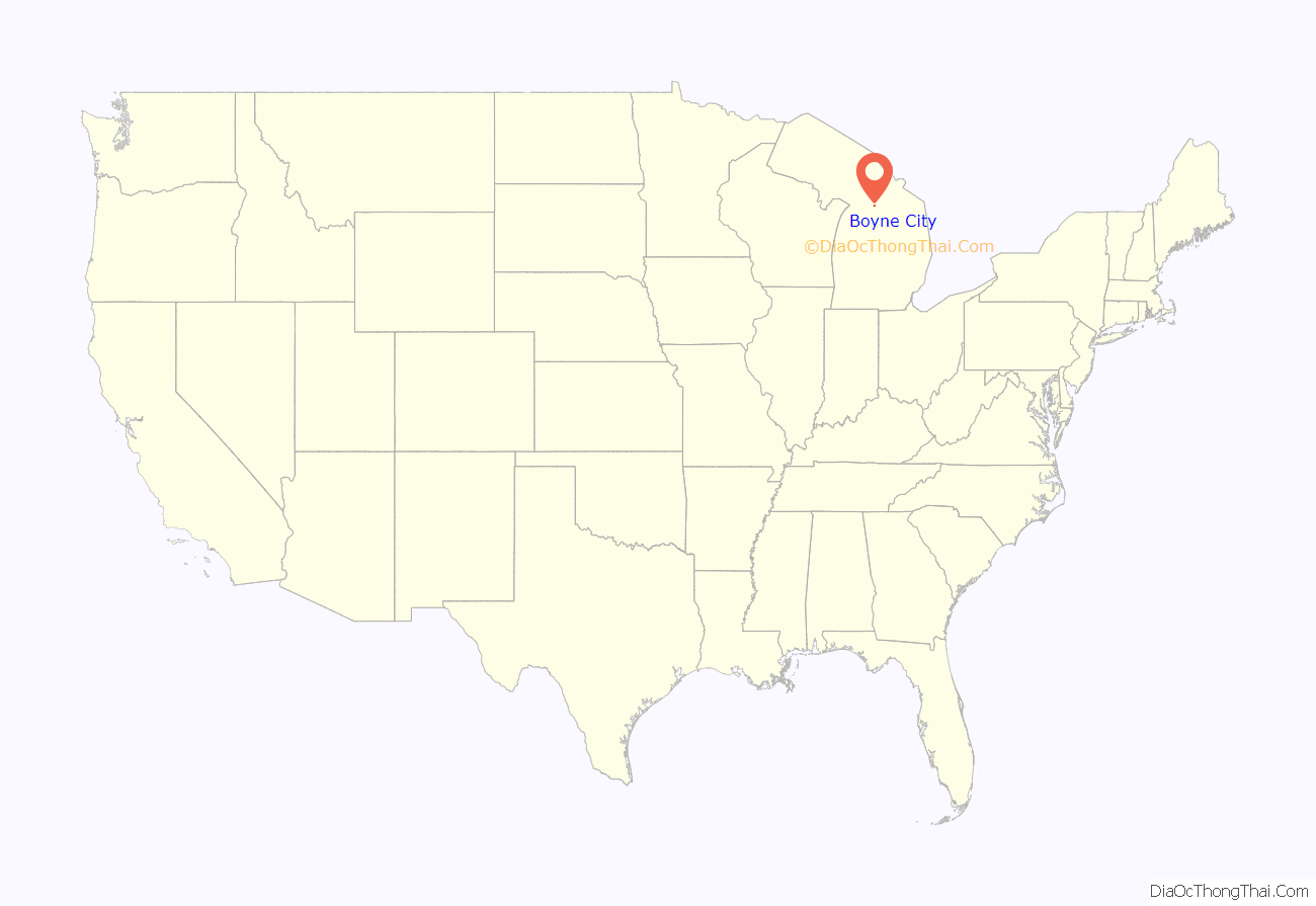
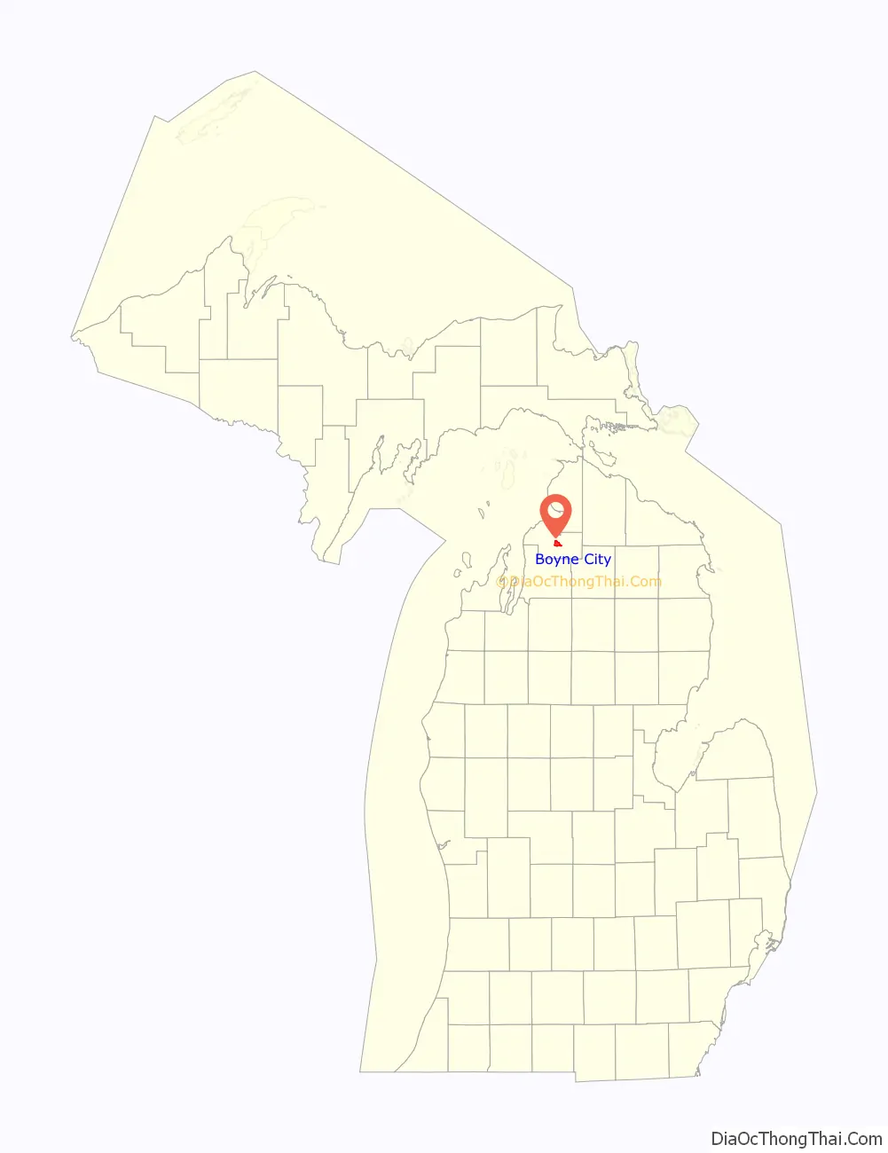
Boyne City location map. Where is Boyne City city?
History
The area was first settled as early as 1856 by the families of John Dixon and John Miller in 1856, which was part of Emmet County until Charlevoix County was organized in 1869. Miller first named the settlement Boyne, as it was near the already-named Boyne River, which derived its name from a river in Ireland. A post office named Boyne opened on September 29, 1869 with Miller serving as the first postmaster. Others moved to the area with the opening of the Pine Lake House by A. J. Hall in 1879. The community incorporated as a village in 1885 and was renamed Boyne City in 1904. It incorporated as a city in 1907.
Boyne City was home to the Buelah Home, which was built by Herman Swift in 1902. It served as a housing facility for delinquent boys. By 1910, the Buelah Home housed approximately 200 boys, who were also reviled by the community for committing numerous crimes and causing mischief. Soon after, Swift was accused of molesting numerous boys under his care, and criminal charges were filed. It became a cause célèbre in Northern Michigan, and it made headlines throughout the country. Many boys who accused Swift of the charges dropped out of the lawsuit to avoid public scrutiny. The case dragged on for three years before eventually making its way to the Michigan Supreme Court under chief justice Joseph H. Steere. Swift was acquitted, but it led to the Buelah Home being closed in 1912 and demolished in 1920.
The city contains three listings on the National Register of Historic Places. The downtown area along Lake Street and Water Street has been included into the Boyne City Central Historic District. The municipal Boyne City Water Works Building was constructed in 1910 when the city was experiencing a tremendous growth in population, and the building continues to serve its purpose as a city water system booster station. The Chicago and West Michigan Railroad Charlevoix Station was built in 1892 as a station along the Chicago and Michigan Lake Shore Railroad, and it now serves as a museum and rental hall.
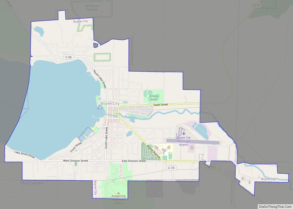
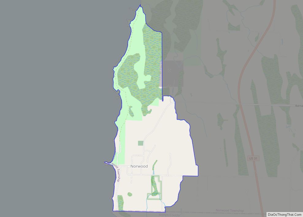
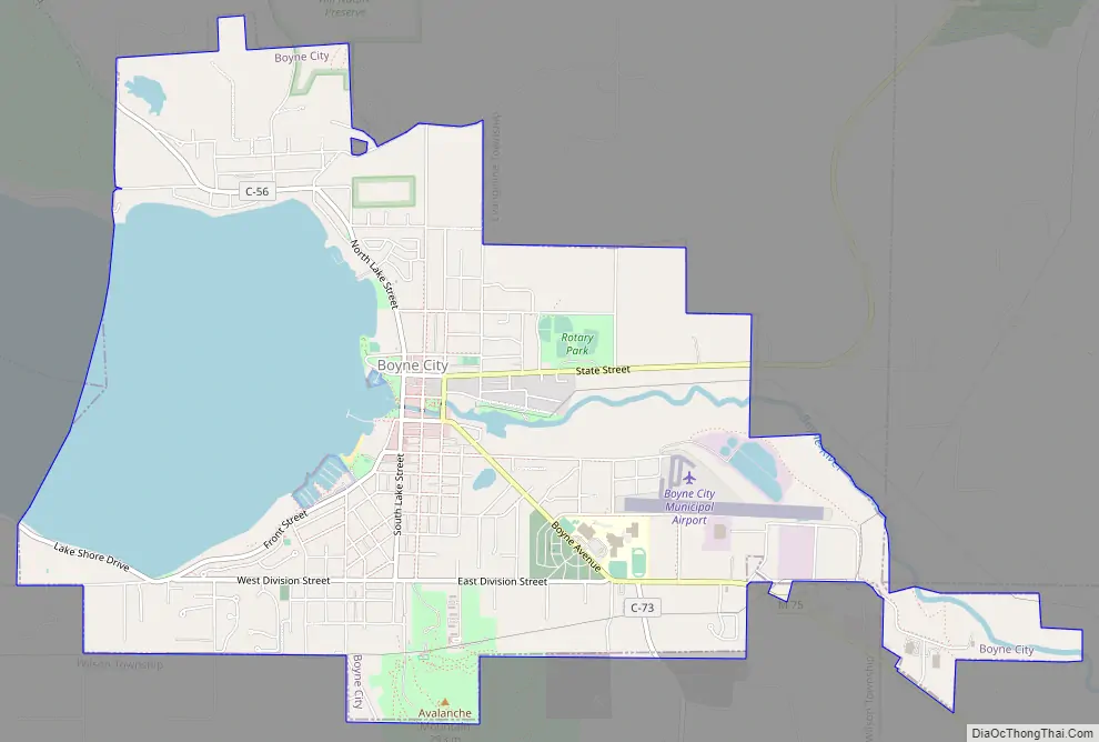
Boyne City Road Map
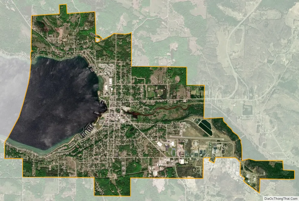
Boyne City city Satellite Map
Geography
According to the U.S. Census Bureau, the city has a total area of 5.34 square miles (13.83 km), of which 3.98 square miles (10.31 km) is land and 1.35 square miles (3.50 km) is water.
The principal geographic feature of the city is Lake Charlevoix. The Boyne River also flows through this city into Lake Charlevoix. Young State Park is just northwest of the city limits in Evangeline Township.
Climate
This climatic region has large seasonal temperature differences, with warm to hot (and often humid) summers and cold (sometimes severely cold) winters. According to the Köppen Climate Classification system, Boyne City has a humid continental climate, abbreviated “Dfb” on climate maps.
See also
Map of Michigan State and its subdivision:- Alcona
- Alger
- Allegan
- Alpena
- Antrim
- Arenac
- Baraga
- Barry
- Bay
- Benzie
- Berrien
- Branch
- Calhoun
- Cass
- Charlevoix
- Cheboygan
- Chippewa
- Clare
- Clinton
- Crawford
- Delta
- Dickinson
- Eaton
- Emmet
- Genesee
- Gladwin
- Gogebic
- Grand Traverse
- Gratiot
- Hillsdale
- Houghton
- Huron
- Ingham
- Ionia
- Iosco
- Iron
- Isabella
- Jackson
- Kalamazoo
- Kalkaska
- Kent
- Keweenaw
- Lake
- Lake Hurron
- Lake Michigan
- Lake St. Clair
- Lake Superior
- Lapeer
- Leelanau
- Lenawee
- Livingston
- Luce
- Mackinac
- Macomb
- Manistee
- Marquette
- Mason
- Mecosta
- Menominee
- Midland
- Missaukee
- Monroe
- Montcalm
- Montmorency
- Muskegon
- Newaygo
- Oakland
- Oceana
- Ogemaw
- Ontonagon
- Osceola
- Oscoda
- Otsego
- Ottawa
- Presque Isle
- Roscommon
- Saginaw
- Saint Clair
- Saint Joseph
- Sanilac
- Schoolcraft
- Shiawassee
- Tuscola
- Van Buren
- Washtenaw
- Wayne
- Wexford
- Alabama
- Alaska
- Arizona
- Arkansas
- California
- Colorado
- Connecticut
- Delaware
- District of Columbia
- Florida
- Georgia
- Hawaii
- Idaho
- Illinois
- Indiana
- Iowa
- Kansas
- Kentucky
- Louisiana
- Maine
- Maryland
- Massachusetts
- Michigan
- Minnesota
- Mississippi
- Missouri
- Montana
- Nebraska
- Nevada
- New Hampshire
- New Jersey
- New Mexico
- New York
- North Carolina
- North Dakota
- Ohio
- Oklahoma
- Oregon
- Pennsylvania
- Rhode Island
- South Carolina
- South Dakota
- Tennessee
- Texas
- Utah
- Vermont
- Virginia
- Washington
- West Virginia
- Wisconsin
- Wyoming