Charlotte (/ʃɑːrˈlɒt/ shar-LOT) is a city in the U.S. state of Michigan. As of the 2010 census, the city population was 9,074. It is the county seat of Eaton County.
Charlotte is in the central portion of the county, on the boundary between Eaton Township and Carmel Township, though politically independent of both. Interstate 69 serves the city, and connects it to the state capital of Lansing. It is located 21.5 miles (34.6 kilometers) from downtown Lansing.
| Name: | Charlotte city |
|---|---|
| LSAD Code: | 25 |
| LSAD Description: | city (suffix) |
| State: | Michigan |
| County: | Eaton County |
| Elevation: | 912 ft (278 m) |
| Total Area: | 6.50 sq mi (16.83 km²) |
| Land Area: | 6.45 sq mi (16.71 km²) |
| Water Area: | 0.05 sq mi (0.12 km²) |
| Total Population: | 9,299 |
| Population Density: | 1,441.48/sq mi (556.57/km²) |
| ZIP code: | 48813 |
| Area code: | 517 |
| FIPS code: | 2614820 |
| GNISfeature ID: | 1626062 |
| Website: | http://www.charlottemi.org/ |
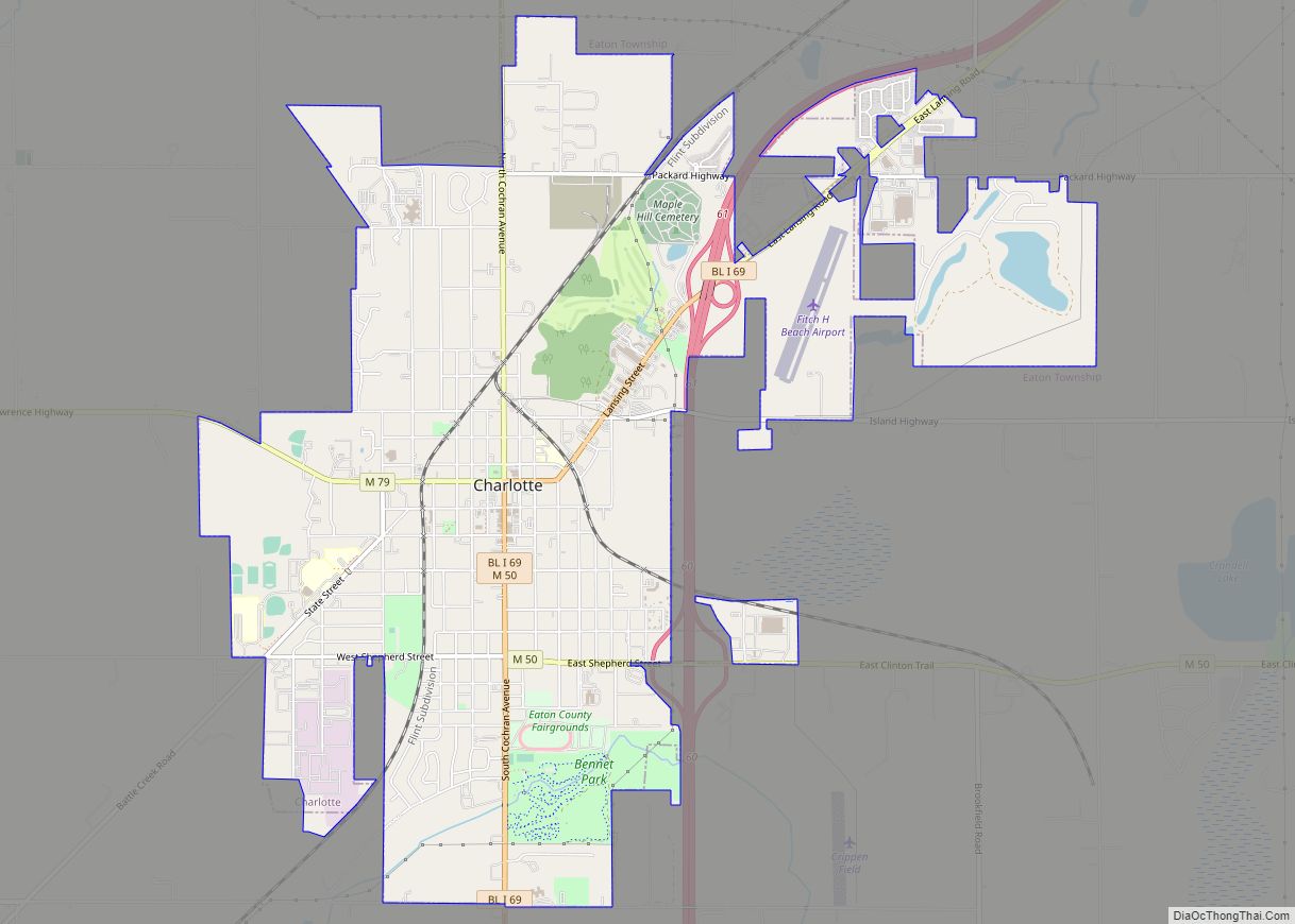
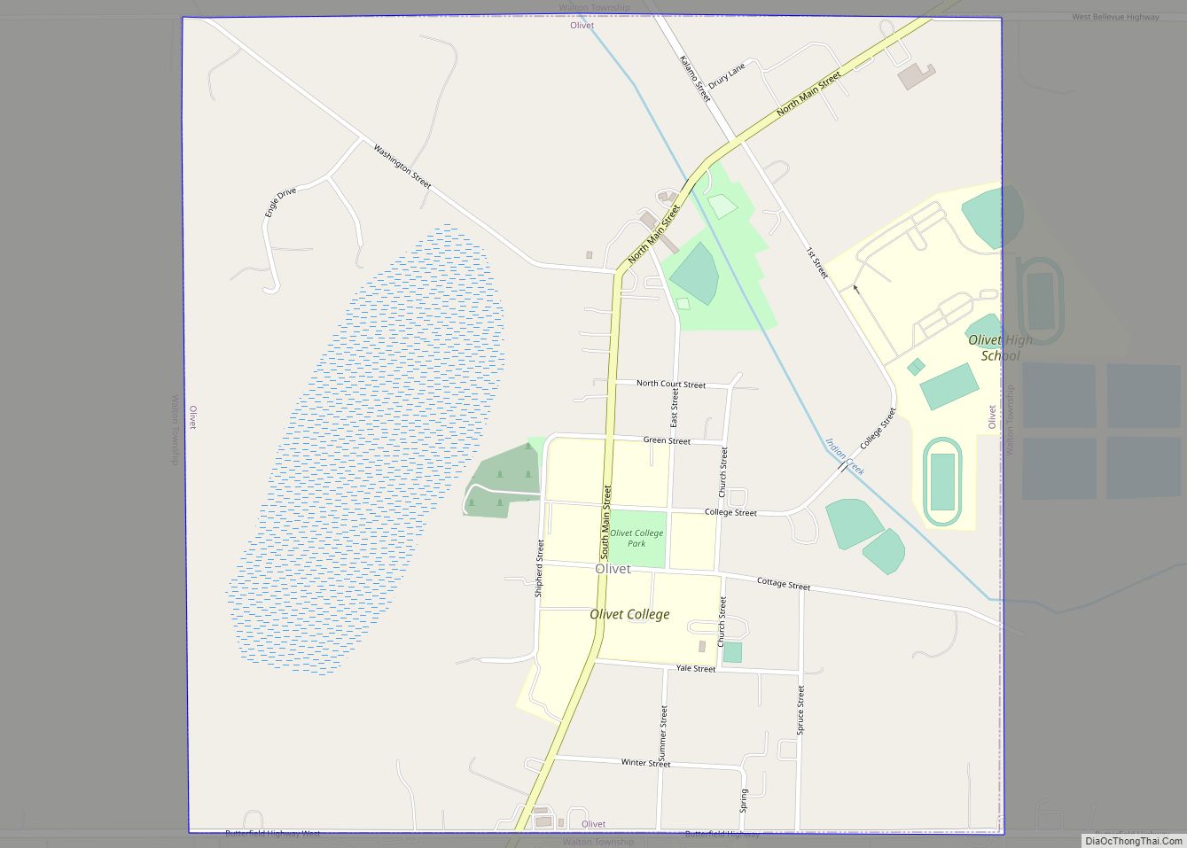
Online Interactive Map
Click on ![]() to view map in "full screen" mode.
to view map in "full screen" mode.
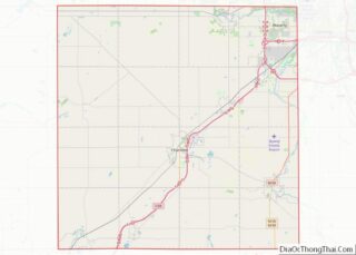
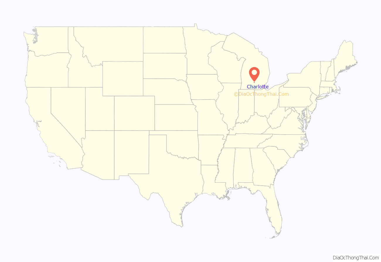
Charlotte location map. Where is Charlotte city?
History
In 1832, George Barnes purchased the land that would become Charlotte from the U.S. Government. Barnes in turn sold the land to Edmond B. Bostwick, a land speculator from New York City three years later in 1835. Bostwick then sold portions of the land to H.I. Lawrence, Townsend Harris, and Francis Cochran. These four created the village which they named after Edmond Bostwick’s wife Charlotte. Jonathan Searles became the first postmaster on March 17, 1838.
Charlotte was incorporated as a village on October 10, 1863, and as a city on March 29, 1871. At various times, Charlotte had the unofficial names of Eaton Centre, and Carmel. It was designated as the county seat when Eaton County was organized in 1837; however, due to a lack of population and buildings, county functions were conducted at Bellevue until 1840.
The Dolson automobile was manufactured in Charlotte from 1904 to 1907.
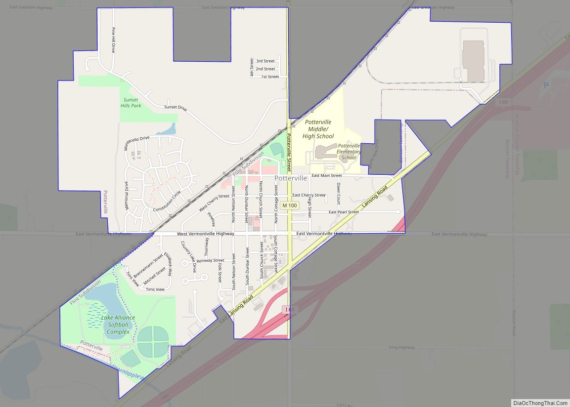
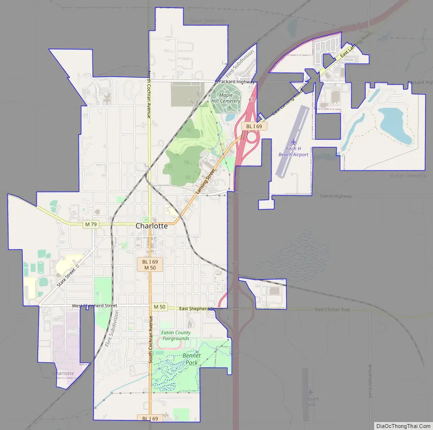
Charlotte Road Map
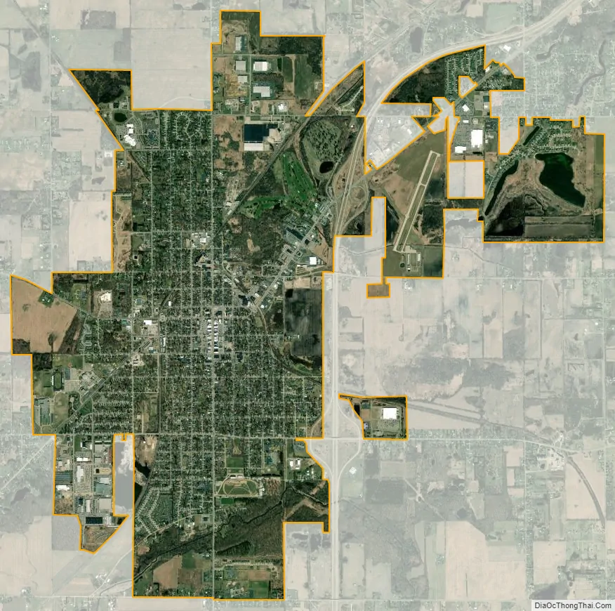
Charlotte city Satellite Map
Geography
According to the United States Census Bureau, the city has a total area of 6.50 square miles (16.83 km), of which 6.45 square miles (16.71 km) is land and 0.05 square miles (0.13 km) is water.
Charlotte is situated on gently rolling prairie. The Battle Creek River has its northern bend in the south part of the city, entering from the southeast and exiting to the southwest. The northern part of the city is part of the Thornapple River watershed.
See also
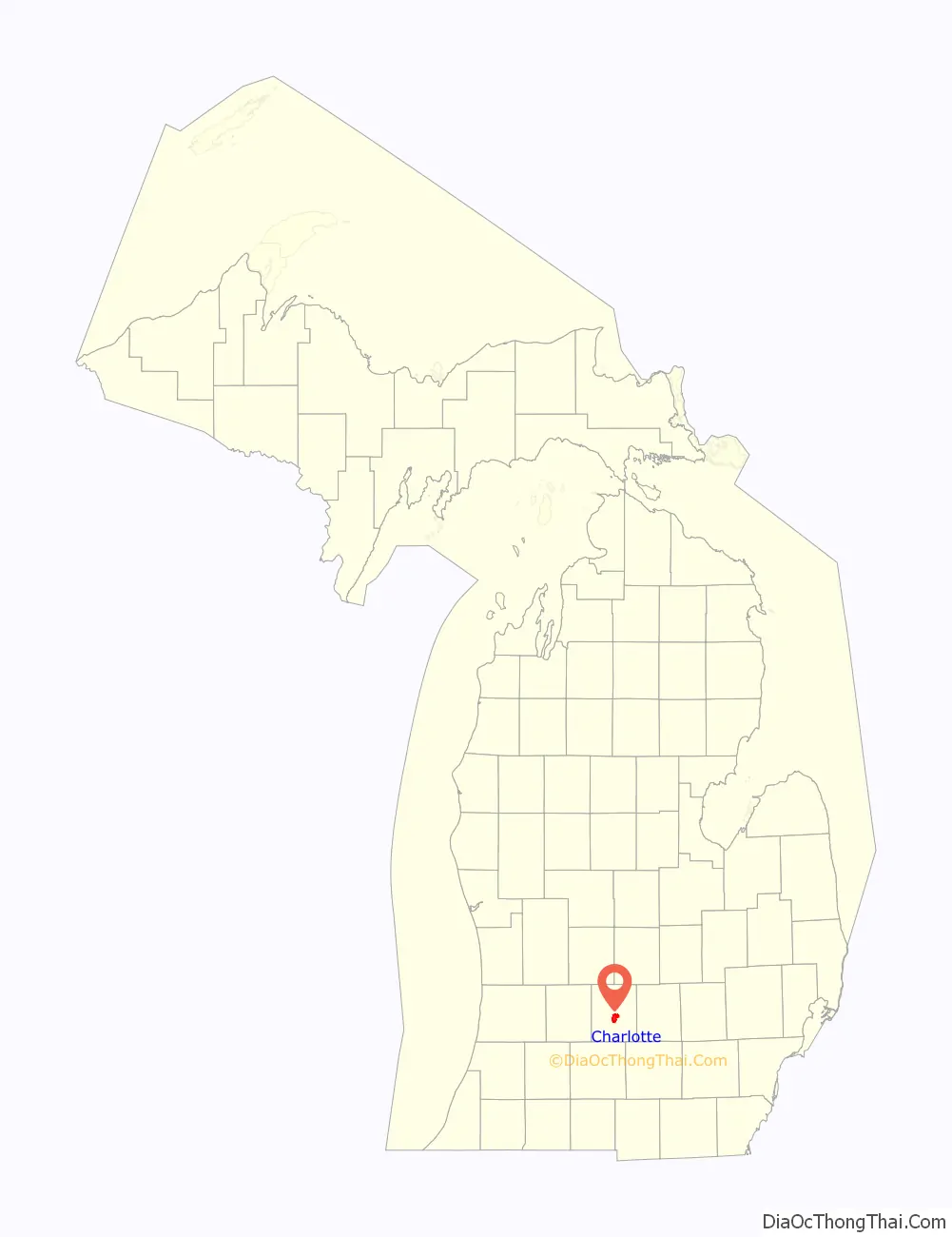
Map of Michigan State and its subdivision:- Alcona
- Alger
- Allegan
- Alpena
- Antrim
- Arenac
- Baraga
- Barry
- Bay
- Benzie
- Berrien
- Branch
- Calhoun
- Cass
- Charlevoix
- Cheboygan
- Chippewa
- Clare
- Clinton
- Crawford
- Delta
- Dickinson
- Eaton
- Emmet
- Genesee
- Gladwin
- Gogebic
- Grand Traverse
- Gratiot
- Hillsdale
- Houghton
- Huron
- Ingham
- Ionia
- Iosco
- Iron
- Isabella
- Jackson
- Kalamazoo
- Kalkaska
- Kent
- Keweenaw
- Lake
- Lake Hurron
- Lake Michigan
- Lake St. Clair
- Lake Superior
- Lapeer
- Leelanau
- Lenawee
- Livingston
- Luce
- Mackinac
- Macomb
- Manistee
- Marquette
- Mason
- Mecosta
- Menominee
- Midland
- Missaukee
- Monroe
- Montcalm
- Montmorency
- Muskegon
- Newaygo
- Oakland
- Oceana
- Ogemaw
- Ontonagon
- Osceola
- Oscoda
- Otsego
- Ottawa
- Presque Isle
- Roscommon
- Saginaw
- Saint Clair
- Saint Joseph
- Sanilac
- Schoolcraft
- Shiawassee
- Tuscola
- Van Buren
- Washtenaw
- Wayne
- Wexford
- Alabama
- Alaska
- Arizona
- Arkansas
- California
- Colorado
- Connecticut
- Delaware
- District of Columbia
- Florida
- Georgia
- Hawaii
- Idaho
- Illinois
- Indiana
- Iowa
- Kansas
- Kentucky
- Louisiana
- Maine
- Maryland
- Massachusetts
- Michigan
- Minnesota
- Mississippi
- Missouri
- Montana
- Nebraska
- Nevada
- New Hampshire
- New Jersey
- New Mexico
- New York
- North Carolina
- North Dakota
- Ohio
- Oklahoma
- Oregon
- Pennsylvania
- Rhode Island
- South Carolina
- South Dakota
- Tennessee
- Texas
- Utah
- Vermont
- Virginia
- Washington
- West Virginia
- Wisconsin
- Wyoming