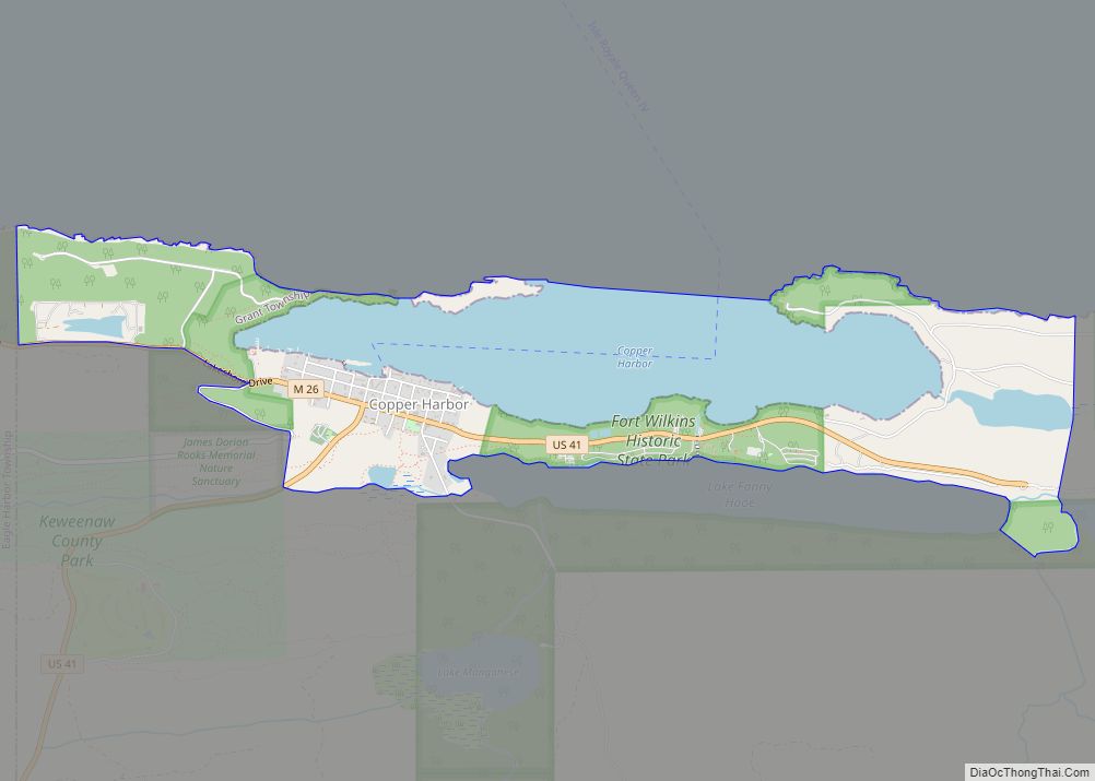
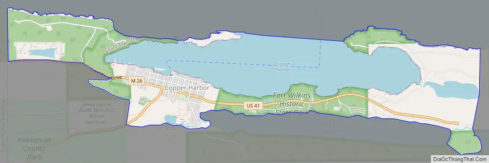
Copper Harbor is an unincorporated community and census-designated place (CDP) located in Keweenaw County in the U.S. state of Michigan. It is located within Grant Township. The population of the CDP was 136 as of the 2020 census.
The community is located at the northern tip of the Keweenaw Peninsula. Copper Harbor is also the northernmost permanently populated community and northernmost point of mainland in the state of Michigan. Due to its natural environment and surroundings, Copper Harbor is marketed as an all-season tourist destination and also contains Fort Wilkins Historic State Park.
| Name: | Copper Harbor CDP |
|---|---|
| LSAD Code: | 57 |
| LSAD Description: | CDP (suffix) |
| State: | Michigan |
| County: | Keweenaw County |
| Elevation: | 605 ft (184 m) |
| Total Area: | 2.43 sq mi (6.28 km²) |
| Land Area: | 1.51 sq mi (3.92 km²) |
| Water Area: | 0.91 sq mi (2.37 km²) |
| Total Population: | 136 |
| Population Density: | 89.89/sq mi (34.71/km²) |
| Area code: | 906 |
| FIPS code: | 2618100 |
| GNISfeature ID: | 623809 |
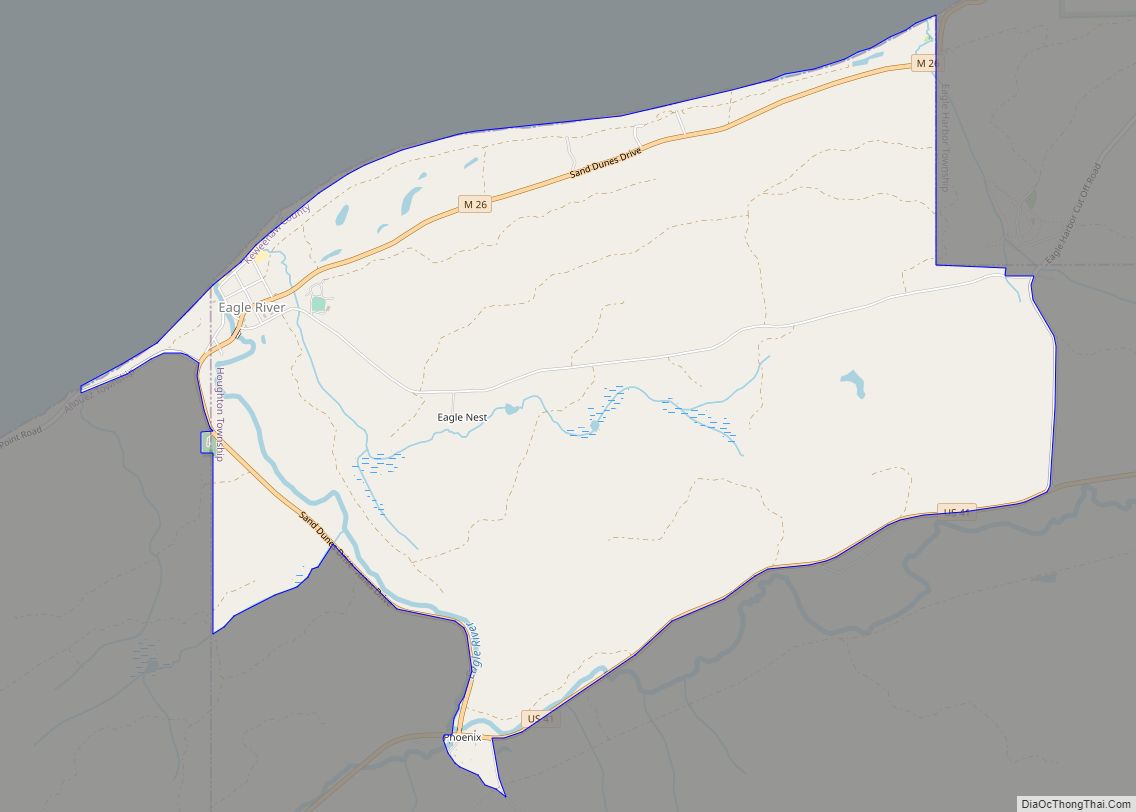
Online Interactive Map
Click on ![]() to view map in "full screen" mode.
to view map in "full screen" mode.
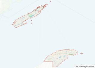
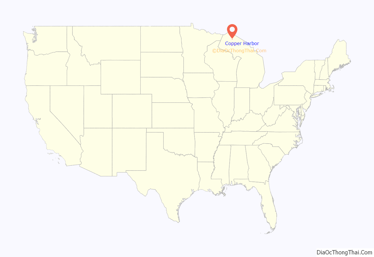
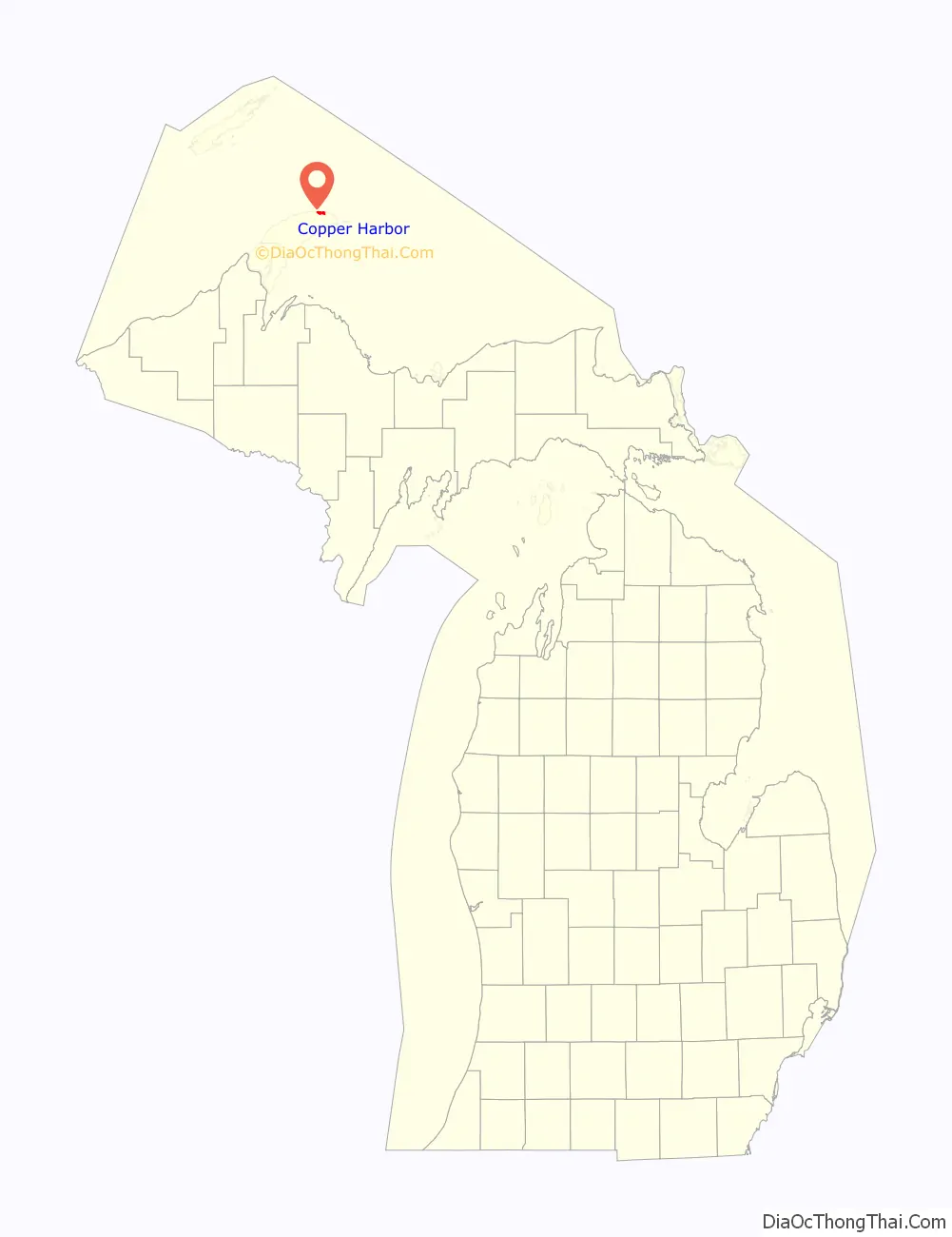
Copper Harbor location map. Where is Copper Harbor CDP?
History
The Keweenaw Peninsula and the area that would become the Copper Country was home to the Ojibwe people prior to European settlement. In 1836, the Upper Peninsula was officially ceded from the Native American Chippewa to the United States following the signing of the Treaty of Washington. The treaty was signed in the national capital, Washington, D.C., by Henry Schoolcraft and Native American representatives from the Ojibwe and Odawa nations.
Copper Harbor was host to the first mineral land agency throughout the entire Lake Superior District. Captain Walter Cunningham was appointed by the United States Department of War to act as a Special Agent to the area. As soon as wayfinding was established in the spring of 1843, Cunningham had come to the area and opened his office, which was thereafter named the “Government House”. It was positioned on Porter’s Island, a small rocky island just opposite of present-day downtown Copper Harbor.
The Pittsburgh and Boston Copper Harbor Mining Company, formed by John Hayes of Cleveland, Ohio, began excavating some pits near Haye’s Point in Copper Harbor in 1844. It was a small development at first, but its mine was modern for its time, and the company struck it rich in 1845. The Pittsburgh and Boston mine operations were some of the very first in the state of Michigan.
A few years later, the Central Mine, Cliff Mine, and others were opened and became successful. However, by 1870 the copper resources in the community had been largely worked out.
The community of Copper Harbor was listed as a newly-organized census-designated place for the 2010 census, meaning it now has officially defined boundaries and population statistics.
Copper Harbor Road Map
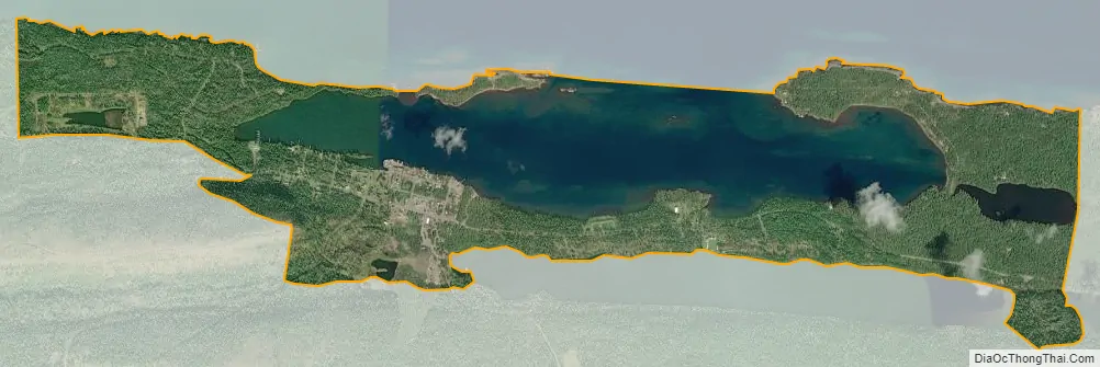
Copper Harbor city Satellite Map
Geography
In 2010, Copper Harbor was listed as a census-designated place, but this does not give the community any legal autonomy. The CDP contains a total area of 2.43 square miles (6.29 km), of which 1.51 square miles (3.91 km) is land and 0.92 square miles (2.38 km) (37.86%) is water.
Copper Harbor is located at the northern edge of the Keweenaw Peninsula, although the peninsula extends for several miles to the east. Copper Harbor contains its own post office using the 49918 ZIP Code, which serves the small area surrounding the community. Some areas within the community and the surrounding area may use the Mohawk 49950 ZIP Code.
Beyond the community center, there are thick forests, no roadways, and no development.
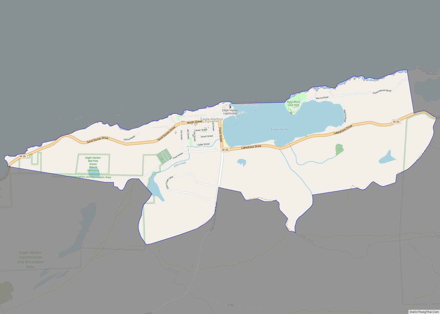
In relation to other communities in the Keweenaw, Copper Harbor is located 9 miles (14.5 km) from Mandan, 12 miles (19.3 km) north of Delaware, and 16 miles (25.7 km) east of Eagle Harbor. The village of Ahmeek is the nearest incorporated community at 30 miles (48.3 km) to the southwest.
Climate
Copper Harbor has a humid continental climate. Summers are warm but rarely hot due to the moderating influence of Lake Superior, while winters are cold and snowy, albeit milder than areas on similar parallels to the west, due to the low-scale maritime moderation. Although winter temperatures are similar to those in the nearest large metropolitan city Minneapolis, a couple of degrees latitude south-west, the main difference is that April is also a winter month in Copper Harbor, since the marine effects delay spring. The temperature lag effect is so great that March holds the town’s record low, and April’s record low temperatures are not much warmer than those of December.
Notable attractions
- Hunter’s Point is the name of a non-hilly point, running out from the west into Lake Superior. It was named for an early settler of the area named Hunter who owned a tract of land on what is now Hunter’s Point. He is buried in the Fort Wilkins Cemetery. Today, Hunter’s Island is a Grant Township park, hosting a wide variety of both flora and fauna alike. It is also a well-known stop for migratory birds.
- Just outside the town is the sign marking the end of U.S. Highway 41, which begins in Copper Harbor and ends in the city of Miami, Florida, nearly 2,000 miles away.
- Just north of downtown Copper Harbor is the Fort Wilkins Historic State Park, an early restored frontier United States Army base originally built in 1844 to protect the vital port of Copper Harbor from the Ojibwe during the early years of the copper mining boom, America’s first great mining rush. It became clear later that issues in the region were their own—rough and icy winters, isolation, and sheer loneliness.
- The Copper Harbor Schoolhouse, one of the oldest one-room schools in Michigan, is found here. In 1999, this 140-year-old school had nine students who attended classes. The school district it lies in is called Grant Township Schools, District No. 2. The District motto is “Searching For Knowledge” and the mascot of the schoolhouse is the Copper Harbor Prospectors.
- Copper Harbor is home to a Fourth of July fireworks show that is locally notable on the Keweenaw Peninsula.
- Lake Fanny Hooe, named after the mining Captain William Albutrtis’ juvenile sister-in-law, borders Fort Wilkins and is well-known in the area for the origin of its name. This lake is one mile east of Copper Harbor, and runs parallel with the highway M-26. The lake is two miles long and a quarter mile wide, with a total depth of thirty-five feet and numerous points.
- The historic Copper Harbor Lighthouse is situated at the opening of the physical harbor itself. The lighthouse was rebuilt in 1866, replacing an original light from 1849, and is only accessible via a short ride in a compact, open vessel from the Copper Harbor Marina. Taken out of service in 1933, the historic navigational aid is one of the oldest lighthouses on Lake Superior. Within the yellow-bricked maritime post, furnishings from the era remain to conceptualize the life of the lighthouse keepers. Exhibits in the lighthouse museum cover both the lighthouse’s history and the local shipwreck culture of the area.
- The historic Copper Harbor Cemetery discloses the gravestones of some of the earliest settlers in the Copper Country, with the first recorded interment in 1853 and a number of other tombstones that predate the year 1900.
- Characterized as “the most beautiful road in Michigan,” Brockway Mountain Drive is a 8.9-mile (14.3 km) roadway that follows the spine of a 735-foot (224 m) ridge between the communities of Copper Harbor and Eagle Harbor, and it is the highest-paved road between the Rocky Mountains to the west and the Allegheny Mountains in the east. The notoriously picturesque road was constructed during the 1930s in the midst of the Great Depression by the Works Progress Administration. It offers views of Lake Superior, and the Keweenaw Peninsula, as well the archipelago of Isle Royale on an especially clear, transparent day. There is also a close on the drive called Brockway Mountain Lookout that offers a view of the community of Copper Harbor itself.
- In addition to the main 1849 Copper Harbor Lighthouse, the Copper Harbor Front Range and Rear Range Lights, both completed in 1869, remain and are locally considered to be iconic, as well as being the subject of memorabilia. The purpose of the Copper Harbor Range Lights was to do what the main lighthouse could not; it guided vessels and their sailors past the hazardous reefs on either side of the waterway.
See also
Map of Michigan State and its subdivision:- Alcona
- Alger
- Allegan
- Alpena
- Antrim
- Arenac
- Baraga
- Barry
- Bay
- Benzie
- Berrien
- Branch
- Calhoun
- Cass
- Charlevoix
- Cheboygan
- Chippewa
- Clare
- Clinton
- Crawford
- Delta
- Dickinson
- Eaton
- Emmet
- Genesee
- Gladwin
- Gogebic
- Grand Traverse
- Gratiot
- Hillsdale
- Houghton
- Huron
- Ingham
- Ionia
- Iosco
- Iron
- Isabella
- Jackson
- Kalamazoo
- Kalkaska
- Kent
- Keweenaw
- Lake
- Lake Hurron
- Lake Michigan
- Lake St. Clair
- Lake Superior
- Lapeer
- Leelanau
- Lenawee
- Livingston
- Luce
- Mackinac
- Macomb
- Manistee
- Marquette
- Mason
- Mecosta
- Menominee
- Midland
- Missaukee
- Monroe
- Montcalm
- Montmorency
- Muskegon
- Newaygo
- Oakland
- Oceana
- Ogemaw
- Ontonagon
- Osceola
- Oscoda
- Otsego
- Ottawa
- Presque Isle
- Roscommon
- Saginaw
- Saint Clair
- Saint Joseph
- Sanilac
- Schoolcraft
- Shiawassee
- Tuscola
- Van Buren
- Washtenaw
- Wayne
- Wexford
- Alabama
- Alaska
- Arizona
- Arkansas
- California
- Colorado
- Connecticut
- Delaware
- District of Columbia
- Florida
- Georgia
- Hawaii
- Idaho
- Illinois
- Indiana
- Iowa
- Kansas
- Kentucky
- Louisiana
- Maine
- Maryland
- Massachusetts
- Michigan
- Minnesota
- Mississippi
- Missouri
- Montana
- Nebraska
- Nevada
- New Hampshire
- New Jersey
- New Mexico
- New York
- North Carolina
- North Dakota
- Ohio
- Oklahoma
- Oregon
- Pennsylvania
- Rhode Island
- South Carolina
- South Dakota
- Tennessee
- Texas
- Utah
- Vermont
- Virginia
- Washington
- West Virginia
- Wisconsin
- Wyoming