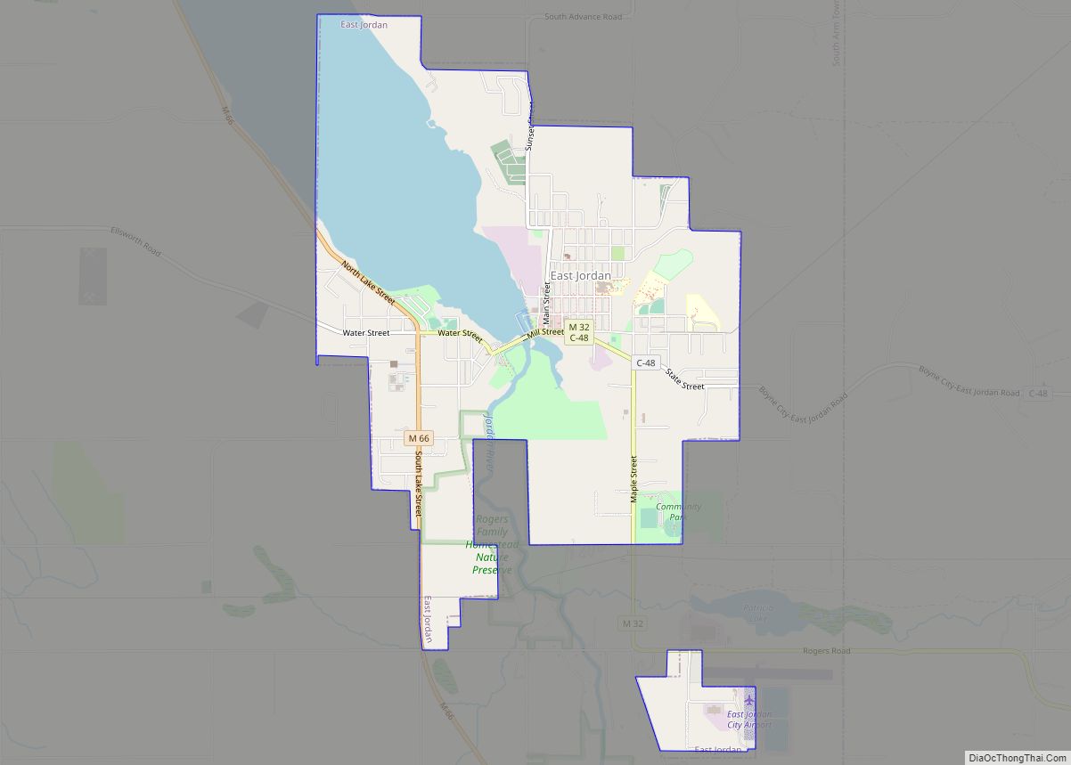
East Jordan is a city in Charlevoix County in the U.S. state of Michigan. The population was 2,239 at the 2020 census.
The city is at the end of the south arm of Lake Charlevoix at the mouth of the Jordan River. The corporate headquarters of EJ, an international company formerly known as East Jordan Iron Works, is located in East Jordan. EJ was founded in East Jordan in 1883.
| Name: | East Jordan city |
|---|---|
| LSAD Code: | 25 |
| LSAD Description: | city (suffix) |
| State: | Michigan |
| County: | Charlevoix County |
| Incorporated: | 1887 (village) 1911 (city) |
| Elevation: | 646 ft (197 m) |
| Total Area: | 3.92 sq mi (10.15 km²) |
| Land Area: | 3.00 sq mi (7.77 km²) |
| Water Area: | 0.92 sq mi (2.38 km²) |
| Total Population: | 2,239 |
| Population Density: | 746.33/sq mi (288.19/km²) |
| Area code: | 231 |
| FIPS code: | 2624020 |
| GNISfeature ID: | 0625200 |
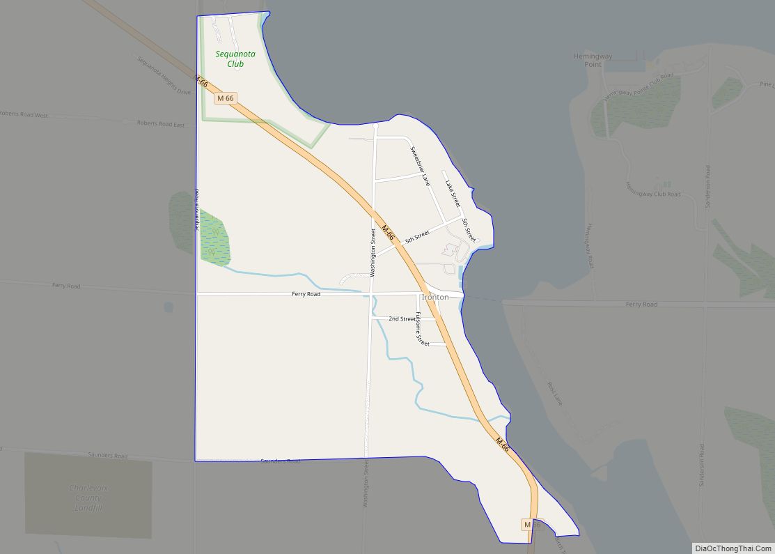
Online Interactive Map
Click on ![]() to view map in "full screen" mode.
to view map in "full screen" mode.
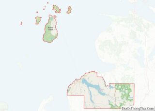
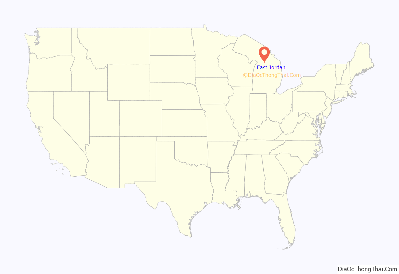
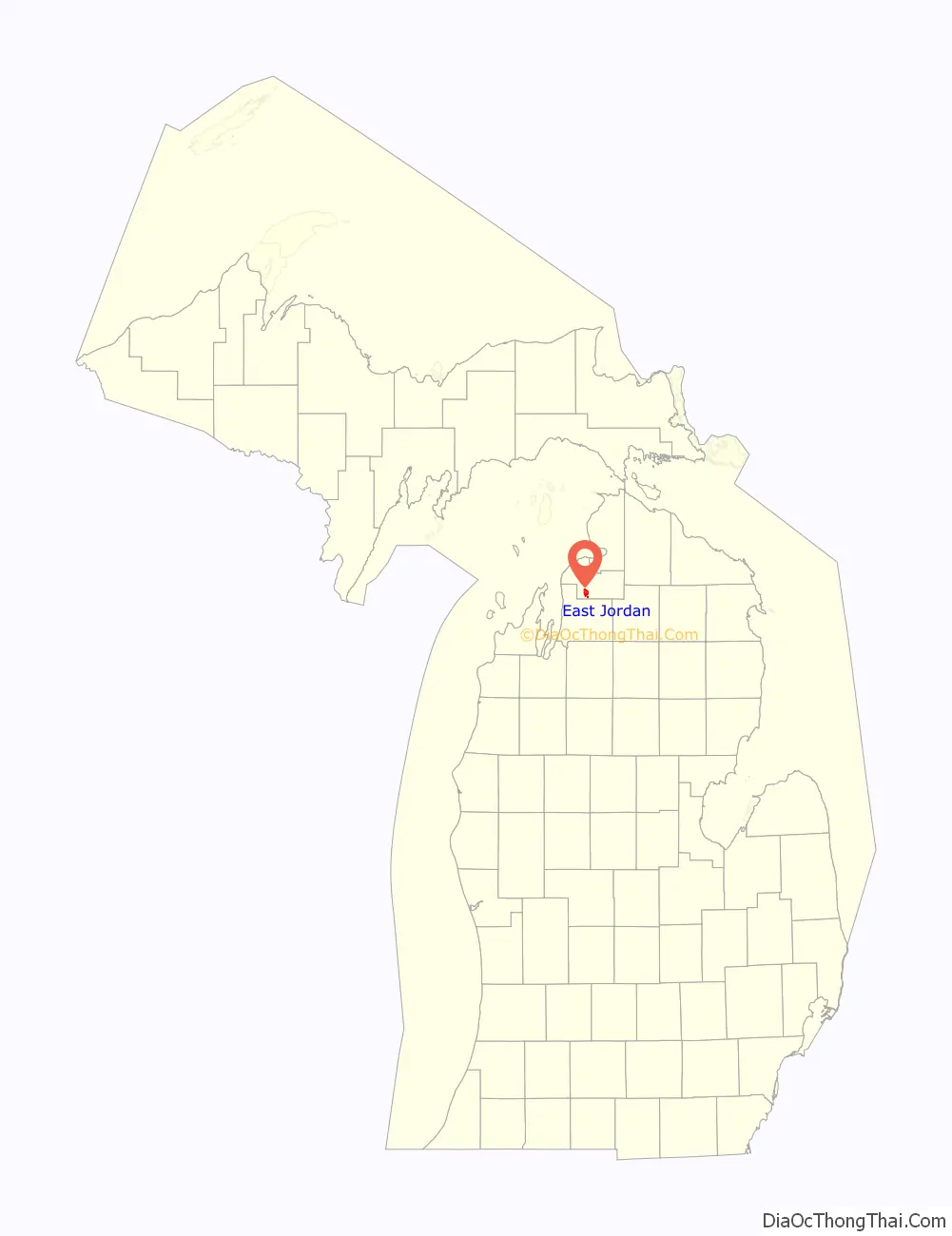
East Jordan location map. Where is East Jordan city?
History
The area was first settled by Canadian William Empey in 1873. He built the first store here in 1874 at the mouth of the Jordan River at the southernmost point of Lake Charlevoix. He became the first postmaster when a post office opened on May 31, 1878. The community absorbed the nearby village of South Arm and incorporated as the village of East Jordan in 1887. It incorporated as a city in 1911.
East Jordan grew quickly, and by 1890, it boasted a large ironworks company now known as EJ. The city was serviced by two railroads. With these two railroad connections, East Jordan quickly grew into a major manufacturing center. To this day, four industrial corporations still operate within the town. In 1899, the Detroit and Charlevoix Railroad built their mainline through the East side of the city, and in 1901, the East Jordan and Southern Railroad began operations on the western end of the city. With these two railroad connections, East Jordan quickly grew into a major manufacturing center. In 1932, the Detroit and Charlevoix was abandoned, and the East Jordan and Southern closed in 1961 after the East Jordan Iron Works ended shipping by rail.
East Jordan contains two listing on the National Register of Historic Places. The East Jordan Lumber Company Store Building and the Votruba Block were both built in 1899 and are located next to each other in the city’s downtown area.
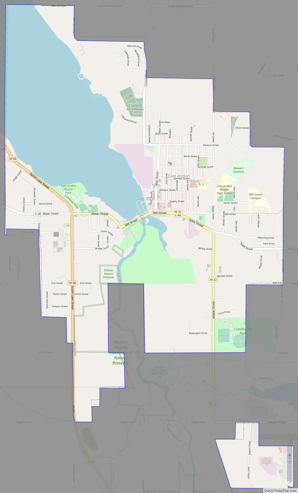
East Jordan Road Map
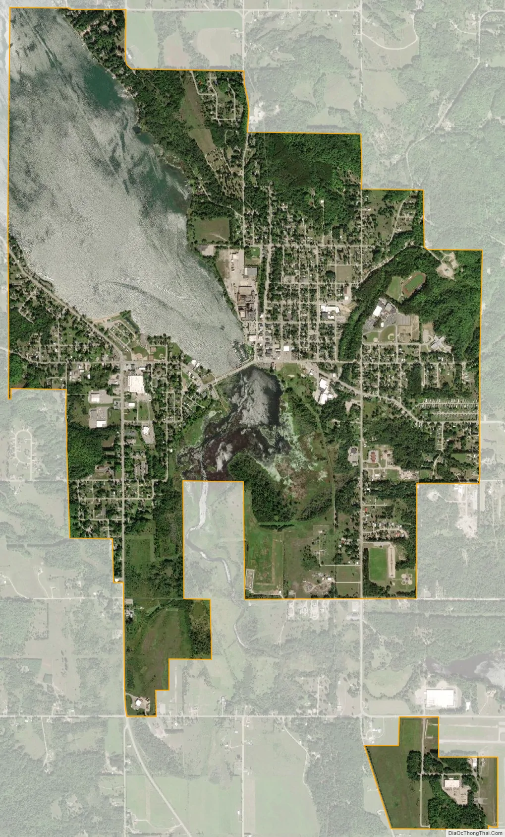
East Jordan city Satellite Map
Geography
According to the U.S. Census Bureau, the city has a total area of 3.92 square miles (10.15 km), of which 3.00 square miles (7.77 km) is land and 0.92 square miles (2.38 km) (23.47%) is water.
The city boundaries contain an exclave which is used to incorporate the East Jordan City Airport to the southeast of the city.
Major highways
- M-32 enters the city from the east and has its western terminus at M-66. within East Jordan.
- M-66 runs south–north through the western portion of the city.
- C-48 is a county-designated highway that runs through the center of the city and briefly concurrent with M-32.
Climate
This climatic region has large seasonal temperature differences, with warm to hot (and often humid) summers and cold (sometimes severely cold) winters. According to the Köppen Climate Classification system, East Jordan has a humid continental climate, abbreviated “Dfb” on climate maps.
See also
Map of Michigan State and its subdivision:- Alcona
- Alger
- Allegan
- Alpena
- Antrim
- Arenac
- Baraga
- Barry
- Bay
- Benzie
- Berrien
- Branch
- Calhoun
- Cass
- Charlevoix
- Cheboygan
- Chippewa
- Clare
- Clinton
- Crawford
- Delta
- Dickinson
- Eaton
- Emmet
- Genesee
- Gladwin
- Gogebic
- Grand Traverse
- Gratiot
- Hillsdale
- Houghton
- Huron
- Ingham
- Ionia
- Iosco
- Iron
- Isabella
- Jackson
- Kalamazoo
- Kalkaska
- Kent
- Keweenaw
- Lake
- Lake Hurron
- Lake Michigan
- Lake St. Clair
- Lake Superior
- Lapeer
- Leelanau
- Lenawee
- Livingston
- Luce
- Mackinac
- Macomb
- Manistee
- Marquette
- Mason
- Mecosta
- Menominee
- Midland
- Missaukee
- Monroe
- Montcalm
- Montmorency
- Muskegon
- Newaygo
- Oakland
- Oceana
- Ogemaw
- Ontonagon
- Osceola
- Oscoda
- Otsego
- Ottawa
- Presque Isle
- Roscommon
- Saginaw
- Saint Clair
- Saint Joseph
- Sanilac
- Schoolcraft
- Shiawassee
- Tuscola
- Van Buren
- Washtenaw
- Wayne
- Wexford
- Alabama
- Alaska
- Arizona
- Arkansas
- California
- Colorado
- Connecticut
- Delaware
- District of Columbia
- Florida
- Georgia
- Hawaii
- Idaho
- Illinois
- Indiana
- Iowa
- Kansas
- Kentucky
- Louisiana
- Maine
- Maryland
- Massachusetts
- Michigan
- Minnesota
- Mississippi
- Missouri
- Montana
- Nebraska
- Nevada
- New Hampshire
- New Jersey
- New Mexico
- New York
- North Carolina
- North Dakota
- Ohio
- Oklahoma
- Oregon
- Pennsylvania
- Rhode Island
- South Carolina
- South Dakota
- Tennessee
- Texas
- Utah
- Vermont
- Virginia
- Washington
- West Virginia
- Wisconsin
- Wyoming