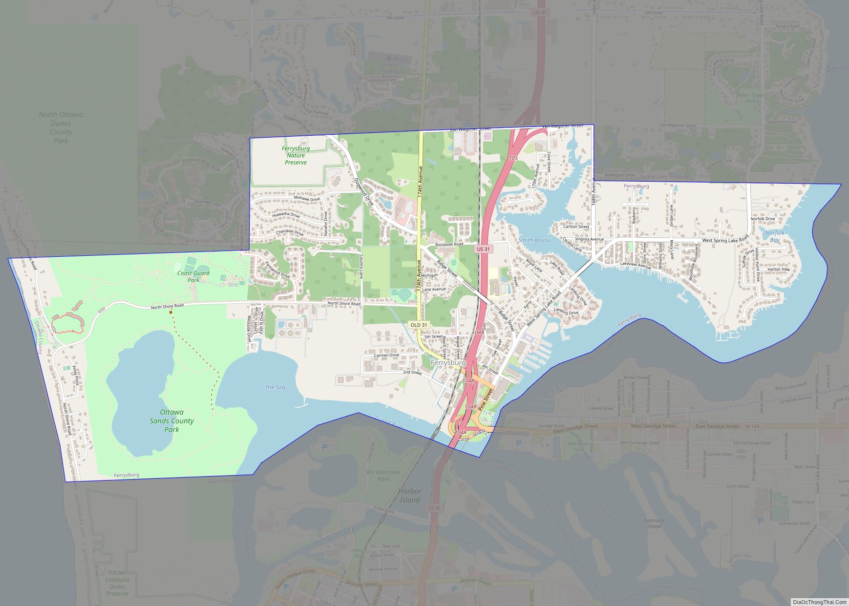
Ferrysburg is a city in Ottawa County in the U.S. state of Michigan. The population was 2,892 at the 2010 census.
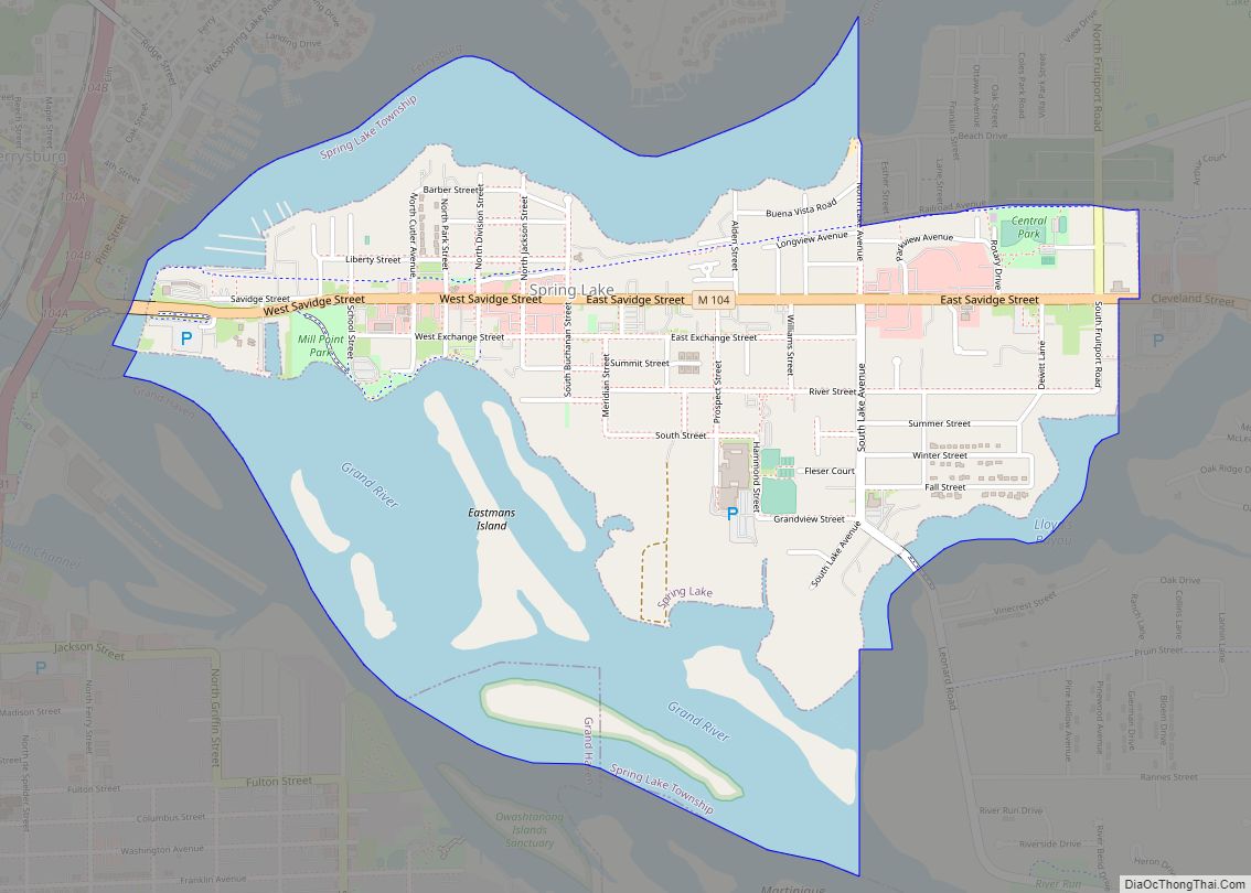
Spring Lake Township borders the city on the north and east, though it is administratively autonomous. The village of Spring Lake is located to the southeast, on the opposite side of Spring Lake from Ferrysburg. The city of Grand Haven is located to the south, on the opposite side of the Grand River. Lake Michigan is to the west of the city.
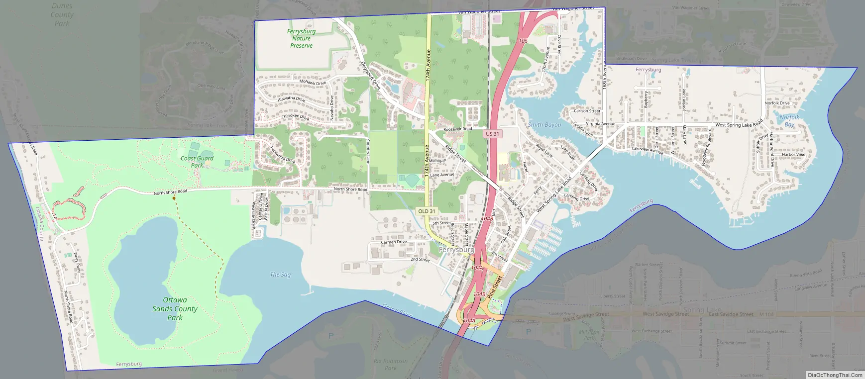
US 31 passes north-south through the city and M-104 has its western terminus at US 31 in Ferrysburg.
| Name: | Ferrysburg city |
|---|---|
| LSAD Code: | 25 |
| LSAD Description: | city (suffix) |
| State: | Michigan |
| County: | Ottawa County |
| Elevation: | 623 ft (190 m) |
| Land Area: | 2.99 sq mi (7.74 km²) |
| Water Area: | 0.60 sq mi (1.55 km²) 16.71% |
| Population Density: | 987.29/sq mi (381.17/km²) |
| ZIP code: | 49409 |
| Area code: | 616 |
| FIPS code: | 2627960 |
| GNISfeature ID: | 0625927 |
| Website: | http://www.ferrysburg.org/ |
Online Interactive Map
Click on ![]() to view map in "full screen" mode.
to view map in "full screen" mode.
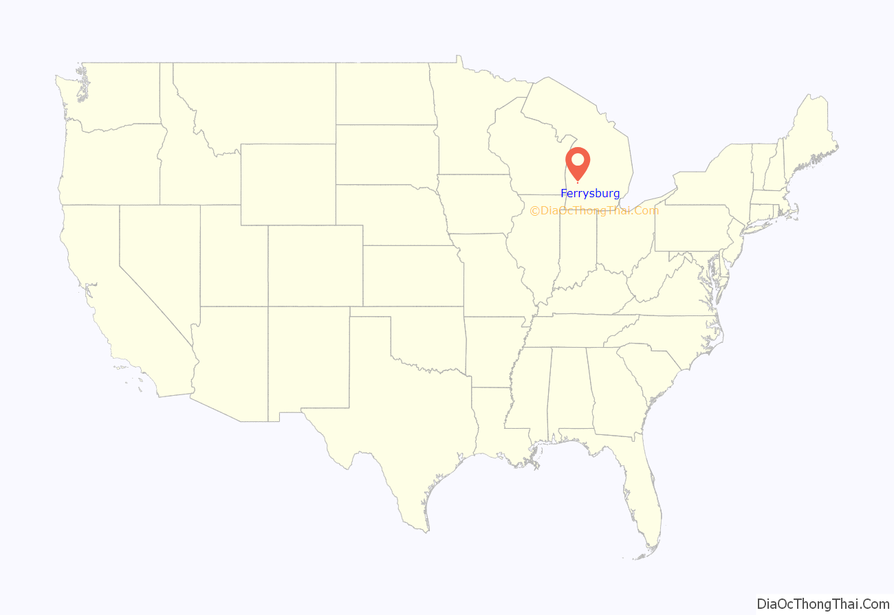
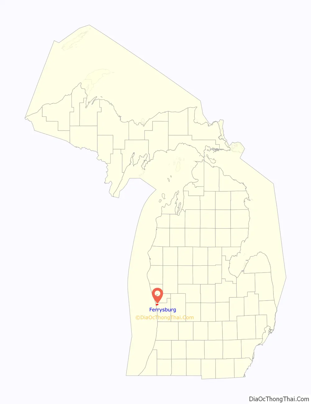
Ferrysburg location map. Where is Ferrysburg city?
History
Settlement in the area of Ferrysburg began in the 1830s by William Montague Ferry and his family. It was platted in 1857.
Ferrysburg Road Map
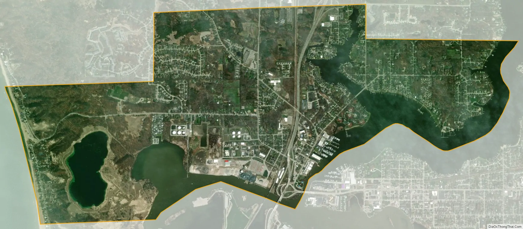
Ferrysburg city Satellite Map
Geography
The city is situated on the north side of the Grand River at its mouth on Lake Michigan. The harbor of Grand Haven and Spring Lake form the southern boundary of the city.
According to the United States Census Bureau, the city has a total area of 3.59 square miles (9.30 km), of which 2.99 square miles (7.74 km) is land and 0.60 square miles (1.55 km) is water.
See also
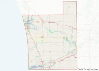
Map of Michigan State and its subdivision:- Alcona
- Alger
- Allegan
- Alpena
- Antrim
- Arenac
- Baraga
- Barry
- Bay
- Benzie
- Berrien
- Branch
- Calhoun
- Cass
- Charlevoix
- Cheboygan
- Chippewa
- Clare
- Clinton
- Crawford
- Delta
- Dickinson
- Eaton
- Emmet
- Genesee
- Gladwin
- Gogebic
- Grand Traverse
- Gratiot
- Hillsdale
- Houghton
- Huron
- Ingham
- Ionia
- Iosco
- Iron
- Isabella
- Jackson
- Kalamazoo
- Kalkaska
- Kent
- Keweenaw
- Lake
- Lake Hurron
- Lake Michigan
- Lake St. Clair
- Lake Superior
- Lapeer
- Leelanau
- Lenawee
- Livingston
- Luce
- Mackinac
- Macomb
- Manistee
- Marquette
- Mason
- Mecosta
- Menominee
- Midland
- Missaukee
- Monroe
- Montcalm
- Montmorency
- Muskegon
- Newaygo
- Oakland
- Oceana
- Ogemaw
- Ontonagon
- Osceola
- Oscoda
- Otsego
- Ottawa
- Presque Isle
- Roscommon
- Saginaw
- Saint Clair
- Saint Joseph
- Sanilac
- Schoolcraft
- Shiawassee
- Tuscola
- Van Buren
- Washtenaw
- Wayne
- Wexford
- Alabama
- Alaska
- Arizona
- Arkansas
- California
- Colorado
- Connecticut
- Delaware
- District of Columbia
- Florida
- Georgia
- Hawaii
- Idaho
- Illinois
- Indiana
- Iowa
- Kansas
- Kentucky
- Louisiana
- Maine
- Maryland
- Massachusetts
- Michigan
- Minnesota
- Mississippi
- Missouri
- Montana
- Nebraska
- Nevada
- New Hampshire
- New Jersey
- New Mexico
- New York
- North Carolina
- North Dakota
- Ohio
- Oklahoma
- Oregon
- Pennsylvania
- Rhode Island
- South Carolina
- South Dakota
- Tennessee
- Texas
- Utah
- Vermont
- Virginia
- Washington
- West Virginia
- Wisconsin
- Wyoming