Fruitport is a village in Muskegon County in the U.S. state of Michigan. The population was 1,093 at the 2010 census. The community is located within Fruitport Charter Township.
Water and sewer utilities are provided by Fruitport Charter Township.
Fruitport is also known for its athletic programs, mainly from its successes in volleyball and wrestling. In volleyball, since 2001, the program has been a state finalist eight times, winning three state titles (2005, 2010, and 2011). In football the team in 2001 were state runners-up. The football program also produced Mike Teeter, who played defensive end at the University of Michigan, and in the NFL for the Minnesota Vikings and the Houston Oilers. In wrestling, the team has won two of the last three district titles, and has had a number of state qualifiers over the years, including sending six wrestlers to the state championships in 2014,.
Fruitport was founded by Edward L. Craw in 1868, who platted and named it as Crawville. It was renamed Fruitport a year later when the Pere Marquette Railroad built a station there, as the town was in the middle of a fertile fruit growing area and also a port. It incorporated as a village in 1891.
In an election on November 8, 2005, 306 residents voted to dissolve the village municipal corporation, while 155 voted no. However, a two-thirds majority (308 votes) was needed to dissolve the village. This was the fourth time since 1979 that a proposal to dissolve the village was on the ballot for an election. In 1990, a proposal to disincorporate was defeated by a 2 to 1 margin while a proposal in 1998 failed by 41 votes.
| Name: | Fruitport village |
|---|---|
| LSAD Code: | 47 |
| LSAD Description: | village (suffix) |
| State: | Michigan |
| County: | Muskegon County |
| Elevation: | 627 ft (191 m) |
| Total Area: | 1.02 sq mi (2.63 km²) |
| Land Area: | 0.91 sq mi (2.35 km²) |
| Water Area: | 0.11 sq mi (0.28 km²) |
| Total Population: | 1,103 |
| Population Density: | 1,216.10/sq mi (469.28/km²) |
| ZIP code: | 49415 |
| Area code: | 231 |
| FIPS code: | 2631000 |
| GNISfeature ID: | 0626541 |
| Website: | http://www.villageoffruitport.com/ |
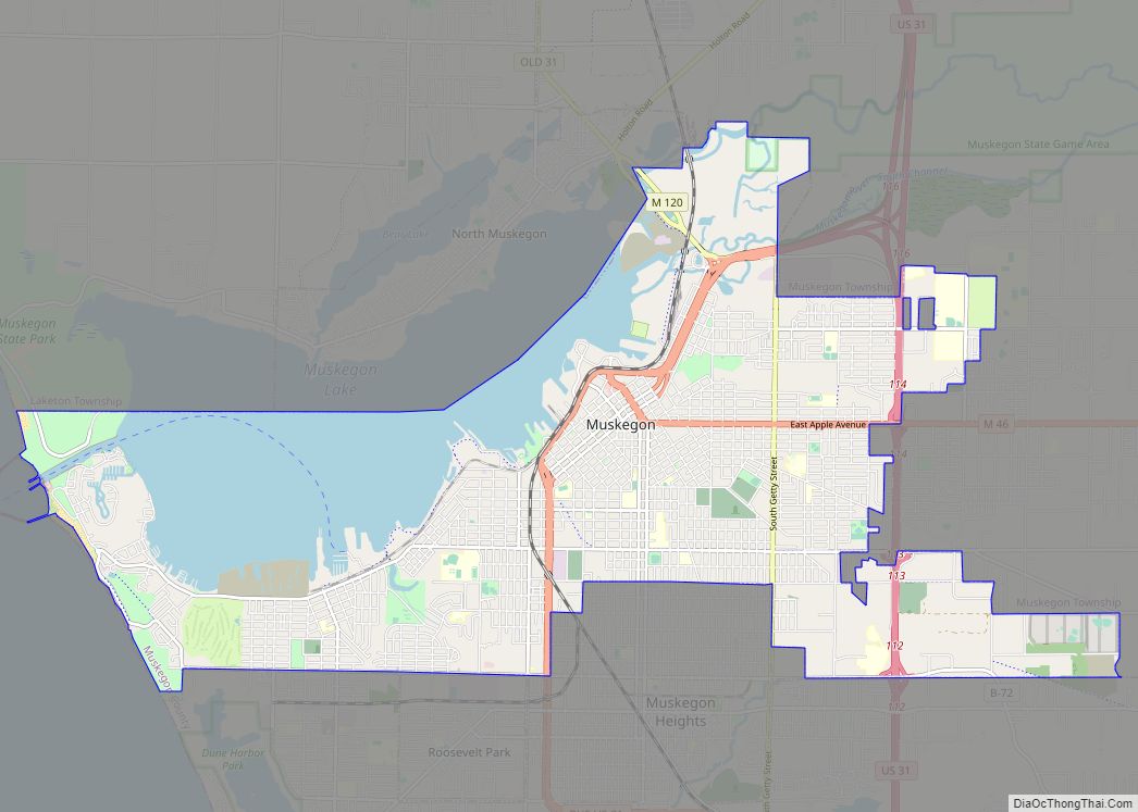
Online Interactive Map
Click on ![]() to view map in "full screen" mode.
to view map in "full screen" mode.
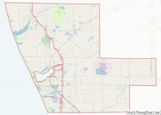
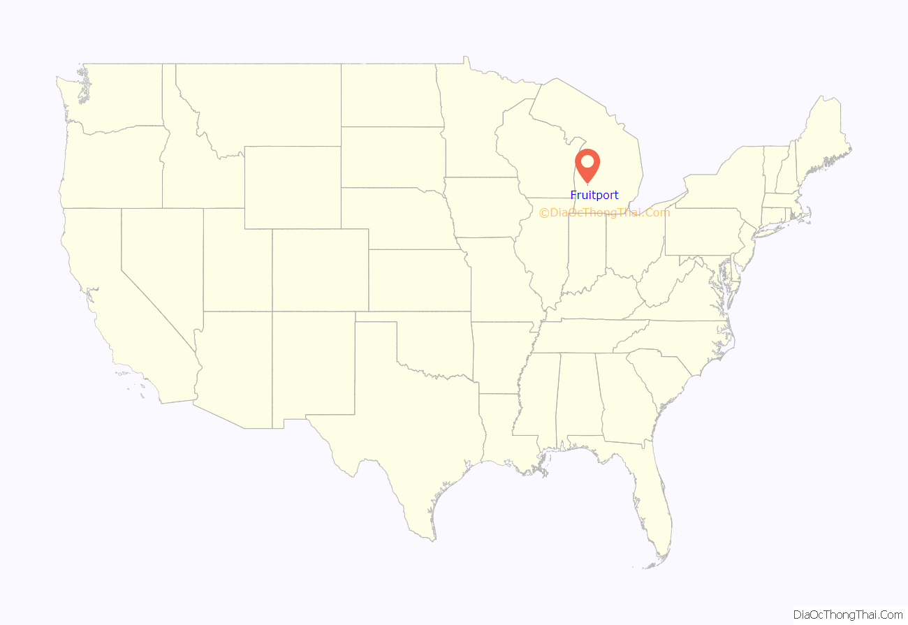
Fruitport location map. Where is Fruitport village?
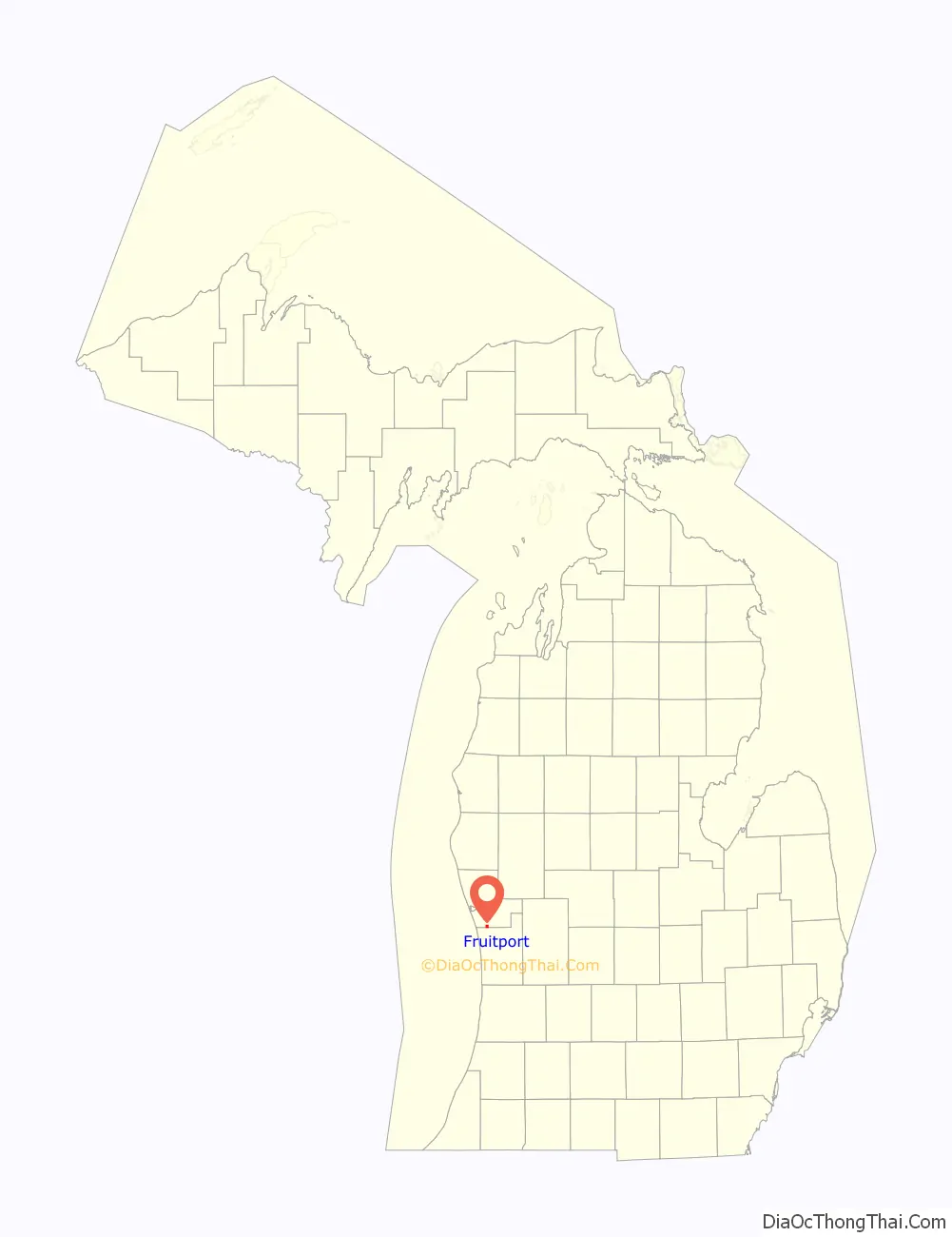
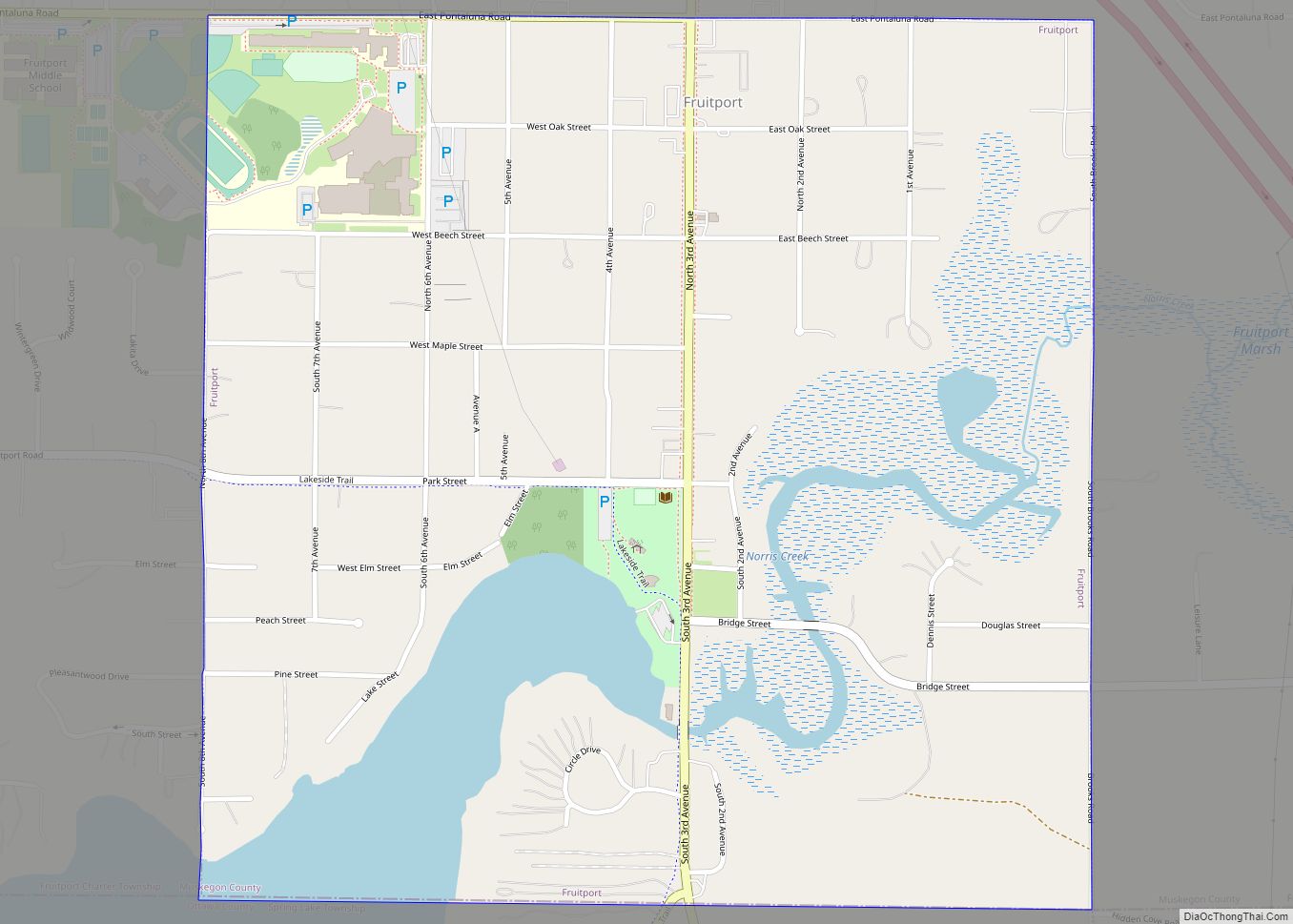
Fruitport Road Map
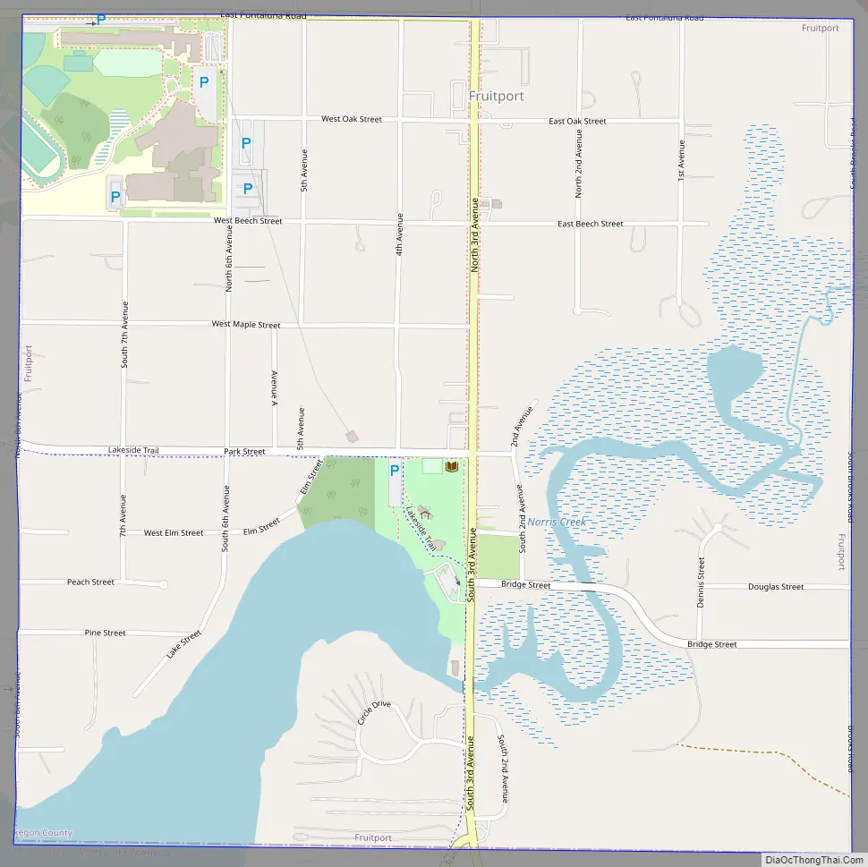
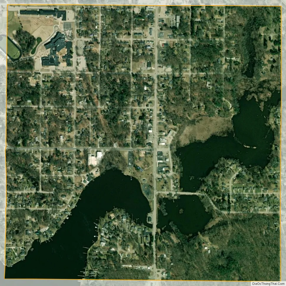
Fruitport city Satellite Map
Geography
According to the United States Census Bureau, the village has a total area of 1.02 square miles (2.64 km), of which 0.91 square miles (2.36 km) is land and 0.11 square miles (0.28 km) is water.
See also
Map of Michigan State and its subdivision:- Alcona
- Alger
- Allegan
- Alpena
- Antrim
- Arenac
- Baraga
- Barry
- Bay
- Benzie
- Berrien
- Branch
- Calhoun
- Cass
- Charlevoix
- Cheboygan
- Chippewa
- Clare
- Clinton
- Crawford
- Delta
- Dickinson
- Eaton
- Emmet
- Genesee
- Gladwin
- Gogebic
- Grand Traverse
- Gratiot
- Hillsdale
- Houghton
- Huron
- Ingham
- Ionia
- Iosco
- Iron
- Isabella
- Jackson
- Kalamazoo
- Kalkaska
- Kent
- Keweenaw
- Lake
- Lake Hurron
- Lake Michigan
- Lake St. Clair
- Lake Superior
- Lapeer
- Leelanau
- Lenawee
- Livingston
- Luce
- Mackinac
- Macomb
- Manistee
- Marquette
- Mason
- Mecosta
- Menominee
- Midland
- Missaukee
- Monroe
- Montcalm
- Montmorency
- Muskegon
- Newaygo
- Oakland
- Oceana
- Ogemaw
- Ontonagon
- Osceola
- Oscoda
- Otsego
- Ottawa
- Presque Isle
- Roscommon
- Saginaw
- Saint Clair
- Saint Joseph
- Sanilac
- Schoolcraft
- Shiawassee
- Tuscola
- Van Buren
- Washtenaw
- Wayne
- Wexford
- Alabama
- Alaska
- Arizona
- Arkansas
- California
- Colorado
- Connecticut
- Delaware
- District of Columbia
- Florida
- Georgia
- Hawaii
- Idaho
- Illinois
- Indiana
- Iowa
- Kansas
- Kentucky
- Louisiana
- Maine
- Maryland
- Massachusetts
- Michigan
- Minnesota
- Mississippi
- Missouri
- Montana
- Nebraska
- Nevada
- New Hampshire
- New Jersey
- New Mexico
- New York
- North Carolina
- North Dakota
- Ohio
- Oklahoma
- Oregon
- Pennsylvania
- Rhode Island
- South Carolina
- South Dakota
- Tennessee
- Texas
- Utah
- Vermont
- Virginia
- Washington
- West Virginia
- Wisconsin
- Wyoming