Mayville is a village in Tuscola County, in the U.S. state of Michigan. The population was 950 at the 2010 census. The village is within Fremont Township along the boundary with Dayton Township.
| Name: | Mayville village |
|---|---|
| LSAD Code: | 47 |
| LSAD Description: | village (suffix) |
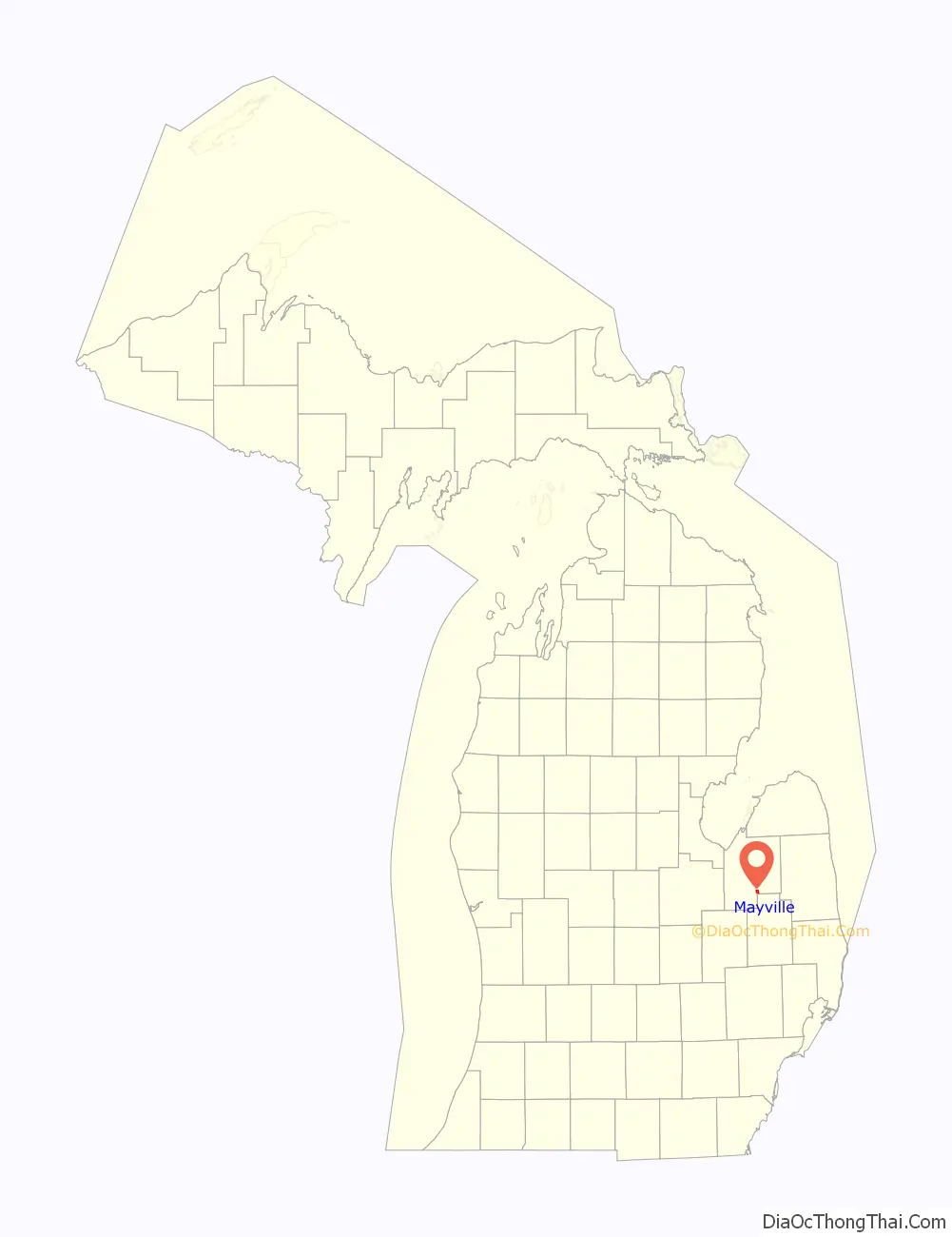
| State: | Michigan |
| County: | Tuscola County |
| Elevation: | 912 ft (278 m) |
| Total Area: | 1.10 sq mi (2.84 km²) |
| Land Area: | 1.08 sq mi (2.79 km²) |
| Water Area: | 0.02 sq mi (0.05 km²) |
| Total Population: | 922 |
| Population Density: | 856.08/sq mi (330.49/km²) |
| ZIP code: | 48744 |
| Area code: | 989 |
| FIPS code: | 2652540 |
| GNISfeature ID: | 0631783 |
| Website: | www.villageofmayville.net |
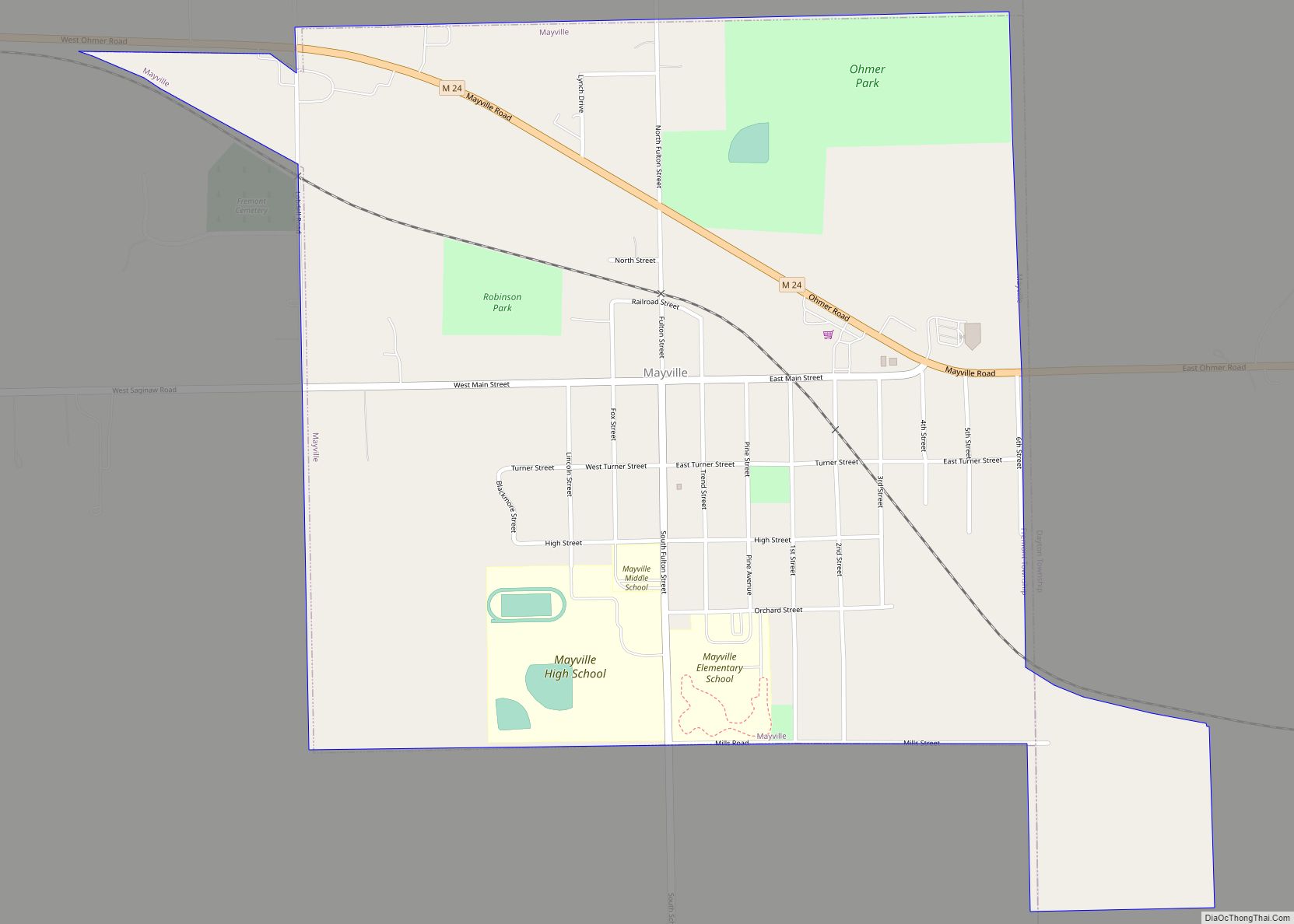
Online Interactive Map
Click on ![]() to view map in "full screen" mode.
to view map in "full screen" mode.
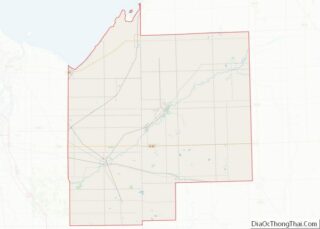
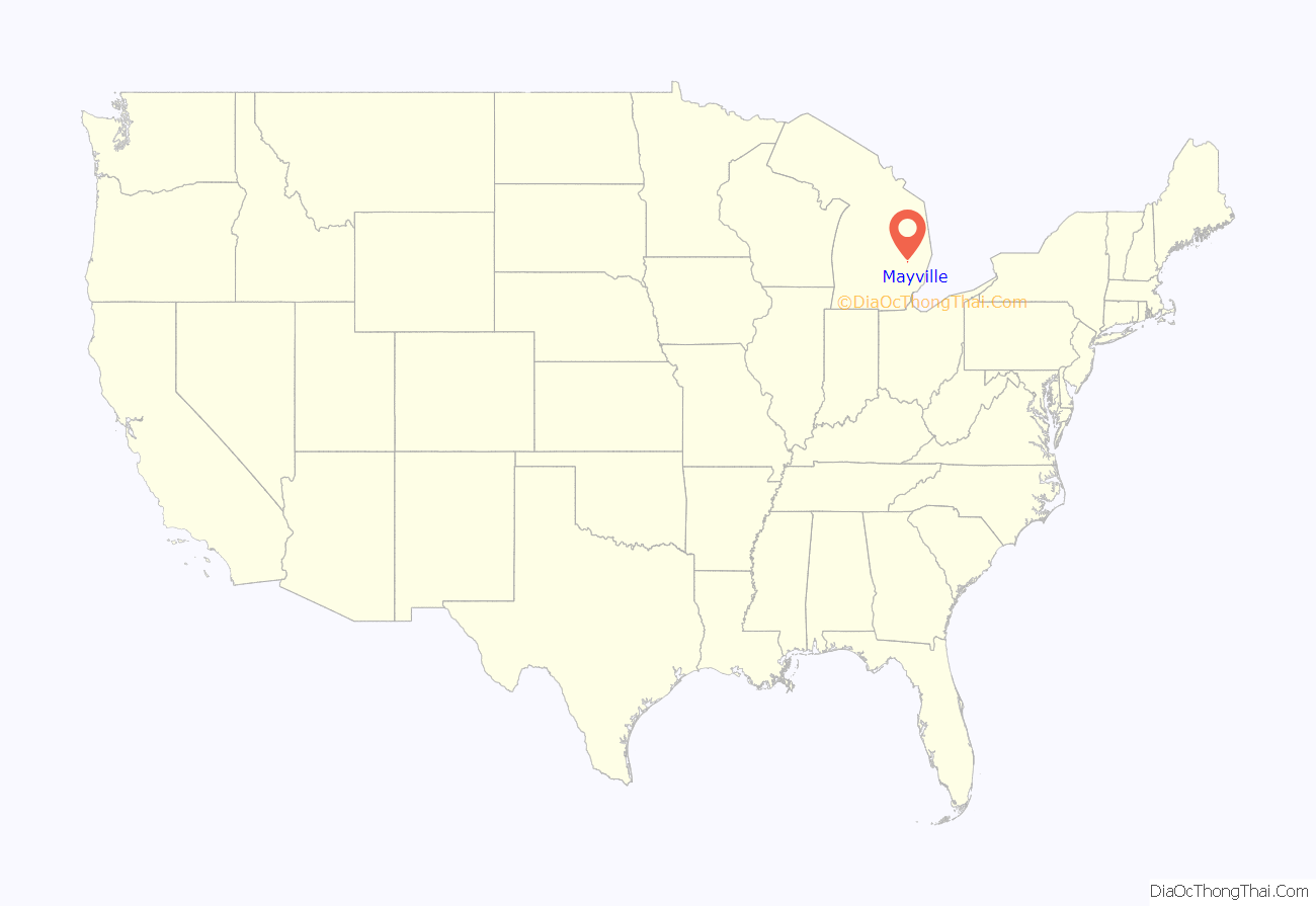
Mayville location map. Where is Mayville village?
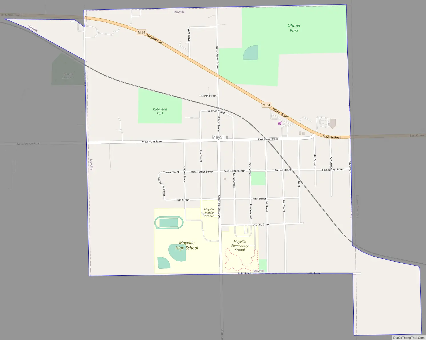
Mayville Road Map
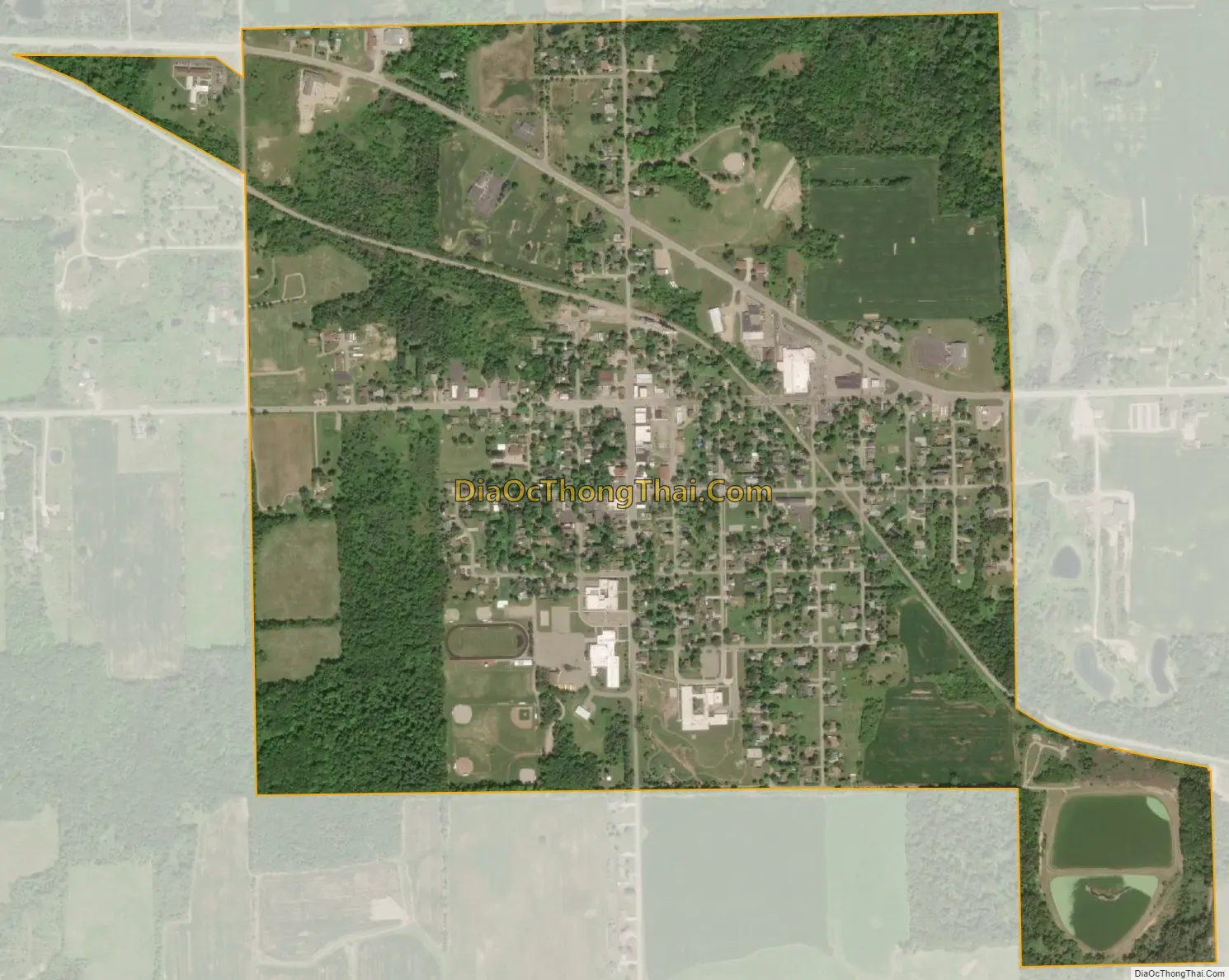
Mayville city Satellite Map
Geography
According to the United States Census Bureau, the village has a total area of 1.15 square miles (2.98 km), of which 1.13 square miles (2.93 km) is land and 0.02 square miles (0.05 km) is water. Mayville is home to one public school system, grades K-12, the ‘Mayville Wildcats’ include students from the nearby towns of Silverwood and Fostoria. The village was founded in 1865 by Dexter Choat.
See also
Map of Michigan State and its subdivision:- Alcona
- Alger
- Allegan
- Alpena
- Antrim
- Arenac
- Baraga
- Barry
- Bay
- Benzie
- Berrien
- Branch
- Calhoun
- Cass
- Charlevoix
- Cheboygan
- Chippewa
- Clare
- Clinton
- Crawford
- Delta
- Dickinson
- Eaton
- Emmet
- Genesee
- Gladwin
- Gogebic
- Grand Traverse
- Gratiot
- Hillsdale
- Houghton
- Huron
- Ingham
- Ionia
- Iosco
- Iron
- Isabella
- Jackson
- Kalamazoo
- Kalkaska
- Kent
- Keweenaw
- Lake
- Lake Hurron
- Lake Michigan
- Lake St. Clair
- Lake Superior
- Lapeer
- Leelanau
- Lenawee
- Livingston
- Luce
- Mackinac
- Macomb
- Manistee
- Marquette
- Mason
- Mecosta
- Menominee
- Midland
- Missaukee
- Monroe
- Montcalm
- Montmorency
- Muskegon
- Newaygo
- Oakland
- Oceana
- Ogemaw
- Ontonagon
- Osceola
- Oscoda
- Otsego
- Ottawa
- Presque Isle
- Roscommon
- Saginaw
- Saint Clair
- Saint Joseph
- Sanilac
- Schoolcraft
- Shiawassee
- Tuscola
- Van Buren
- Washtenaw
- Wayne
- Wexford
- Alabama
- Alaska
- Arizona
- Arkansas
- California
- Colorado
- Connecticut
- Delaware
- District of Columbia
- Florida
- Georgia
- Hawaii
- Idaho
- Illinois
- Indiana
- Iowa
- Kansas
- Kentucky
- Louisiana
- Maine
- Maryland
- Massachusetts
- Michigan
- Minnesota
- Mississippi
- Missouri
- Montana
- Nebraska
- Nevada
- New Hampshire
- New Jersey
- New Mexico
- New York
- North Carolina
- North Dakota
- Ohio
- Oklahoma
- Oregon
- Pennsylvania
- Rhode Island
- South Carolina
- South Dakota
- Tennessee
- Texas
- Utah
- Vermont
- Virginia
- Washington
- West Virginia
- Wisconsin
- Wyoming