Oxford is a village in Oakland County in the U.S. state of Michigan. The population was 3,436 at the 2010 census. The village is located within Oxford Township. Located about 30 miles (48 km) north of Detroit, it is a northern suburb of the Metro Detroit region.
| Name: | Oxford village |
|---|---|
| LSAD Code: | 47 |
| LSAD Description: | village (suffix) |
| State: | Michigan |
| County: | Oakland County |
| Incorporated: | 1876 |
| Elevation: | 1,056 ft (322 m) |
| Land Area: | 1.26 sq mi (3.26 km²) |
| Water Area: | 0.20 sq mi (0.52 km²) |
| Population Density: | 2,773.63/sq mi (1,071.31/km²) |
| Area code: | 248 and 810 |
| FIPS code: | 2662020 |
| GNISfeature ID: | 0634267 |
Online Interactive Map
Click on ![]() to view map in "full screen" mode.
to view map in "full screen" mode.
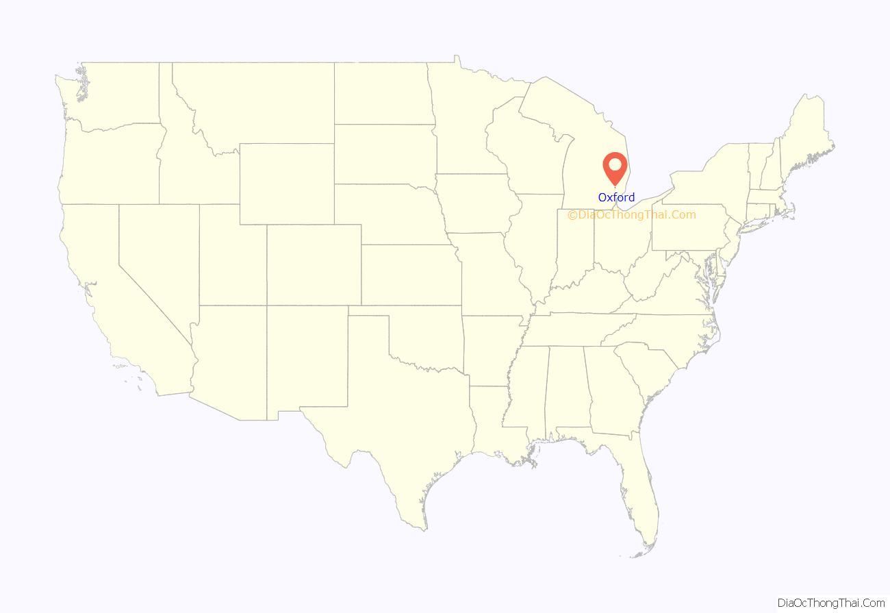
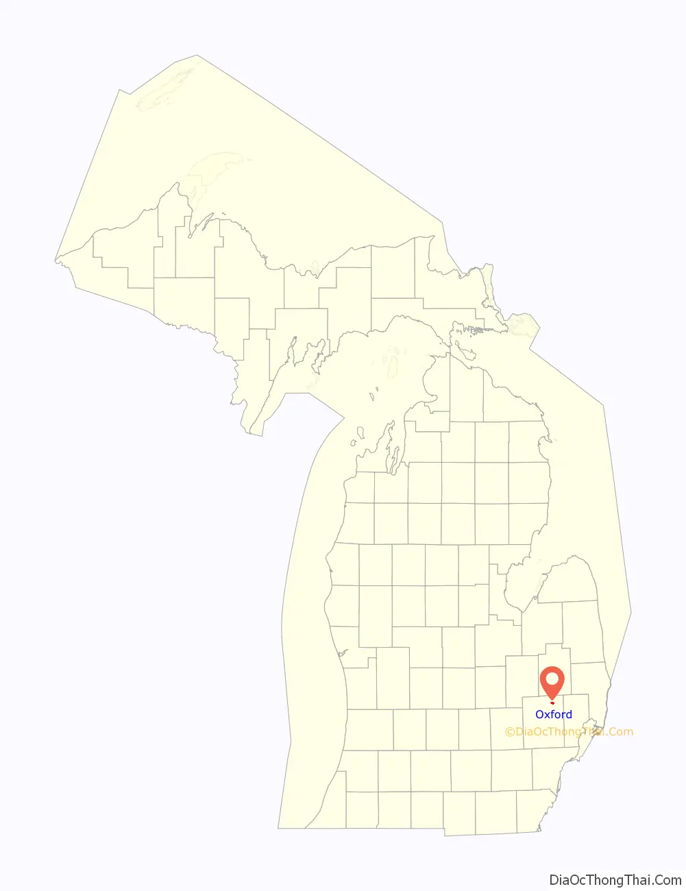
Oxford location map. Where is Oxford village?
History
During the early 19th century the northeast Oakland County area was largely avoided by the early settlers because it was believed to be nothing but impenetrable swamp land. The area was, at that time, nicknamed “The Barren Plains of Oxford.” It was called this primarily because of a report made in 1812 by the U.S. Surveyor General that described the area as a poor, barren, sandy land, on which scarcely any vegetation could grow with the exception of some very small scrubby oaks. It was concluded in the surveyors’ report that there was one acre out of one hundred that appeared to be eligible for cultivation. Any hope for crop production was thought to be preposterous. At this point, the area was deemed worthless, and discouragement of any hope for development by forthcoming settlers was inevitable.
Purchase of public land in what is now called Oxford was in 1823 by a man named Elbridge G. Deming. Soon after, the first person to settle in Oxford was a wolf trapper named Avery Brown. He made use of the land and gave some credibility to its value. It wasn’t long after that the first area post office was officially established in what was then known as Demingsburgh on May 2, 1834. Five years later, the name was officially changed to Oxford on January 15, 1839. Elbridge D. Deming was the first postmaster for Oxford, as the post office was located in his log home near the intersection of M-24 and Metamora Road.
On November 30, 2021, a mass shooting occurred at Oxford High School. Four people were killed, and seven others were injured, including an injured teacher. School attendance was very low that day, as rumors had spread earlier that week of a shooting being about to occur. Most of the students escaped into a nearby Meijer. The suspect, a 15-year-old sophomore student, reportedly fired between 15 and 20 bullets in a chemistry room and did not resist arrest.
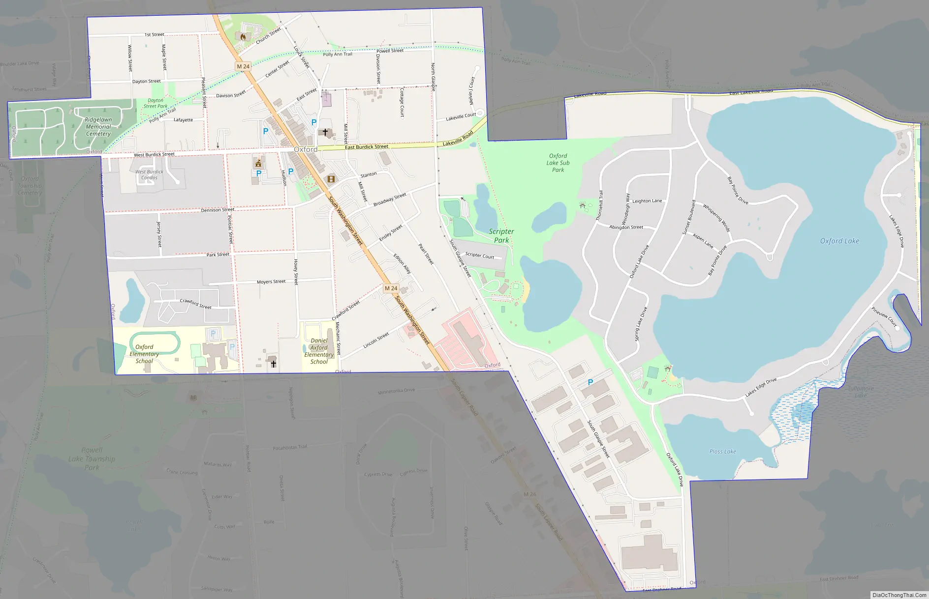
Oxford Road Map
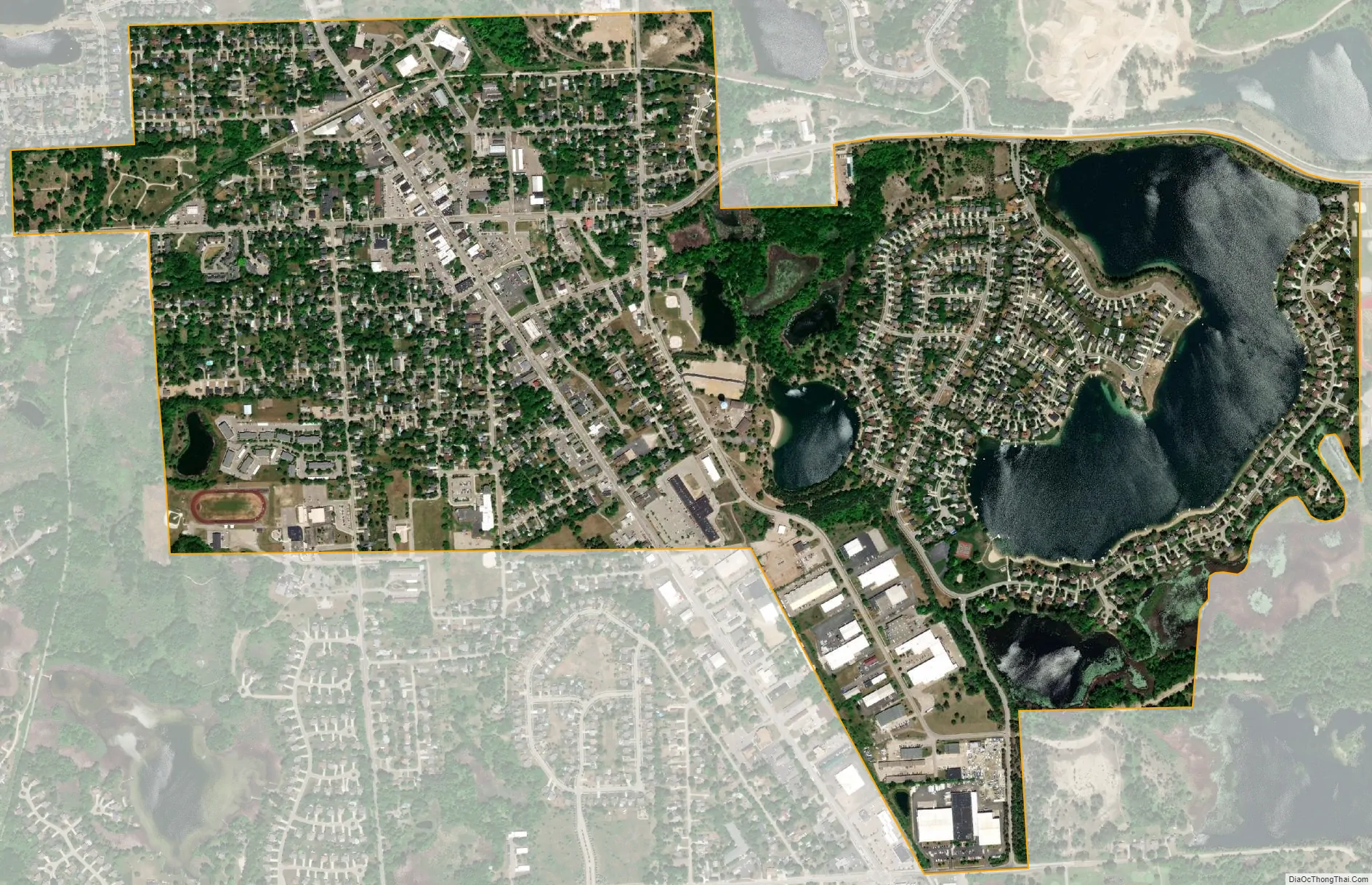
Oxford city Satellite Map
Geography
According to the United States Census Bureau, the village has a total area of 1.46 square miles (3.78 km), of which 1.26 square miles (3.26 km) is land and 0.20 square miles (0.52 km) (1.37%) is water.
See also
Map of Michigan State and its subdivision:- Alcona
- Alger
- Allegan
- Alpena
- Antrim
- Arenac
- Baraga
- Barry
- Bay
- Benzie
- Berrien
- Branch
- Calhoun
- Cass
- Charlevoix
- Cheboygan
- Chippewa
- Clare
- Clinton
- Crawford
- Delta
- Dickinson
- Eaton
- Emmet
- Genesee
- Gladwin
- Gogebic
- Grand Traverse
- Gratiot
- Hillsdale
- Houghton
- Huron
- Ingham
- Ionia
- Iosco
- Iron
- Isabella
- Jackson
- Kalamazoo
- Kalkaska
- Kent
- Keweenaw
- Lake
- Lake Hurron
- Lake Michigan
- Lake St. Clair
- Lake Superior
- Lapeer
- Leelanau
- Lenawee
- Livingston
- Luce
- Mackinac
- Macomb
- Manistee
- Marquette
- Mason
- Mecosta
- Menominee
- Midland
- Missaukee
- Monroe
- Montcalm
- Montmorency
- Muskegon
- Newaygo
- Oakland
- Oceana
- Ogemaw
- Ontonagon
- Osceola
- Oscoda
- Otsego
- Ottawa
- Presque Isle
- Roscommon
- Saginaw
- Saint Clair
- Saint Joseph
- Sanilac
- Schoolcraft
- Shiawassee
- Tuscola
- Van Buren
- Washtenaw
- Wayne
- Wexford
- Alabama
- Alaska
- Arizona
- Arkansas
- California
- Colorado
- Connecticut
- Delaware
- District of Columbia
- Florida
- Georgia
- Hawaii
- Idaho
- Illinois
- Indiana
- Iowa
- Kansas
- Kentucky
- Louisiana
- Maine
- Maryland
- Massachusetts
- Michigan
- Minnesota
- Mississippi
- Missouri
- Montana
- Nebraska
- Nevada
- New Hampshire
- New Jersey
- New Mexico
- New York
- North Carolina
- North Dakota
- Ohio
- Oklahoma
- Oregon
- Pennsylvania
- Rhode Island
- South Carolina
- South Dakota
- Tennessee
- Texas
- Utah
- Vermont
- Virginia
- Washington
- West Virginia
- Wisconsin
- Wyoming


