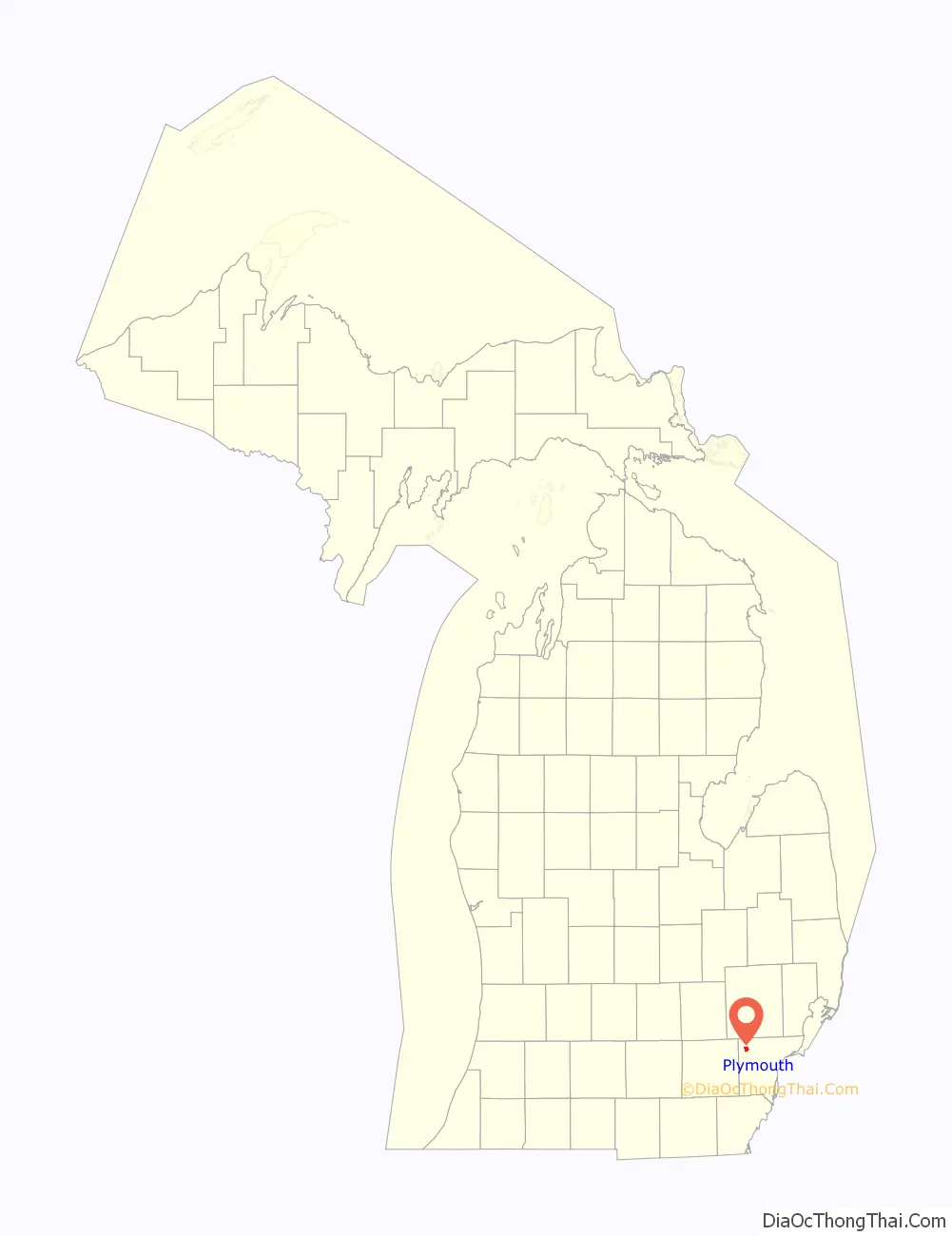
Plymouth is a city in Wayne County, Michigan, United States. The population was 9,370 at the 2020 census. The city of Plymouth is surrounded by Plymouth Township, but the two are administered autonomously. Plymouth is a western suburb of Metro Detroit and is located about 10 miles (16.1 km) west of the city of Detroit.
| Name: | Plymouth city |
|---|---|
| LSAD Code: | 25 |
| LSAD Description: | city (suffix) |
| State: | Michigan |
| County: | Wayne County |
| Incorporated: | 1867 (village) 1932 (city) |
| Elevation: | 725 ft (221 m) |
| Land Area: | 2.21 sq mi (5.73 km²) |
| Water Area: | 0.01 sq mi (0.03 km²) 0.45% |
| Population Density: | 4,235.99/sq mi (1,635.61/km²) |
| Area code: | 734 |
| FIPS code: | 2665060 |
| GNISfeature ID: | 0635148 |
| Website: | plymouthmi.gov |
Online Interactive Map
Click on ![]() to view map in "full screen" mode.
to view map in "full screen" mode.
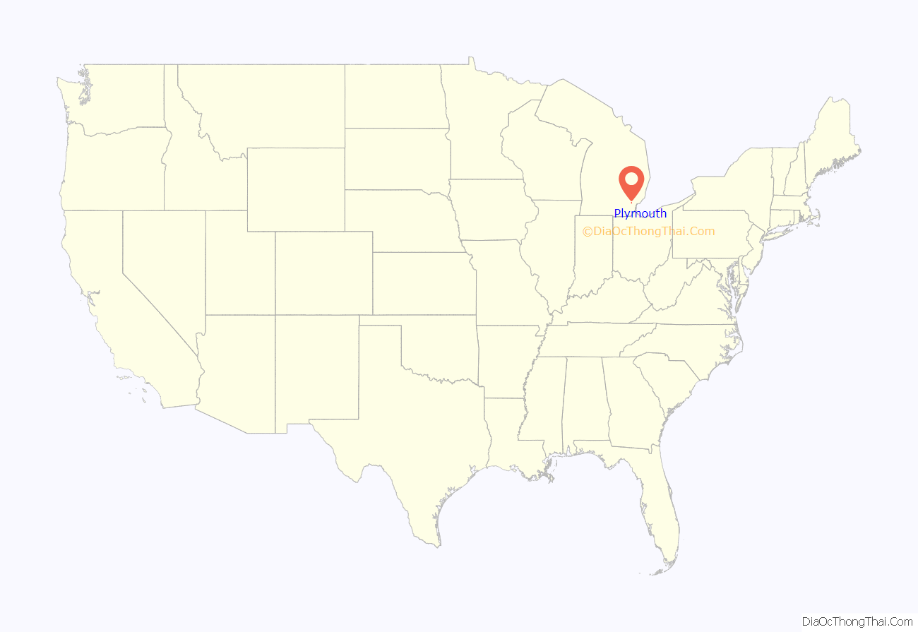
Plymouth location map. Where is Plymouth city?
History
Plymouth was first settled in 1825, incorporated as a village in 1867, and became a city in 1932.
Foundation
In 1825, Luther Lincoln was granted two land patents in what is now Plymouth by the federal government. Lincoln built his place of business, his saw mill, and abode, near the eastern boundary of his land, along the Rouge River. His actual abode and saw mill was always outside the city limits. Another early settler was William Starkweather. William and his wife Keziah brought their firstborn son Albert to the area and built the first home in Plymouth, at what is now the southwest corner of Main Street and Ann Arbor Trail. The first home was a lean-to, and was later replaced by a log cabin, which has since been destroyed.
Growth
In 1831, William Starkweather sold his land in downtown Plymouth and in 1831 purchased an 80-acre (320,000 m) parcel of land in what was then called “North Village” (now called “The Historic Old Village”). In 1844, William died and the land in Old Village was then passed to William’s son, George A Starkweather. George felt that the railroad coming to North Village would give it a commercial advantage over the Kellogg Park area. In the 1860s, he convinced the Detroit and Howell Railroad Company to build through the town. Starkweather was responsible for cutting Oak Street North through his farm in order to reach his new store and the train station. After his death in 1907, Oak Street was renamed Starkweather in his honor.
Notable streets in Plymouth are named after some Starkweather family members, including Blanche (after Blanche Starkweather, daughter of George Starkweather), Karmada (after the grandchildren of George Starkweather – Karl, Max and Davis), Davis – after Davis B Hillmer – youngest grandson of George Starkweather, Starkweather (formerly Oak Street), Amelia (after Lydia Amelia Heywood – Davis – Starkweather) – George Starkweather’s wife, and Rose – after Rose Hillmer, eldest grand daughter of George Starkweather. Starkweather Elementary School was named after George Anson Starkweather of Plymouth, which was converted to an adult education center.
Daisy Manufacturing Company, now Daisy Outdoor Products, started in 1882 in Plymouth as the Plymouth Iron Windmill Company. In 1886 Plymouth inventor Clarence Hamilton introduced a new idea to the windmill company. It was a combination of metal and wire, vaguely resembling a gun that could fire a lead ball using compressed air. Lewis Cass Hough, then president of the firm, gave it a try and, after his first shot, enthusiastically exclaimed, “Boy, that’s a daisy!” The name stuck, and the BB gun went into production as a premium item given to farmers when they purchased a windmill. The gun was such a huge success that Plymouth Iron Windmill soon began manufacturing the Daisy BB gun in place of windmills. On January 26, 1895, the company’s board of directors officially voted to change the name to Daisy Manufacturing Company, Inc.
Recent history
Much to the dismay of Plymouth residents, Daisy moved its corporate offices and manufacturing facilities from Plymouth to Rogers, Arkansas in 1958.
In 2003 the former Daisy factory was converted to Daisy Square Condominiums despite being situated next to an active freight rail line. The front wall of the Daisy factory was left standing to be built into the apartment building. The wall has since been demolished.
In 2009 Plymouth Township was named 28th Best Place to Live in the United States by CNN Money Magazine.
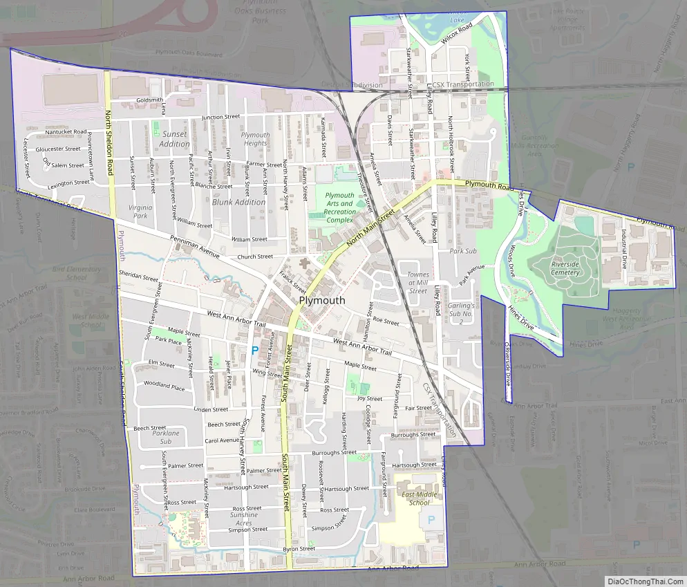
Plymouth Road Map
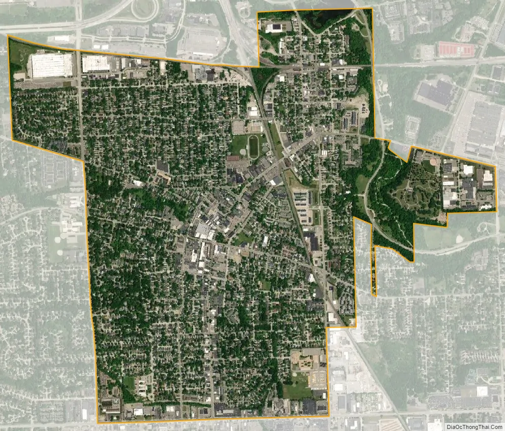
Plymouth city Satellite Map
Geography
According to the United States Census Bureau, the city has a total area of 2.22 square miles (5.75 km), of which 2.21 square miles (5.72 km) is land and 0.01 square miles (0.03 km) is water. It is located 15.6 miles (25.1 km) east of Ann Arbor and 26.3 miles (42.3 km) west of Detroit, just south of the M-14 highway and west of Interstate 275.
See also
Map of Michigan State and its subdivision:- Alcona
- Alger
- Allegan
- Alpena
- Antrim
- Arenac
- Baraga
- Barry
- Bay
- Benzie
- Berrien
- Branch
- Calhoun
- Cass
- Charlevoix
- Cheboygan
- Chippewa
- Clare
- Clinton
- Crawford
- Delta
- Dickinson
- Eaton
- Emmet
- Genesee
- Gladwin
- Gogebic
- Grand Traverse
- Gratiot
- Hillsdale
- Houghton
- Huron
- Ingham
- Ionia
- Iosco
- Iron
- Isabella
- Jackson
- Kalamazoo
- Kalkaska
- Kent
- Keweenaw
- Lake
- Lake Hurron
- Lake Michigan
- Lake St. Clair
- Lake Superior
- Lapeer
- Leelanau
- Lenawee
- Livingston
- Luce
- Mackinac
- Macomb
- Manistee
- Marquette
- Mason
- Mecosta
- Menominee
- Midland
- Missaukee
- Monroe
- Montcalm
- Montmorency
- Muskegon
- Newaygo
- Oakland
- Oceana
- Ogemaw
- Ontonagon
- Osceola
- Oscoda
- Otsego
- Ottawa
- Presque Isle
- Roscommon
- Saginaw
- Saint Clair
- Saint Joseph
- Sanilac
- Schoolcraft
- Shiawassee
- Tuscola
- Van Buren
- Washtenaw
- Wayne
- Wexford
- Alabama
- Alaska
- Arizona
- Arkansas
- California
- Colorado
- Connecticut
- Delaware
- District of Columbia
- Florida
- Georgia
- Hawaii
- Idaho
- Illinois
- Indiana
- Iowa
- Kansas
- Kentucky
- Louisiana
- Maine
- Maryland
- Massachusetts
- Michigan
- Minnesota
- Mississippi
- Missouri
- Montana
- Nebraska
- Nevada
- New Hampshire
- New Jersey
- New Mexico
- New York
- North Carolina
- North Dakota
- Ohio
- Oklahoma
- Oregon
- Pennsylvania
- Rhode Island
- South Carolina
- South Dakota
- Tennessee
- Texas
- Utah
- Vermont
- Virginia
- Washington
- West Virginia
- Wisconsin
- Wyoming


