Potterville is a city in Eaton County in the U.S. state of Michigan. The population was 2,617 at the 2010 census.
| Name: | Potterville city |
|---|---|
| LSAD Code: | 25 |
| LSAD Description: | city (suffix) |
| State: | Michigan |
| County: | Eaton County |
| Elevation: | 902 ft (275 m) |
| Total Area: | 1.88 sq mi (4.87 km²) |
| Land Area: | 1.75 sq mi (4.52 km²) |
| Water Area: | 0.14 sq mi (0.35 km²) |
| Total Population: | 3,055 |
| Population Density: | 1,749.71/sq mi (675.57/km²) |
| ZIP code: | 48876 |
| Area code: | 517 |
| FIPS code: | 2666100 |
| GNISfeature ID: | 1626939 |
| Website: | http://www.pottervillemi.org/ |
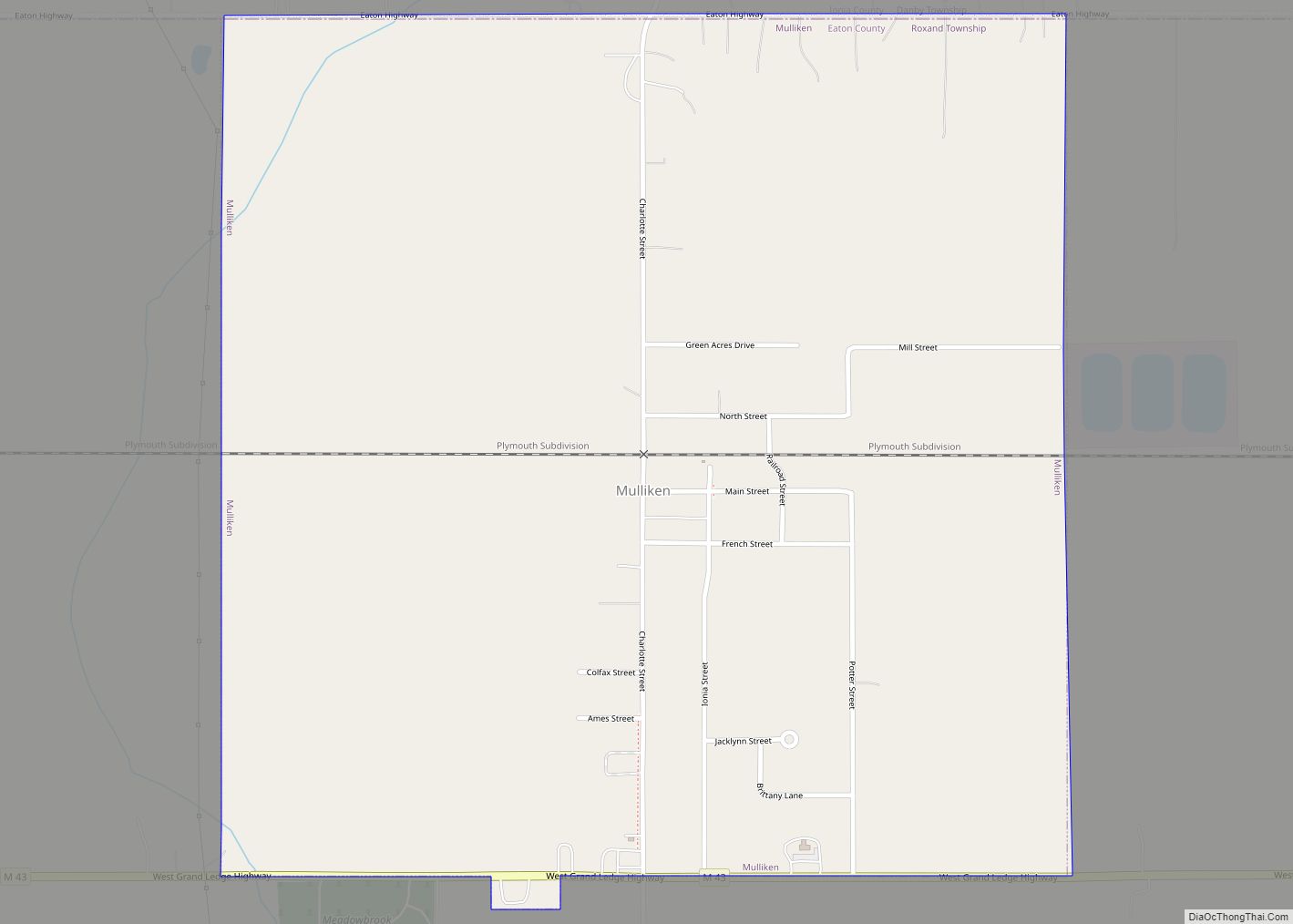
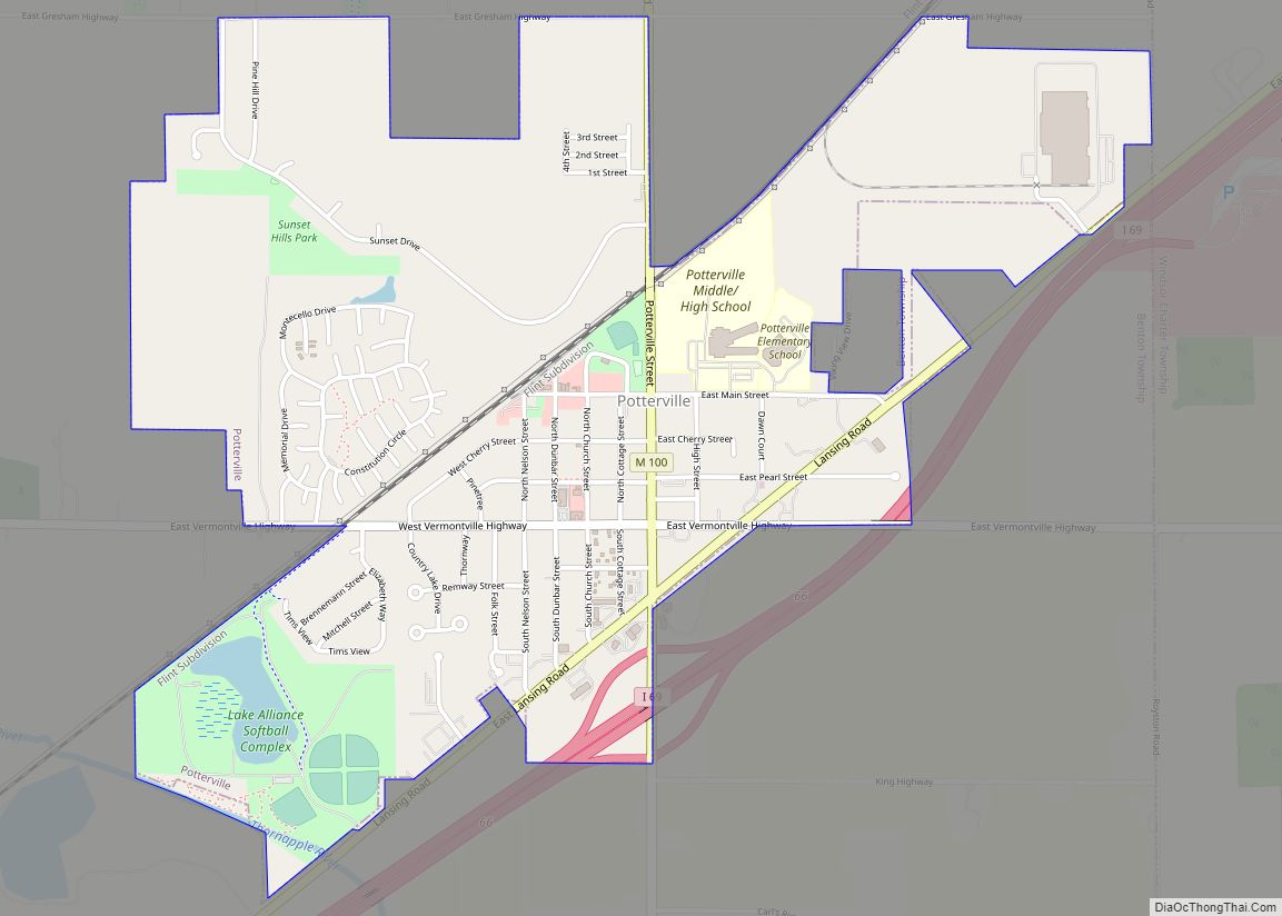
Online Interactive Map
Click on ![]() to view map in "full screen" mode.
to view map in "full screen" mode.
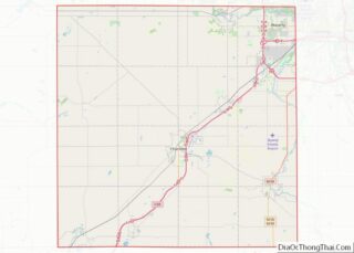
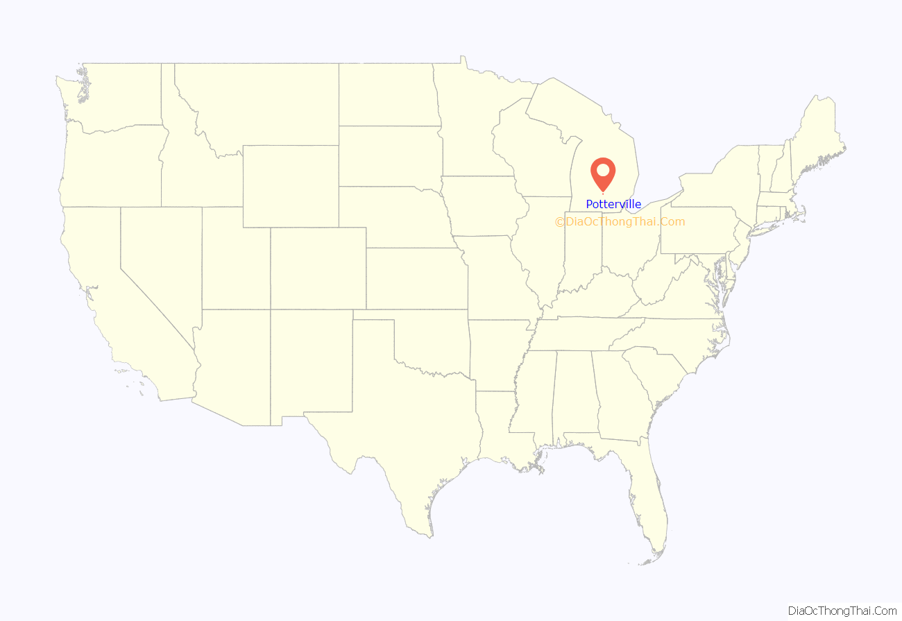
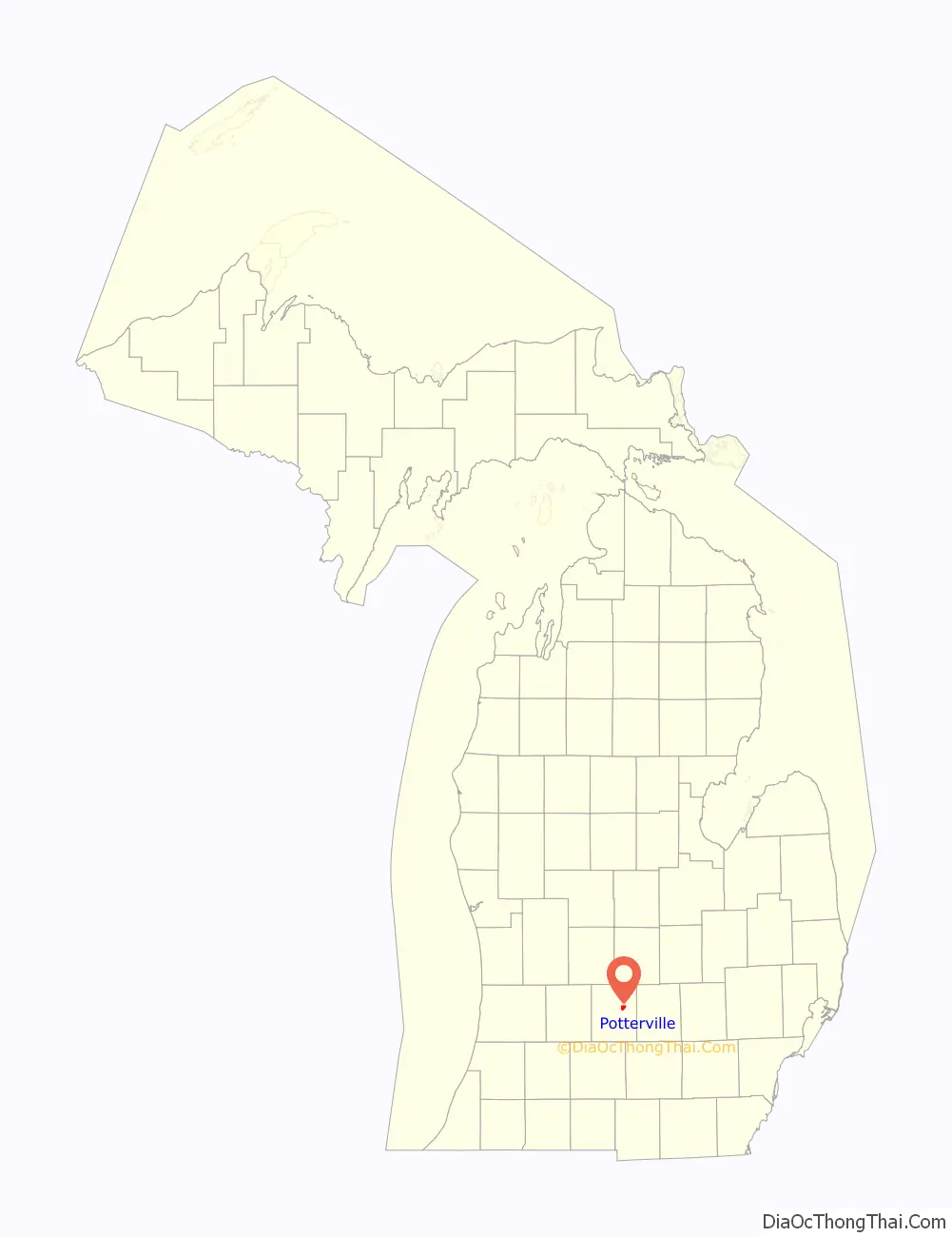
Potterville location map. Where is Potterville city?
History
Potterville is named after Linus Potter, who settled his family in the area in November, 1844. Linus was elected supervisor of Benton Township in 1846. In 1830, Linus and his wife Diantha came from Cayuga County, New York, by way of the Erie Canal, to Buffalo and then by way of Lake Erie steamboat to Detroit. From there, Linus and Diantha walked to Plymouth, Michigan, a journey of about thirty miles, before walking on to Saline. The pair carried their three-year-old son, George, and their infant daughter, Louisa.
Potterville incorporated as a village within Benton Township in 1881, and as a city in 1962 withdrawing it completely from the township.
On July 6, 1994, a lightning strike at Fox Park injured 22 beach-goers. The lightning struck the water and “walked up the beach.”
A rare Michigan earthquake on September 2, 1994, had its epicenter just east of the city. The shock had a body wave magnitude of 3.5 and a maximum Mercalli intensity of V (Moderate). It could be felt through most of Mid-Michigan.
The city experienced a massive train derailment of 35 Canadian National railroad cars over Memorial Day weekend 2002. Due to leaking propane from the cars, the entire city was evacuated. The cause of the derailment was found to have been a faulty rail.
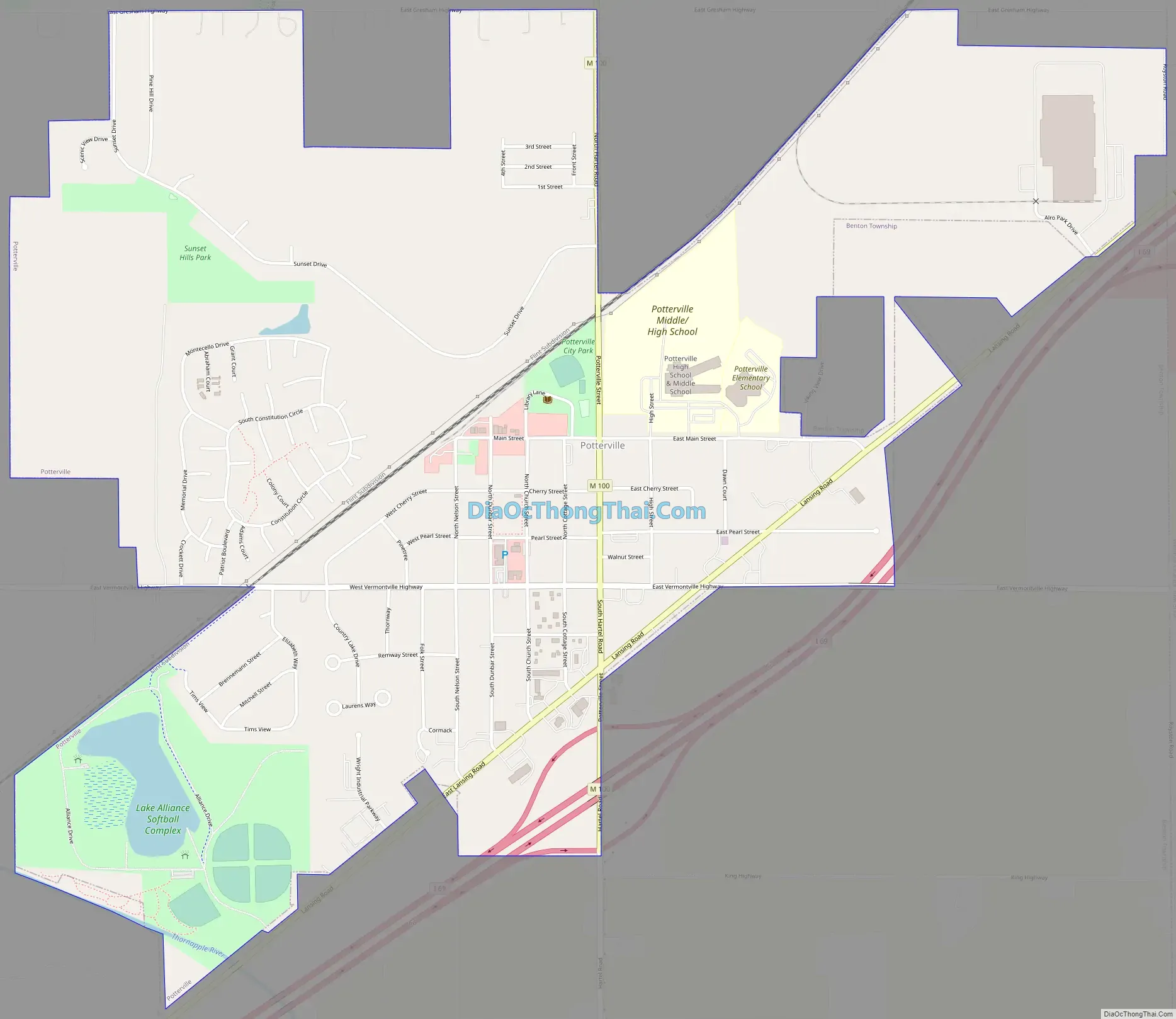
Potterville Road Map
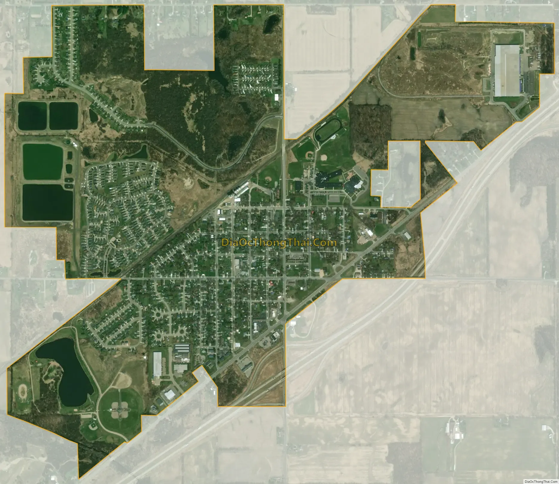
Potterville city Satellite Map
Geography
According to the United States Census Bureau, the city has a total area of 1.82 square miles (4.71 km), of which 1.68 square miles (4.35 km) is land and 0.14 square miles (0.36 km) is water.
See also
Map of Michigan State and its subdivision:- Alcona
- Alger
- Allegan
- Alpena
- Antrim
- Arenac
- Baraga
- Barry
- Bay
- Benzie
- Berrien
- Branch
- Calhoun
- Cass
- Charlevoix
- Cheboygan
- Chippewa
- Clare
- Clinton
- Crawford
- Delta
- Dickinson
- Eaton
- Emmet
- Genesee
- Gladwin
- Gogebic
- Grand Traverse
- Gratiot
- Hillsdale
- Houghton
- Huron
- Ingham
- Ionia
- Iosco
- Iron
- Isabella
- Jackson
- Kalamazoo
- Kalkaska
- Kent
- Keweenaw
- Lake
- Lake Hurron
- Lake Michigan
- Lake St. Clair
- Lake Superior
- Lapeer
- Leelanau
- Lenawee
- Livingston
- Luce
- Mackinac
- Macomb
- Manistee
- Marquette
- Mason
- Mecosta
- Menominee
- Midland
- Missaukee
- Monroe
- Montcalm
- Montmorency
- Muskegon
- Newaygo
- Oakland
- Oceana
- Ogemaw
- Ontonagon
- Osceola
- Oscoda
- Otsego
- Ottawa
- Presque Isle
- Roscommon
- Saginaw
- Saint Clair
- Saint Joseph
- Sanilac
- Schoolcraft
- Shiawassee
- Tuscola
- Van Buren
- Washtenaw
- Wayne
- Wexford
- Alabama
- Alaska
- Arizona
- Arkansas
- California
- Colorado
- Connecticut
- Delaware
- District of Columbia
- Florida
- Georgia
- Hawaii
- Idaho
- Illinois
- Indiana
- Iowa
- Kansas
- Kentucky
- Louisiana
- Maine
- Maryland
- Massachusetts
- Michigan
- Minnesota
- Mississippi
- Missouri
- Montana
- Nebraska
- Nevada
- New Hampshire
- New Jersey
- New Mexico
- New York
- North Carolina
- North Dakota
- Ohio
- Oklahoma
- Oregon
- Pennsylvania
- Rhode Island
- South Carolina
- South Dakota
- Tennessee
- Texas
- Utah
- Vermont
- Virginia
- Washington
- West Virginia
- Wisconsin
- Wyoming