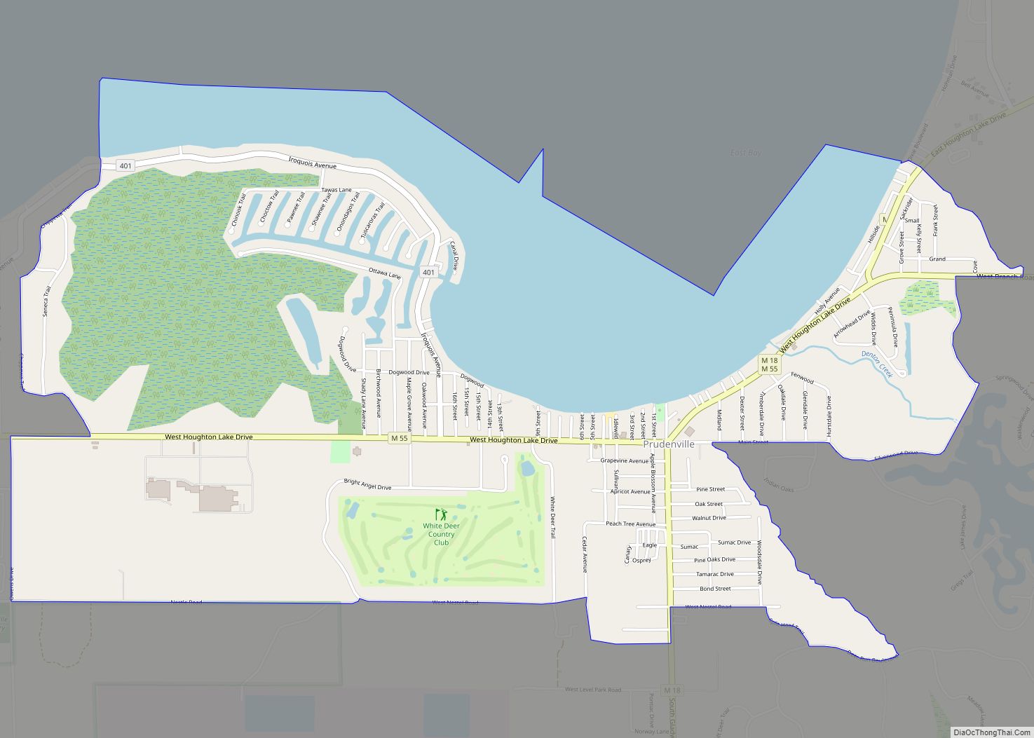
Prudenville is an unincorporated community and census-designated place (CDP) in Roscommon County in the U.S. state of Michigan. The population was 1,643 at the 2020 census. Prudenville is located within Denton Township.
| Name: | Prudenville CDP |
|---|---|
| LSAD Code: | 57 |
| LSAD Description: | CDP (suffix) |
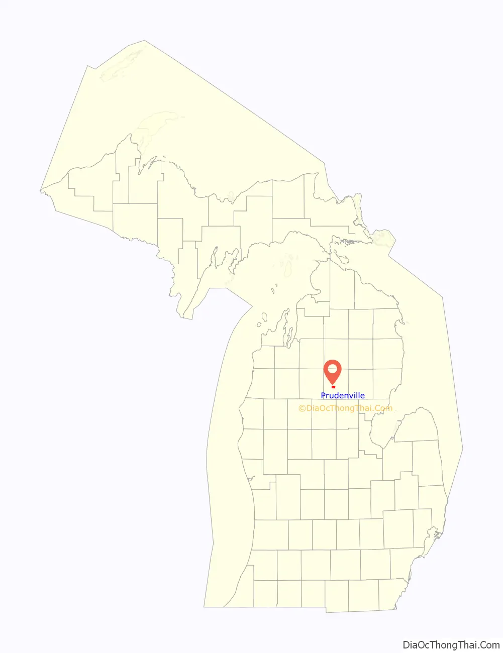
| State: | Michigan |
| County: | Roscommon County |
| Elevation: | 1,145 ft (349 m) |
| Total Area: | 3.72 sq mi (9.63 km²) |
| Land Area: | 2.85 sq mi (7.39 km²) |
| Water Area: | 0.87 sq mi (2.24 km²) |
| Total Population: | 1,643 |
| Population Density: | 575.89/sq mi (222.37/km²) |
| Area code: | 989 |
| FIPS code: | 2666400 |
| GNISfeature ID: | 0635500 |
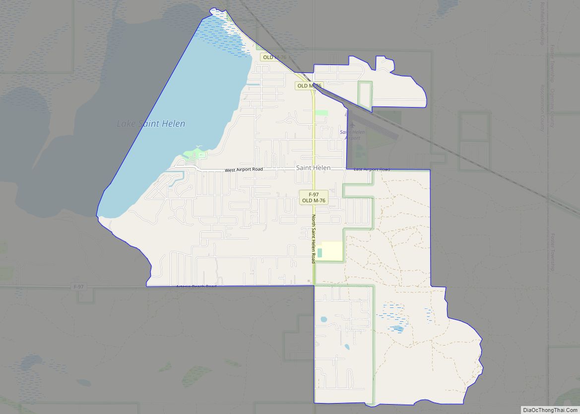
Online Interactive Map
Click on ![]() to view map in "full screen" mode.
to view map in "full screen" mode.
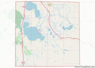
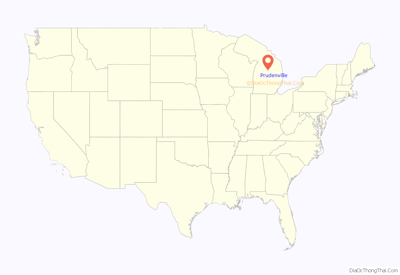
Prudenville location map. Where is Prudenville CDP?
History
The area received its first post office on September 6, 1875 under the name Prudenville, and it was soon changed to the name Edna on January 10, 1876. The name Edna existed until it was changed back to Prudenville on January 14, 1886. The Prudenville post office was discontinued on August 15, 1911, but reestablished 10 years later on August 30, 1921. The post office remains in operation and is located at 899 West Houghton Lake Drive (M-55).
The Homestead Act of 1862, which granted free land to travelers moving west, prompted settlers to the Prudenville area in 1870 due to its plentiful lumber resources. The growing community was named after early developer Peter Pruden, and the community grew to include a post office, two hotels, many businesses, and a school. In 1882, the Roscommon Lumber Company built a “stand-alone” trestle railroad to assist logging crews in pushing timber into the east bay of Houghton Lake. The logs were floated across the lake into the draining Muskegon River and further down the river to the mills of Muskegon on the shores of Lake Michigan. During its operation from 1882 to 1887, the company employed 700 workers and logged 175 million board feet of white and Norway pine.
In 2004, the Roscommon Lumber Company and the community of Prudenville were dually listed as a Michigan State Historic Site. A historic marker was dedicated in Trestle Park on September 6, 2014.
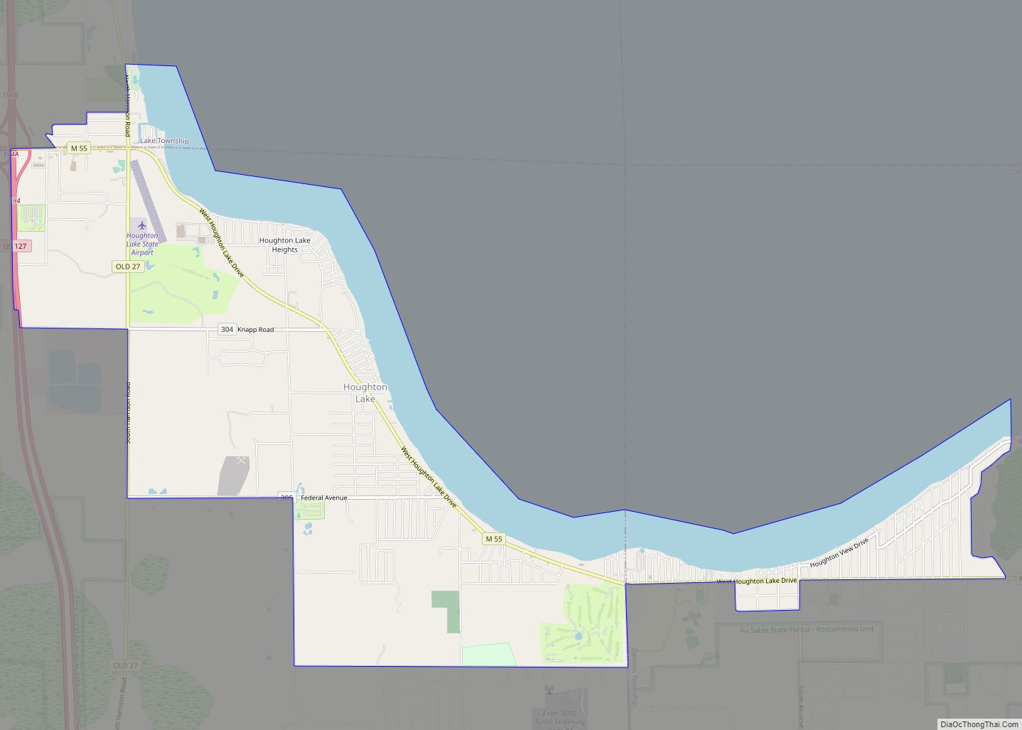
Prudenville Road Map
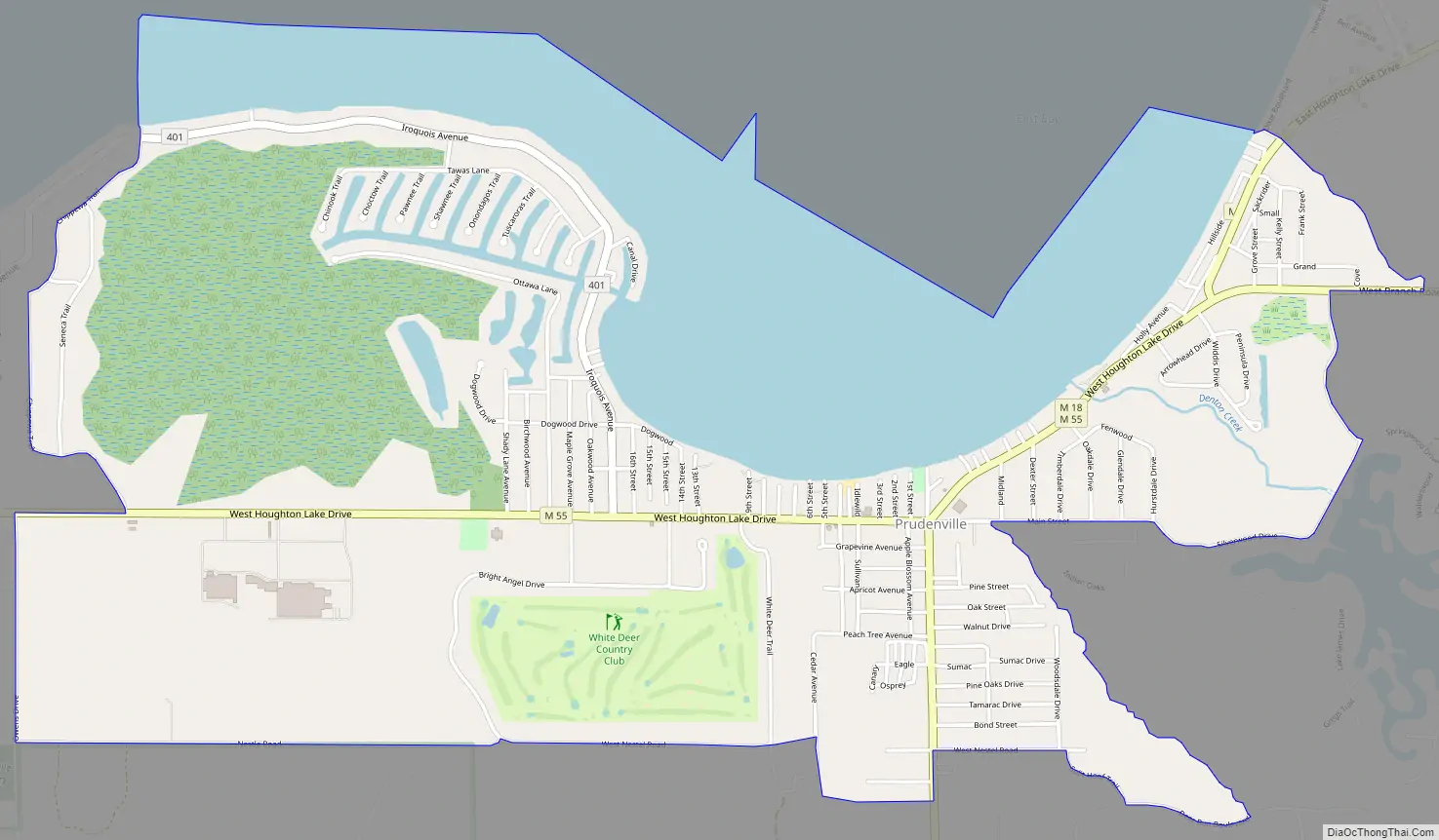
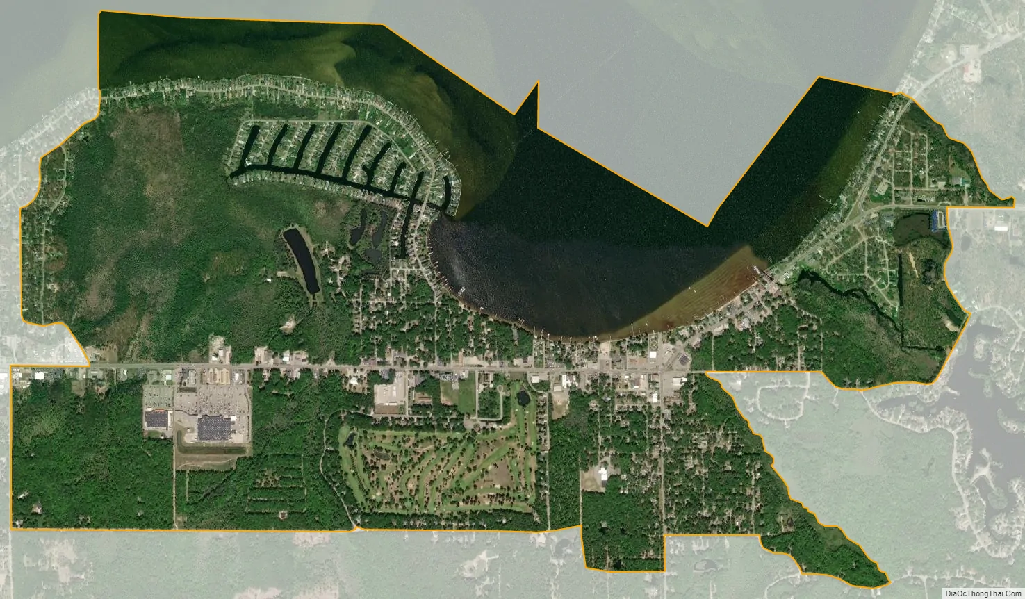
Prudenville city Satellite Map
Geography
According to the U.S. Census Bureau, the CDP has a total area of 3.72 square miles (9.63 km), of which 2.85 square miles (7.38 km) is land and 0.87 square miles (2.25 km) (23.38%) is water.
Prudenville has its own post office with the 48651 ZIP Code. The Prudenville post office serves most of Denton Township and smaller portions of Roscommon Township to the south, Nester Township to the southwest, and Backus Township and Higgins Township to the northeast. Prudenville is an unincorporated community listed by the U.S. Census Bureau as a census-designated place (CDP) for statistical purposes only, and the community itself has no legal autonomy as an incorporated municipality. The western portion of the Prudenville CDP also includes a small portion of the Houghton Lake 48629 ZIP Code.
Prudenville is considered part of the Northern Michigan region. It is located on the southeast shores of Houghton Lake, which is the state’s largest inland lake. Portions of the Au Sable State Forest (Roscommon State Forest Management Unit) and Backus Creek State Game Area are within close proximity.
Major highways
- M-18 is known locally as S. Gladwin Road; briefly runs concurrent with M-55 before continuing north as E. Houghton Lake Drive
- M-55 is known locally as W. Houghton Lake Drive and then exiting under the name W. West Branch Road
- M-157, located just east of the boundaries of the Prudenville CDP
See also
Map of Michigan State and its subdivision:- Alcona
- Alger
- Allegan
- Alpena
- Antrim
- Arenac
- Baraga
- Barry
- Bay
- Benzie
- Berrien
- Branch
- Calhoun
- Cass
- Charlevoix
- Cheboygan
- Chippewa
- Clare
- Clinton
- Crawford
- Delta
- Dickinson
- Eaton
- Emmet
- Genesee
- Gladwin
- Gogebic
- Grand Traverse
- Gratiot
- Hillsdale
- Houghton
- Huron
- Ingham
- Ionia
- Iosco
- Iron
- Isabella
- Jackson
- Kalamazoo
- Kalkaska
- Kent
- Keweenaw
- Lake
- Lake Hurron
- Lake Michigan
- Lake St. Clair
- Lake Superior
- Lapeer
- Leelanau
- Lenawee
- Livingston
- Luce
- Mackinac
- Macomb
- Manistee
- Marquette
- Mason
- Mecosta
- Menominee
- Midland
- Missaukee
- Monroe
- Montcalm
- Montmorency
- Muskegon
- Newaygo
- Oakland
- Oceana
- Ogemaw
- Ontonagon
- Osceola
- Oscoda
- Otsego
- Ottawa
- Presque Isle
- Roscommon
- Saginaw
- Saint Clair
- Saint Joseph
- Sanilac
- Schoolcraft
- Shiawassee
- Tuscola
- Van Buren
- Washtenaw
- Wayne
- Wexford
- Alabama
- Alaska
- Arizona
- Arkansas
- California
- Colorado
- Connecticut
- Delaware
- District of Columbia
- Florida
- Georgia
- Hawaii
- Idaho
- Illinois
- Indiana
- Iowa
- Kansas
- Kentucky
- Louisiana
- Maine
- Maryland
- Massachusetts
- Michigan
- Minnesota
- Mississippi
- Missouri
- Montana
- Nebraska
- Nevada
- New Hampshire
- New Jersey
- New Mexico
- New York
- North Carolina
- North Dakota
- Ohio
- Oklahoma
- Oregon
- Pennsylvania
- Rhode Island
- South Carolina
- South Dakota
- Tennessee
- Texas
- Utah
- Vermont
- Virginia
- Washington
- West Virginia
- Wisconsin
- Wyoming