St. Louis is a city in Gratiot County in the U.S. state of Michigan. As of the 2010 census the population was 7,482.
| Name: | St. Louis city |
|---|---|
| LSAD Code: | 25 |
| LSAD Description: | city (suffix) |
| State: | Michigan |
| County: | Gratiot County |
| Elevation: | 732 ft (223 m) |
| Total Area: | 3.50 sq mi (9.06 km²) |
| Land Area: | 3.31 sq mi (8.59 km²) |
| Water Area: | 0.18 sq mi (0.47 km²) |
| Total Population: | 7,010 |
| Population Density: | 2,114.63/sq mi (816.52/km²) |
| ZIP code: | 48880 |
| Area code: | 989 |
| FIPS code: | 2671000 |
| GNISfeature ID: | 0636831 |
| Website: | www.stlouismi.com |
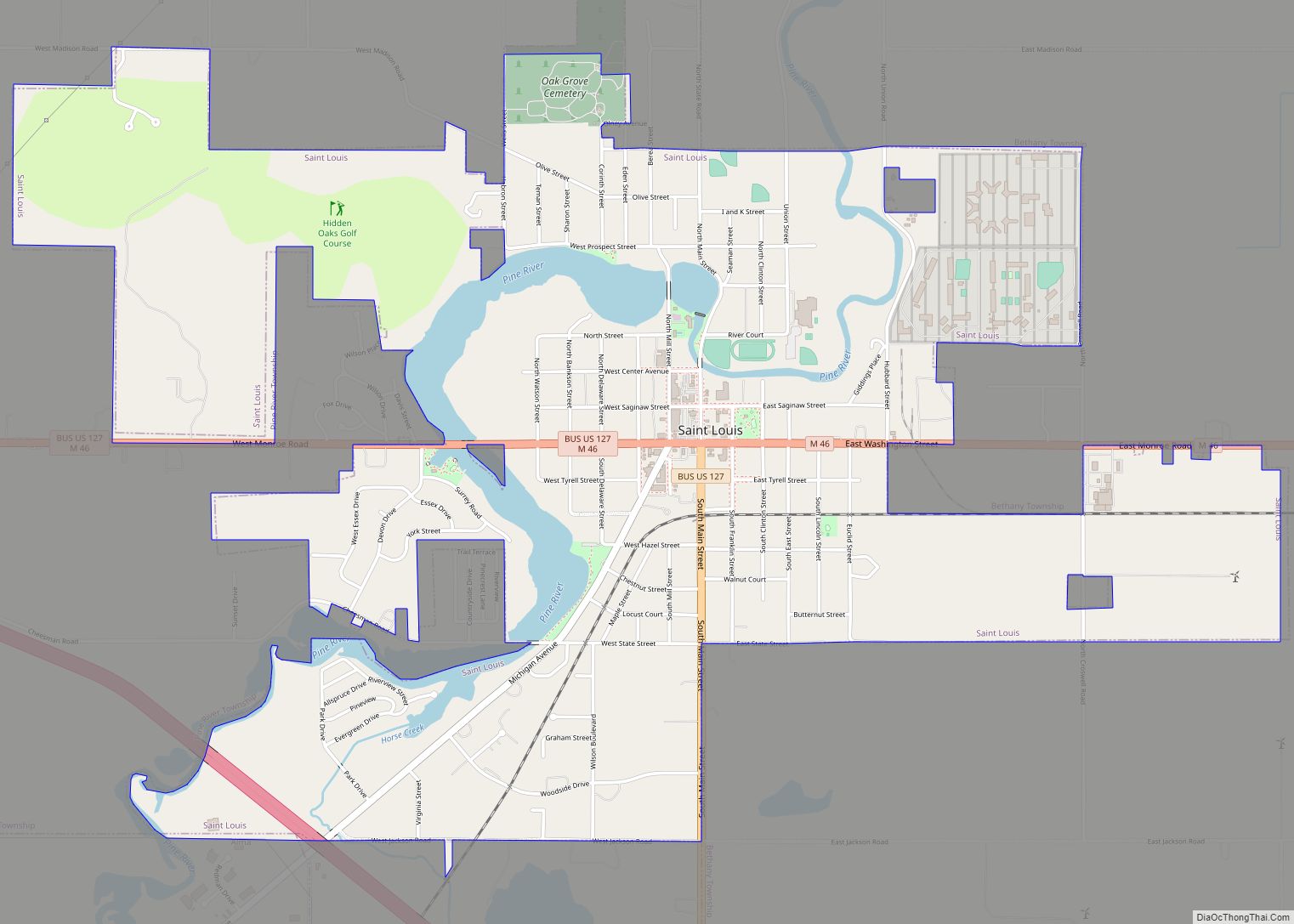
Online Interactive Map
Click on ![]() to view map in "full screen" mode.
to view map in "full screen" mode.
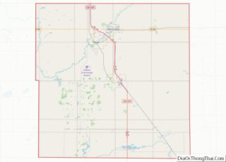
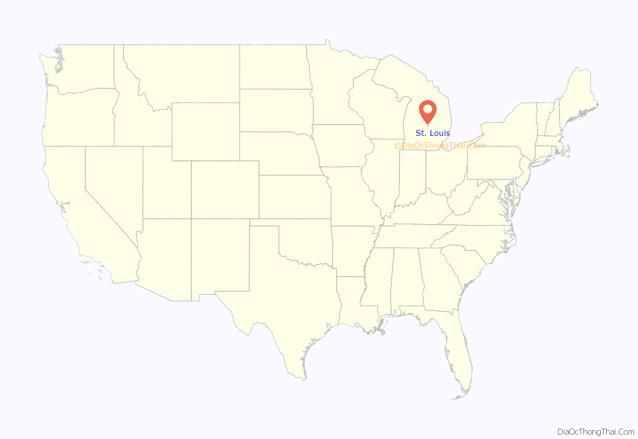
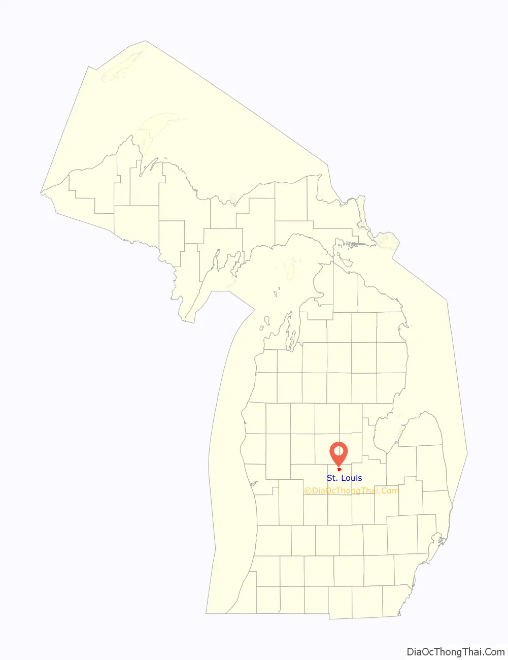
St. Louis location map. Where is St. Louis city?
History
Indigenous people lived in this area for thousands of years before European contact. The French were early explorers in present-day Michigan. They established fur trading with the historic First Nations and Native American nations. By the 18th century, the Ojibwe were the dominant tribe in present-day Michigan. After the Seven Years’ War, France was forced to cede its New France territory to the victorious English, who increased fur trade at Sault Ste. Marie. After the rebellious colonists’ victory in the American Revolutionary War, the territory changed hands again, being ceded to the new United States.
It was not until the mid-19th century that much European-American settlement reached this area. In 1848 missionaries established the Bethany Lutheran Mission to serve local American Indians, mostly Anishinaabe-speaking Ojibwe (also known in the US as Chippewa). Following a Native American path to the mission, the European-American Joseph W. Clapp came to the area in 1853, where he built the first house of present-day St. Louis. Over 150 years later, the Mission still stands near Main Street Bridge across the Pine River.
By the late nineteenth century, the discovery of mineral springs made St. Louis a destination for people seeking the health benefits of local mineral-rich water, which had the added feature of magnetizing steel. Famous guests who credited the water with cures included detective Allan Pinkerton and Civil War general “Fighting Joe” Hooker. The Park Hotel became noted as a health spa, and for its duck dinners as well.
St. Louis is the site of the former Michigan Chemical Corporation plant, which helped market and produce DDT as a widely commercial product. After its purchase by Velsicol Chemical Corporation, the plant was responsible for a product mixup in the 1970s. This resulted in contamination of cattle feed with PBB, a flame retardant. The feed was distributed throughout Michigan and the Midwest. The mixup occurred due what was described as a “triple witching hour” of events: a labor strike with management’s replacing regular workers; a shortage of bags that helped distinguish between cattle feed additive and the flame-retardant PBB; and storing both the cattle feed and the fire retardant in the same dimly lit warehouse.
Dredging has been underway for years to remove contaminants from the Pine River, which runs alongside the property where the plant was located. Although the plant was disassembled years ago, the land remains vacant to this day.
St. Louis has gained some jobs by inviting the State of Michigan to build a minimum-security prison between Union and Croswell Roads (Pine River Correctional Facility), on the former Reichard “Rainbow Trail” hatchery property.
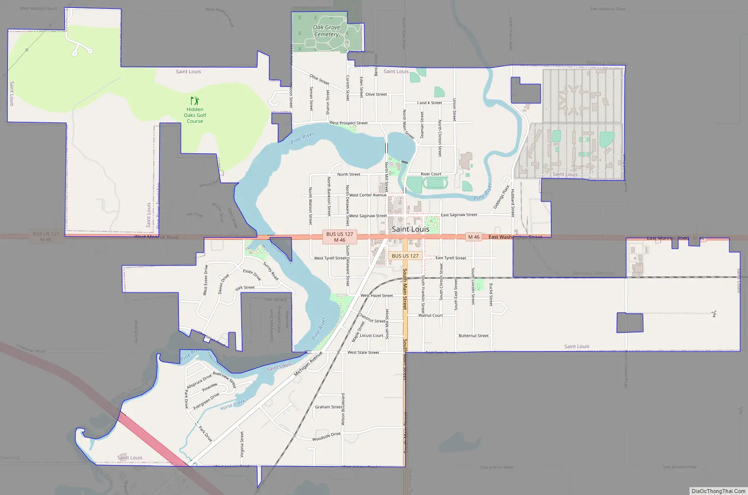
St. Louis Road Map
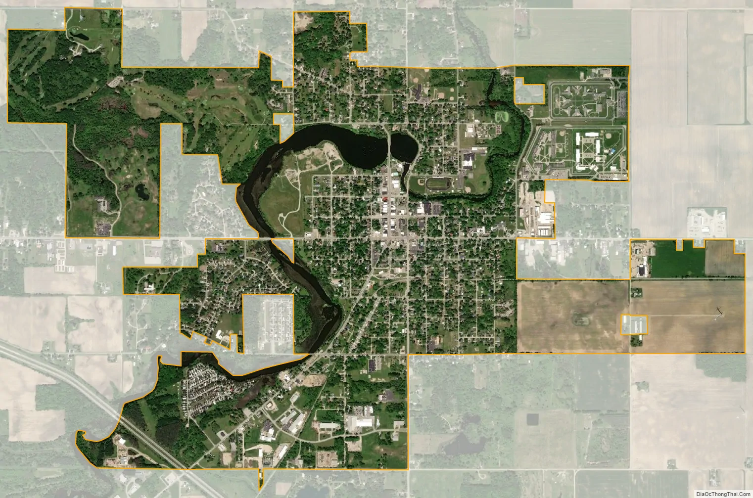
St. Louis city Satellite Map
Geography
According to the United States Census Bureau, the city has a total area of 3.53 square miles (9.14 km), of which 3.34 square miles (8.65 km) is land and 0.19 square miles (0.49 km) is water.
It was long recognized that St. Louis sits at the geographic center of Michigan’s lower peninsula “as closely as can be determined.” A campaign by Clarence and Odessa Smazel in the early 1950s, owners of the St. Louis Leader-Press, a now-defunct local newspaper, resulted in the State of Michigan designating it as such: a sign in Clapp Park on Highway M-46 denotes the city as the official “Middle of the Mitten.”
See also
Map of Michigan State and its subdivision:- Alcona
- Alger
- Allegan
- Alpena
- Antrim
- Arenac
- Baraga
- Barry
- Bay
- Benzie
- Berrien
- Branch
- Calhoun
- Cass
- Charlevoix
- Cheboygan
- Chippewa
- Clare
- Clinton
- Crawford
- Delta
- Dickinson
- Eaton
- Emmet
- Genesee
- Gladwin
- Gogebic
- Grand Traverse
- Gratiot
- Hillsdale
- Houghton
- Huron
- Ingham
- Ionia
- Iosco
- Iron
- Isabella
- Jackson
- Kalamazoo
- Kalkaska
- Kent
- Keweenaw
- Lake
- Lake Hurron
- Lake Michigan
- Lake St. Clair
- Lake Superior
- Lapeer
- Leelanau
- Lenawee
- Livingston
- Luce
- Mackinac
- Macomb
- Manistee
- Marquette
- Mason
- Mecosta
- Menominee
- Midland
- Missaukee
- Monroe
- Montcalm
- Montmorency
- Muskegon
- Newaygo
- Oakland
- Oceana
- Ogemaw
- Ontonagon
- Osceola
- Oscoda
- Otsego
- Ottawa
- Presque Isle
- Roscommon
- Saginaw
- Saint Clair
- Saint Joseph
- Sanilac
- Schoolcraft
- Shiawassee
- Tuscola
- Van Buren
- Washtenaw
- Wayne
- Wexford
- Alabama
- Alaska
- Arizona
- Arkansas
- California
- Colorado
- Connecticut
- Delaware
- District of Columbia
- Florida
- Georgia
- Hawaii
- Idaho
- Illinois
- Indiana
- Iowa
- Kansas
- Kentucky
- Louisiana
- Maine
- Maryland
- Massachusetts
- Michigan
- Minnesota
- Mississippi
- Missouri
- Montana
- Nebraska
- Nevada
- New Hampshire
- New Jersey
- New Mexico
- New York
- North Carolina
- North Dakota
- Ohio
- Oklahoma
- Oregon
- Pennsylvania
- Rhode Island
- South Carolina
- South Dakota
- Tennessee
- Texas
- Utah
- Vermont
- Virginia
- Washington
- West Virginia
- Wisconsin
- Wyoming