Wolverine is a village in Cheboygan County in the U.S. state of Michigan. The population was 244 at the 2010 census.
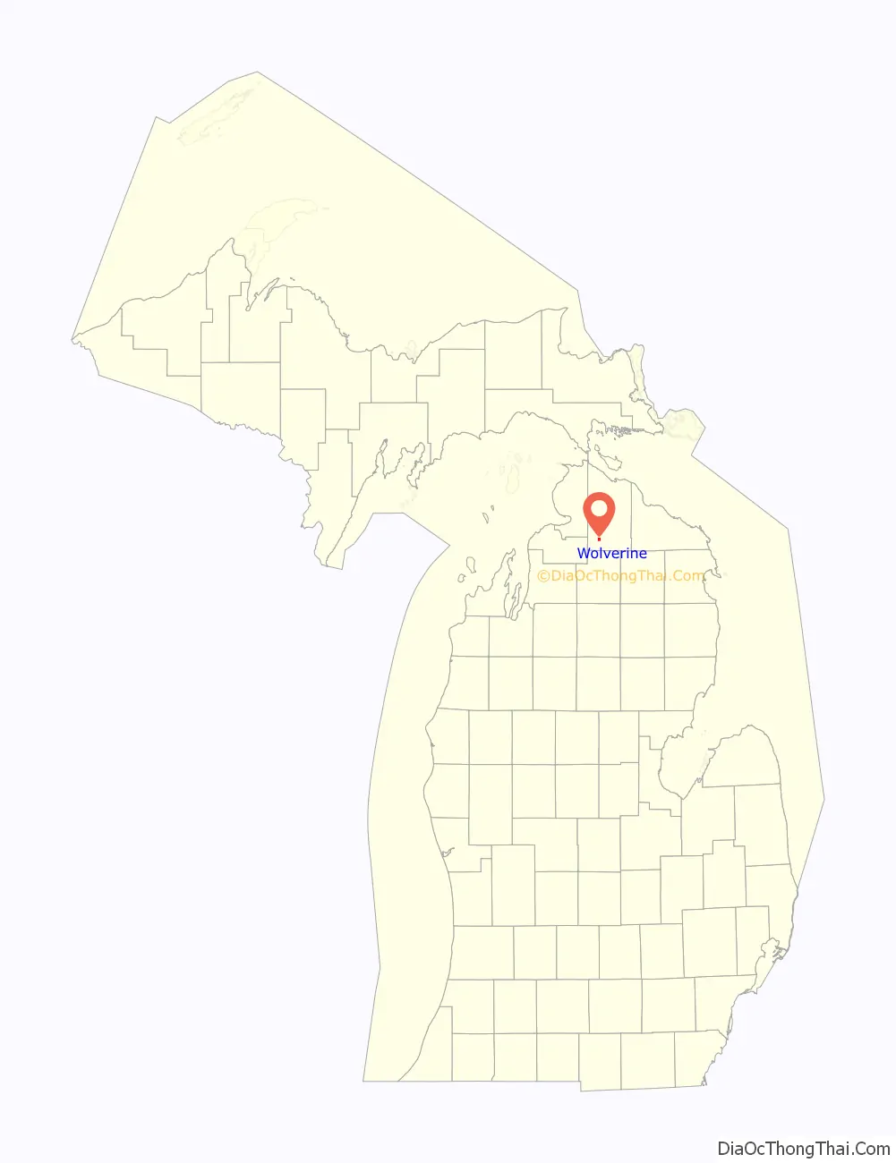
The village is mostly located within Nunda Township with a small portion extending west into Wilmot Township. It is located directly west of Interstate 75 about 40 miles (64.4 km) south of the Mackinac Bridge.
| Name: | Wolverine village |
|---|---|
| LSAD Code: | 47 |
| LSAD Description: | village (suffix) |
| State: | Michigan |
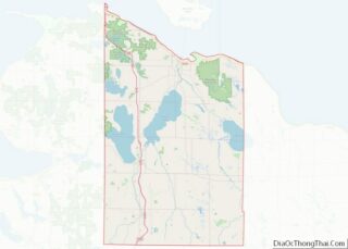
| County: | Cheboygan County |
| Incorporated: | 1903 |
| Elevation: | 817 ft (249 m) |
| Total Area: | 0.99 sq mi (2.56 km²) |
| Land Area: | 0.98 sq mi (2.54 km²) |
| Water Area: | 0.01 sq mi (0.02 km²) |
| Total Population: | 309 |
| Population Density: | 314.34/sq mi (121.42/km²) |
| Area code: | 231 |
| FIPS code: | 2688240 |
| GNISfeature ID: | 1616712 |
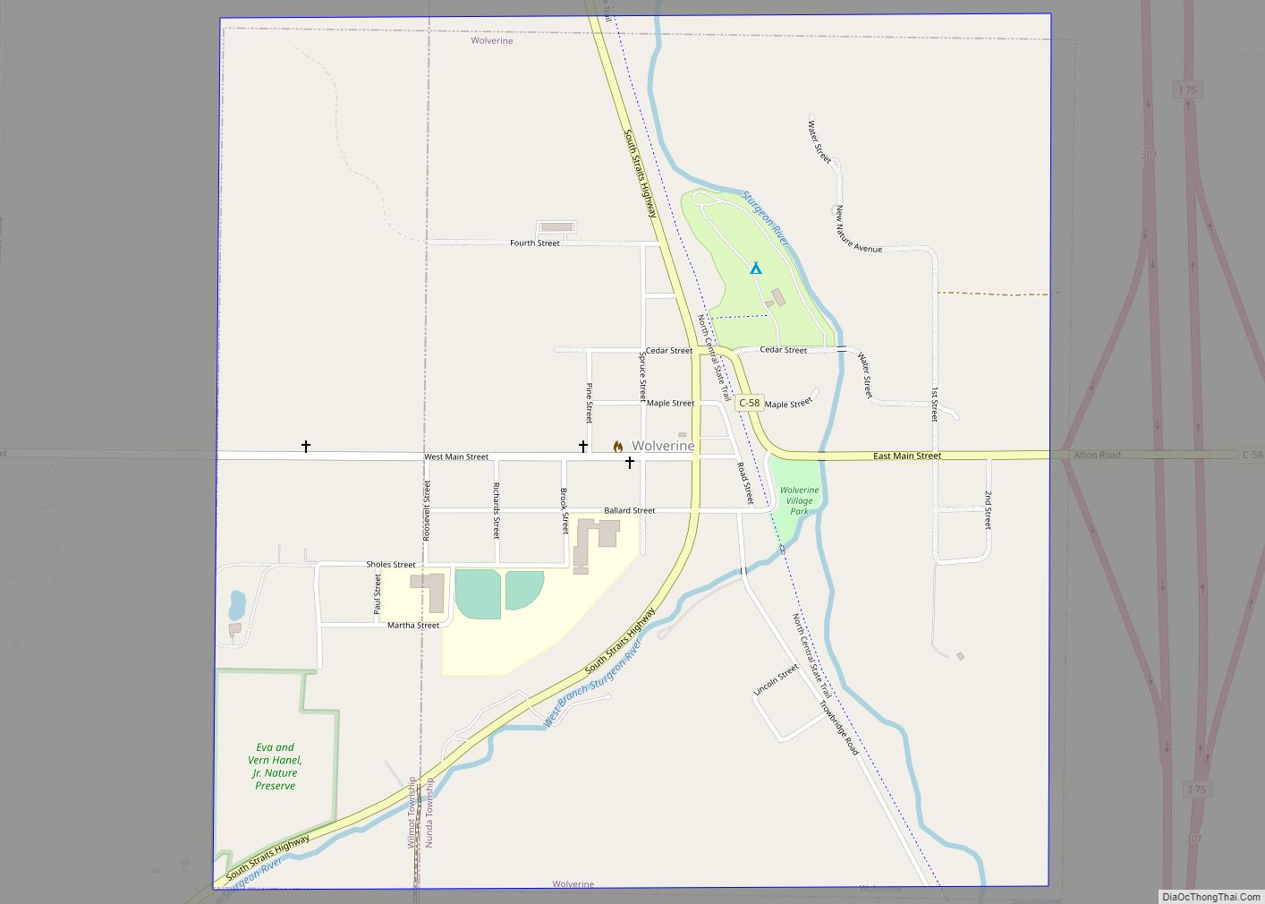
Online Interactive Map
Click on ![]() to view map in "full screen" mode.
to view map in "full screen" mode.
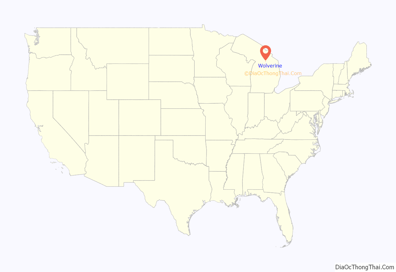
Wolverine location map. Where is Wolverine village?
History
The area was originally settled by Jacob Shook and his family as early as 1874. The community was named “Torrey” when George Richards settled in the area soon after. Venturing to the area was difficult, as the nearest railway line ended in Gaylord about 20 miles (32.2 km) to the south. Richards was a frequent traveler back and forth to Gaylord for mail and supplies, often staying mid-route at Vanderbilt. He requested a closer post office, which was granted under the name Wolverine in late 1880.
The post office was first established on January 3, 1881 and continues to remain in operation. Richards served as the first postmaster. As an early settler of the community, he helped organize and operate the local school district and was also a real estate dealer and lumberman. He was elected to the Michigan House of Representatives in 1903.
In 1881, Wolverine recorded 18 residents. Soon after, the Jackson, Lansing, and Saginaw Railroad Company received a deed and began railway construction at the community of Trowbridge about 5 miles (8.0 km) to the southeast. By 1891, the population of Wolverine increased to about 1,000 residents, who mainly worked for the railway and lumbering industry. The community incorporated as a village in 1903. By 1905, the area population was around 1,800. When the lumber industry declined by the 1930s, the population drastically decreased as many people left Wolverine.
Wolverine Road Map
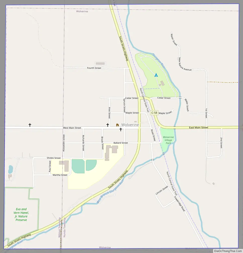
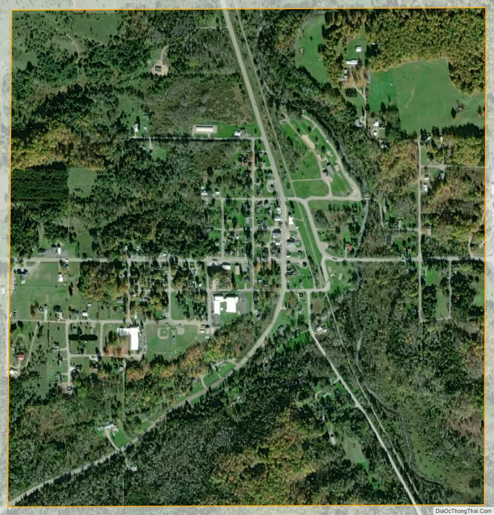
Wolverine city Satellite Map
Geography
According to the U.S. Census Bureau, the village has a total area of 0.99 square miles (2.56 km), of which 0.98 square miles (2.54 km) is land and 0.01 square miles (0.03 km) (1.01%) is water.
Wolverine is situated on the Sturgeon River where the west branch joins the main branch at 45°16′24″N 84°36′16″W / 45.27333°N 84.60444°W / 45.27333; -84.60444.
Wolverine contains its own post office using the 49799 ZIP Code, which is the highest numeric ZIP Code in the state’s Lower Peninsula. The Wolverine post office serves a much larger area that includes most of Nunda Township and Wilmot Township, as well as smaller portions of Ellis Township and Mentor Township. The post office also serves a very small portion of Corwith Township in Otsego County to the south, as well as very small portions of Chandler Township in Charlevoix County and Springvale Township in Emmet County to the west.
See also
Map of Michigan State and its subdivision:- Alcona
- Alger
- Allegan
- Alpena
- Antrim
- Arenac
- Baraga
- Barry
- Bay
- Benzie
- Berrien
- Branch
- Calhoun
- Cass
- Charlevoix
- Cheboygan
- Chippewa
- Clare
- Clinton
- Crawford
- Delta
- Dickinson
- Eaton
- Emmet
- Genesee
- Gladwin
- Gogebic
- Grand Traverse
- Gratiot
- Hillsdale
- Houghton
- Huron
- Ingham
- Ionia
- Iosco
- Iron
- Isabella
- Jackson
- Kalamazoo
- Kalkaska
- Kent
- Keweenaw
- Lake
- Lake Hurron
- Lake Michigan
- Lake St. Clair
- Lake Superior
- Lapeer
- Leelanau
- Lenawee
- Livingston
- Luce
- Mackinac
- Macomb
- Manistee
- Marquette
- Mason
- Mecosta
- Menominee
- Midland
- Missaukee
- Monroe
- Montcalm
- Montmorency
- Muskegon
- Newaygo
- Oakland
- Oceana
- Ogemaw
- Ontonagon
- Osceola
- Oscoda
- Otsego
- Ottawa
- Presque Isle
- Roscommon
- Saginaw
- Saint Clair
- Saint Joseph
- Sanilac
- Schoolcraft
- Shiawassee
- Tuscola
- Van Buren
- Washtenaw
- Wayne
- Wexford
- Alabama
- Alaska
- Arizona
- Arkansas
- California
- Colorado
- Connecticut
- Delaware
- District of Columbia
- Florida
- Georgia
- Hawaii
- Idaho
- Illinois
- Indiana
- Iowa
- Kansas
- Kentucky
- Louisiana
- Maine
- Maryland
- Massachusetts
- Michigan
- Minnesota
- Mississippi
- Missouri
- Montana
- Nebraska
- Nevada
- New Hampshire
- New Jersey
- New Mexico
- New York
- North Carolina
- North Dakota
- Ohio
- Oklahoma
- Oregon
- Pennsylvania
- Rhode Island
- South Carolina
- South Dakota
- Tennessee
- Texas
- Utah
- Vermont
- Virginia
- Washington
- West Virginia
- Wisconsin
- Wyoming