Bell City is a city in northeastern Stoddard County, Missouri, United States. It was founded as a sawmill town circa 1900, and lies at the foothills of Crowley’s Ridge on Missouri Route 91. The population was 448 at the 2010 census. Dorothy Burton is the current mayor.
| Name: | Bell City city |
|---|---|
| LSAD Code: | 25 |
| LSAD Description: | city (suffix) |
| State: | Missouri |
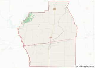
| County: | Stoddard County |
| Elevation: | 331 ft (101 m) |
| Total Area: | 0.55 sq mi (1.44 km²) |
| Land Area: | 0.55 sq mi (1.43 km²) |
| Water Area: | 0.00 sq mi (0.01 km²) |
| Total Population: | 464 |
| Population Density: | 843.64/sq mi (325.53/km²) |
| ZIP code: | 63735 |
| Area code: | 573 |
| FIPS code: | 2904132 |
| GNISfeature ID: | 2394109 |
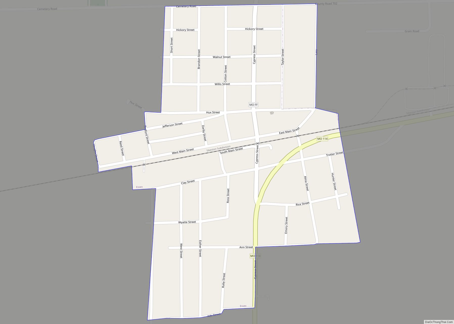
Online Interactive Map
Click on ![]() to view map in "full screen" mode.
to view map in "full screen" mode.
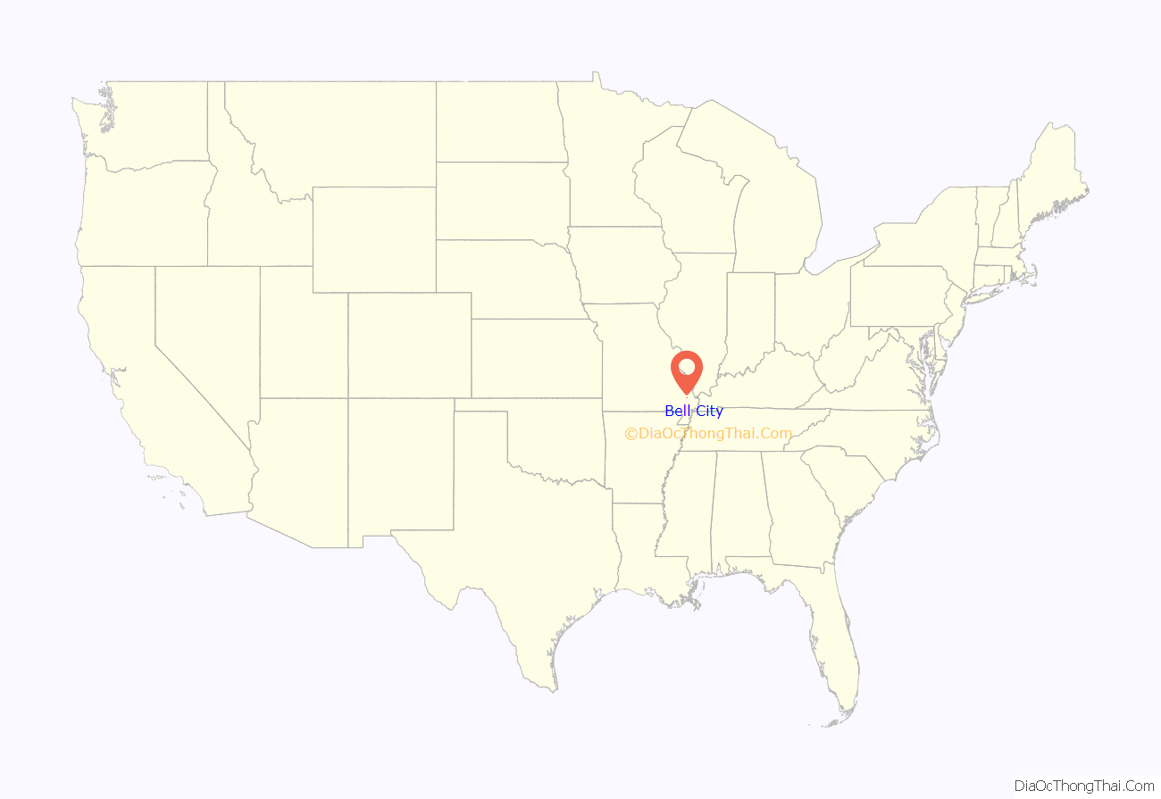
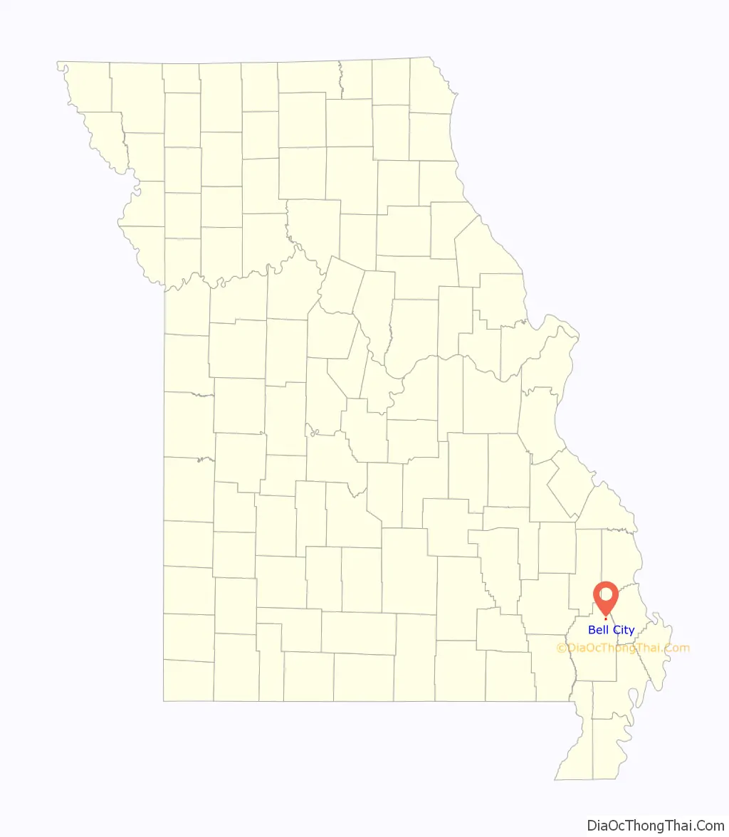
Bell City location map. Where is Bell City city?
History
A post office called Bell City has been in operation since 1890. The community was named after brothers Gesper Albert and Ralford Stephen Bell, proprietors of a local sawmill. Bell City was situated along the St. Louis Southwestern Railway.
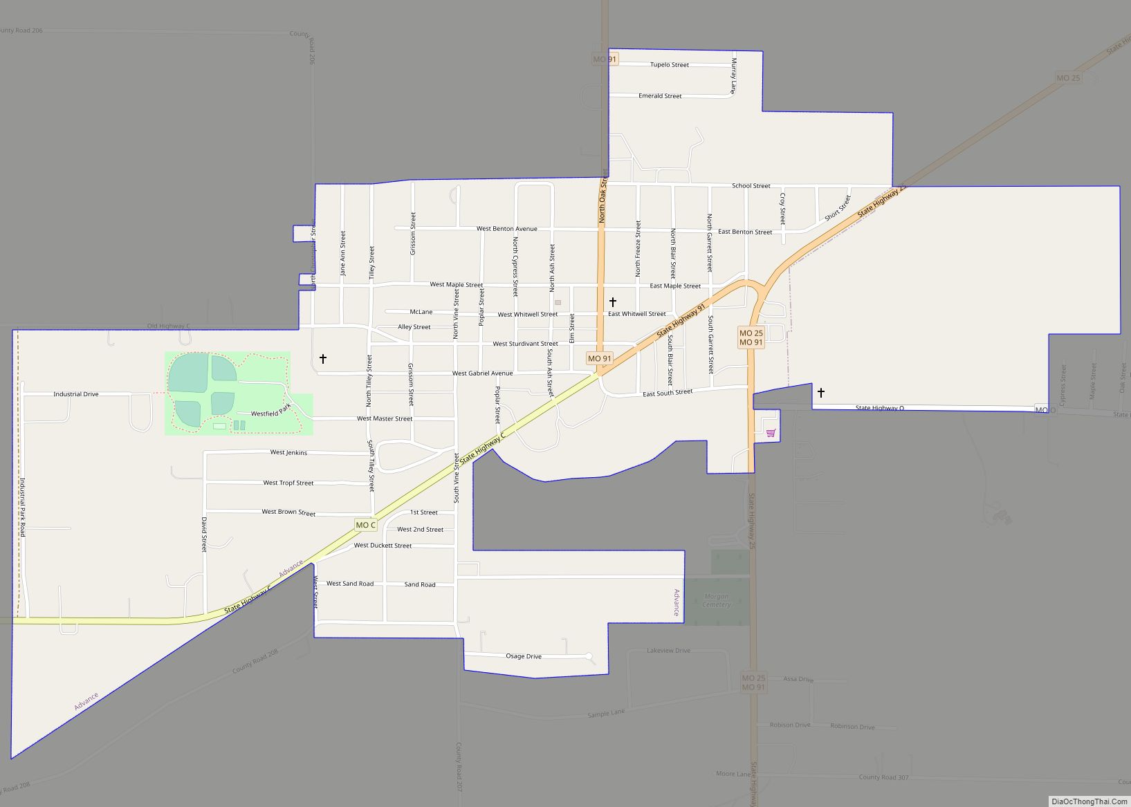
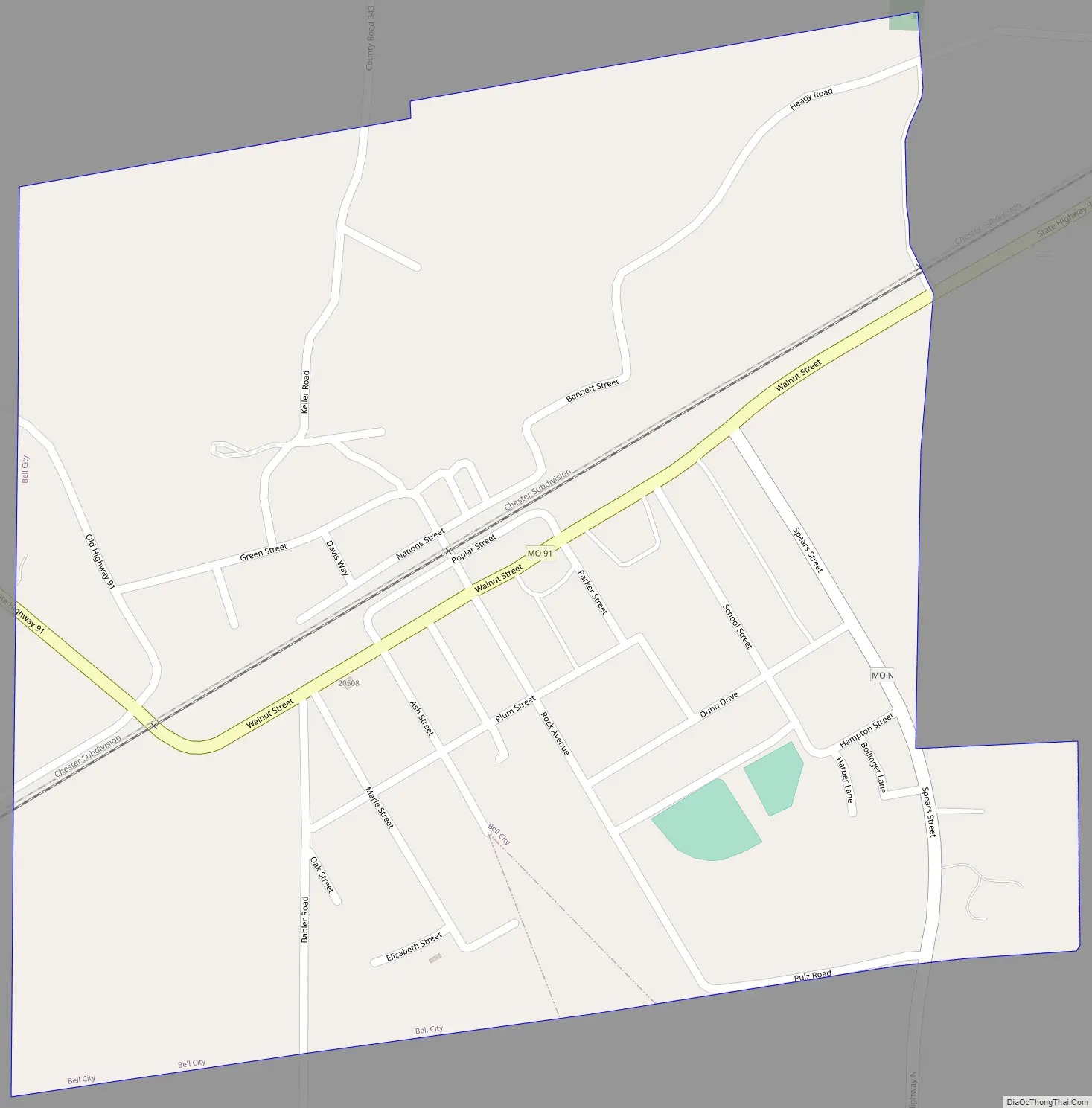
Bell City Road Map
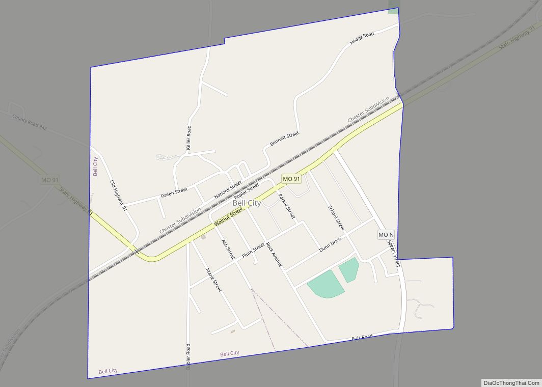
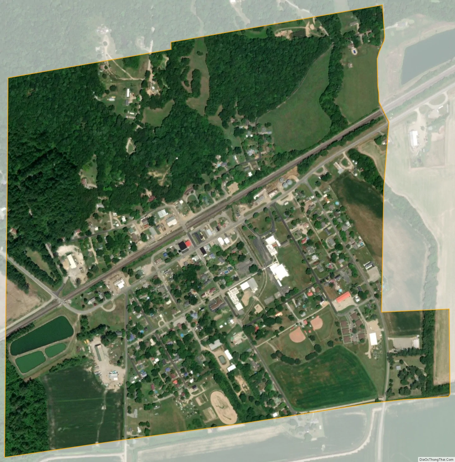
Bell City city Satellite Map
Geography
Bell City is located on the western edge of the lowland region of southeast Missouri. Sikeston lies 15 miles to the southeast. The head of Little River is three miles to the east. Missouri Route 91 passes through the community, connecting with U.S. Route 61 at Morley, ten miles to the east.
According to the United States Census Bureau, the city has a total area of 0.55 square miles (1.42 km), all land.
See also
Map of Missouri State and its subdivision:- Adair
- Andrew
- Atchison
- Audrain
- Barry
- Barton
- Bates
- Benton
- Bollinger
- Boone
- Buchanan
- Butler
- Caldwell
- Callaway
- Camden
- Cape Girardeau
- Carroll
- Carter
- Cass
- Cedar
- Chariton
- Christian
- Clark
- Clay
- Clinton
- Cole
- Cooper
- Crawford
- Dade
- Dallas
- Daviess
- De Kalb
- Dent
- Douglas
- Dunklin
- Franklin
- Gasconade
- Gentry
- Greene
- Grundy
- Harrison
- Henry
- Hickory
- Holt
- Howard
- Howell
- Iron
- Jackson
- Jasper
- Jefferson
- Johnson
- Knox
- Laclede
- Lafayette
- Lawrence
- Lewis
- Lincoln
- Linn
- Livingston
- Macon
- Madison
- Maries
- Marion
- McDonald
- Mercer
- Miller
- Mississippi
- Moniteau
- Monroe
- Montgomery
- Morgan
- New Madrid
- Newton
- Nodaway
- Oregon
- Osage
- Ozark
- Pemiscot
- Perry
- Pettis
- Phelps
- Pike
- Platte
- Polk
- Pulaski
- Putnam
- Ralls
- Randolph
- Ray
- Reynolds
- Ripley
- Saint Charles
- Saint Clair
- Saint Francois
- Saint Louis
- Sainte Genevieve
- Saline
- Schuyler
- Scotland
- Scott
- Shannon
- Shelby
- Stoddard
- Stone
- Sullivan
- Taney
- Texas
- Vernon
- Warren
- Washington
- Wayne
- Webster
- Worth
- Wright
- Alabama
- Alaska
- Arizona
- Arkansas
- California
- Colorado
- Connecticut
- Delaware
- District of Columbia
- Florida
- Georgia
- Hawaii
- Idaho
- Illinois
- Indiana
- Iowa
- Kansas
- Kentucky
- Louisiana
- Maine
- Maryland
- Massachusetts
- Michigan
- Minnesota
- Mississippi
- Missouri
- Montana
- Nebraska
- Nevada
- New Hampshire
- New Jersey
- New Mexico
- New York
- North Carolina
- North Dakota
- Ohio
- Oklahoma
- Oregon
- Pennsylvania
- Rhode Island
- South Carolina
- South Dakota
- Tennessee
- Texas
- Utah
- Vermont
- Virginia
- Washington
- West Virginia
- Wisconsin
- Wyoming