Bellefontaine Neighbors (/bɛlˈfaʊntən/ bel-FOWN-tən) is an inner-ring suburb city in St. Louis County, Missouri, United States. The population was 10,860 at the 2010 census.
| Name: | Bellefontaine Neighbors city |
|---|---|
| LSAD Code: | 25 |
| LSAD Description: | city (suffix) |
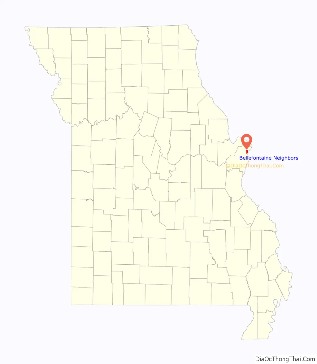
| State: | Missouri |
| County: | St. Louis County |
| Incorporated: | June 19, 1950 |
| Elevation: | 492 ft (150 m) |
| Total Area: | 4.40 sq mi (11.40 km²) |
| Land Area: | 4.40 sq mi (11.40 km²) |
| Water Area: | 0.00 sq mi (0.00 km²) |
| Total Population: | 10,740 |
| Population Density: | 2,440.91/sq mi (942.37/km²) |
| FIPS code: | 2904222 |
| GNISfeature ID: | 2394117 |
| Website: | http://www.cityofbn.com |
Online Interactive Map
Click on ![]() to view map in "full screen" mode.
to view map in "full screen" mode.
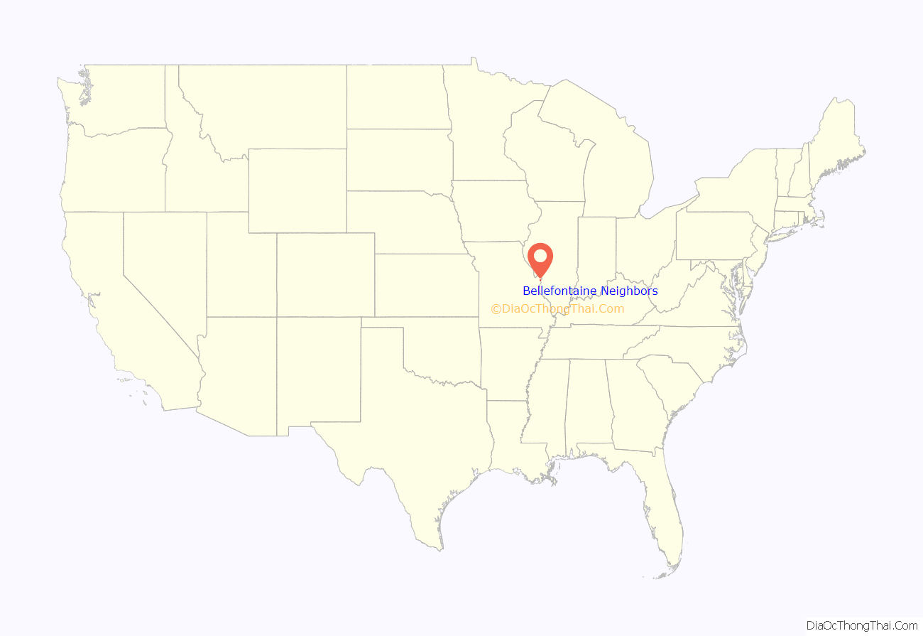
Bellefontaine Neighbors location map. Where is Bellefontaine Neighbors city?
History
The history of Bellefontaine Neighbors, Missouri, can be traced back to the mid-1800s when the area was part of the Louisiana Territory, which was ceded by France to Spain in 1762 in the Treaty of Fontainebleau. Spanish military authorities constructed forts near the mouth of the Missouri River to strengthen their hold on the territory and discourage intruders from the east. A Captain Rios, who was dispatched to the area, established forts near the present-day locations of Spanish Pond (or Spanish Lake) and Fort San Carlos in St. Louis.
In 1800, Spain ceded the territory west of the Mississippi River back to France, which then sold it to the United States in 1803 as part of the Louisiana Purchase. In 1804, a treaty was made with the Sac and Fox Indians that led to the establishment of a trading post on the south bank of the Missouri River. The area was chosen for its natural advantages, including a large clear water spring called “la belle fontaine” by the early French settlers.
By the winter of 1805, Fort Bellefontaine was constructed under the command of Colonel Jacob Kingsbury, with log cabins, a trading house, a bakery, a blacksmith shop, and huts for enlisted soldiers. General Daniel Bissell served as the military commander of the territory and resided at Fort Bellefontaine for several years. The fort was connected to St. Louis by a trail that eventually evolved into present-day Bellefontaine Road.
Fort Bellefontaine was abandoned in 1834, and the surrounding land was divided into land grants. The area that is now Bellefontaine Neighbors was made up of land grants issued by Spanish, French, and American officials. Notable landowners in the area included General Daniel Bissell, who purchased land through public land sales, and Dr. James W. Gibson, who built his home “Forest Home” in the area in 1832.
The area remained primarily agricultural until the 1950s, when a building boom following World War II led to the construction of subdivisions and a population increase. Bellefontaine Neighbors was incorporated as a fourth-class city in 1950, with a population of 766 people. At the time, the city had 18 streets, one public school, and one church, the Bellefontaine Methodist Church.
Between 1950 and 1960, the population of Bellefontaine Neighbors grew rapidly, reaching 13,650 people by 1960. The growth resulted in the construction of new churches, such as St. Jerome’s Catholic Church, Our Lady of Good Counsel Catholic Church, Bellefontaine Neighbors Baptist Church, Grace Lutheran Chapel, and Frieden’s Evangelical and Reformed Church. Additionally, the number of schools in the city increased, with Gibson Elementary, Danforth Elementary, Grace Lutheran, Stormin Academy, and Riverview Gardens Senior High School now serving the community.
The city administration of Bellefontaine Neighbors has evolved since its incorporation, with A. W. Schnur appointed as the first mayor in 1950. The city is divided into four wards and operates under a Mayor-Aldermen form of government, with the mayor and aldermen elected to four-year terms. Elections are held on the first Tuesday in April.
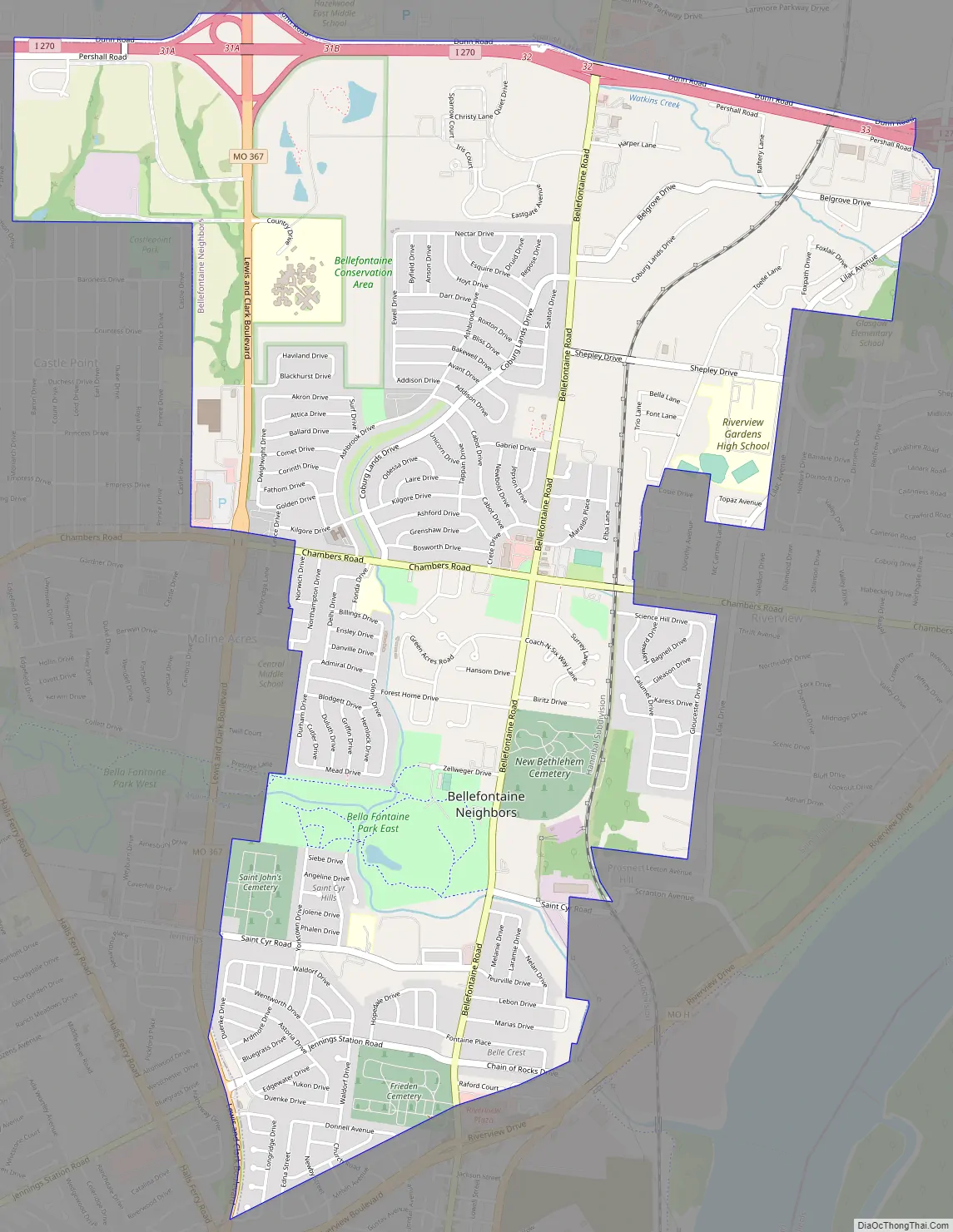
Bellefontaine Neighbors Road Map
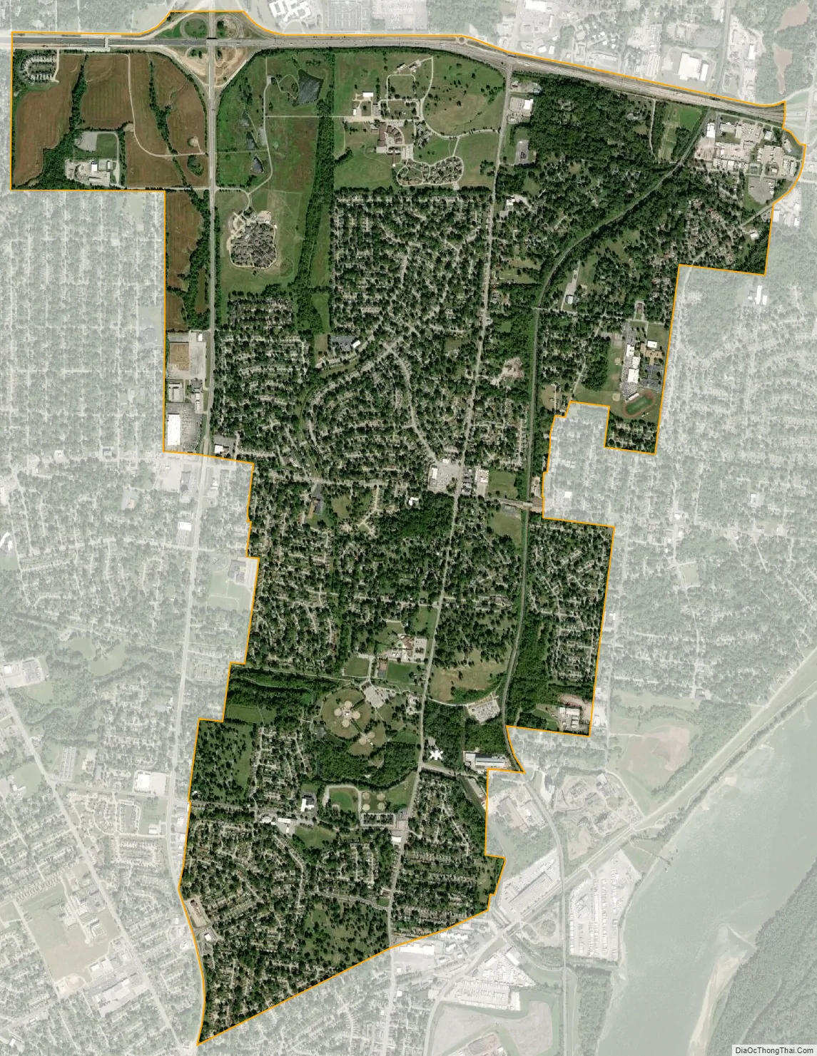
Bellefontaine Neighbors city Satellite Map
Geography
Bellefontaine Neighbors is a second-ring northern suburb of St. Louis.
According to the United States Census Bureau, the city has a total area of 4.32 square miles (11.19 km), all land.
See also
Map of Missouri State and its subdivision:- Adair
- Andrew
- Atchison
- Audrain
- Barry
- Barton
- Bates
- Benton
- Bollinger
- Boone
- Buchanan
- Butler
- Caldwell
- Callaway
- Camden
- Cape Girardeau
- Carroll
- Carter
- Cass
- Cedar
- Chariton
- Christian
- Clark
- Clay
- Clinton
- Cole
- Cooper
- Crawford
- Dade
- Dallas
- Daviess
- De Kalb
- Dent
- Douglas
- Dunklin
- Franklin
- Gasconade
- Gentry
- Greene
- Grundy
- Harrison
- Henry
- Hickory
- Holt
- Howard
- Howell
- Iron
- Jackson
- Jasper
- Jefferson
- Johnson
- Knox
- Laclede
- Lafayette
- Lawrence
- Lewis
- Lincoln
- Linn
- Livingston
- Macon
- Madison
- Maries
- Marion
- McDonald
- Mercer
- Miller
- Mississippi
- Moniteau
- Monroe
- Montgomery
- Morgan
- New Madrid
- Newton
- Nodaway
- Oregon
- Osage
- Ozark
- Pemiscot
- Perry
- Pettis
- Phelps
- Pike
- Platte
- Polk
- Pulaski
- Putnam
- Ralls
- Randolph
- Ray
- Reynolds
- Ripley
- Saint Charles
- Saint Clair
- Saint Francois
- Saint Louis
- Sainte Genevieve
- Saline
- Schuyler
- Scotland
- Scott
- Shannon
- Shelby
- Stoddard
- Stone
- Sullivan
- Taney
- Texas
- Vernon
- Warren
- Washington
- Wayne
- Webster
- Worth
- Wright
- Alabama
- Alaska
- Arizona
- Arkansas
- California
- Colorado
- Connecticut
- Delaware
- District of Columbia
- Florida
- Georgia
- Hawaii
- Idaho
- Illinois
- Indiana
- Iowa
- Kansas
- Kentucky
- Louisiana
- Maine
- Maryland
- Massachusetts
- Michigan
- Minnesota
- Mississippi
- Missouri
- Montana
- Nebraska
- Nevada
- New Hampshire
- New Jersey
- New Mexico
- New York
- North Carolina
- North Dakota
- Ohio
- Oklahoma
- Oregon
- Pennsylvania
- Rhode Island
- South Carolina
- South Dakota
- Tennessee
- Texas
- Utah
- Vermont
- Virginia
- Washington
- West Virginia
- Wisconsin
- Wyoming


