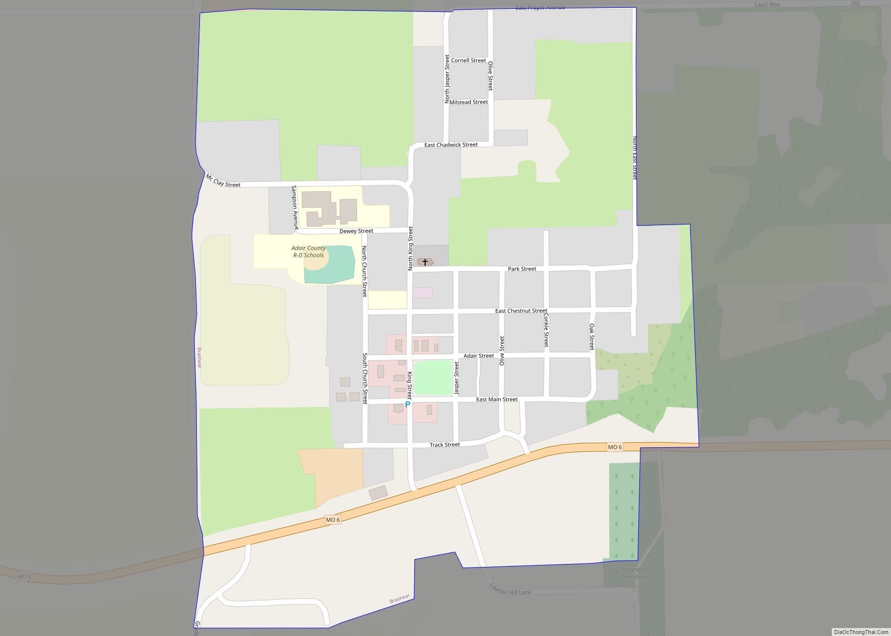
Brashear is a city in Salt River Township, Adair County, Missouri, United States. The population was 273 at the 2010 census.
| Name: | Brashear city |
|---|---|
| LSAD Code: | 25 |
| LSAD Description: | city (suffix) |
| State: | Missouri |
| County: | Adair County |
| Elevation: | 873 ft (266 m) |
| Total Area: | 0.35 sq mi (0.91 km²) |
| Land Area: | 0.35 sq mi (0.91 km²) |
| Water Area: | 0.00 sq mi (0.00 km²) |
| Total Population: | 235 |
| Population Density: | 671.43/sq mi (259.03/km²) |
| ZIP code: | 63533 |
| Area code: | 660 |
| FIPS code: | 2908002 |
| GNISfeature ID: | 2393401 |
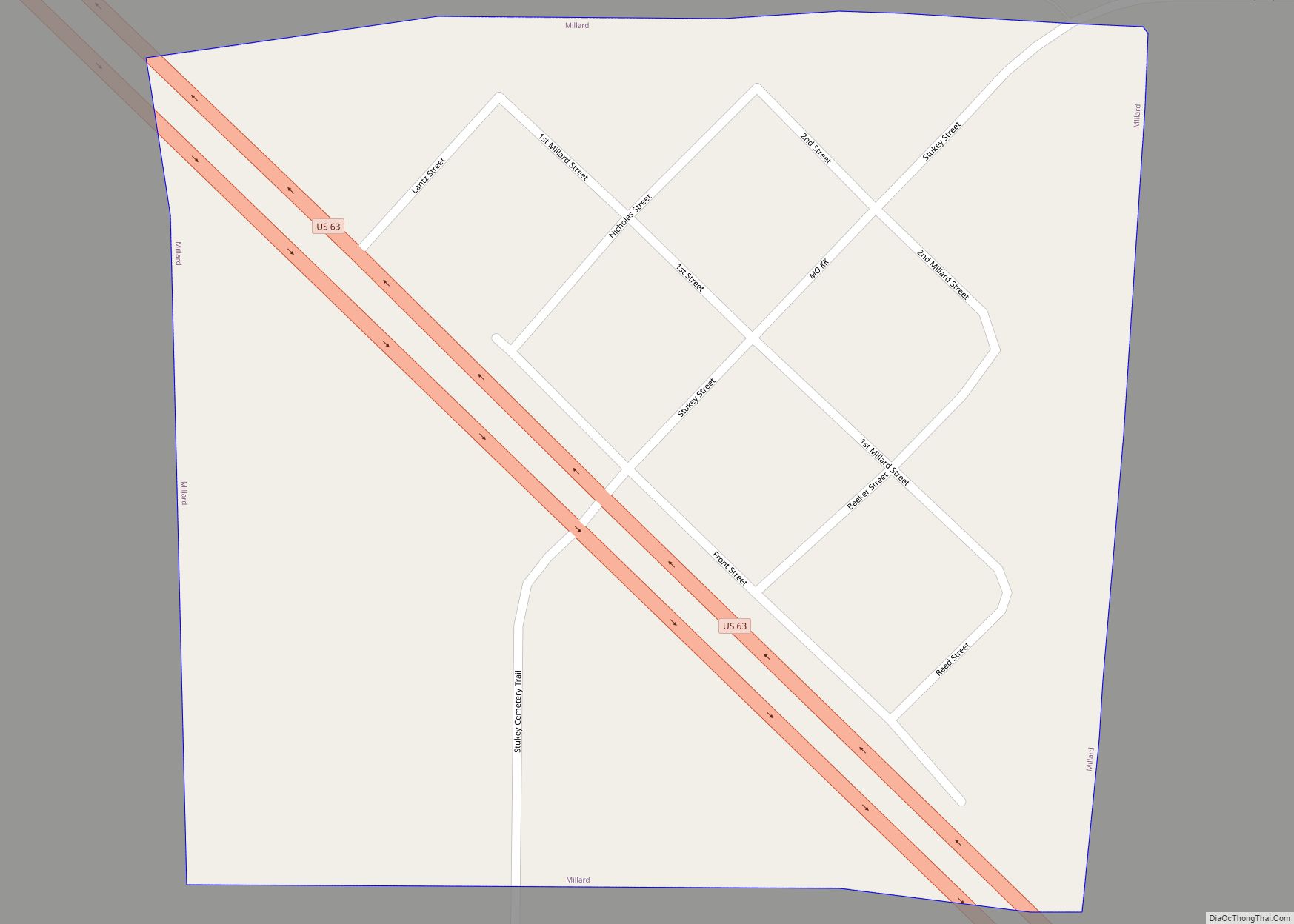
Online Interactive Map
Click on ![]() to view map in "full screen" mode.
to view map in "full screen" mode.
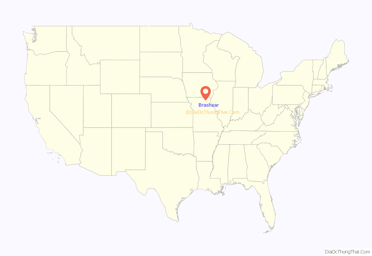
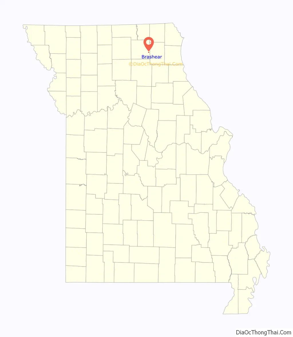
Brashear location map. Where is Brashear city?
History
The town of Brashear was laid out in 1872. It was named after Richard Matson Brashear (1846-1933), who was a prominent farmer and businessman in the area. Richard Matson Brashear was the son of William Gowan Brashear (1807-1862), who is said to have been one of the first white settlers in the area in 1842. However, the Brashear community dates back prior to 1872 by several years. Approximately one mile north of the current location, there once stood a prosperous small village named Paulville, also known as Paultown, which was established around 1855 by a man named Walker Paul (1816-1888). Paulville served as a trading hub for the farms of eastern Adair County, along with several other businesses, one of which was a grist mill. Sometime during the Civil War, the grist mill was put to the torch to prevent Confederate recruits from being resupplied. The coming of the Quincy, Missouri & Pacific Railroad in 1872 saw a wholesale population shift. The building of a rail depot at the newly platted town of Brashear caused a very large portion of Paulville’s population and business to migrate the short distance south. Through the latter half of the 19th century and first few decades of the 20th, Brashear’s business district ebbed and flowed. Similarly, the Great Depression and post-World War Two mobility of the American public led to many changes. In 1950 Brashear had a population of only 152, however that number has been on a slight rise ever since. A few business concerns remain today, but most residents travel west to Kirksville or east to Edina for their shopping and employment.
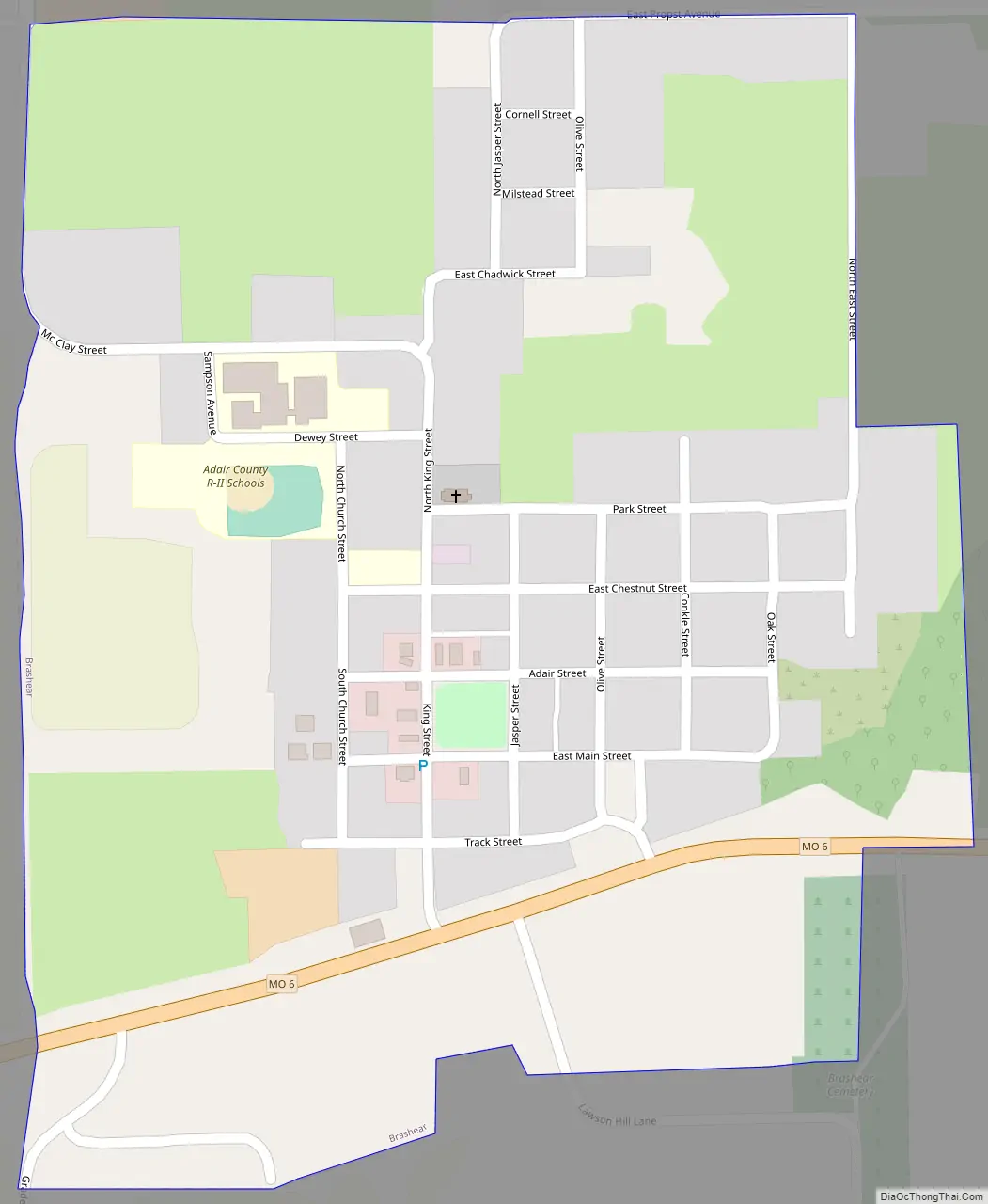
Brashear Road Map
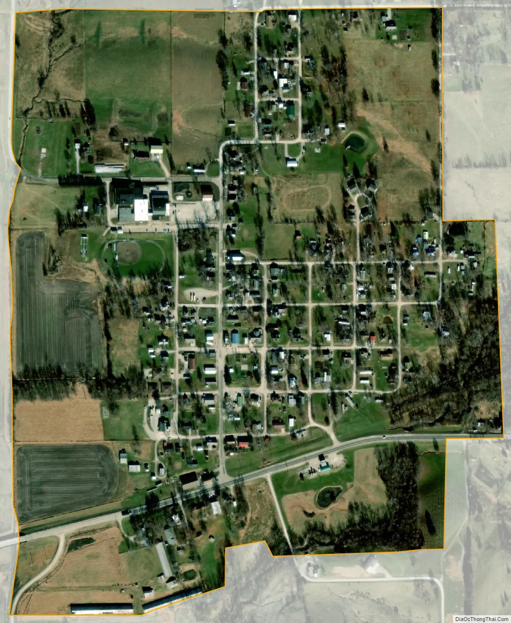
Brashear city Satellite Map
Geography
Brashear is located on Missouri Route 6 3.5 miles west of Hurdland and 13 miles east-southeast of Kirksville. The community lies on Hog Branch one mile east of the North Fork of the Salt River.
According to the United States Census Bureau, the city has a total area of 0.35 square miles (0.91 km), all land.
See also
Map of Missouri State and its subdivision:- Adair
- Andrew
- Atchison
- Audrain
- Barry
- Barton
- Bates
- Benton
- Bollinger
- Boone
- Buchanan
- Butler
- Caldwell
- Callaway
- Camden
- Cape Girardeau
- Carroll
- Carter
- Cass
- Cedar
- Chariton
- Christian
- Clark
- Clay
- Clinton
- Cole
- Cooper
- Crawford
- Dade
- Dallas
- Daviess
- De Kalb
- Dent
- Douglas
- Dunklin
- Franklin
- Gasconade
- Gentry
- Greene
- Grundy
- Harrison
- Henry
- Hickory
- Holt
- Howard
- Howell
- Iron
- Jackson
- Jasper
- Jefferson
- Johnson
- Knox
- Laclede
- Lafayette
- Lawrence
- Lewis
- Lincoln
- Linn
- Livingston
- Macon
- Madison
- Maries
- Marion
- McDonald
- Mercer
- Miller
- Mississippi
- Moniteau
- Monroe
- Montgomery
- Morgan
- New Madrid
- Newton
- Nodaway
- Oregon
- Osage
- Ozark
- Pemiscot
- Perry
- Pettis
- Phelps
- Pike
- Platte
- Polk
- Pulaski
- Putnam
- Ralls
- Randolph
- Ray
- Reynolds
- Ripley
- Saint Charles
- Saint Clair
- Saint Francois
- Saint Louis
- Sainte Genevieve
- Saline
- Schuyler
- Scotland
- Scott
- Shannon
- Shelby
- Stoddard
- Stone
- Sullivan
- Taney
- Texas
- Vernon
- Warren
- Washington
- Wayne
- Webster
- Worth
- Wright
- Alabama
- Alaska
- Arizona
- Arkansas
- California
- Colorado
- Connecticut
- Delaware
- District of Columbia
- Florida
- Georgia
- Hawaii
- Idaho
- Illinois
- Indiana
- Iowa
- Kansas
- Kentucky
- Louisiana
- Maine
- Maryland
- Massachusetts
- Michigan
- Minnesota
- Mississippi
- Missouri
- Montana
- Nebraska
- Nevada
- New Hampshire
- New Jersey
- New Mexico
- New York
- North Carolina
- North Dakota
- Ohio
- Oklahoma
- Oregon
- Pennsylvania
- Rhode Island
- South Carolina
- South Dakota
- Tennessee
- Texas
- Utah
- Vermont
- Virginia
- Washington
- West Virginia
- Wisconsin
- Wyoming