Kirksville is the county seat and most populous city in Adair County, Missouri. Located in Benton Township, its population was 17,530 at the 2020 census. Kirksville is home to two colleges: Truman State University and A.T. Still University.
| Name: | Kirksville city |
|---|---|
| LSAD Code: | 25 |
| LSAD Description: | city (suffix) |
| State: | Missouri |
| County: | Adair County |
| Incorporated: | 1857 |
| Elevation: | 968 ft (295 m) |
| Total Area: | 14.42 sq mi (37.36 km²) |
| Land Area: | 14.39 sq mi (37.26 km²) |
| Water Area: | 0.04 sq mi (0.10 km²) |
| Total Population: | 17,530 |
| Population Density: | 1,218.55/sq mi (470.48/km²) |
| ZIP code: | 63501 |
| Area code: | 660 |
| FIPS code: | 2939026 |
| GNISfeature ID: | 2395547 |
| Website: | kirksvillecity.com |
Online Interactive Map
Click on ![]() to view map in "full screen" mode.
to view map in "full screen" mode.
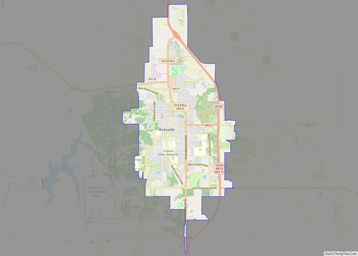
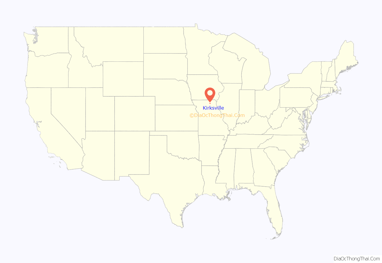
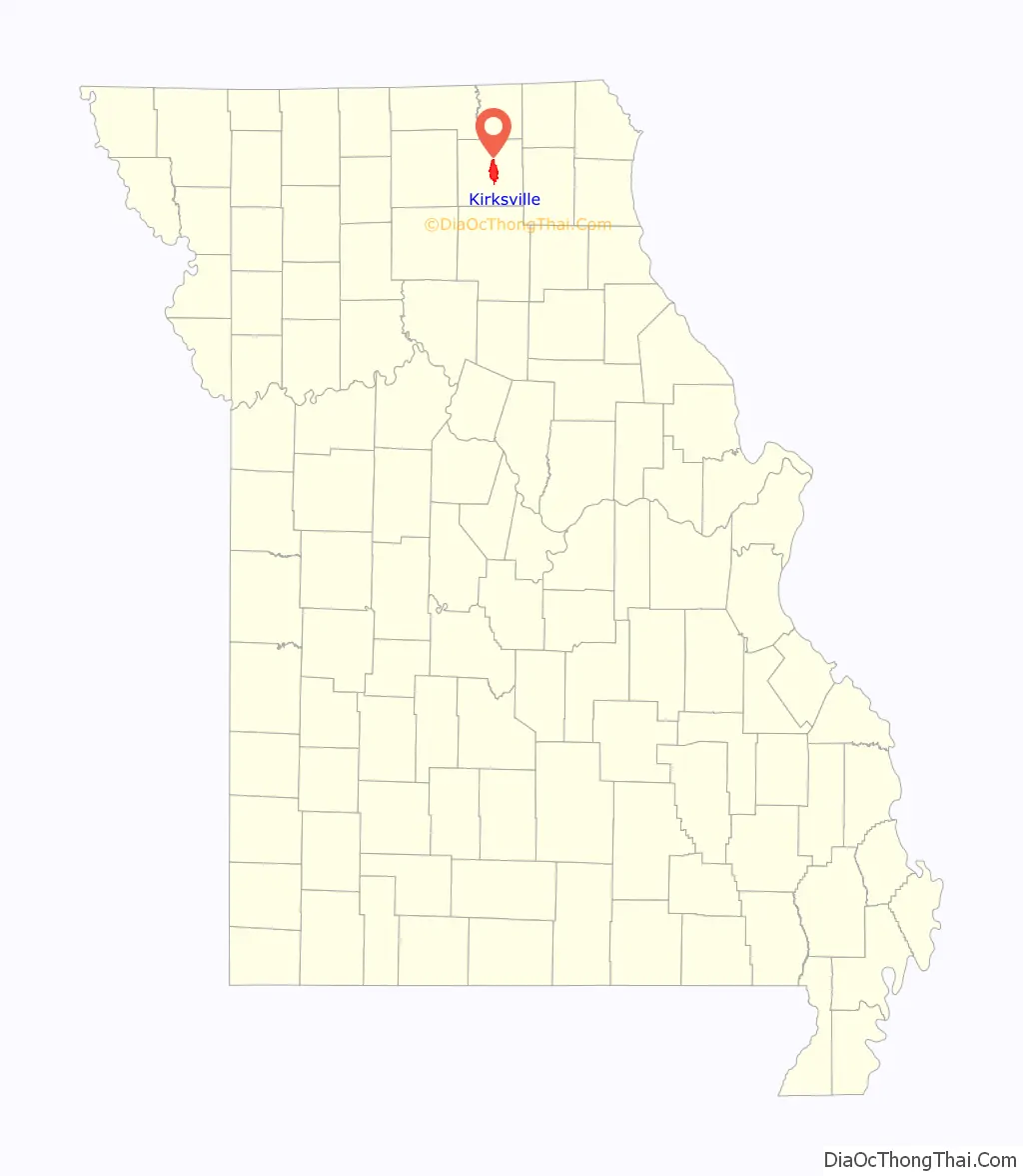
Kirksville location map. Where is Kirksville city?
History
Kirksville was laid out in 1841 on a 40-acre (0.06 sq mi; 16.19 ha) site, and was first incorporated in 1857.
Origin of name
According to tradition Jesse Kirk, Kirksville’s first postmaster, shared a dinner of turkey and whiskey with surveyors working in the area on the condition that they would name the town after him. Not only the first postmaster, Kirk was also the first to own a hotel and a tavern in Kirksville.
Contrary to popular belief, the name of the city has no connection to John Kirk, onetime president of Truman State University from 1899 to 1925. However, the grandson of Jesse Kirk reported that the town was named for Kirk’s son John, a figure of local legend credited with killing two deer with a single bullet. “Hopkinsville” was explained as a joking reference to the peculiar gait of John Kirk’s lame father-in-law, David Sloan; the jocular name was discarded when the village was selected for the seat of justice in Adair County.
Battle of Kirksville
The Battle of Kirksville was fought August 6–9, 1862, during the American Civil War. Union troops led by John McNeil forced Confederate volunteers under Joseph Porter to vacate the city. Casualty estimates (almost entirely Confederate) range from 150-200 dead and up to 400 wounded. According to the August 12, 1862, Quincy Herald there were 8 Federal dead and 25 wounded. The victorious Union commander, Colonel McNeil, gained brief national attention for his post-battle execution of a small number of Confederate prisoners. These prisoners had been previously captured in battle and then paroled with the understanding they would no longer take up arms against the Union, upon penalty of death if recaptured. Nonetheless, Confederate government officials were outraged, and it is said that Confederate president Jefferson Davis even called for the execution of Colonel (later Brigadier General) McNeil if he were to be captured.
Tornadoes
On the evening of April 27, 1899, an F4 tornado passing through Adair County cut a path of destruction three blocks wide, killed 34 people and destroyed hundreds of buildings. The popular song “Just as the Storm Passed O’er” was based on the event, and the Kimball Piano Company exploited the incident for its advertising, when one of their instruments was carried a long distance by the tornado but still found in working condition.
On May 13, 2009, Kirksville was again the victim of a large tornado. An EF2 tornado struck the northern edge of Kirksville destroying or severely damaging many homes, several businesses, a car dealership, and at least one factory. Two residents living just outside the city limits were killed by the tornado, and as many as a dozen other area residents were injured. The story and extensive video of the 2009 twister was featured in season 3, episode 4 of Storm Chasers on the Discovery Channel as well as a 2010 episode of Storm Stories on The Weather Channel.
National Register of Historic Places
The Adair County Courthouse, Bear Creek Baptist Church, Dockery Hotel, Grim Building, Capt. Thomas C. Harris House, Journal Printing Company Building, Kirksville Courthouse Square Historic District, Drs. George and Blanche Laughlin House, Masonic Temple, Dr. E. Sanborn Smith House, Orie J. Smith Black and White Stock Farm Historic District, Sojourners Club, Thousand Hills State Park Petroglyphs Archeological Site, Travelers Hotel, and Trinity Episcopal Church are listed on the National Register of Historic Places.
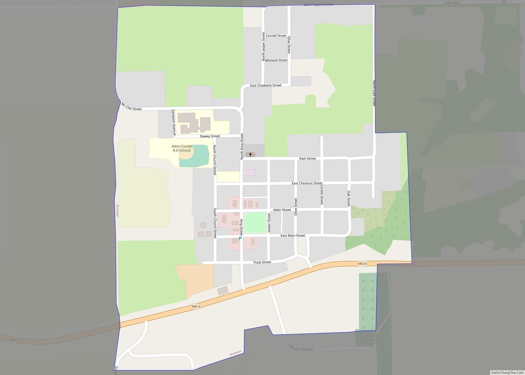
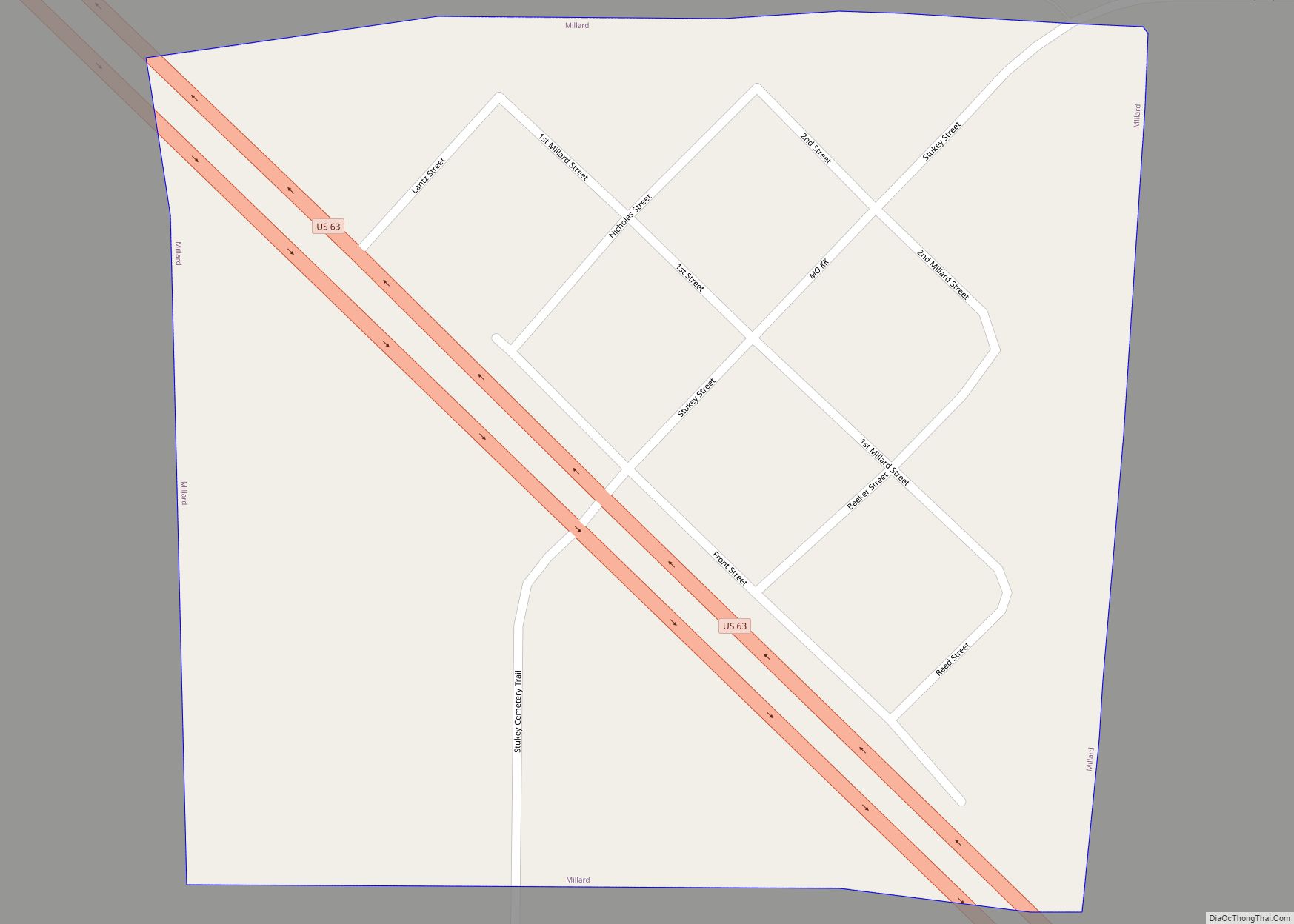
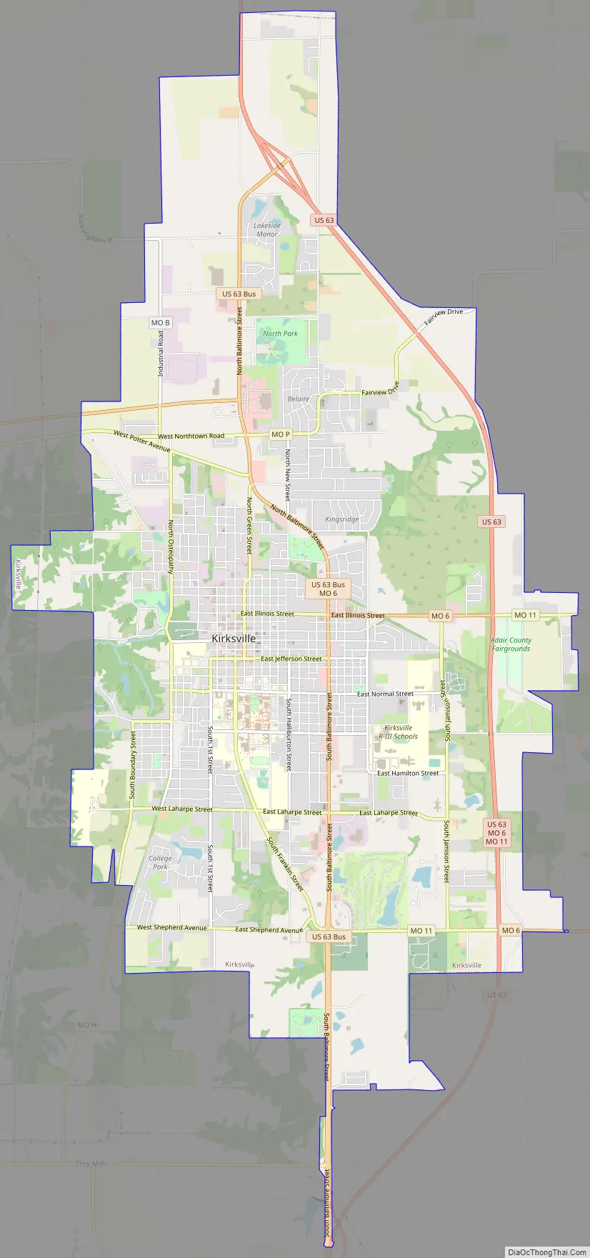
Kirksville Road Map
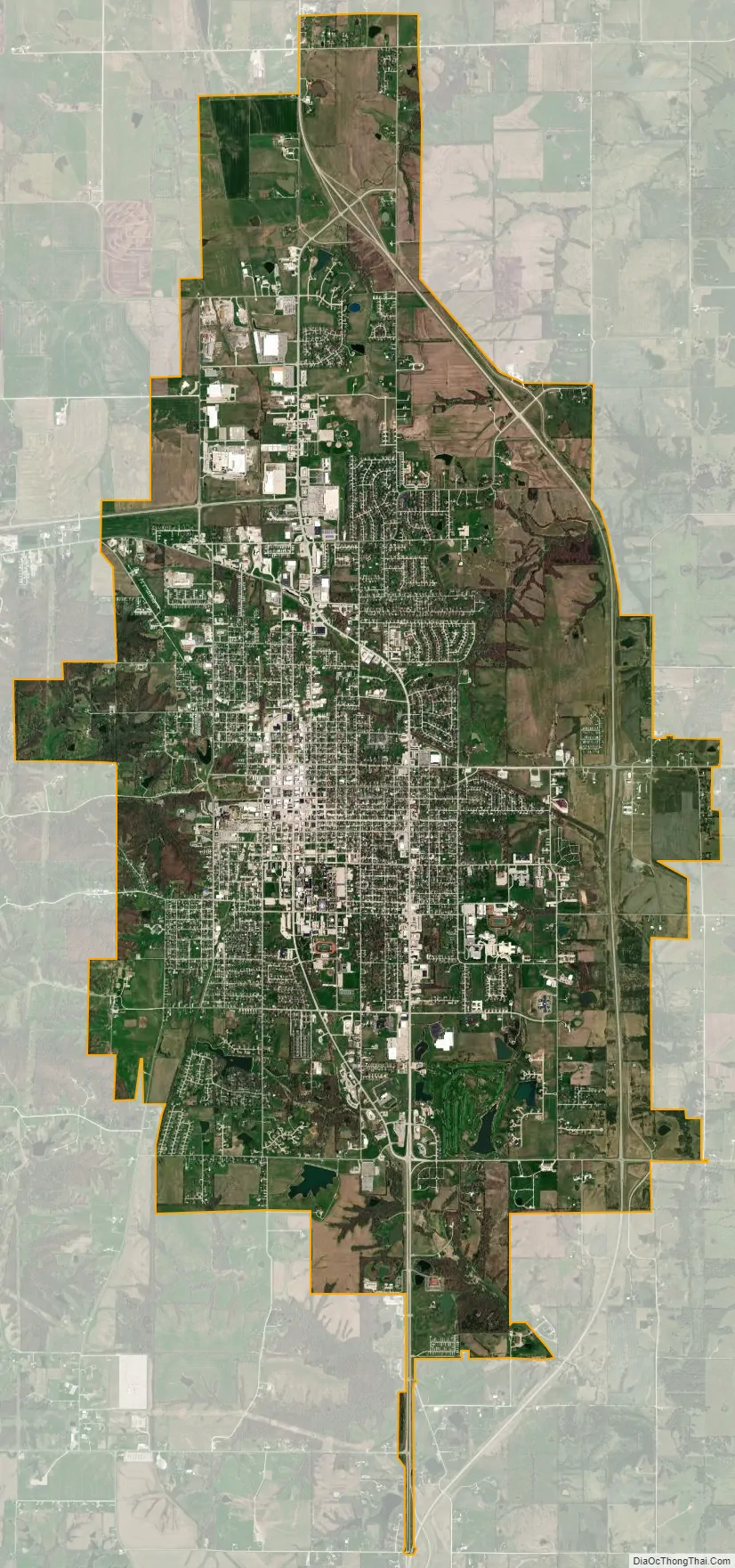
Kirksville city Satellite Map
Geography
According to the United States Census Bureau, the city has a total area of 14.43 square miles (37.37 km), of which, 14.39 square miles (37.27 km) is land and 0.04 square miles (0.10 km) is water.
Climate
Kirksville has a hot-summer humid continental climate (Köppen Dfa). Summers are warm and humid, while winters are cold and snowy. Precipitation is highest in the summer months, and is mostly produced by thunderstorms (a few of which can become severe).
See also
Map of Missouri State and its subdivision:- Adair
- Andrew
- Atchison
- Audrain
- Barry
- Barton
- Bates
- Benton
- Bollinger
- Boone
- Buchanan
- Butler
- Caldwell
- Callaway
- Camden
- Cape Girardeau
- Carroll
- Carter
- Cass
- Cedar
- Chariton
- Christian
- Clark
- Clay
- Clinton
- Cole
- Cooper
- Crawford
- Dade
- Dallas
- Daviess
- De Kalb
- Dent
- Douglas
- Dunklin
- Franklin
- Gasconade
- Gentry
- Greene
- Grundy
- Harrison
- Henry
- Hickory
- Holt
- Howard
- Howell
- Iron
- Jackson
- Jasper
- Jefferson
- Johnson
- Knox
- Laclede
- Lafayette
- Lawrence
- Lewis
- Lincoln
- Linn
- Livingston
- Macon
- Madison
- Maries
- Marion
- McDonald
- Mercer
- Miller
- Mississippi
- Moniteau
- Monroe
- Montgomery
- Morgan
- New Madrid
- Newton
- Nodaway
- Oregon
- Osage
- Ozark
- Pemiscot
- Perry
- Pettis
- Phelps
- Pike
- Platte
- Polk
- Pulaski
- Putnam
- Ralls
- Randolph
- Ray
- Reynolds
- Ripley
- Saint Charles
- Saint Clair
- Saint Francois
- Saint Louis
- Sainte Genevieve
- Saline
- Schuyler
- Scotland
- Scott
- Shannon
- Shelby
- Stoddard
- Stone
- Sullivan
- Taney
- Texas
- Vernon
- Warren
- Washington
- Wayne
- Webster
- Worth
- Wright
- Alabama
- Alaska
- Arizona
- Arkansas
- California
- Colorado
- Connecticut
- Delaware
- District of Columbia
- Florida
- Georgia
- Hawaii
- Idaho
- Illinois
- Indiana
- Iowa
- Kansas
- Kentucky
- Louisiana
- Maine
- Maryland
- Massachusetts
- Michigan
- Minnesota
- Mississippi
- Missouri
- Montana
- Nebraska
- Nevada
- New Hampshire
- New Jersey
- New Mexico
- New York
- North Carolina
- North Dakota
- Ohio
- Oklahoma
- Oregon
- Pennsylvania
- Rhode Island
- South Carolina
- South Dakota
- Tennessee
- Texas
- Utah
- Vermont
- Virginia
- Washington
- West Virginia
- Wisconsin
- Wyoming