Bridgeton is a second-ring suburb of Greater St. Louis in northwestern St. Louis County, Missouri, United States. Bridgeton is located at the intersection of the St. Louis outer belt and I-70. Bridgeton serves as the primary transport hub within Greater St. Louis. The population at the 2020 census was 11,445. Portions of St. Louis Lambert International Airport are within Bridgeton. The town is featured in the documentary Atomic Homefront, which covers the effects of radioactive waste stored in the nearby West Lake Landfill site.
| Name: | Bridgeton city |
|---|---|
| LSAD Code: | 25 |
| LSAD Description: | city (suffix) |
| State: | Missouri |
| County: | St. Louis County |
| Elevation: | 541 ft (165 m) |
| Total Area: | 15.24 sq mi (90.00 km²) |
| Land Area: | 14.55 sq mi (37.69 km²) |
| Water Area: | 0.69 sq mi (1.77 km²) |
| Total Population: | 11,445 |
| Population Density: | 786.44/sq mi (303.65/km²) |
| ZIP code: | 63044 |
| Area code: | 314 |
| FIPS code: | 2908398 |
| GNISfeature ID: | 2393417 |
| Website: | www.bridgetonmo.com |
Online Interactive Map
Click on ![]() to view map in "full screen" mode.
to view map in "full screen" mode.
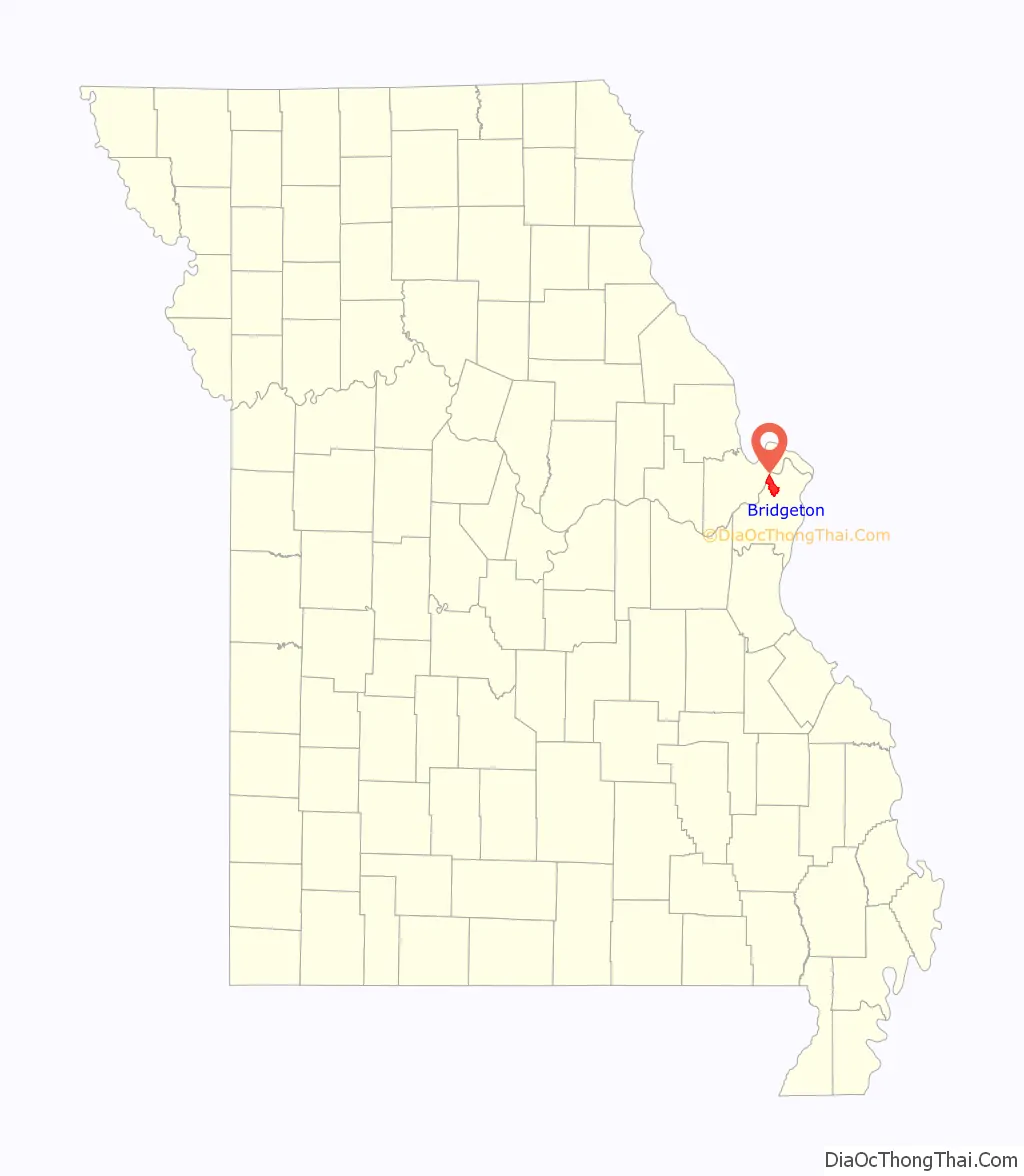
Bridgeton location map. Where is Bridgeton city?

History
Early history
The first Europeans to interact with Native American peoples and settle there were associated with the area’s days as part of the French Illinois Territory. The French explorer, Étienne de Veniard de Bourgmont traveled the area in 1724, on a trail that developed as the main route between St. Louis and St. Charles.
The Spanish gained colonial control in 1768 after France was defeated by Great Britain in the Seven Years’ War and ceded its territory west of the Mississippi to Spain; they remained in control until 1804, when the area was transferred to the Americans in the Louisiana Purchase. In a 1799 census, the population of “Marais des Liards” was given as 337 whites and 42 slaves.
Bridgeton was first platted in 1794, and named Marais des Liards (Cottonwood Swamp). It was also known as Village à Robert, named after Robert Owen, its founder, who had received a land grant from the Spanish government. In a Spanish census two years later it had a population (including slaves) of 77 males and 47 females. As the area received more and more English-speaking settlers, the village’s name became Owen’s Station.
Because of its location, including its proximity to a ferry across the Missouri River, Bridgeton became a stop along the way from St. Louis to St. Charles. Meriwether Lewis passed through on his way to meet members who were gathering as part of the Lewis and Clark Expedition. The city was granted a state charter in 1843; throughout the next few years it was a stop along the way for emigrants seeking the major trailheads to the Oregon and Santa Fe trails.
The Jesuits, a Catholic religious order of priests and brothers, came to Bridgeton from St. Stanislaus Seminary and St. Ferdinand Parish of Florissant, Missouri. The order established St. Mary’s Church in 1851 as a mission to serve area Catholics; it became a full parish within its first year. The Archdiocese of St. Louis suppressed the parish in 2001 due to the expansion of Lambert-St. Louis International Airport, which caused a decline in residential population.
Modern history
By 1950, Bridgeton’s population was 276, lower than it had been in the late 1790s and early 19th century. The city expanded in size during the decade, growing through annexation, to 16 square miles (41 km). The decade included the founding of the Northwest Chamber of Commerce, the chamber of commerce for the Northwest St. Louis area, which includes Bridgeton.
This led into its period of greatest residential growth, the 1960s, during which nearly 8000 single-family homes were built. Denser development was strong during that decade as well, at nearly 2000 units. Unlike with single-family development, the multi-family development continued at about the same average pace during the 1970s and 1980s.
In 1968, the city bought the Payne-Gentry House, the oldest home in Bridgeton, from the heirs of the Payne Gentry family and built Gentry Park around the home. The home was later put on the National Register of Historic Places and contains the oldest surviving doctor’s office in Missouri.
While residential construction nearly ended in the 1990s, that decade has seen significant growth in commercial development. Levee-protected floodplains of the river, together with good access to interstate highways, rail, and the airport have translated into continued growth for Bridgeton and nearby communities, and a diversification of the city’s tax base. Proximity to Lambert-Saint Louis International Airport proved to be a mixed blessing. Starting in 1995, an expansion plan for the airport, centered on a new runway plan called W-1W, was fought (unsuccessfully) by the city. The new runway led to the elimination of 2000 homes in the city, most notably in the Carrollton subdivision, undoubtedly playing a significant role in the city’s recent population decline.
Bridgeton Road Map
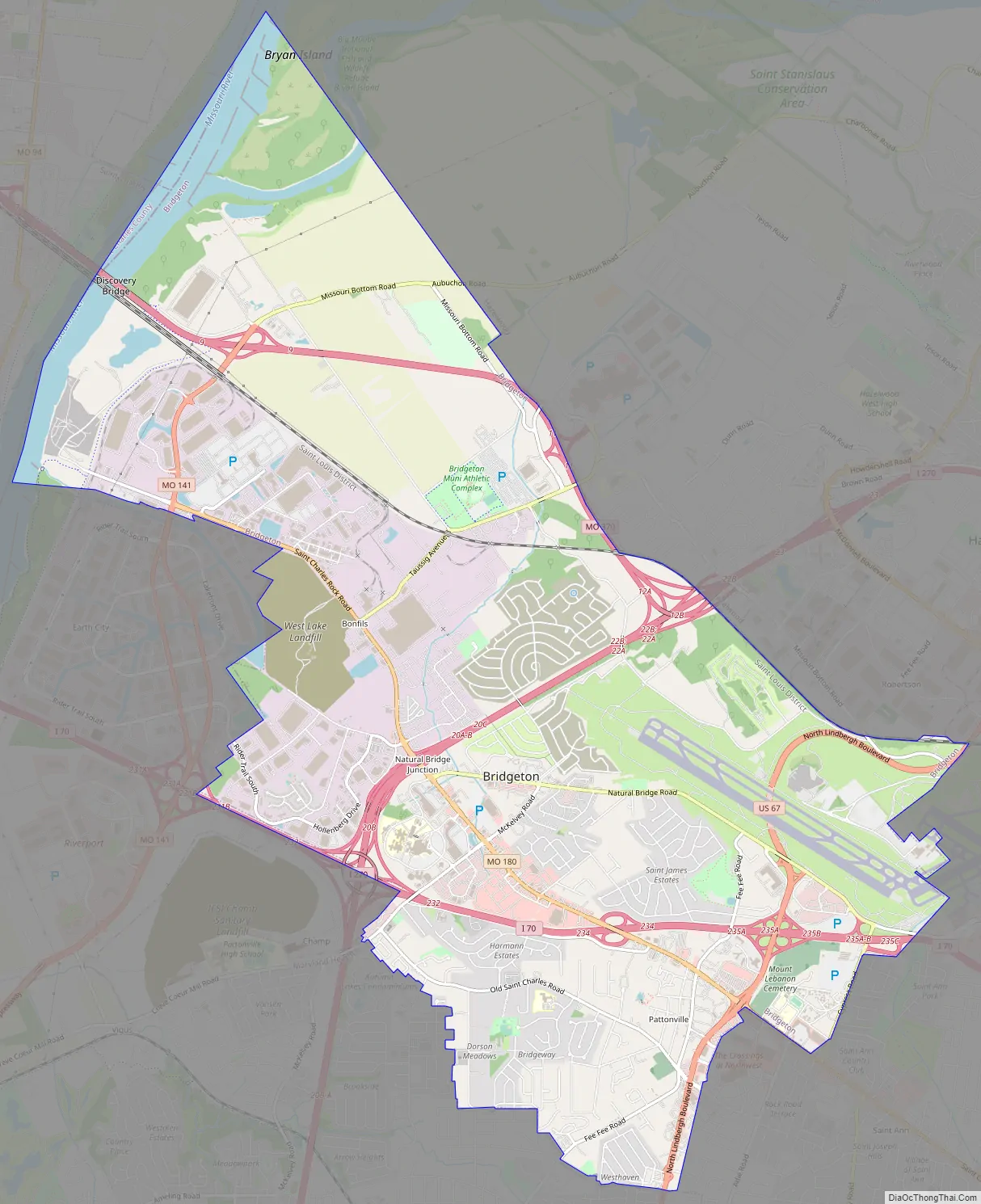
Bridgeton city Satellite Map

See also
Map of Missouri State and its subdivision:- Adair
- Andrew
- Atchison
- Audrain
- Barry
- Barton
- Bates
- Benton
- Bollinger
- Boone
- Buchanan
- Butler
- Caldwell
- Callaway
- Camden
- Cape Girardeau
- Carroll
- Carter
- Cass
- Cedar
- Chariton
- Christian
- Clark
- Clay
- Clinton
- Cole
- Cooper
- Crawford
- Dade
- Dallas
- Daviess
- De Kalb
- Dent
- Douglas
- Dunklin
- Franklin
- Gasconade
- Gentry
- Greene
- Grundy
- Harrison
- Henry
- Hickory
- Holt
- Howard
- Howell
- Iron
- Jackson
- Jasper
- Jefferson
- Johnson
- Knox
- Laclede
- Lafayette
- Lawrence
- Lewis
- Lincoln
- Linn
- Livingston
- Macon
- Madison
- Maries
- Marion
- McDonald
- Mercer
- Miller
- Mississippi
- Moniteau
- Monroe
- Montgomery
- Morgan
- New Madrid
- Newton
- Nodaway
- Oregon
- Osage
- Ozark
- Pemiscot
- Perry
- Pettis
- Phelps
- Pike
- Platte
- Polk
- Pulaski
- Putnam
- Ralls
- Randolph
- Ray
- Reynolds
- Ripley
- Saint Charles
- Saint Clair
- Saint Francois
- Saint Louis
- Sainte Genevieve
- Saline
- Schuyler
- Scotland
- Scott
- Shannon
- Shelby
- Stoddard
- Stone
- Sullivan
- Taney
- Texas
- Vernon
- Warren
- Washington
- Wayne
- Webster
- Worth
- Wright
- Alabama
- Alaska
- Arizona
- Arkansas
- California
- Colorado
- Connecticut
- Delaware
- District of Columbia
- Florida
- Georgia
- Hawaii
- Idaho
- Illinois
- Indiana
- Iowa
- Kansas
- Kentucky
- Louisiana
- Maine
- Maryland
- Massachusetts
- Michigan
- Minnesota
- Mississippi
- Missouri
- Montana
- Nebraska
- Nevada
- New Hampshire
- New Jersey
- New Mexico
- New York
- North Carolina
- North Dakota
- Ohio
- Oklahoma
- Oregon
- Pennsylvania
- Rhode Island
- South Carolina
- South Dakota
- Tennessee
- Texas
- Utah
- Vermont
- Virginia
- Washington
- West Virginia
- Wisconsin
- Wyoming


