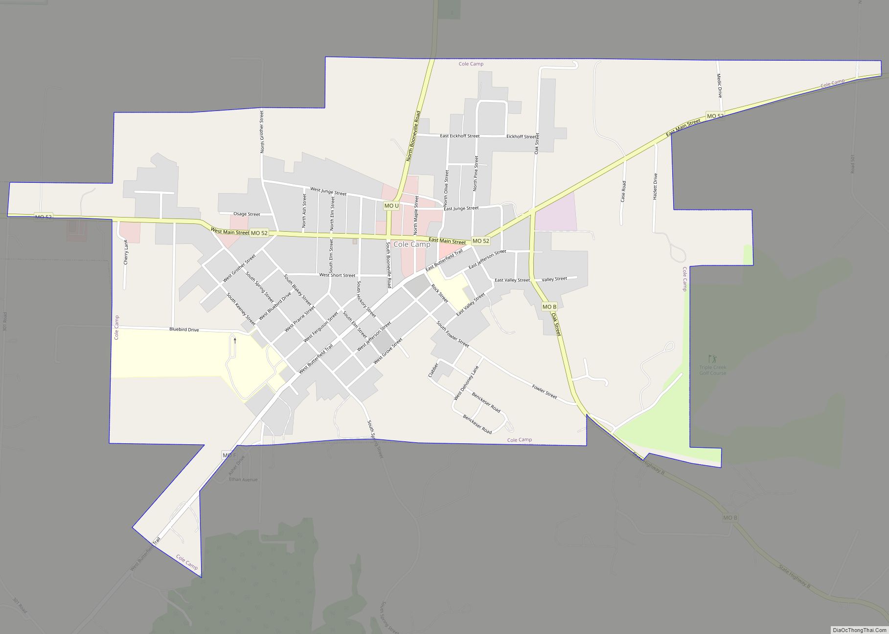
Cole Camp is a small city in Benton County, Missouri, United States. The population was 1,121 at the 2010 census.
The town is known for the annual street fair in September. It also hosts a Maifest in May, an Oktoberfest in October, and a Christbaumfest in late November; all highlight the town’s German heritage.
| Name: | Cole Camp city |
|---|---|
| LSAD Code: | 25 |
| LSAD Description: | city (suffix) |
| State: | Missouri |
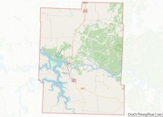
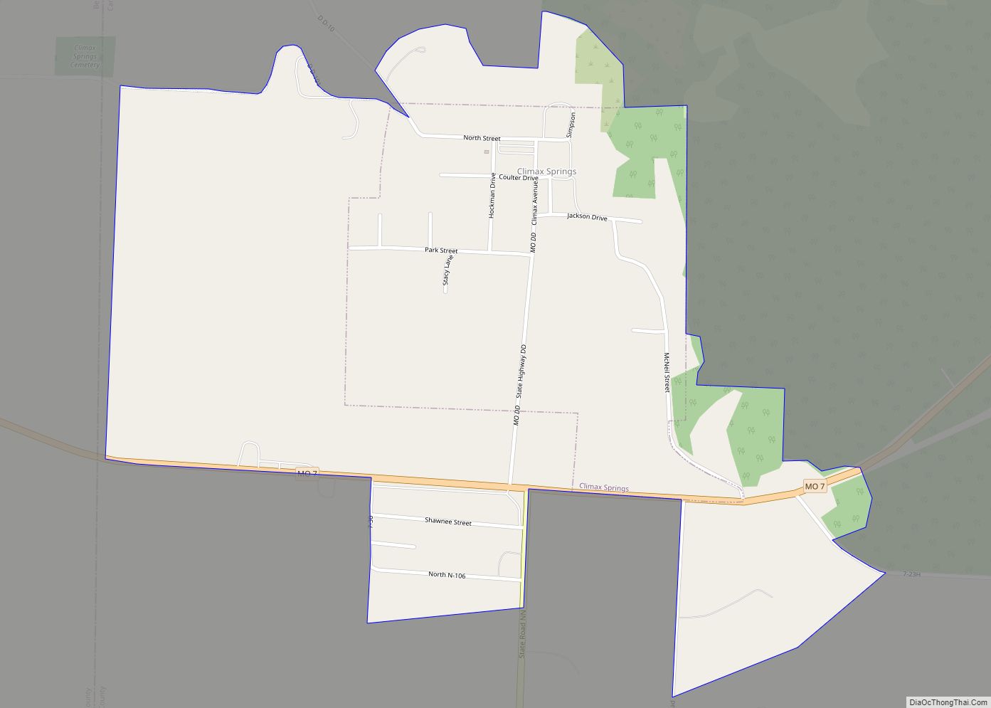
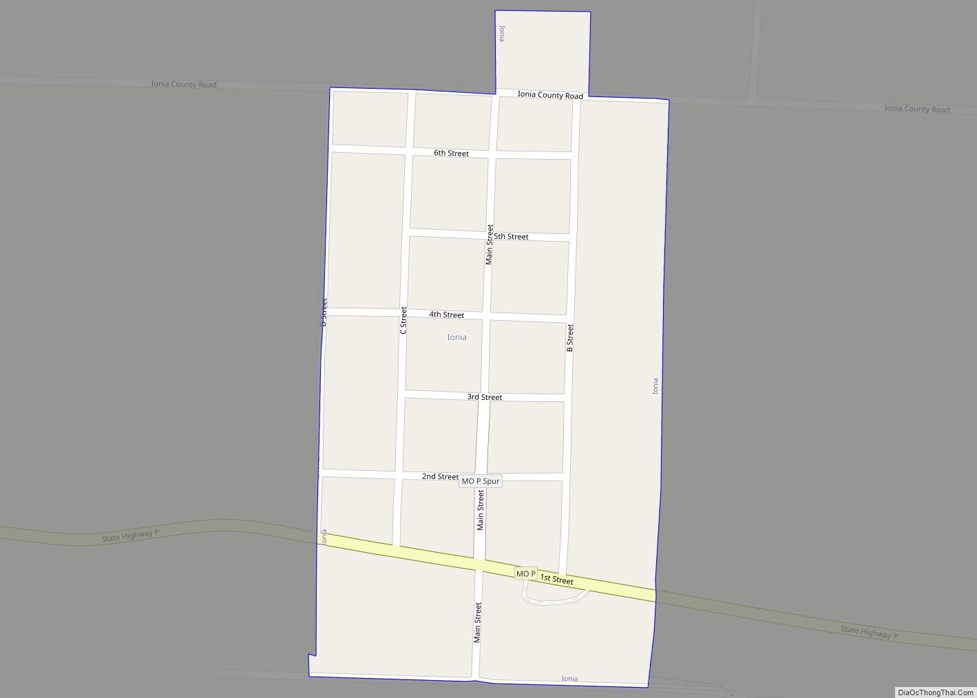
| County: | Benton County |
| Elevation: | 1,053 ft (321 m) |
| Total Area: | 1.30 sq mi (3.37 km²) |
| Land Area: | 1.30 sq mi (3.37 km²) |
| Water Area: | 0.00 sq mi (0.00 km²) |
| Total Population: | 1,104 |
| Population Density: | 847.93/sq mi (327.47/km²) |
| ZIP code: | 65325 |
| Area code: | 660 |
| FIPS code: | 2915436 |
| GNISfeature ID: | 2393592 |
Online Interactive Map
Click on ![]() to view map in "full screen" mode.
to view map in "full screen" mode.
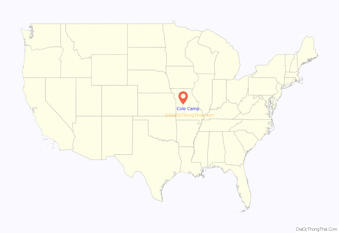
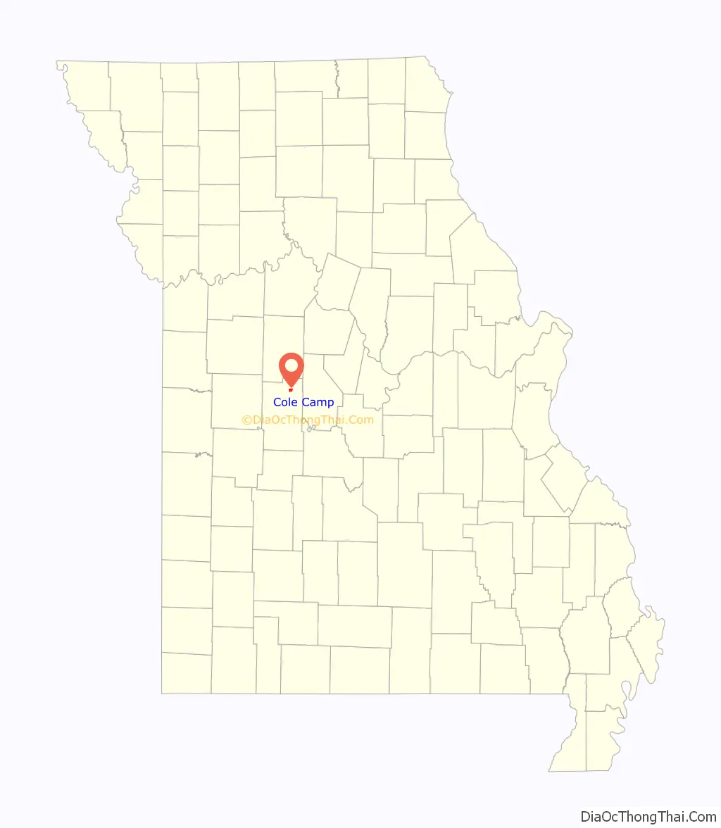
Cole Camp location map. Where is Cole Camp city?
History
Cole Camp was laid out in 1857. The city most likely was named after pioneer Captain Stephen Cole. The first postmaster of Cole Camp was Ezekiel Williams, Sr., appointed February 26, 1839.
Cole Camp was the site of a skirmish early in the American Civil War, when the local pro-Union Home Guard company was attacked by a Missouri State Guard force on June 19, 1861. At the Battle of Cole Camp, the Home Guard were defeated with a loss of 35 men killed or wounded.
The Central Cole Camp Historic District and Augustus Sander House are listed on the National Register of Historic Places.
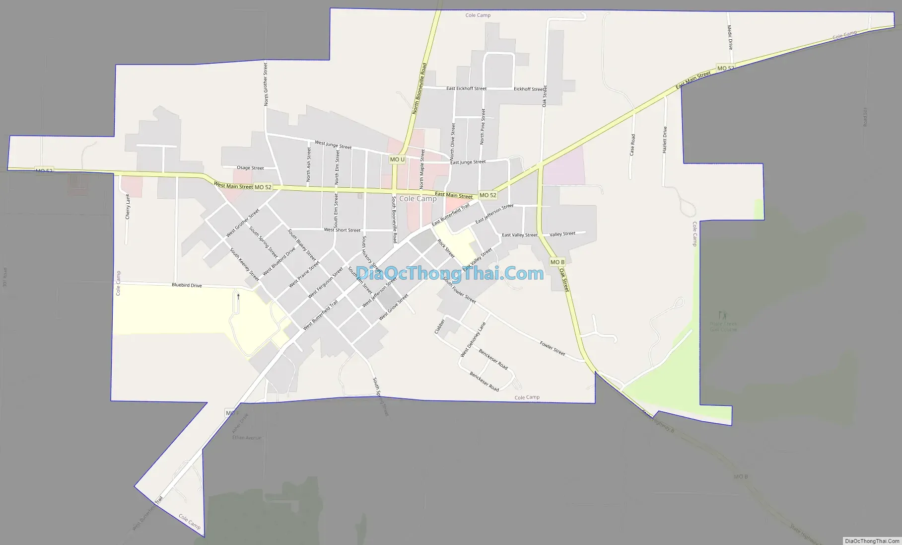
Cole Camp Road Map
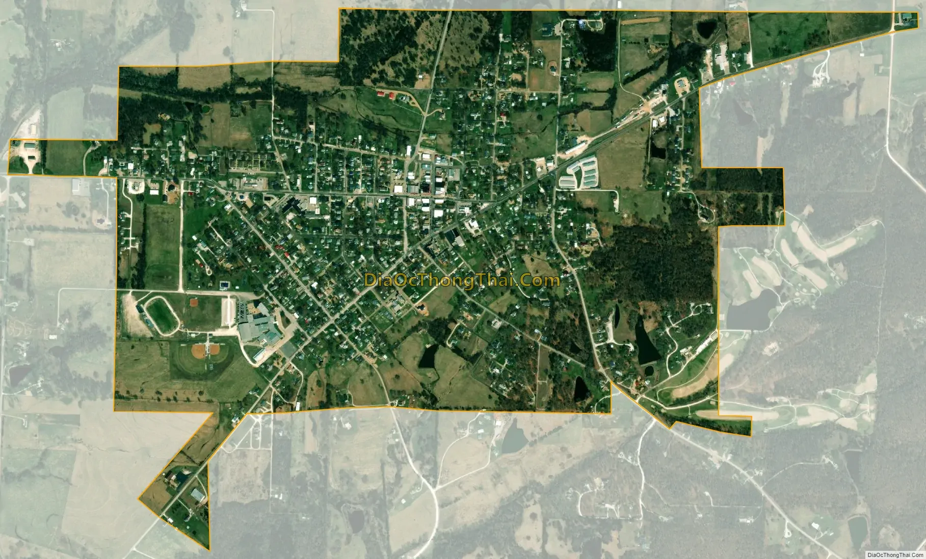
Cole Camp city Satellite Map
Geography
Cole Camp is located in northeast Benton County along Missouri Route 52 approximately four miles west of US Route 65. The headwaters of Cole Camp Creek are adjacent to the west side of the community.
According to the United States Census Bureau, the city has a total area of 1.30 square miles (3.37 km), all land.
See also
Map of Missouri State and its subdivision:- Adair
- Andrew
- Atchison
- Audrain
- Barry
- Barton
- Bates
- Benton
- Bollinger
- Boone
- Buchanan
- Butler
- Caldwell
- Callaway
- Camden
- Cape Girardeau
- Carroll
- Carter
- Cass
- Cedar
- Chariton
- Christian
- Clark
- Clay
- Clinton
- Cole
- Cooper
- Crawford
- Dade
- Dallas
- Daviess
- De Kalb
- Dent
- Douglas
- Dunklin
- Franklin
- Gasconade
- Gentry
- Greene
- Grundy
- Harrison
- Henry
- Hickory
- Holt
- Howard
- Howell
- Iron
- Jackson
- Jasper
- Jefferson
- Johnson
- Knox
- Laclede
- Lafayette
- Lawrence
- Lewis
- Lincoln
- Linn
- Livingston
- Macon
- Madison
- Maries
- Marion
- McDonald
- Mercer
- Miller
- Mississippi
- Moniteau
- Monroe
- Montgomery
- Morgan
- New Madrid
- Newton
- Nodaway
- Oregon
- Osage
- Ozark
- Pemiscot
- Perry
- Pettis
- Phelps
- Pike
- Platte
- Polk
- Pulaski
- Putnam
- Ralls
- Randolph
- Ray
- Reynolds
- Ripley
- Saint Charles
- Saint Clair
- Saint Francois
- Saint Louis
- Sainte Genevieve
- Saline
- Schuyler
- Scotland
- Scott
- Shannon
- Shelby
- Stoddard
- Stone
- Sullivan
- Taney
- Texas
- Vernon
- Warren
- Washington
- Wayne
- Webster
- Worth
- Wright
- Alabama
- Alaska
- Arizona
- Arkansas
- California
- Colorado
- Connecticut
- Delaware
- District of Columbia
- Florida
- Georgia
- Hawaii
- Idaho
- Illinois
- Indiana
- Iowa
- Kansas
- Kentucky
- Louisiana
- Maine
- Maryland
- Massachusetts
- Michigan
- Minnesota
- Mississippi
- Missouri
- Montana
- Nebraska
- Nevada
- New Hampshire
- New Jersey
- New Mexico
- New York
- North Carolina
- North Dakota
- Ohio
- Oklahoma
- Oregon
- Pennsylvania
- Rhode Island
- South Carolina
- South Dakota
- Tennessee
- Texas
- Utah
- Vermont
- Virginia
- Washington
- West Virginia
- Wisconsin
- Wyoming