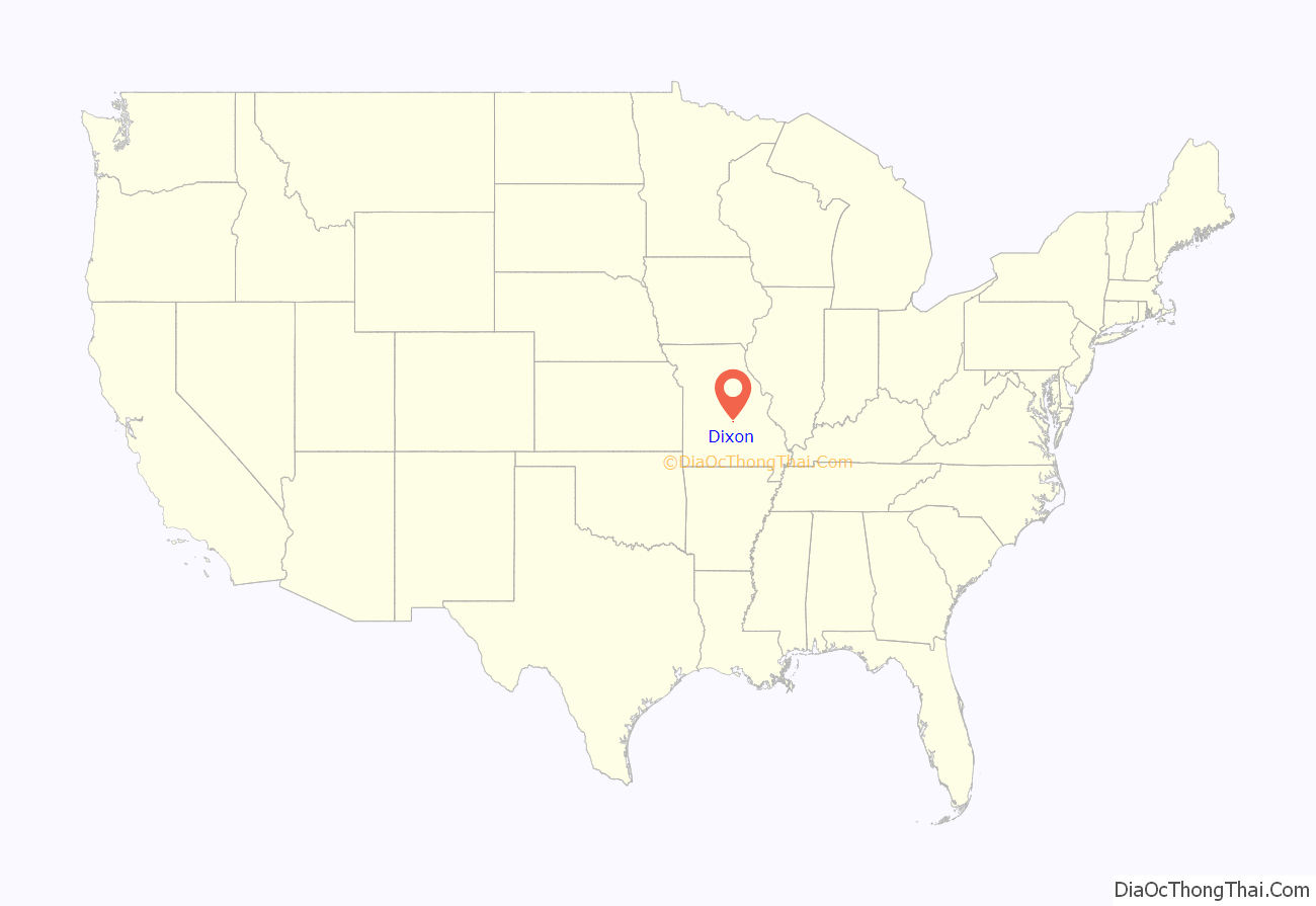
Dixon is a city in northern Pulaski County, Missouri, United States, with a population of 1,549 at the time of the 2010 census.
| Name: | Dixon city |
|---|---|
| LSAD Code: | 25 |
| LSAD Description: | city (suffix) |
| State: | Missouri |
| County: | Pulaski County |
| Founded: | 1869 |
| Elevation: | 1,148 ft (350 m) |
| Total Area: | 1.04 sq mi (2.71 km²) |
| Land Area: | 1.04 sq mi (2.71 km²) |
| Water Area: | 0.00 sq mi (0.00 km²) |
| Total Population: | 1,232 |
| Population Density: | 1,180.08/sq mi (455.43/km²) |
| ZIP code: | 65459 |
| Area code: | 573 |
| FIPS code: | 2919630 |
| GNISfeature ID: | 2394539 |
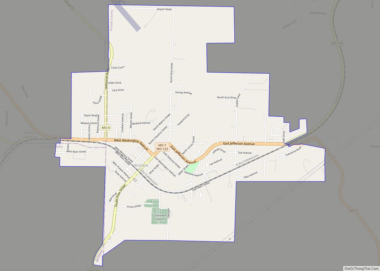
Online Interactive Map
Click on ![]() to view map in "full screen" mode.
to view map in "full screen" mode.
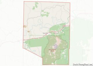
Dixon location map. Where is Dixon city?

History
Dixon was platted in 1869 at the time a railroad was extended through to the neighborhood and a post office bearing the name of the town has been in operation since that time. The community takes its name from Dixon, Illinois, the native home of a share of the railway builders.
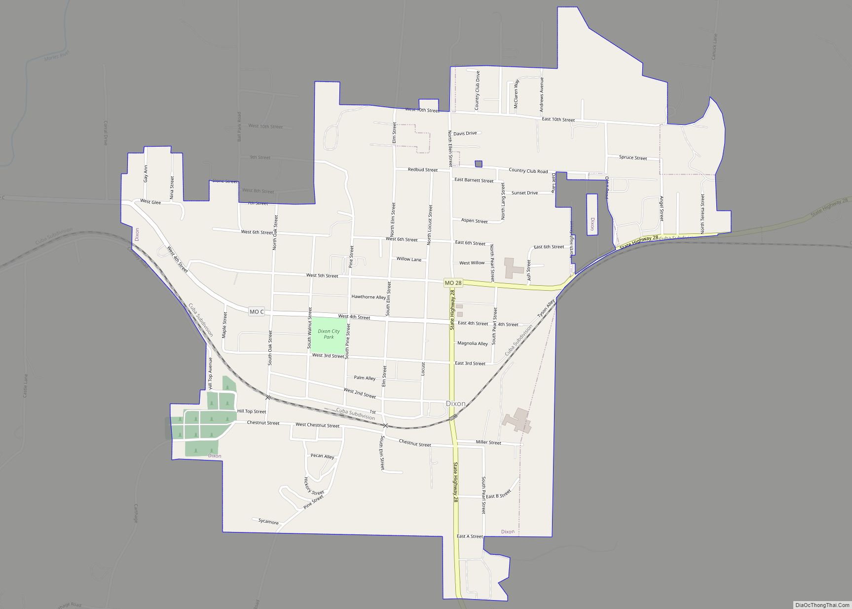
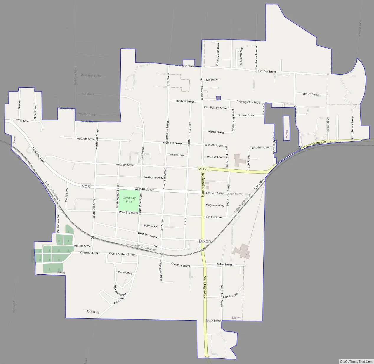
Dixon Road Map
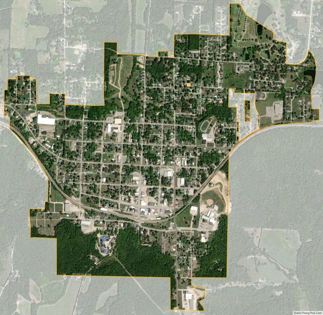
Dixon city Satellite Map
Geography
The city is in the northeast corner of Pulaski County and is one mile south of the Pulaski-Maries county line. The headwaters of the north flowing Maries River are located along the northwest edge of the community. Streams along the south and east sides of the city flow into the Gasconade River, which is approximately five miles to the southeast.The community is served by State highways 28 and 133.
According to the United States Census Bureau, the city has a total area of 1.01 square miles (2.62 km), all land.
See also
Map of Missouri State and its subdivision:- Adair
- Andrew
- Atchison
- Audrain
- Barry
- Barton
- Bates
- Benton
- Bollinger
- Boone
- Buchanan
- Butler
- Caldwell
- Callaway
- Camden
- Cape Girardeau
- Carroll
- Carter
- Cass
- Cedar
- Chariton
- Christian
- Clark
- Clay
- Clinton
- Cole
- Cooper
- Crawford
- Dade
- Dallas
- Daviess
- De Kalb
- Dent
- Douglas
- Dunklin
- Franklin
- Gasconade
- Gentry
- Greene
- Grundy
- Harrison
- Henry
- Hickory
- Holt
- Howard
- Howell
- Iron
- Jackson
- Jasper
- Jefferson
- Johnson
- Knox
- Laclede
- Lafayette
- Lawrence
- Lewis
- Lincoln
- Linn
- Livingston
- Macon
- Madison
- Maries
- Marion
- McDonald
- Mercer
- Miller
- Mississippi
- Moniteau
- Monroe
- Montgomery
- Morgan
- New Madrid
- Newton
- Nodaway
- Oregon
- Osage
- Ozark
- Pemiscot
- Perry
- Pettis
- Phelps
- Pike
- Platte
- Polk
- Pulaski
- Putnam
- Ralls
- Randolph
- Ray
- Reynolds
- Ripley
- Saint Charles
- Saint Clair
- Saint Francois
- Saint Louis
- Sainte Genevieve
- Saline
- Schuyler
- Scotland
- Scott
- Shannon
- Shelby
- Stoddard
- Stone
- Sullivan
- Taney
- Texas
- Vernon
- Warren
- Washington
- Wayne
- Webster
- Worth
- Wright
- Alabama
- Alaska
- Arizona
- Arkansas
- California
- Colorado
- Connecticut
- Delaware
- District of Columbia
- Florida
- Georgia
- Hawaii
- Idaho
- Illinois
- Indiana
- Iowa
- Kansas
- Kentucky
- Louisiana
- Maine
- Maryland
- Massachusetts
- Michigan
- Minnesota
- Mississippi
- Missouri
- Montana
- Nebraska
- Nevada
- New Hampshire
- New Jersey
- New Mexico
- New York
- North Carolina
- North Dakota
- Ohio
- Oklahoma
- Oregon
- Pennsylvania
- Rhode Island
- South Carolina
- South Dakota
- Tennessee
- Texas
- Utah
- Vermont
- Virginia
- Washington
- West Virginia
- Wisconsin
- Wyoming