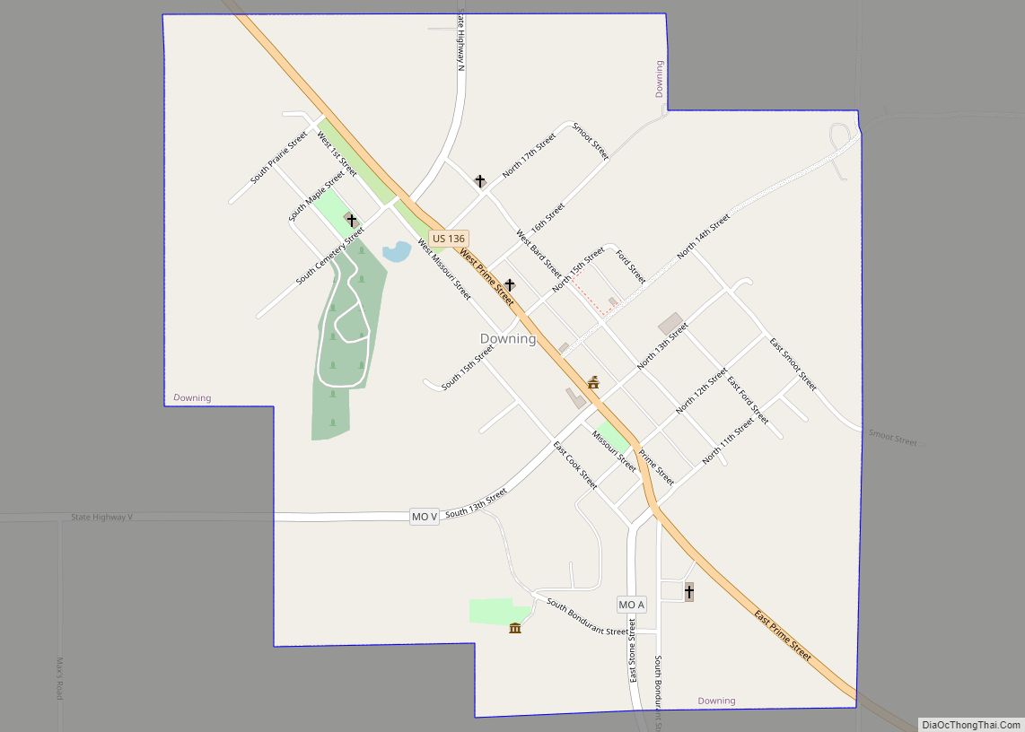
Downing is a city in Schuyler County, Missouri, United States. As of the 2020 census, its population was 300. It is part of the Kirksville Micropolitan Statistical Area.
| Name: | Downing city |
|---|---|
| LSAD Code: | 25 |
| LSAD Description: | city (suffix) |
| State: | Missouri |
| County: | Schuyler County |
| Elevation: | 873 ft (266 m) |
| Total Area: | 0.66 sq mi (1.72 km²) |
| Land Area: | 0.66 sq mi (1.71 km²) |
| Water Area: | 0.01 sq mi (0.01 km²) |
| Total Population: | 300 |
| Population Density: | 455.24/sq mi (175.73/km²) |
| ZIP code: | 63536 |
| Area code: | 660 |
| FIPS code: | 2919990 |
| GNISfeature ID: | 2394558 |
Online Interactive Map
Click on ![]() to view map in "full screen" mode.
to view map in "full screen" mode.
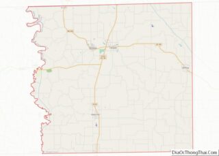
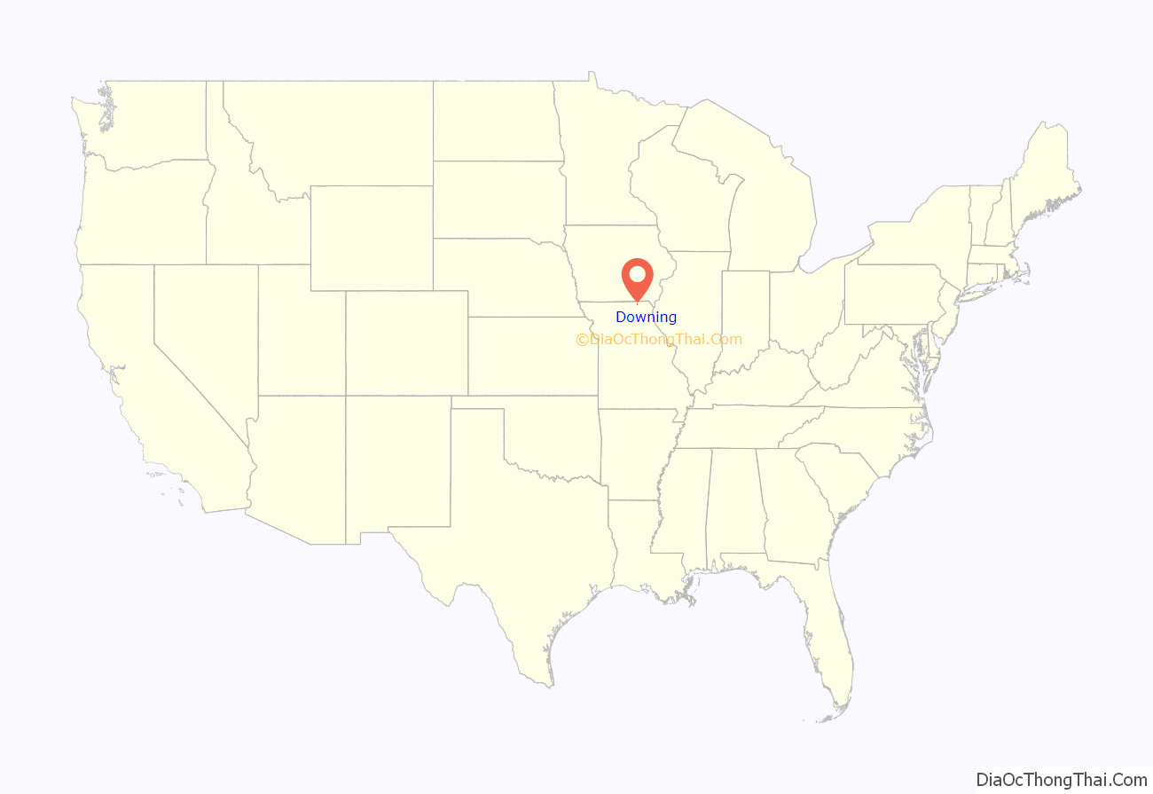
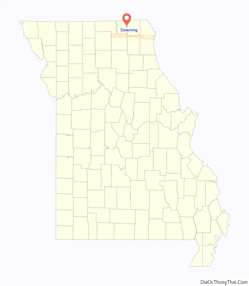
Downing location map. Where is Downing city?
History
Although not being laid out as a town until 1872, the Downing area was one of the earliest settled areas of Schuyler County, with Henry Downing building a home and claiming land a few miles south of the area circa 1837. It was also near present-day Downing that the first school in the county was established. In the spring of 1841, a crude log cabin was built for use as a school near Henry Downing’s home and Miss Esther Hathaway was employed as a teacher. One of the early names for the unincorporated settlement was Cherry Grove.
During the Civil War, on July 1, 1862, a small skirmish took place near Cherry Grove. Cavalry from the second battalion, Eleventh Missouri State Militia, a pro-Union force, engaged a small number of Confederate troops under Colonel Joseph C. Porter. Porter’s outnumbered forces were defeated, with four killed and several men and horses captured. The Union forces had one man badly injured, who would die a few days later. At the time of the skirmish, Porter was heavily involved in recruiting men in northeast Missouri for the Confederate cause. The following month, he would suffer a larger defeat some twenty-five miles southwest at the Battle of Kirksville.
In September 1872, the Missouri Town Company created the original town plat, naming it for the president of the company, H. H. Downing. Land for the town, the railroad right of way, and depot were donated by James Prime, and the Missouri, Iowa, and Nebraska Railway constructed the depot in April, 1872. By the late 1880s, the Downing business district included four general stores, two drug stores, two grocers, two hardware stores, a restaurant, blacksmith, and two hotels. Manufacturing included two handle factories, a wagon maker, a hoop factory, a harness and saddle maker, and two combination saw/grist mills. Downing had two tobacco-buying warehouses in the late 1800s, with both reporting extensive business. At its peak in 1902, over 155,000 pounds of tobacco were dealt through the Downing warehouses. The town’s location on the Keokuk & Western railroad provided opportunity for the convenient shipment of goods, crops, and livestock from the Downing area.
The Downing Railroad Depot was listed on the National Register of Historic Places in 1983 and now serves as a museum. The depot was moved approximately one-quarter mile from its original trackside location and now serves as the centerpiece of a city park with other nearby buildings, including the former Downing jail.
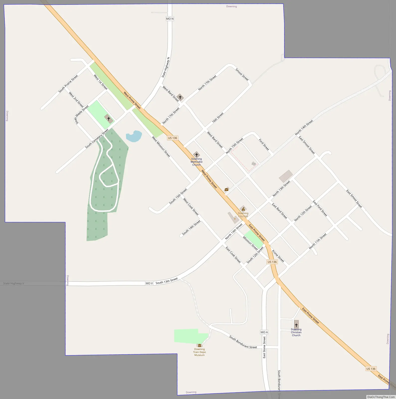
Downing Road Map
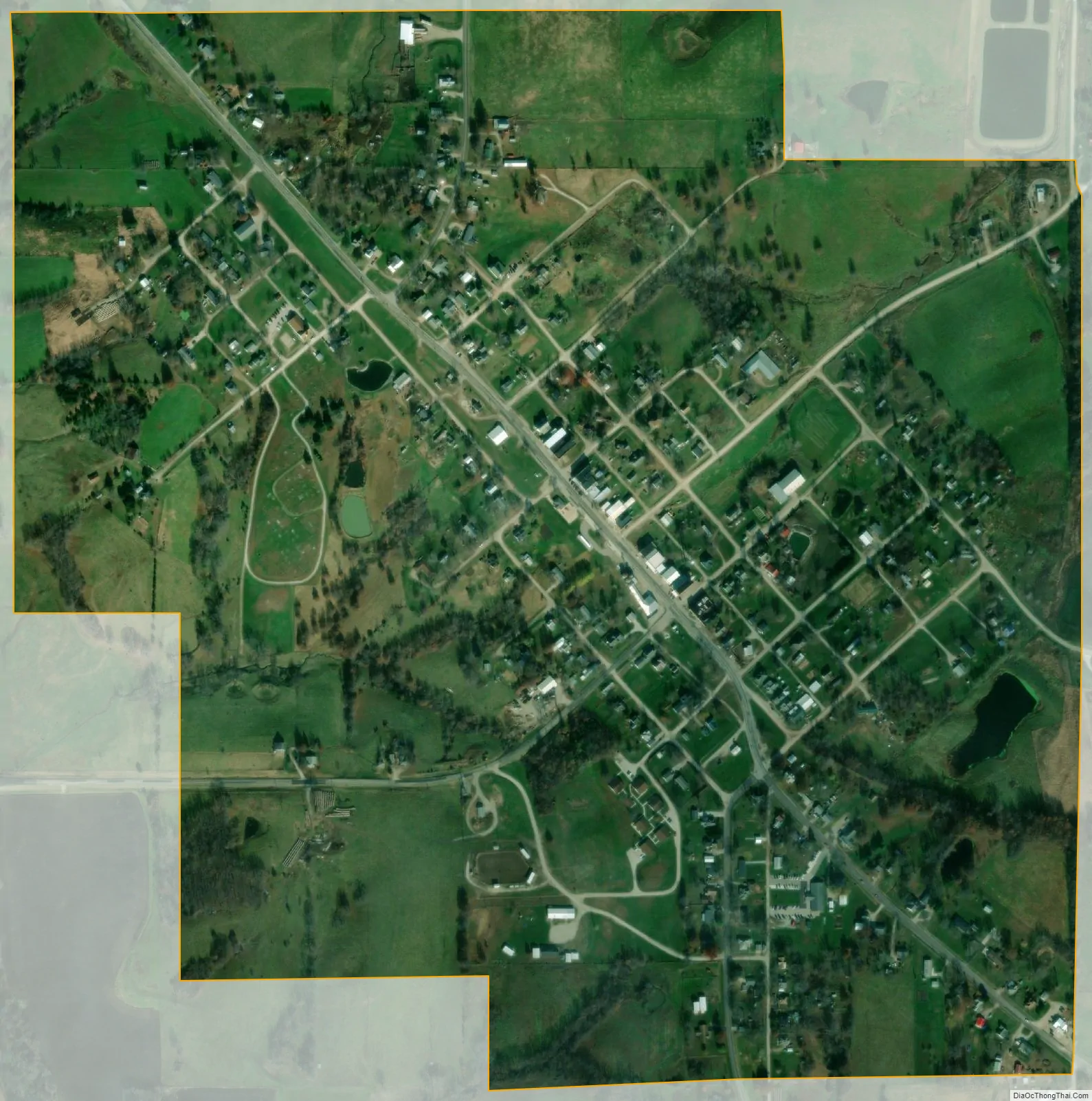
Downing city Satellite Map
Geography
Downing is located at 40°29′16″N 92°22′5″W / 40.48778°N 92.36806°W / 40.48778; -92.36806 (40.487682, -92.368022).
According to the United States Census Bureau, the city has a total area of 0.67 square miles (1.74 km), of which 0.66 square miles (1.71 km) is land and 0.01 square miles (0.03 km) is water.
See also
Map of Missouri State and its subdivision:- Adair
- Andrew
- Atchison
- Audrain
- Barry
- Barton
- Bates
- Benton
- Bollinger
- Boone
- Buchanan
- Butler
- Caldwell
- Callaway
- Camden
- Cape Girardeau
- Carroll
- Carter
- Cass
- Cedar
- Chariton
- Christian
- Clark
- Clay
- Clinton
- Cole
- Cooper
- Crawford
- Dade
- Dallas
- Daviess
- De Kalb
- Dent
- Douglas
- Dunklin
- Franklin
- Gasconade
- Gentry
- Greene
- Grundy
- Harrison
- Henry
- Hickory
- Holt
- Howard
- Howell
- Iron
- Jackson
- Jasper
- Jefferson
- Johnson
- Knox
- Laclede
- Lafayette
- Lawrence
- Lewis
- Lincoln
- Linn
- Livingston
- Macon
- Madison
- Maries
- Marion
- McDonald
- Mercer
- Miller
- Mississippi
- Moniteau
- Monroe
- Montgomery
- Morgan
- New Madrid
- Newton
- Nodaway
- Oregon
- Osage
- Ozark
- Pemiscot
- Perry
- Pettis
- Phelps
- Pike
- Platte
- Polk
- Pulaski
- Putnam
- Ralls
- Randolph
- Ray
- Reynolds
- Ripley
- Saint Charles
- Saint Clair
- Saint Francois
- Saint Louis
- Sainte Genevieve
- Saline
- Schuyler
- Scotland
- Scott
- Shannon
- Shelby
- Stoddard
- Stone
- Sullivan
- Taney
- Texas
- Vernon
- Warren
- Washington
- Wayne
- Webster
- Worth
- Wright
- Alabama
- Alaska
- Arizona
- Arkansas
- California
- Colorado
- Connecticut
- Delaware
- District of Columbia
- Florida
- Georgia
- Hawaii
- Idaho
- Illinois
- Indiana
- Iowa
- Kansas
- Kentucky
- Louisiana
- Maine
- Maryland
- Massachusetts
- Michigan
- Minnesota
- Mississippi
- Missouri
- Montana
- Nebraska
- Nevada
- New Hampshire
- New Jersey
- New Mexico
- New York
- North Carolina
- North Dakota
- Ohio
- Oklahoma
- Oregon
- Pennsylvania
- Rhode Island
- South Carolina
- South Dakota
- Tennessee
- Texas
- Utah
- Vermont
- Virginia
- Washington
- West Virginia
- Wisconsin
- Wyoming