Ellsinore is a town in Carter County, Missouri, United States. The 2020 U.S. Census showed Ellsinore with a population of 416.
| Name: | Ellsinore city |
|---|---|
| LSAD Code: | 25 |
| LSAD Description: | city (suffix) |
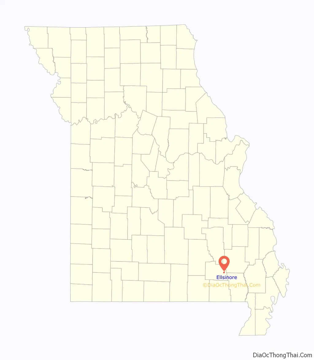
| State: | Missouri |
| County: | Carter County |
| Elevation: | 732 ft (223 m) |
| Total Area: | 0.51 sq mi (1.31 km²) |
| Land Area: | 0.51 sq mi (1.31 km²) |
| Water Area: | 0.00 sq mi (0.00 km²) |
| Total Population: | 416 |
| Population Density: | 822.13/sq mi (317.66/km²) |
| ZIP code: | 63937 |
| Area code: | 573 |
| FIPS code: | 2921916 |
| GNISfeature ID: | 2394665 |
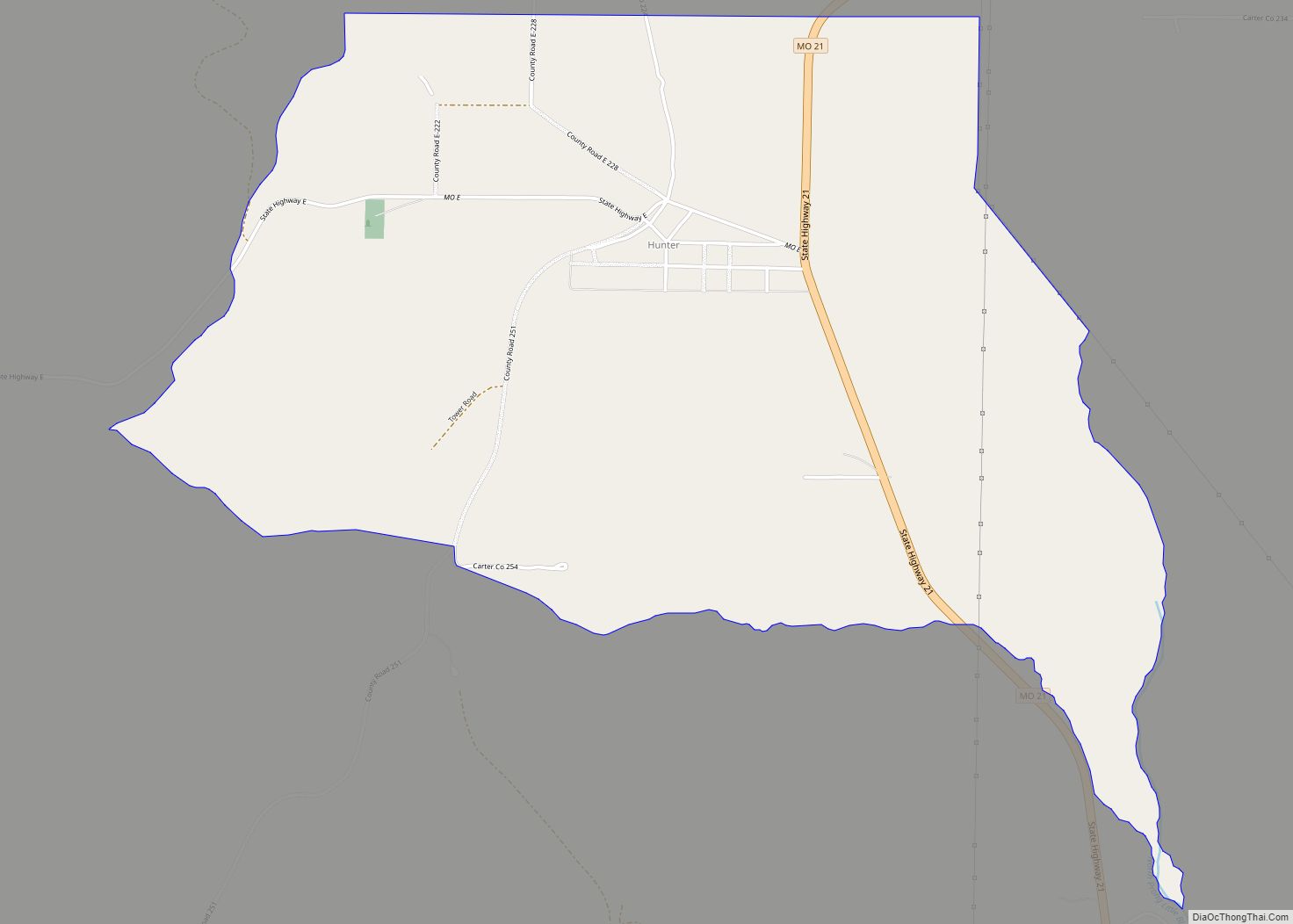
Online Interactive Map
Click on ![]() to view map in "full screen" mode.
to view map in "full screen" mode.
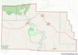
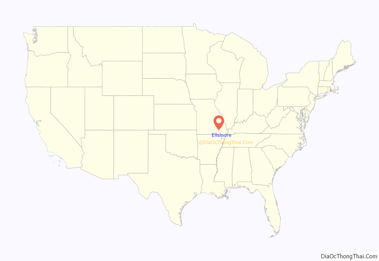
Ellsinore location map. Where is Ellsinore city?
History
The site of the town of Ellsinore was originally patented on April 15, 1857 by Robert Patterson just two years before Carter County was organized. The land was later sold to a Mr. Cook, who in October 1876 sold the land to Charles Hearin. Charles Hearin cleared the land and raised corn and pumpkins on it. In 1888 Charles Hearin gave the Houck Railroad a right of way across his land, laid out the town, and built a railroad depot on the south side of the creek.
On March 2, 1889, the Current Local printed the following: “Over in the kingdom of Carter, on the land of the Cape Girardeau and Southwestern Railroad (Houck Railroad), at a point eleven miles distant from Williamsville, there is in process of evolution a little town bearing the name of Ellsinore …”
It is not exactly certain how the town came to be called Ellsinore, but the most widely accepted story is that Mr. Brooks, the chief engineer of the Houck Railroad, named the town after Elsinore Castle in Denmark, the setting of Shakespeare’s “Hamlet.” The post office however added an extra “l” making the spelling “Ellsinore.”
In 1888 John Carr opened the first store in Ellsinore which catered largely to the men who were building the railroad.
In early 1889 the Ellsinore Post Office was established, Silace Pace being its first postmaster.
In 1889 William Crommer and Bob Evans began operating a sawmill at Ellsinore, buying up most of the timber in the area that had not already been bought up by the Missouri Lumber and Mining Company. After passing through a number of hands it finally closed down in 1903 and the equipment moved to Kelley Fork in Wayne County.
In 1891 the first school was organized in Ellsinore. It consisted of a one-room school building and a two-room L-shaped building. Almost all the equipment was home made and the entire library consisted of a single very old copy of Webster’s dictionary. The school was located near where the old water tower is located.
In 1895 the Ellsinore Hotel, run by Mamie Seats, was built and began operations.
In 1904 E. P. Queen and S. F. Jackson started up a new sawmill at Ellsinore. It was sold to the Store and Timber Company in 1908, which soon after went bankrupt.
In 1904 W. E. Condray and Clarence Crites began the Carter County Canning Company (4C Brand) in Ellsinore, but the business folded in 1907 largely due to a lack of interest.
In 1907 the Bank of Ellsinore was established. The bank was robbed on August 14, 1918, but no arrests were ever made. The Bank of Ellsinore closed its doors in 1930.
In 1912 the Ellsinore, Crommer Town, Lower Ten Mile, Upper Ten Mile, Hogan Hollow, White’s Mill and Freeland school districts consolidated for the purpose of creating a high school.
In 1912 after passing through a number of owners the Ellsinore Hotel burned, and a new structure, the Seats Hotel, was built on the lot in 1913.
In 1913/14 the Ellsinore High School was accredited by the State Department of Education.
In 1918 “The Ellsinore News” began publication. Its name was later changed to “The Carter County News.” The newspaper folded in 1926.
In 1919 a new school building, a two-story brick structure, was built on the south side of town on the site where the school currently stands.
In 1920 the Farmers State Bank was established. Financial difficulty forced it to close its doors in 1924.
In 1937 the Ellsinore School was rebuilt with WPA labor.
In 1938 the Ellsinore Post Office became the first office for Ozark Border Electric Cooperative and its postmaster, P.G. Wingo became the cooperative’s first board president.
On April 13, 1939, a ceremonial first pole for Ozark Border Electric Cooperative was raised behind the Ellsinore Post Office.
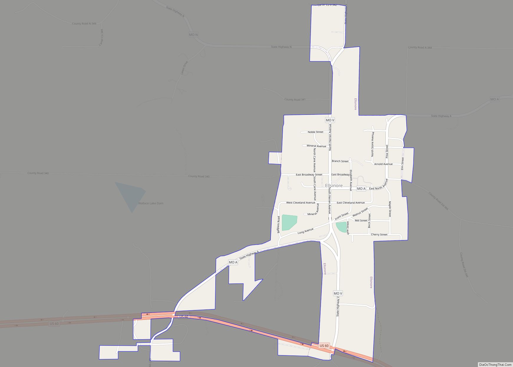
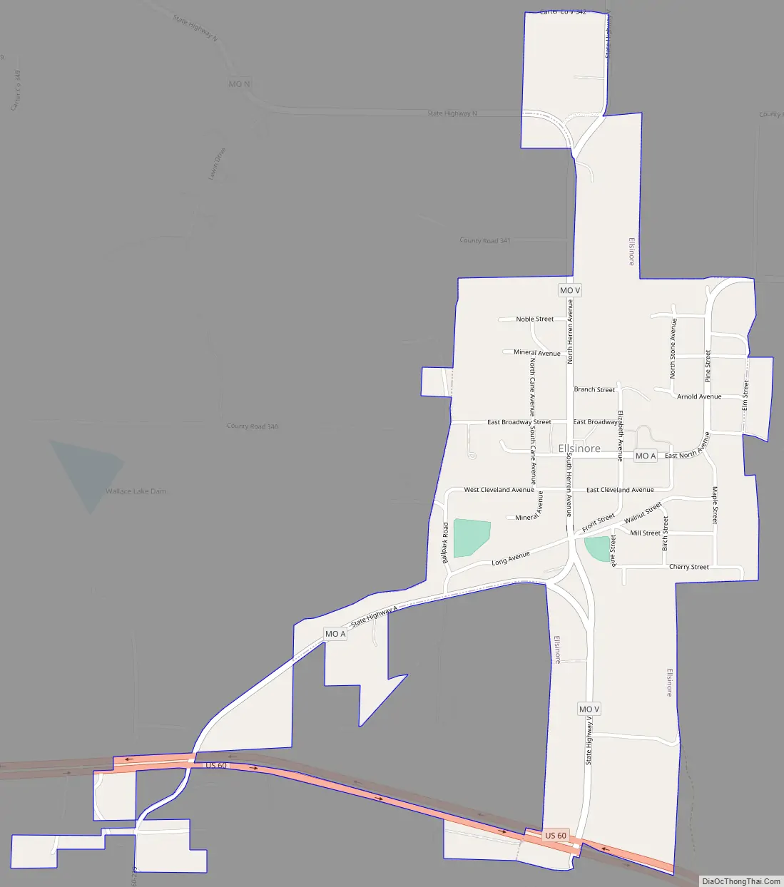
Ellsinore Road Map
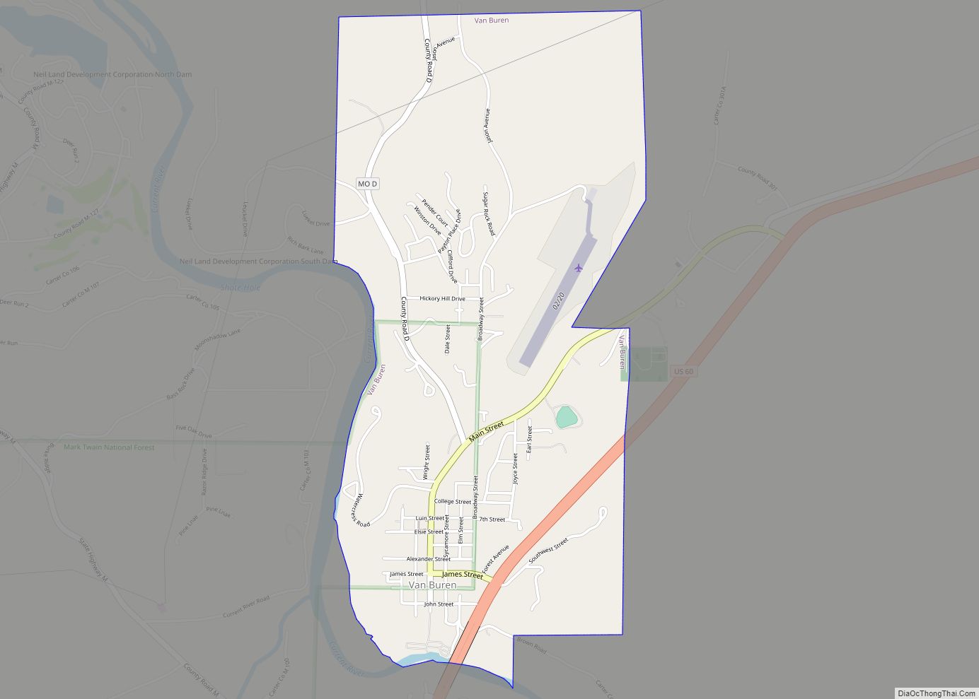
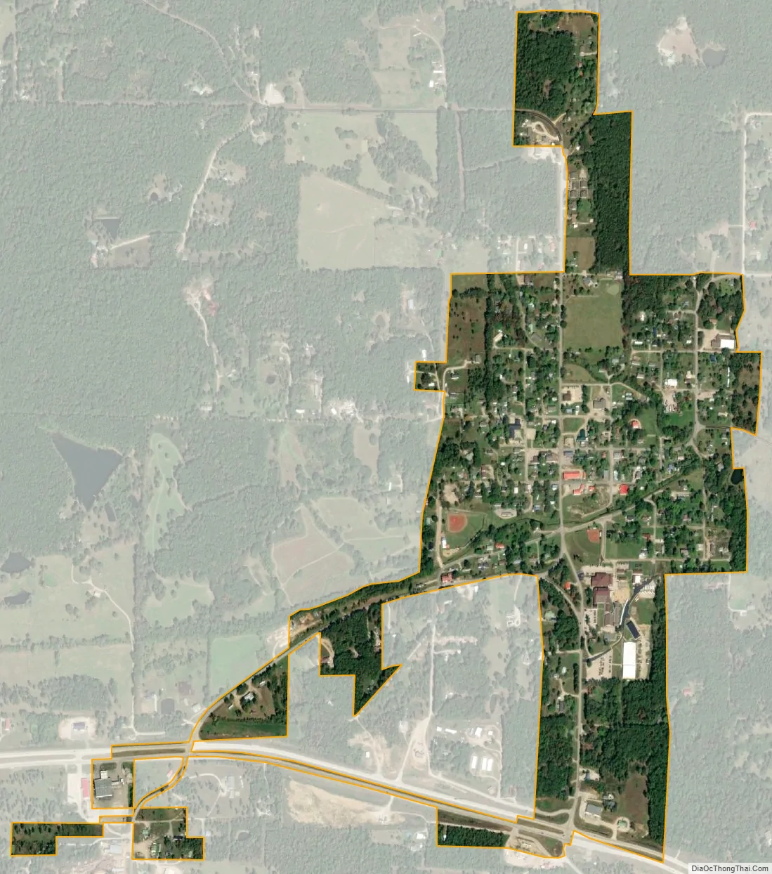
Ellsinore city Satellite Map
Geography
Ellsinore is located on Missouri Route V approximately one mile north of US Route 60. It is approximately 14 miles east-southeast of Van Buren and within the Mark Twain National Forest.
According to the United States Census Bureau, the city has a total area of 0.49 square miles (1.27 km), all land.
Notable Locations
The Alcorn Corner House – At the North side of town by the Headstart building . Is one of the oldest buildings in the town, built around 1904. The name is derived from Lafayette and Alice Alcorn who farmed the property from about 1906 until retirement in 1943. It was later owned by Virgie Alcorn Evans.
2 Historical bridges – one In town that is part of Main Street and one connecting CR330 to town.
The Pioneer Museum – On Main Street, after the first bridge.
Royal Oak Charcoal – on county road 330 off highway 60
See also
Map of Missouri State and its subdivision:- Adair
- Andrew
- Atchison
- Audrain
- Barry
- Barton
- Bates
- Benton
- Bollinger
- Boone
- Buchanan
- Butler
- Caldwell
- Callaway
- Camden
- Cape Girardeau
- Carroll
- Carter
- Cass
- Cedar
- Chariton
- Christian
- Clark
- Clay
- Clinton
- Cole
- Cooper
- Crawford
- Dade
- Dallas
- Daviess
- De Kalb
- Dent
- Douglas
- Dunklin
- Franklin
- Gasconade
- Gentry
- Greene
- Grundy
- Harrison
- Henry
- Hickory
- Holt
- Howard
- Howell
- Iron
- Jackson
- Jasper
- Jefferson
- Johnson
- Knox
- Laclede
- Lafayette
- Lawrence
- Lewis
- Lincoln
- Linn
- Livingston
- Macon
- Madison
- Maries
- Marion
- McDonald
- Mercer
- Miller
- Mississippi
- Moniteau
- Monroe
- Montgomery
- Morgan
- New Madrid
- Newton
- Nodaway
- Oregon
- Osage
- Ozark
- Pemiscot
- Perry
- Pettis
- Phelps
- Pike
- Platte
- Polk
- Pulaski
- Putnam
- Ralls
- Randolph
- Ray
- Reynolds
- Ripley
- Saint Charles
- Saint Clair
- Saint Francois
- Saint Louis
- Sainte Genevieve
- Saline
- Schuyler
- Scotland
- Scott
- Shannon
- Shelby
- Stoddard
- Stone
- Sullivan
- Taney
- Texas
- Vernon
- Warren
- Washington
- Wayne
- Webster
- Worth
- Wright
- Alabama
- Alaska
- Arizona
- Arkansas
- California
- Colorado
- Connecticut
- Delaware
- District of Columbia
- Florida
- Georgia
- Hawaii
- Idaho
- Illinois
- Indiana
- Iowa
- Kansas
- Kentucky
- Louisiana
- Maine
- Maryland
- Massachusetts
- Michigan
- Minnesota
- Mississippi
- Missouri
- Montana
- Nebraska
- Nevada
- New Hampshire
- New Jersey
- New Mexico
- New York
- North Carolina
- North Dakota
- Ohio
- Oklahoma
- Oregon
- Pennsylvania
- Rhode Island
- South Carolina
- South Dakota
- Tennessee
- Texas
- Utah
- Vermont
- Virginia
- Washington
- West Virginia
- Wisconsin
- Wyoming