Fenton is a city in St. Louis County, Missouri, United States, and a suburb of St. Louis. The population was 4,022 at the 2010 census.
| Name: | Fenton city |
|---|---|
| LSAD Code: | 25 |
| LSAD Description: | city (suffix) |
| State: | Missouri |
| County: | St. Louis County |
| Founded: | 1818 |
| Incorporated: | 1948 |
| Elevation: | 413 ft (126 m) |
| Total Area: | 6.59 sq mi (17.07 km²) |
| Land Area: | 6.27 sq mi (16.24 km²) |
| Water Area: | 0.32 sq mi (0.83 km²) |
| Total Population: | 3,989 |
| Population Density: | 636.10/sq mi (245.58/km²) |
| Area code: | 636 |
| FIPS code: | 2923950 |
| GNISfeature ID: | 2394757 |
| Website: | fentonmo.org |
Online Interactive Map
Click on ![]() to view map in "full screen" mode.
to view map in "full screen" mode.
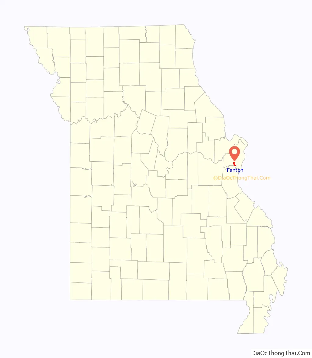
Fenton location map. Where is Fenton city?

History
Due to its proximity to fertile land and the Meramec River, the Fenton area has been inhabited for over 900 years. The earliest proof of ancient dwellers was excavated from the “Fenton Mounds”, two conical earthen burial mounds located near the southwestern border of Fenton. Diagnostic pottery shards from the mounds indicate they date from the Mississippian times, A.D. 1050 – 1400. In 2001, the mounds were leveled, by developer Gary Grewe, for construction of a Walmart Supercenter.
The Fenton territory was occupied by Native Americans and early settlers in the 1770s, but now it is owned by Edward Barton. William Lindsay Long founded the city of Fenton on March 23, 1818. The original eight-square-block area is now referred to as “Old Towne Fenton”. The city remained unincorporated for the next 130 years. Garrett Hitzert was the city’s first mayor after incorporation in 1948, and his leadership helped build the foundation that much of the city’s ongoing prosperity has been based on. He conceived of Fenton’s expansive commercial business and industrial district that is a centerpiece of the city’s fiscal success.
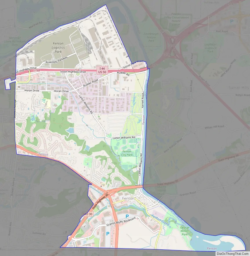
Fenton Road Map
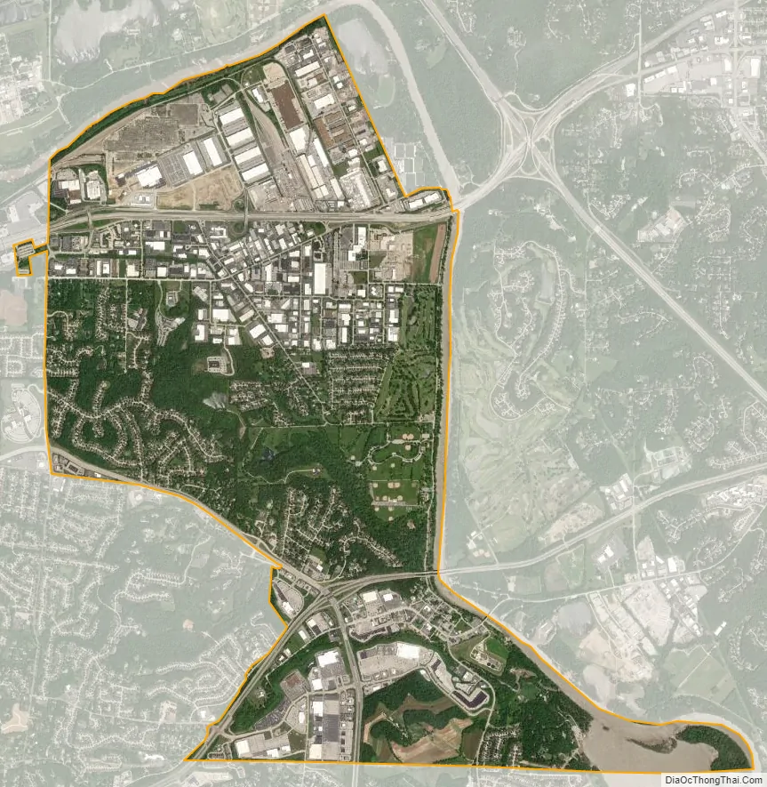
Fenton city Satellite Map
Geography
Fenton is located approximately two miles south of I-44 along the west bank of the Meramec River. The intersection of Missouri routes 30 and 141 lies just to the west.
According to the United States Census Bureau, the city has a total area of 6.38 square miles (16.52 km), of which 6.05 square miles (15.67 km) is land and 0.33 square miles (0.85 km) is water.
See also
Map of Missouri State and its subdivision:- Adair
- Andrew
- Atchison
- Audrain
- Barry
- Barton
- Bates
- Benton
- Bollinger
- Boone
- Buchanan
- Butler
- Caldwell
- Callaway
- Camden
- Cape Girardeau
- Carroll
- Carter
- Cass
- Cedar
- Chariton
- Christian
- Clark
- Clay
- Clinton
- Cole
- Cooper
- Crawford
- Dade
- Dallas
- Daviess
- De Kalb
- Dent
- Douglas
- Dunklin
- Franklin
- Gasconade
- Gentry
- Greene
- Grundy
- Harrison
- Henry
- Hickory
- Holt
- Howard
- Howell
- Iron
- Jackson
- Jasper
- Jefferson
- Johnson
- Knox
- Laclede
- Lafayette
- Lawrence
- Lewis
- Lincoln
- Linn
- Livingston
- Macon
- Madison
- Maries
- Marion
- McDonald
- Mercer
- Miller
- Mississippi
- Moniteau
- Monroe
- Montgomery
- Morgan
- New Madrid
- Newton
- Nodaway
- Oregon
- Osage
- Ozark
- Pemiscot
- Perry
- Pettis
- Phelps
- Pike
- Platte
- Polk
- Pulaski
- Putnam
- Ralls
- Randolph
- Ray
- Reynolds
- Ripley
- Saint Charles
- Saint Clair
- Saint Francois
- Saint Louis
- Sainte Genevieve
- Saline
- Schuyler
- Scotland
- Scott
- Shannon
- Shelby
- Stoddard
- Stone
- Sullivan
- Taney
- Texas
- Vernon
- Warren
- Washington
- Wayne
- Webster
- Worth
- Wright
- Alabama
- Alaska
- Arizona
- Arkansas
- California
- Colorado
- Connecticut
- Delaware
- District of Columbia
- Florida
- Georgia
- Hawaii
- Idaho
- Illinois
- Indiana
- Iowa
- Kansas
- Kentucky
- Louisiana
- Maine
- Maryland
- Massachusetts
- Michigan
- Minnesota
- Mississippi
- Missouri
- Montana
- Nebraska
- Nevada
- New Hampshire
- New Jersey
- New Mexico
- New York
- North Carolina
- North Dakota
- Ohio
- Oklahoma
- Oregon
- Pennsylvania
- Rhode Island
- South Carolina
- South Dakota
- Tennessee
- Texas
- Utah
- Vermont
- Virginia
- Washington
- West Virginia
- Wisconsin
- Wyoming


