Festus is a city situated in Jefferson County, Missouri, United States, and is also a suburb of St. Louis. It had a population of 12,706 individuals as of the 2020 census.
| Name: | Festus city |
|---|---|
| LSAD Code: | 25 |
| LSAD Description: | city (suffix) |
| State: | Missouri |
| County: | Jefferson County |
| Incorporated: | 1887 |
| Elevation: | 512 ft (156 m) |
| Total Area: | 5.91 sq mi (15.29 km²) |
| Land Area: | 5.91 sq mi (15.29 km²) |
| Water Area: | 0.00 sq mi (0.00 km²) |
| Total Population: | 12,706 |
| Population Density: | 2,151.74/sq mi (830.83/km²) |
| ZIP code: | 63028 |
| Area code: | 636 |
| FIPS code: | 2924094 |
| GNISfeature ID: | 2394763 |
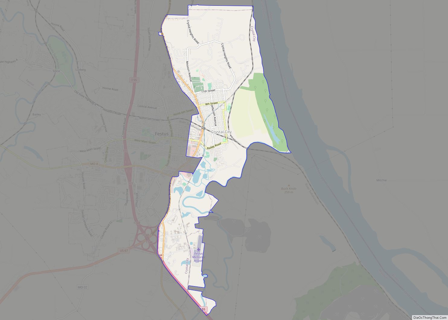
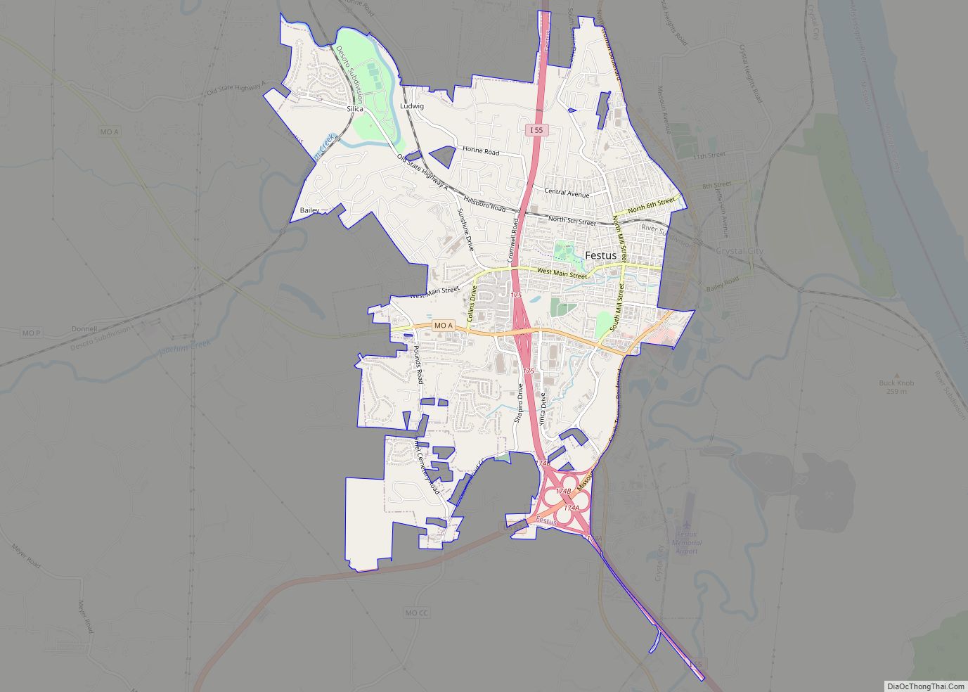
Online Interactive Map
Click on ![]() to view map in "full screen" mode.
to view map in "full screen" mode.
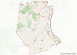
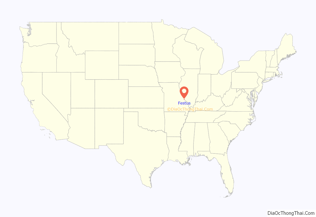
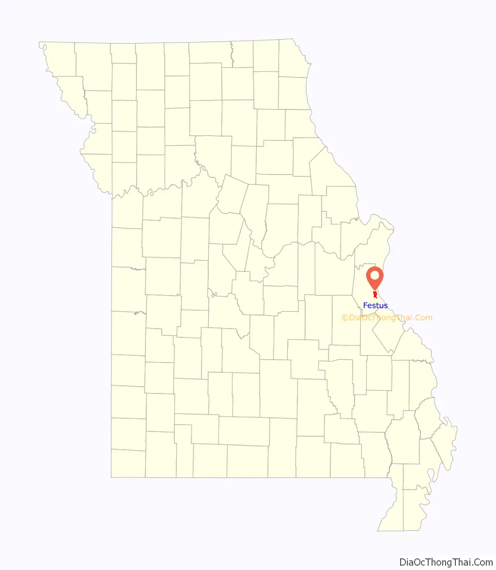
Festus location map. Where is Festus city?
History
Festus originated as an outgrowth of older neighbour Crystal City. It was established in 1878 by an individual named W. J. Adams, and was known as “Tanglefoot”, supposedly because of situations involving drinkers from the local glass factory, who would drunkenly get their feet tangled in brush on their way home. The city was later called Limitville, but eventually “Festus” was chosen, purported to be in honor of St. Louis banker, Festus J. Wade. Others claim the town’s name was picked at random by a preacher who sat there, opened the Bible, and pointed to the name “Festus” in the Book of Acts. The City of Festus was incorporated in 1888 and grew to be one of the largest towns in the county. A post office called Festus has been in operation since 1883.
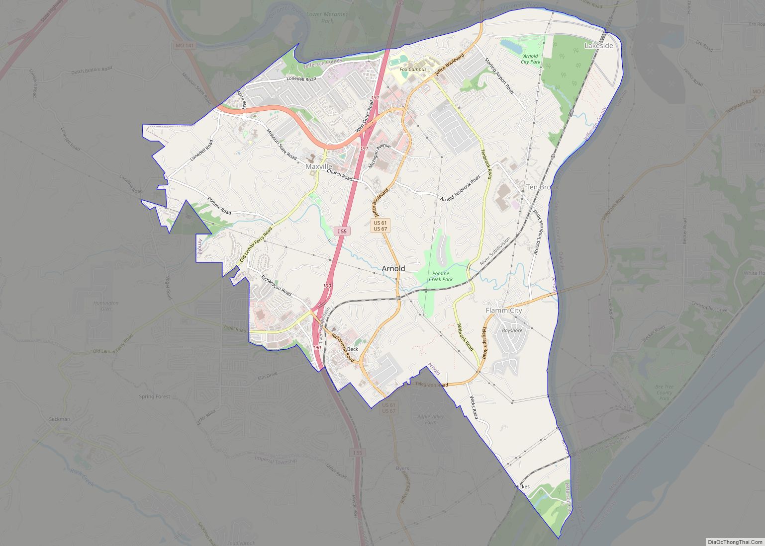
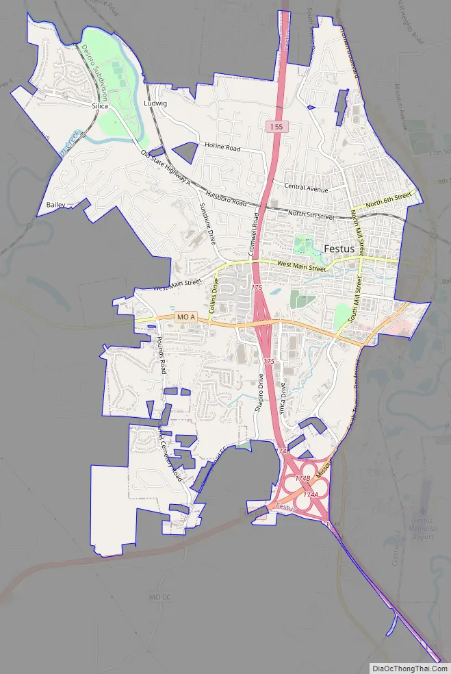
Festus Road Map
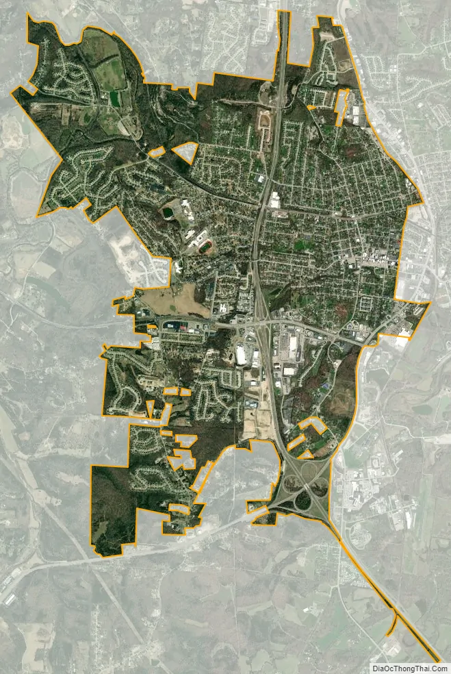
Festus city Satellite Map
Geography
Festus is situated just west of the Mississippi River. The city is served by I-55 and US routes 61 and 67.
According to the United States Census Bureau, the city has a total area of 5.71 square miles (14.79 km), all land.
Climate
See also
Map of Missouri State and its subdivision:- Adair
- Andrew
- Atchison
- Audrain
- Barry
- Barton
- Bates
- Benton
- Bollinger
- Boone
- Buchanan
- Butler
- Caldwell
- Callaway
- Camden
- Cape Girardeau
- Carroll
- Carter
- Cass
- Cedar
- Chariton
- Christian
- Clark
- Clay
- Clinton
- Cole
- Cooper
- Crawford
- Dade
- Dallas
- Daviess
- De Kalb
- Dent
- Douglas
- Dunklin
- Franklin
- Gasconade
- Gentry
- Greene
- Grundy
- Harrison
- Henry
- Hickory
- Holt
- Howard
- Howell
- Iron
- Jackson
- Jasper
- Jefferson
- Johnson
- Knox
- Laclede
- Lafayette
- Lawrence
- Lewis
- Lincoln
- Linn
- Livingston
- Macon
- Madison
- Maries
- Marion
- McDonald
- Mercer
- Miller
- Mississippi
- Moniteau
- Monroe
- Montgomery
- Morgan
- New Madrid
- Newton
- Nodaway
- Oregon
- Osage
- Ozark
- Pemiscot
- Perry
- Pettis
- Phelps
- Pike
- Platte
- Polk
- Pulaski
- Putnam
- Ralls
- Randolph
- Ray
- Reynolds
- Ripley
- Saint Charles
- Saint Clair
- Saint Francois
- Saint Louis
- Sainte Genevieve
- Saline
- Schuyler
- Scotland
- Scott
- Shannon
- Shelby
- Stoddard
- Stone
- Sullivan
- Taney
- Texas
- Vernon
- Warren
- Washington
- Wayne
- Webster
- Worth
- Wright
- Alabama
- Alaska
- Arizona
- Arkansas
- California
- Colorado
- Connecticut
- Delaware
- District of Columbia
- Florida
- Georgia
- Hawaii
- Idaho
- Illinois
- Indiana
- Iowa
- Kansas
- Kentucky
- Louisiana
- Maine
- Maryland
- Massachusetts
- Michigan
- Minnesota
- Mississippi
- Missouri
- Montana
- Nebraska
- Nevada
- New Hampshire
- New Jersey
- New Mexico
- New York
- North Carolina
- North Dakota
- Ohio
- Oklahoma
- Oregon
- Pennsylvania
- Rhode Island
- South Carolina
- South Dakota
- Tennessee
- Texas
- Utah
- Vermont
- Virginia
- Washington
- West Virginia
- Wisconsin
- Wyoming