Freistatt is a village in Lawrence County, Missouri, United States. The population was 163 at the 2010 census.
| Name: | Freistatt village |
|---|---|
| LSAD Code: | 47 |
| LSAD Description: | village (suffix) |
| State: | Missouri |
| County: | Lawrence County |
| Founded: | 1873 |
| Incorporated: | 1884 |
| Elevation: | 1,339 ft (408 m) |
| Total Area: | 0.21 sq mi (0.55 km²) |
| Land Area: | 0.21 sq mi (0.55 km²) |
| Water Area: | 0.00 sq mi (0.00 km²) |
| Total Population: | 179 |
| Population Density: | 844.34/sq mi (326.22/km²) |
| ZIP code: | 65654 |
| Area code: | 417 |
| FIPS code: | 2925912 |
| GNISfeature ID: | 0718213 |
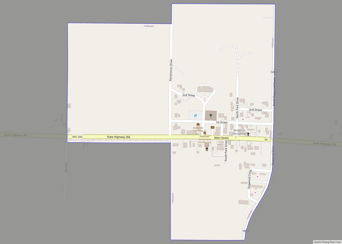
Online Interactive Map
Click on ![]() to view map in "full screen" mode.
to view map in "full screen" mode.
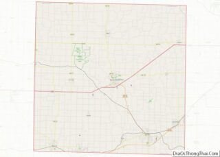
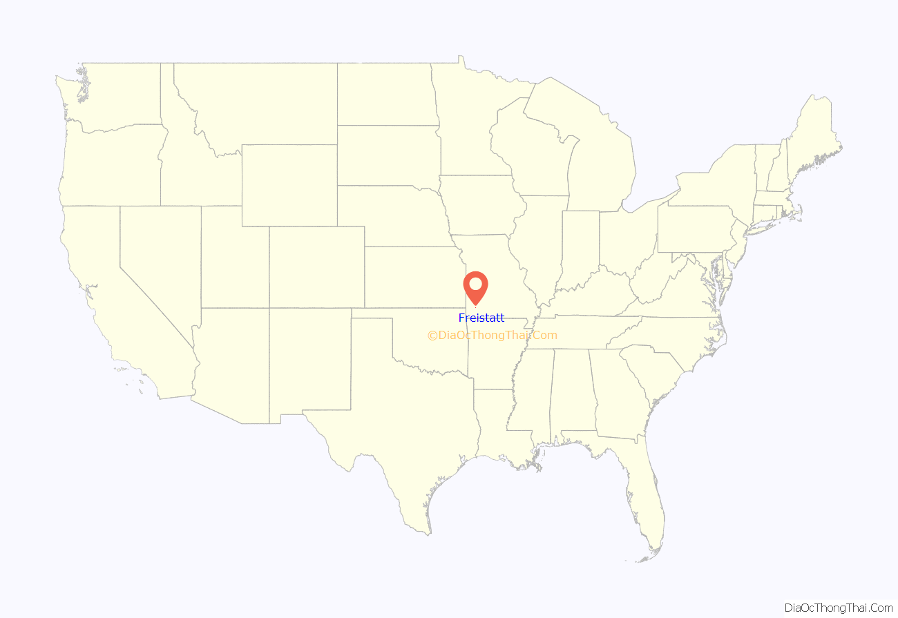
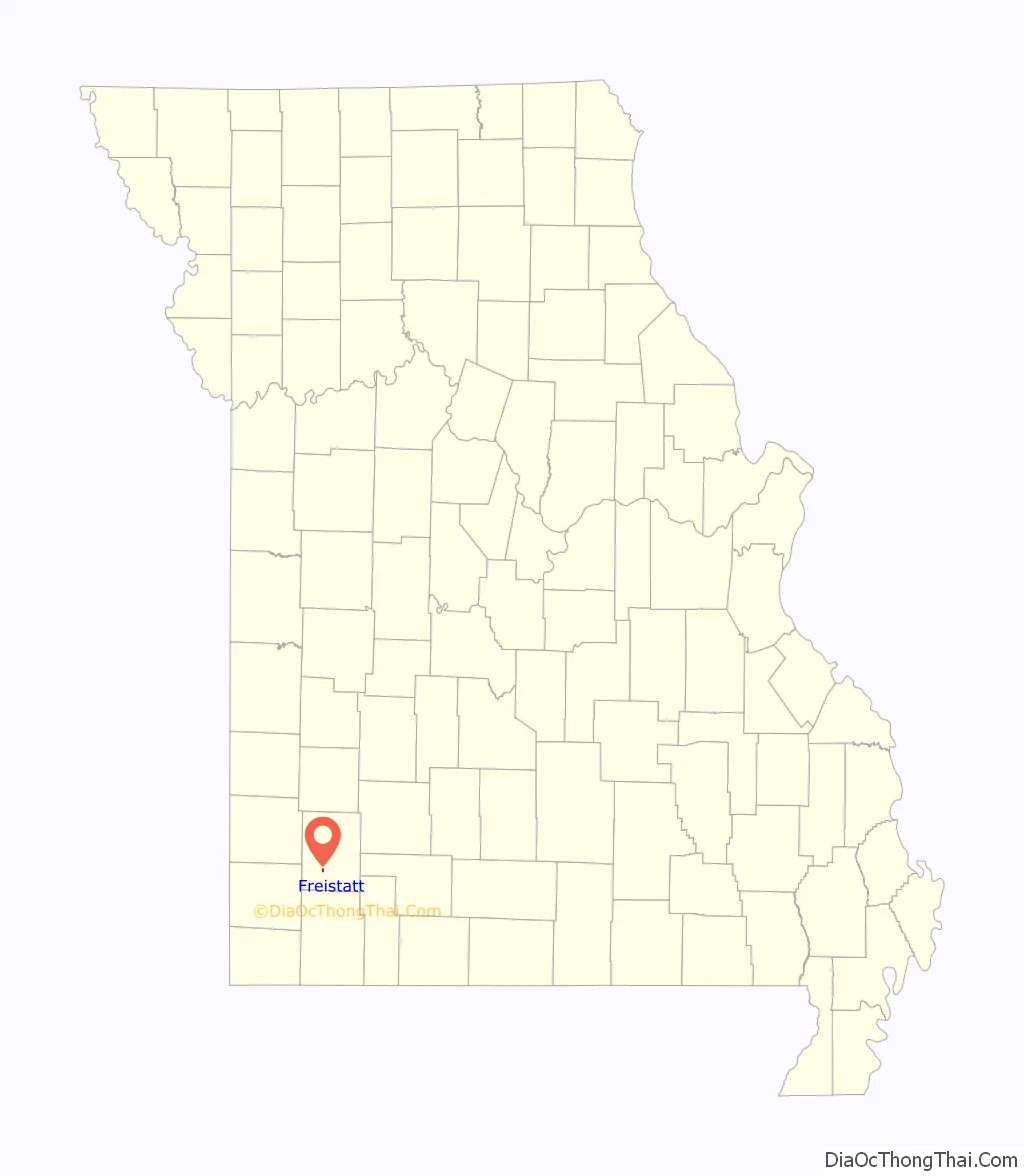
Freistatt location map. Where is Freistatt village?
History
Freistatt was laid out in 1873. The community was named by German settlers after the town of Freistatt in Lower Saxony, Germany. The settlers established Trinity Lutheran Church in 1874 and opened a Lutheran school in 1875, both of which remain important institutions in the village. The Freistatt post office was in operation from 1884 until 2013. It is now a private residence.
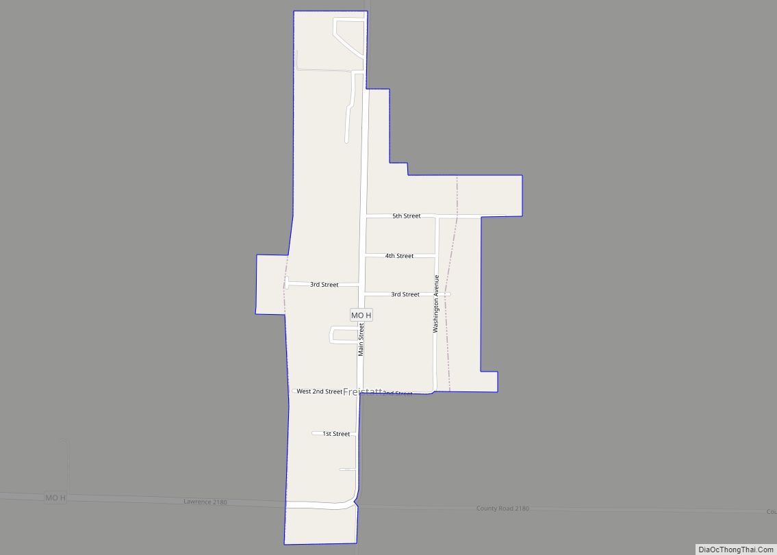
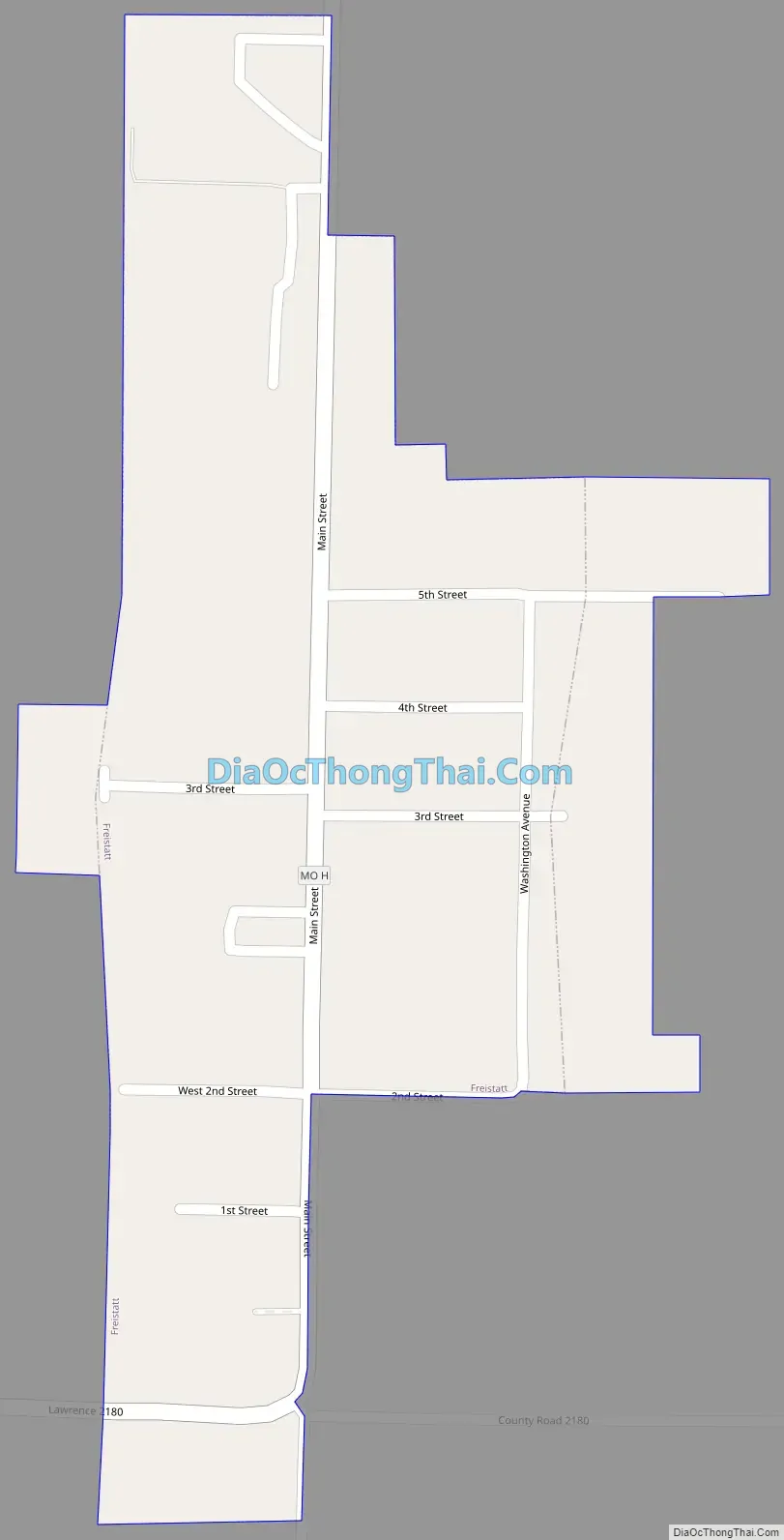
Freistatt Road Map
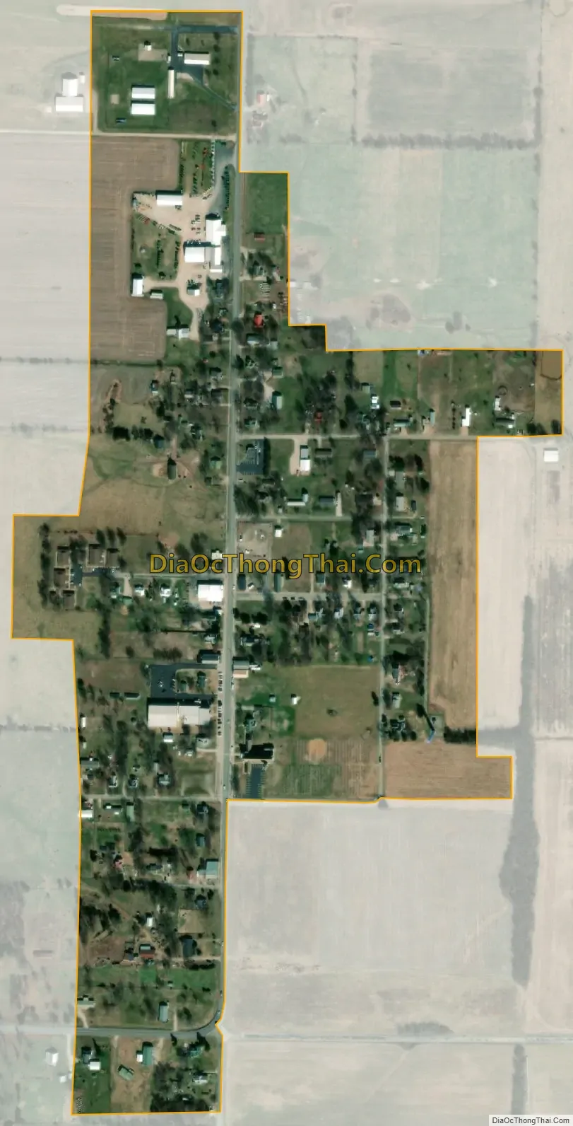
Freistatt city Satellite Map
Geography
Freistatt is located at 37°1′17″N 93°53′47″W / 37.02139°N 93.89639°W / 37.02139; -93.89639 (37.021322, -93.896449).
According to the United States Census Bureau, the village has a total area of 0.21 square miles (0.54 km), all land.
See also
Map of Missouri State and its subdivision:- Adair
- Andrew
- Atchison
- Audrain
- Barry
- Barton
- Bates
- Benton
- Bollinger
- Boone
- Buchanan
- Butler
- Caldwell
- Callaway
- Camden
- Cape Girardeau
- Carroll
- Carter
- Cass
- Cedar
- Chariton
- Christian
- Clark
- Clay
- Clinton
- Cole
- Cooper
- Crawford
- Dade
- Dallas
- Daviess
- De Kalb
- Dent
- Douglas
- Dunklin
- Franklin
- Gasconade
- Gentry
- Greene
- Grundy
- Harrison
- Henry
- Hickory
- Holt
- Howard
- Howell
- Iron
- Jackson
- Jasper
- Jefferson
- Johnson
- Knox
- Laclede
- Lafayette
- Lawrence
- Lewis
- Lincoln
- Linn
- Livingston
- Macon
- Madison
- Maries
- Marion
- McDonald
- Mercer
- Miller
- Mississippi
- Moniteau
- Monroe
- Montgomery
- Morgan
- New Madrid
- Newton
- Nodaway
- Oregon
- Osage
- Ozark
- Pemiscot
- Perry
- Pettis
- Phelps
- Pike
- Platte
- Polk
- Pulaski
- Putnam
- Ralls
- Randolph
- Ray
- Reynolds
- Ripley
- Saint Charles
- Saint Clair
- Saint Francois
- Saint Louis
- Sainte Genevieve
- Saline
- Schuyler
- Scotland
- Scott
- Shannon
- Shelby
- Stoddard
- Stone
- Sullivan
- Taney
- Texas
- Vernon
- Warren
- Washington
- Wayne
- Webster
- Worth
- Wright
- Alabama
- Alaska
- Arizona
- Arkansas
- California
- Colorado
- Connecticut
- Delaware
- District of Columbia
- Florida
- Georgia
- Hawaii
- Idaho
- Illinois
- Indiana
- Iowa
- Kansas
- Kentucky
- Louisiana
- Maine
- Maryland
- Massachusetts
- Michigan
- Minnesota
- Mississippi
- Missouri
- Montana
- Nebraska
- Nevada
- New Hampshire
- New Jersey
- New Mexico
- New York
- North Carolina
- North Dakota
- Ohio
- Oklahoma
- Oregon
- Pennsylvania
- Rhode Island
- South Carolina
- South Dakota
- Tennessee
- Texas
- Utah
- Vermont
- Virginia
- Washington
- West Virginia
- Wisconsin
- Wyoming