Glenwood is a village in Schuyler County, Missouri, United States. As of the 2020 census, its population was 181. It is part of the Kirksville Micropolitan Statistical Area.
| Name: | Glenwood village |
|---|---|
| LSAD Code: | 47 |
| LSAD Description: | village (suffix) |
| State: | Missouri |
| County: | Schuyler County |
| Elevation: | 945 ft (288 m) |
| Total Area: | 0.74 sq mi (1.92 km²) |
| Land Area: | 0.74 sq mi (1.91 km²) |
| Water Area: | 0.00 sq mi (0.01 km²) |
| Total Population: | 181 |
| Population Density: | 245.26/sq mi (94.73/km²) |
| ZIP code: | 63541 |
| Area code: | 660 |
| FIPS code: | 2927514 |
| GNISfeature ID: | 2398980 |
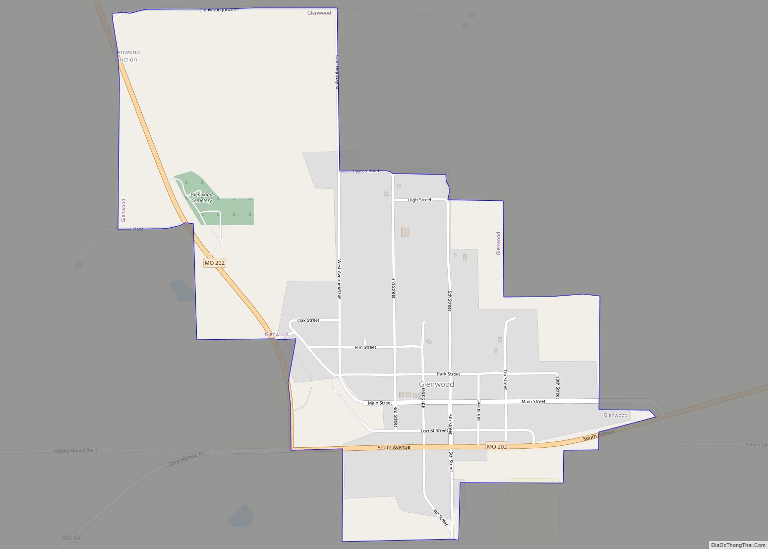
Online Interactive Map
Click on ![]() to view map in "full screen" mode.
to view map in "full screen" mode.
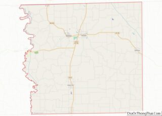
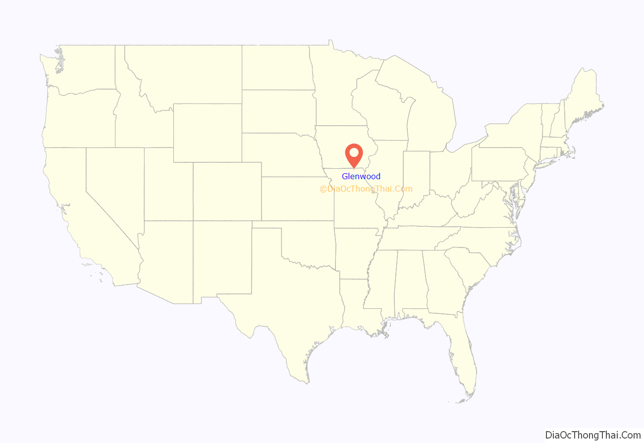
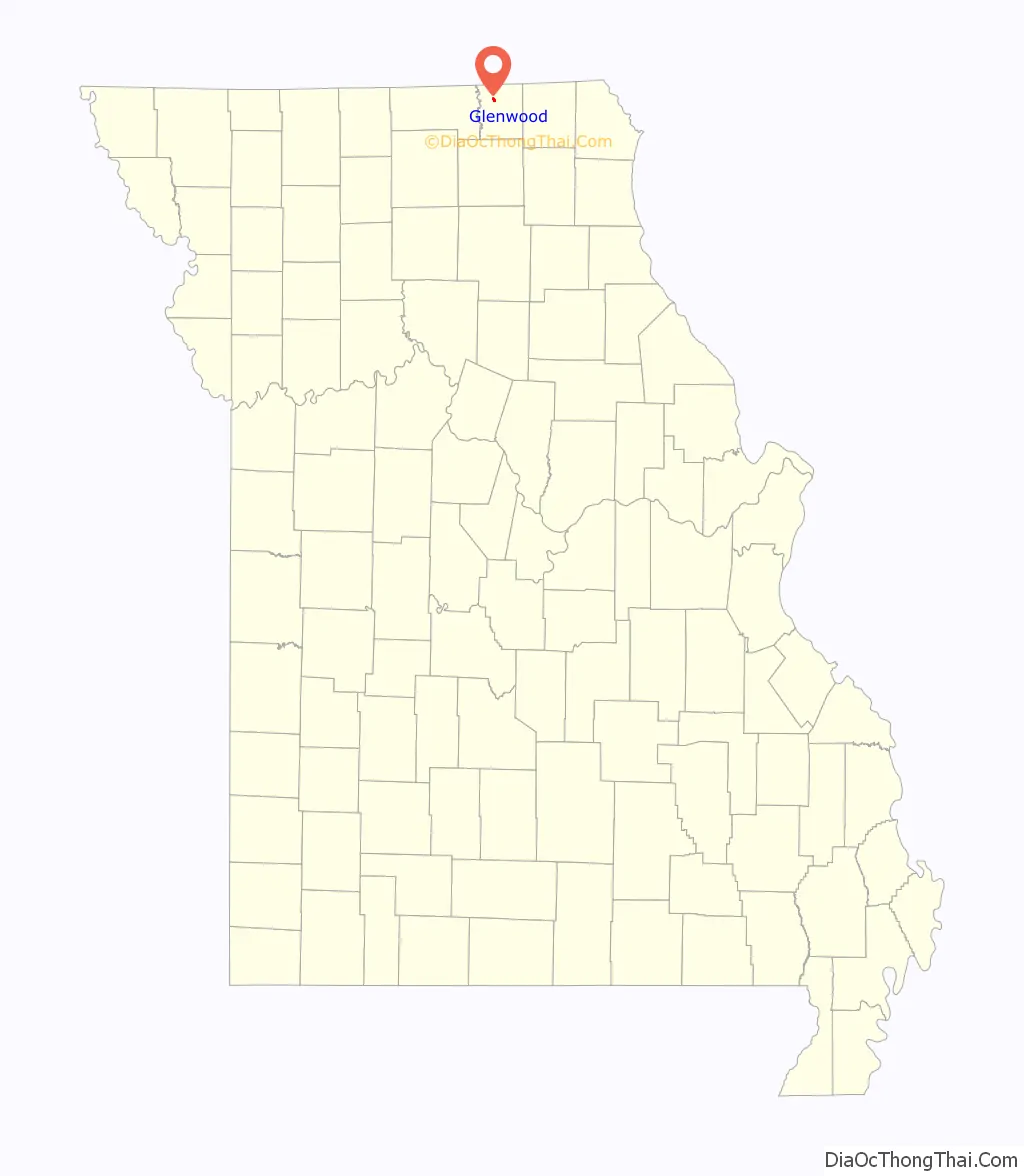
Glenwood location map. Where is Glenwood village?
History
The town of Glenwood was laid out by Alexander and Stiles Forsha in November, 1868 with the plat consisting of a town square and forty-four other blocks. The first home had been built in the town the previous month by John B. Glaze. By 1869, a schoolhouse had been constructed as well as a two-story block of brick buildings with room for four businesses. Being at the crossing point of two railroads, the St. Louis, Kansas City & Nebraska Railroad and the Keokuk & Western railway, Glenwood saw rapid early growth. By 1873, the town included a large woolen factory, a flour mill, foundry, machine shop, wagon factory and a multitude of other businesses. The Glenwood Citerion newspaper began publication in 1870 and Logan’s Bank, the town’s first, was established in 1875.
On July 26, 2011 the United States Postal Service announced plans to permanently close the Glenwood post office as part of a nationwide restructuring plan.
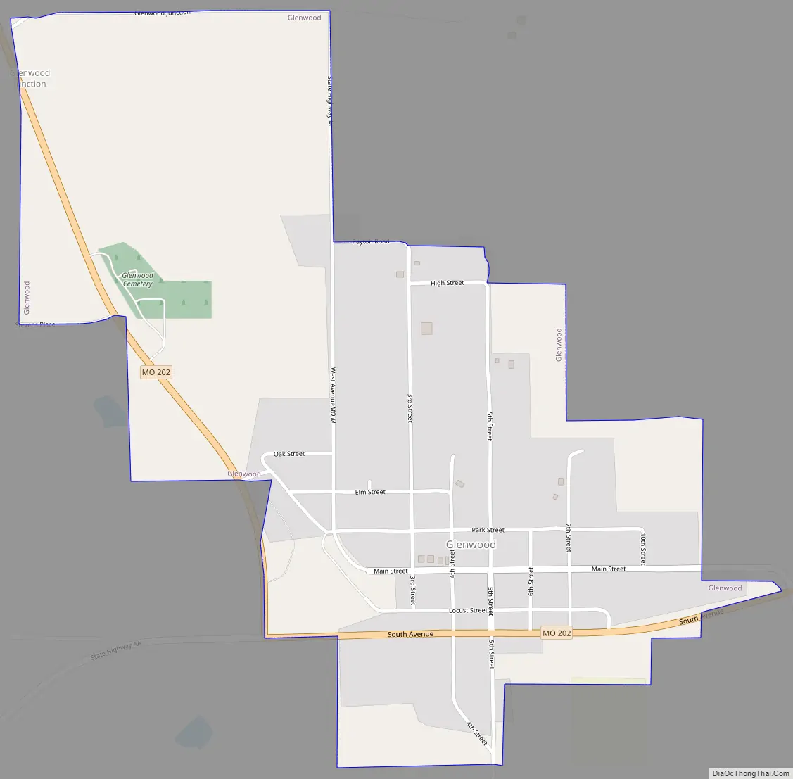
Glenwood Road Map
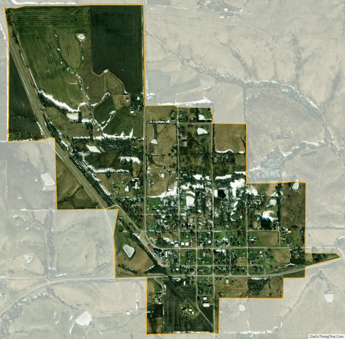
Glenwood city Satellite Map
Geography
According to the United States Census Bureau, the village has a total area of 0.74 square miles (1.92 km), all land.
See also
Map of Missouri State and its subdivision:- Adair
- Andrew
- Atchison
- Audrain
- Barry
- Barton
- Bates
- Benton
- Bollinger
- Boone
- Buchanan
- Butler
- Caldwell
- Callaway
- Camden
- Cape Girardeau
- Carroll
- Carter
- Cass
- Cedar
- Chariton
- Christian
- Clark
- Clay
- Clinton
- Cole
- Cooper
- Crawford
- Dade
- Dallas
- Daviess
- De Kalb
- Dent
- Douglas
- Dunklin
- Franklin
- Gasconade
- Gentry
- Greene
- Grundy
- Harrison
- Henry
- Hickory
- Holt
- Howard
- Howell
- Iron
- Jackson
- Jasper
- Jefferson
- Johnson
- Knox
- Laclede
- Lafayette
- Lawrence
- Lewis
- Lincoln
- Linn
- Livingston
- Macon
- Madison
- Maries
- Marion
- McDonald
- Mercer
- Miller
- Mississippi
- Moniteau
- Monroe
- Montgomery
- Morgan
- New Madrid
- Newton
- Nodaway
- Oregon
- Osage
- Ozark
- Pemiscot
- Perry
- Pettis
- Phelps
- Pike
- Platte
- Polk
- Pulaski
- Putnam
- Ralls
- Randolph
- Ray
- Reynolds
- Ripley
- Saint Charles
- Saint Clair
- Saint Francois
- Saint Louis
- Sainte Genevieve
- Saline
- Schuyler
- Scotland
- Scott
- Shannon
- Shelby
- Stoddard
- Stone
- Sullivan
- Taney
- Texas
- Vernon
- Warren
- Washington
- Wayne
- Webster
- Worth
- Wright
- Alabama
- Alaska
- Arizona
- Arkansas
- California
- Colorado
- Connecticut
- Delaware
- District of Columbia
- Florida
- Georgia
- Hawaii
- Idaho
- Illinois
- Indiana
- Iowa
- Kansas
- Kentucky
- Louisiana
- Maine
- Maryland
- Massachusetts
- Michigan
- Minnesota
- Mississippi
- Missouri
- Montana
- Nebraska
- Nevada
- New Hampshire
- New Jersey
- New Mexico
- New York
- North Carolina
- North Dakota
- Ohio
- Oklahoma
- Oregon
- Pennsylvania
- Rhode Island
- South Carolina
- South Dakota
- Tennessee
- Texas
- Utah
- Vermont
- Virginia
- Washington
- West Virginia
- Wisconsin
- Wyoming