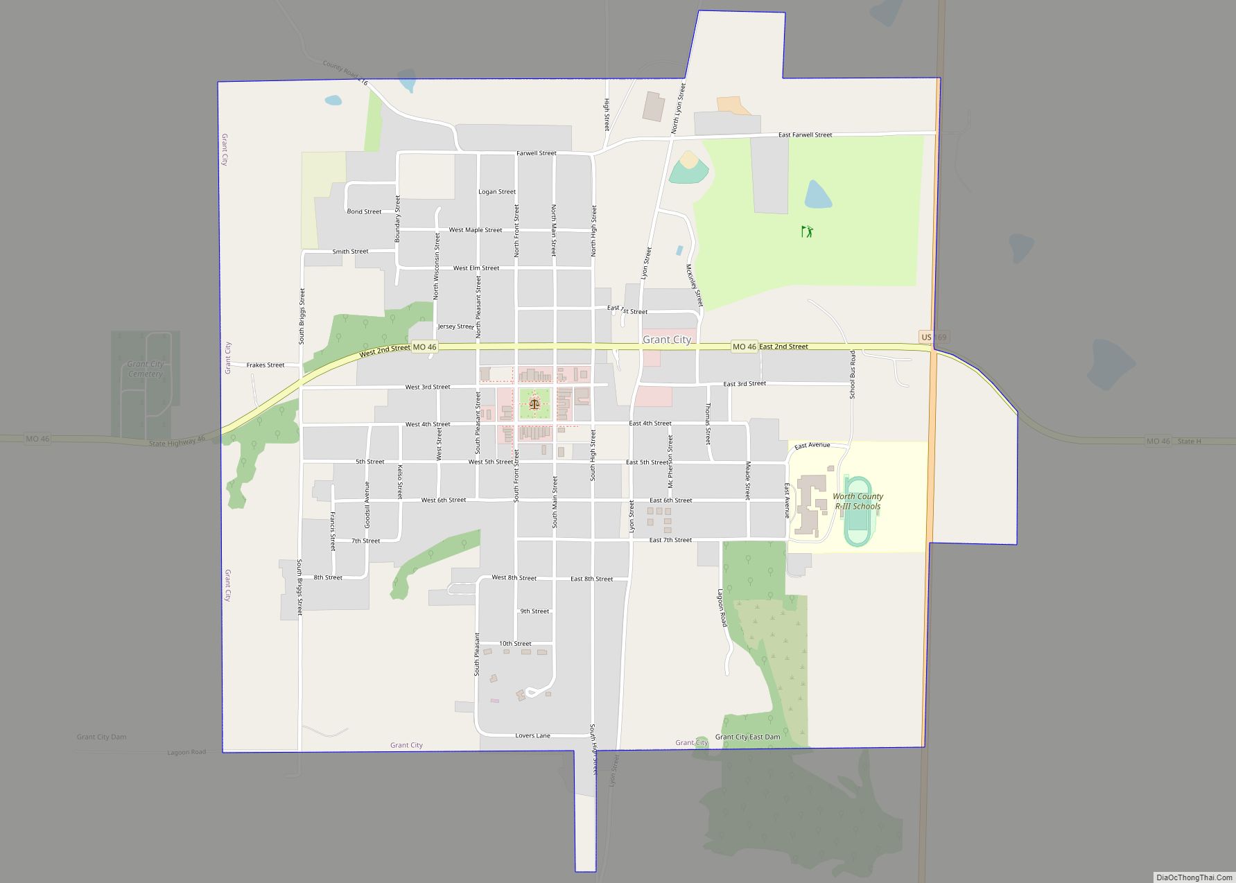
Grant City is a city in, and the county seat of, Worth County, Missouri, United States. The population was 859 at the 2010 census.
| Name: | Grant City town |
|---|---|
| LSAD Code: | 43 |
| LSAD Description: | town (suffix) |
| State: | Missouri |
| County: | Worth County |
| Elevation: | 1,132 ft (345 m) |
| Total Area: | 1.33 sq mi (3.44 km²) |
| Land Area: | 1.33 sq mi (3.44 km²) |
| Water Area: | 0.00 sq mi (0.00 km²) |
| Total Population: | 817 |
| Population Density: | 614.75/sq mi (237.33/km²) |
| ZIP code: | 64456 |
| Area code: | 660 |
| FIPS code: | 2928594 |
| GNISfeature ID: | 2396971 |
| Website: | http://www.grantcity.us/ |
Online Interactive Map
Click on ![]() to view map in "full screen" mode.
to view map in "full screen" mode.
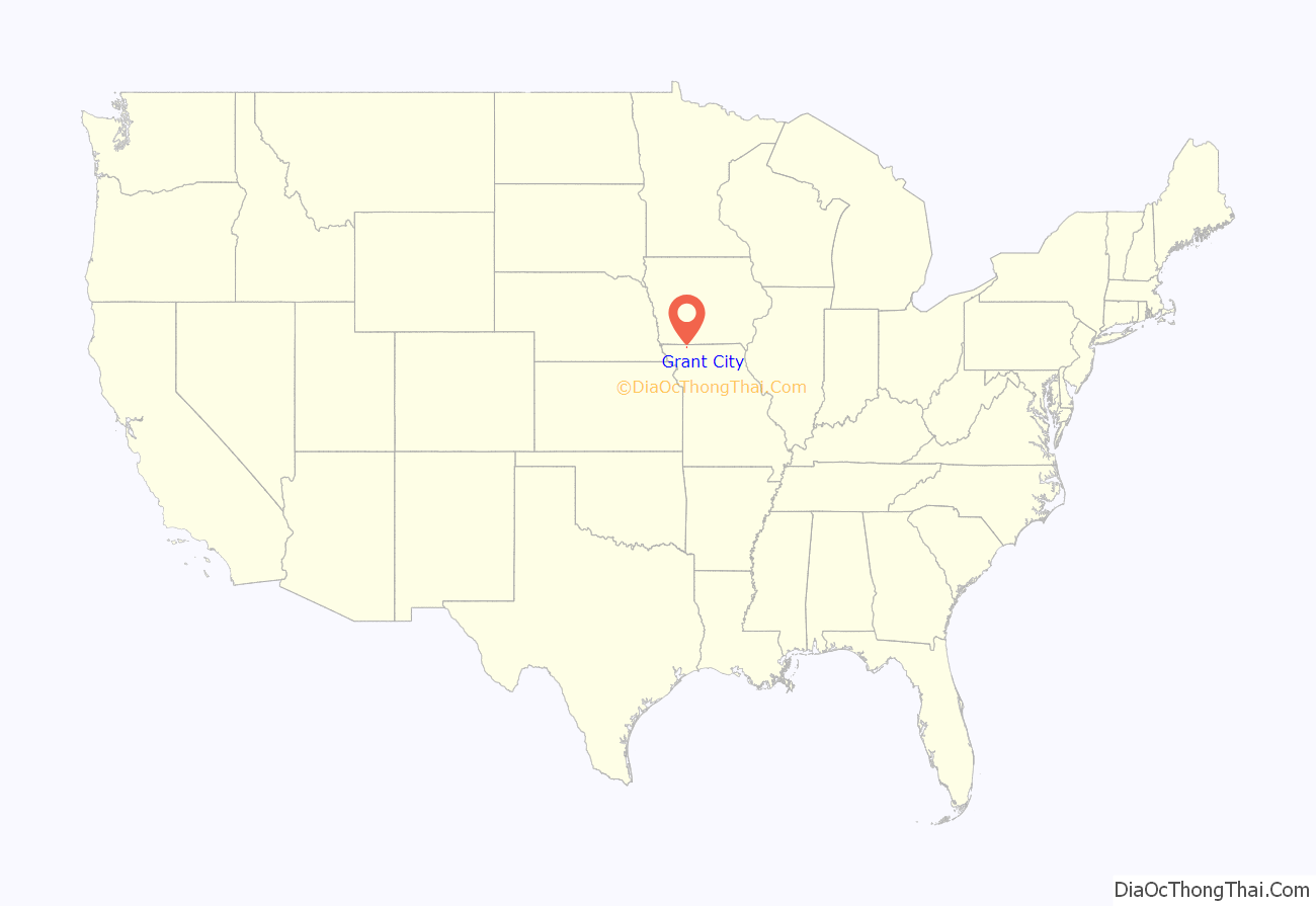
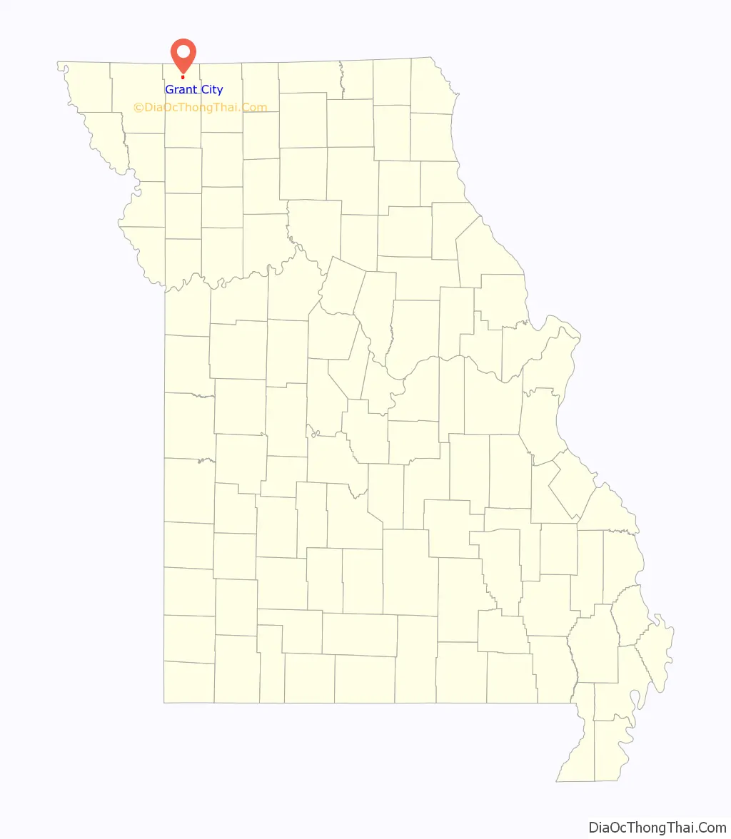
Grant City location map. Where is Grant City town?
History
Grant City was laid out in 1864. The community has the name of General Ulysses S. Grant, afterward 18th President of the United States (1869–77). A post office called Grant City has been in operation since 1864.
The Worth County Courthouse was listed on the National Register of Historic Places in 1983.
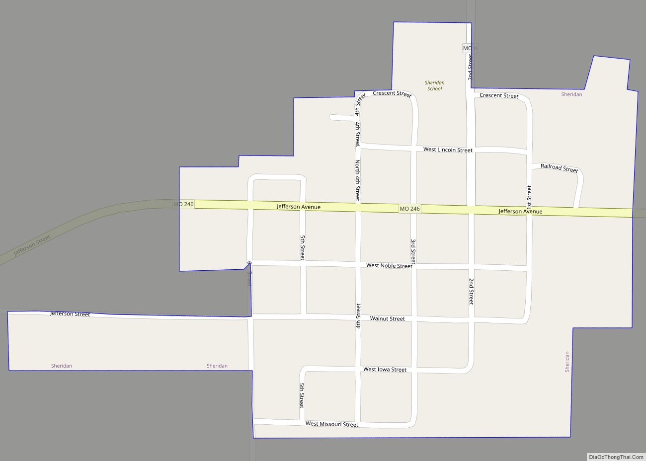
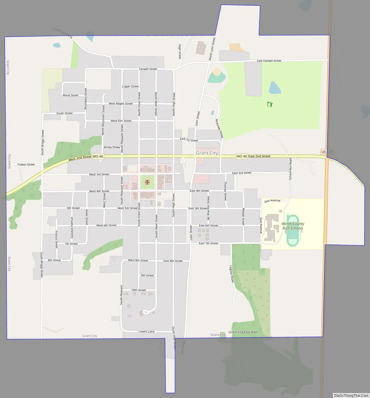
Grant City Road Map
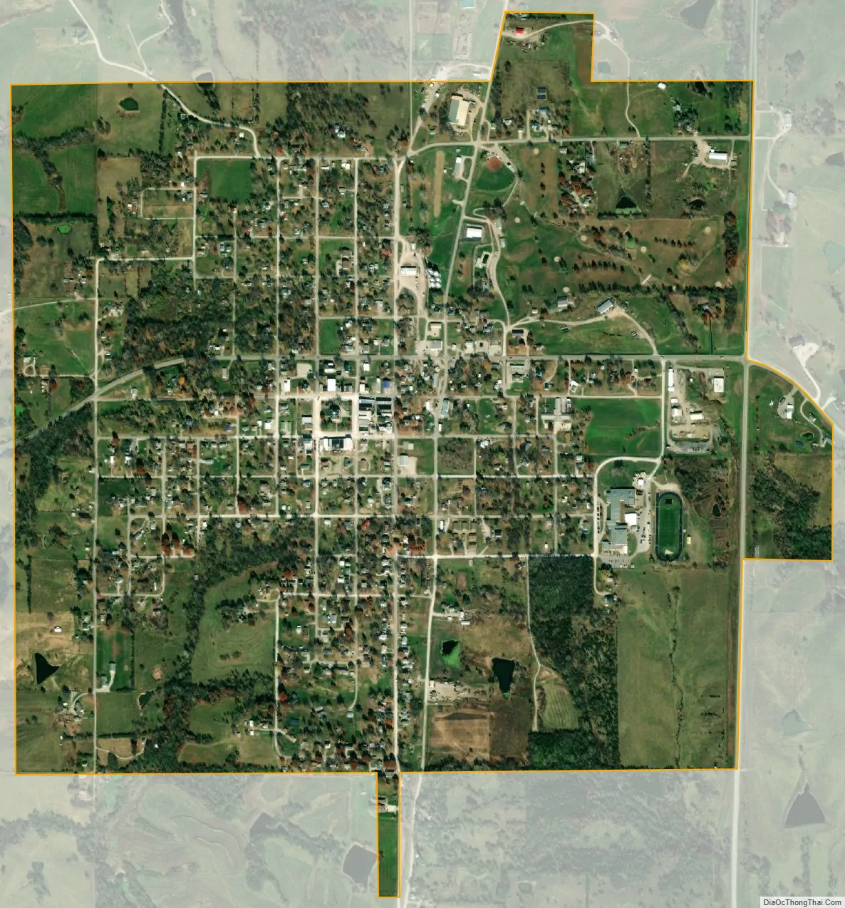
Grant City city Satellite Map
Geography
Grant City is located at the intersection of U. S. Route 169 and Missouri Route 46 and about one mile west of the Middle Fork of the Grand River.
According to the United States Census Bureau, the city has a total area of 1.33 square miles (3.44 km), all land.
See also
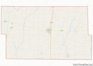
Map of Missouri State and its subdivision:- Adair
- Andrew
- Atchison
- Audrain
- Barry
- Barton
- Bates
- Benton
- Bollinger
- Boone
- Buchanan
- Butler
- Caldwell
- Callaway
- Camden
- Cape Girardeau
- Carroll
- Carter
- Cass
- Cedar
- Chariton
- Christian
- Clark
- Clay
- Clinton
- Cole
- Cooper
- Crawford
- Dade
- Dallas
- Daviess
- De Kalb
- Dent
- Douglas
- Dunklin
- Franklin
- Gasconade
- Gentry
- Greene
- Grundy
- Harrison
- Henry
- Hickory
- Holt
- Howard
- Howell
- Iron
- Jackson
- Jasper
- Jefferson
- Johnson
- Knox
- Laclede
- Lafayette
- Lawrence
- Lewis
- Lincoln
- Linn
- Livingston
- Macon
- Madison
- Maries
- Marion
- McDonald
- Mercer
- Miller
- Mississippi
- Moniteau
- Monroe
- Montgomery
- Morgan
- New Madrid
- Newton
- Nodaway
- Oregon
- Osage
- Ozark
- Pemiscot
- Perry
- Pettis
- Phelps
- Pike
- Platte
- Polk
- Pulaski
- Putnam
- Ralls
- Randolph
- Ray
- Reynolds
- Ripley
- Saint Charles
- Saint Clair
- Saint Francois
- Saint Louis
- Sainte Genevieve
- Saline
- Schuyler
- Scotland
- Scott
- Shannon
- Shelby
- Stoddard
- Stone
- Sullivan
- Taney
- Texas
- Vernon
- Warren
- Washington
- Wayne
- Webster
- Worth
- Wright
- Alabama
- Alaska
- Arizona
- Arkansas
- California
- Colorado
- Connecticut
- Delaware
- District of Columbia
- Florida
- Georgia
- Hawaii
- Idaho
- Illinois
- Indiana
- Iowa
- Kansas
- Kentucky
- Louisiana
- Maine
- Maryland
- Massachusetts
- Michigan
- Minnesota
- Mississippi
- Missouri
- Montana
- Nebraska
- Nevada
- New Hampshire
- New Jersey
- New Mexico
- New York
- North Carolina
- North Dakota
- Ohio
- Oklahoma
- Oregon
- Pennsylvania
- Rhode Island
- South Carolina
- South Dakota
- Tennessee
- Texas
- Utah
- Vermont
- Virginia
- Washington
- West Virginia
- Wisconsin
- Wyoming