Greentop is a city in Adair and Schuyler counties, Missouri, United States. As of the 2020 census, its population was 388.
| Name: | Greentop city |
|---|---|
| LSAD Code: | 25 |
| LSAD Description: | city (suffix) |
| State: | Missouri |
| County: | Adair County, Schuyler County |
| Elevation: | 984 ft (300 m) |
| Total Area: | 0.82 sq mi (2.12 km²) |
| Land Area: | 0.82 sq mi (2.12 km²) |
| Water Area: | 0.00 sq mi (0.00 km²) |
| Total Population: | 388 |
| Population Density: | 474.91/sq mi (183.36/km²) |
| ZIP code: | 63546 |
| Area code: | 660 |
| FIPS code: | 2929422 |
| GNISfeature ID: | 2394993 |
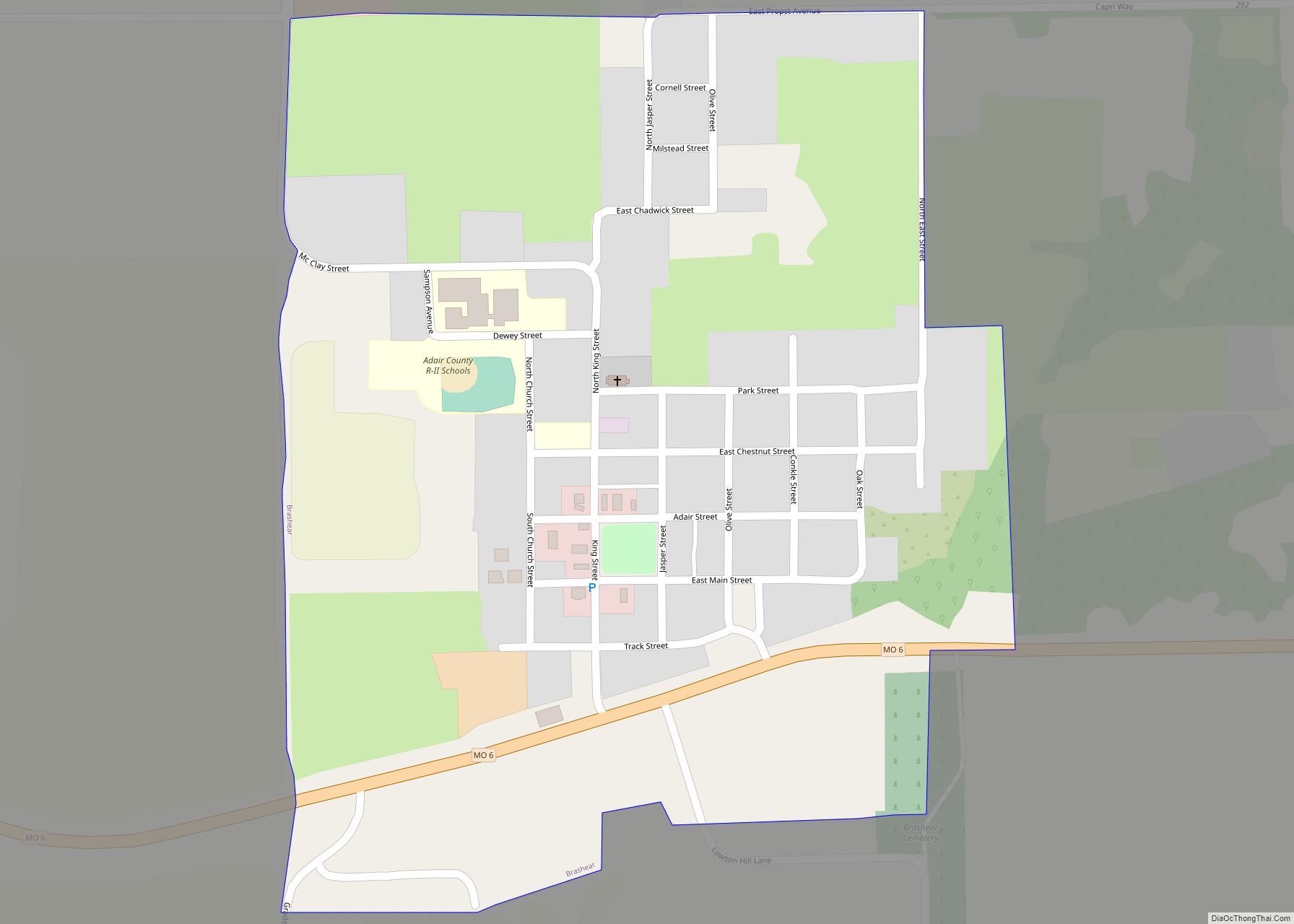
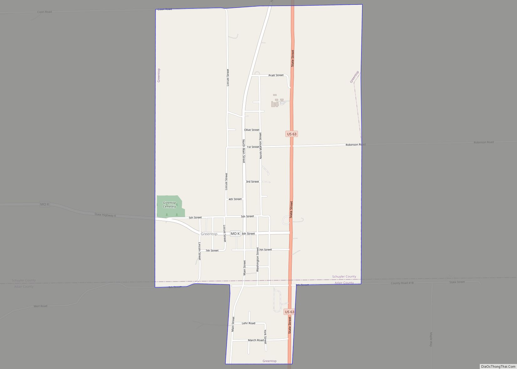
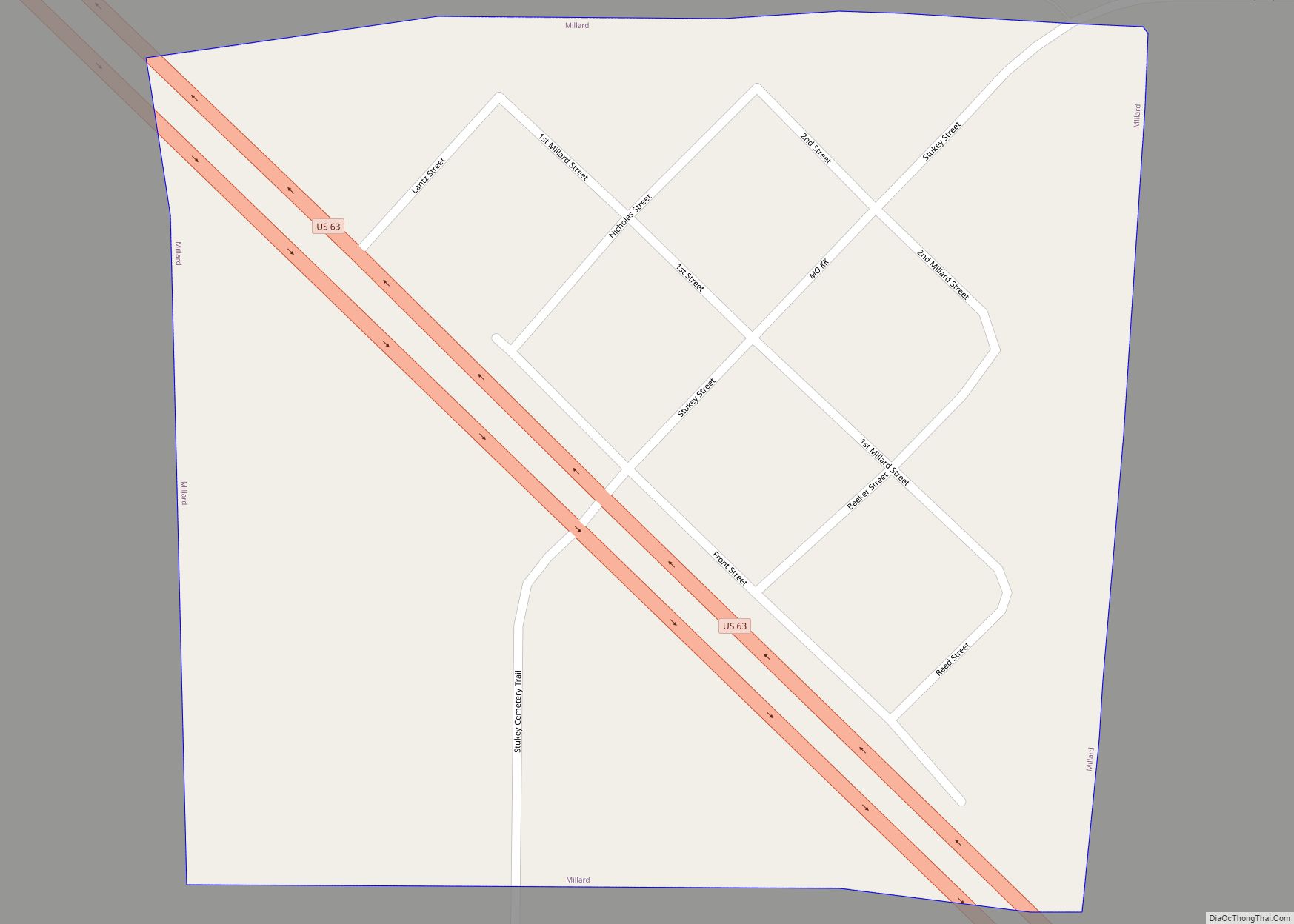
Online Interactive Map
Click on ![]() to view map in "full screen" mode.
to view map in "full screen" mode.
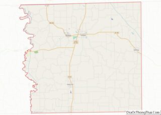
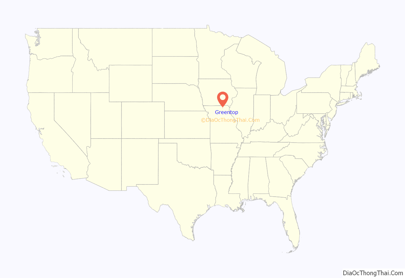
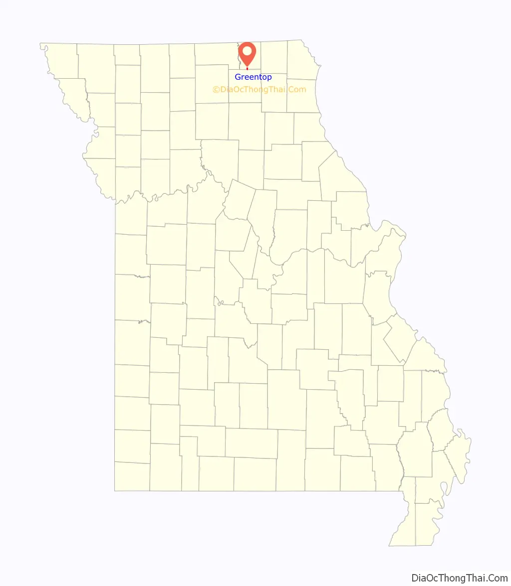
Greentop location map. Where is Greentop city?
History
Greentop is considered one of the oldest communities in Schuyler County, with its first settlement in the early 1840s. However, the town layout was not documented until 1855. A U.S. Post Office was established in 1857, and the town was finally incorporated in February 1867.
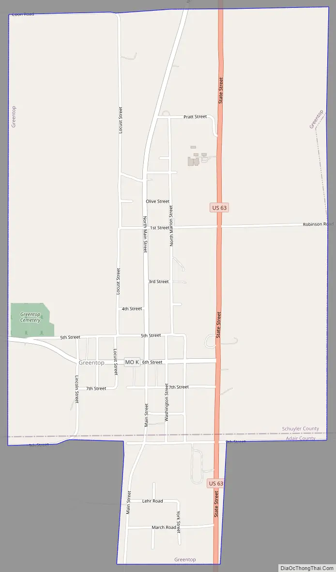
Greentop Road Map
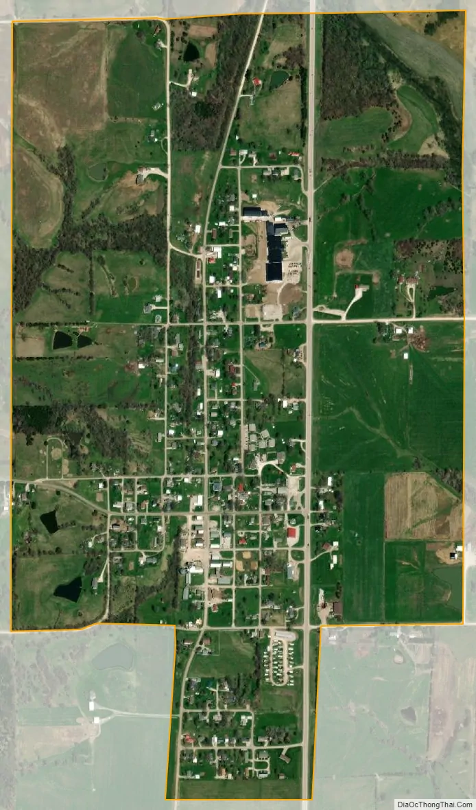
Greentop city Satellite Map
Geography
Greentop is located at 40°20′54″N 92°34′2″W / 40.34833°N 92.56722°W / 40.34833; -92.56722 (40.348360, -92.567281). According to the United States Census Bureau, the city has a total area of 0.82 square miles (2.12 km), all land. A residential portion lies in Adair County while the majority of the town, including the business district, is in Schuyler County.
See also
Map of Missouri State and its subdivision:- Adair
- Andrew
- Atchison
- Audrain
- Barry
- Barton
- Bates
- Benton
- Bollinger
- Boone
- Buchanan
- Butler
- Caldwell
- Callaway
- Camden
- Cape Girardeau
- Carroll
- Carter
- Cass
- Cedar
- Chariton
- Christian
- Clark
- Clay
- Clinton
- Cole
- Cooper
- Crawford
- Dade
- Dallas
- Daviess
- De Kalb
- Dent
- Douglas
- Dunklin
- Franklin
- Gasconade
- Gentry
- Greene
- Grundy
- Harrison
- Henry
- Hickory
- Holt
- Howard
- Howell
- Iron
- Jackson
- Jasper
- Jefferson
- Johnson
- Knox
- Laclede
- Lafayette
- Lawrence
- Lewis
- Lincoln
- Linn
- Livingston
- Macon
- Madison
- Maries
- Marion
- McDonald
- Mercer
- Miller
- Mississippi
- Moniteau
- Monroe
- Montgomery
- Morgan
- New Madrid
- Newton
- Nodaway
- Oregon
- Osage
- Ozark
- Pemiscot
- Perry
- Pettis
- Phelps
- Pike
- Platte
- Polk
- Pulaski
- Putnam
- Ralls
- Randolph
- Ray
- Reynolds
- Ripley
- Saint Charles
- Saint Clair
- Saint Francois
- Saint Louis
- Sainte Genevieve
- Saline
- Schuyler
- Scotland
- Scott
- Shannon
- Shelby
- Stoddard
- Stone
- Sullivan
- Taney
- Texas
- Vernon
- Warren
- Washington
- Wayne
- Webster
- Worth
- Wright
- Alabama
- Alaska
- Arizona
- Arkansas
- California
- Colorado
- Connecticut
- Delaware
- District of Columbia
- Florida
- Georgia
- Hawaii
- Idaho
- Illinois
- Indiana
- Iowa
- Kansas
- Kentucky
- Louisiana
- Maine
- Maryland
- Massachusetts
- Michigan
- Minnesota
- Mississippi
- Missouri
- Montana
- Nebraska
- Nevada
- New Hampshire
- New Jersey
- New Mexico
- New York
- North Carolina
- North Dakota
- Ohio
- Oklahoma
- Oregon
- Pennsylvania
- Rhode Island
- South Carolina
- South Dakota
- Tennessee
- Texas
- Utah
- Vermont
- Virginia
- Washington
- West Virginia
- Wisconsin
- Wyoming