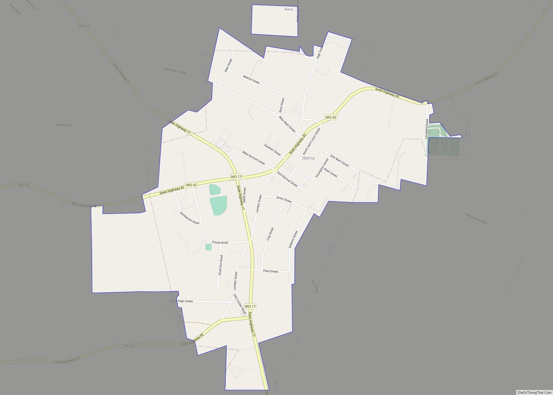
Iberia is a city in southeast Miller County, Missouri, United States. The population was 736 at the 2010 census.
| Name: | Iberia city |
|---|---|
| LSAD Code: | 25 |
| LSAD Description: | city (suffix) |
| State: | Missouri |
| County: | Miller County |
| Founded: | 1860 |
| Elevation: | 938 ft (286 m) |
| Total Area: | 0.88 sq mi (2.28 km²) |
| Land Area: | 0.88 sq mi (2.28 km²) |
| Water Area: | 0.00 sq mi (0.00 km²) |
| Total Population: | 703 |
| Population Density: | 797.96/sq mi (308.08/km²) |
| ZIP code: | 65486 |
| Area code: | 573 |
| FIPS code: | 2934228 |
| GNISfeature ID: | 2394462 |
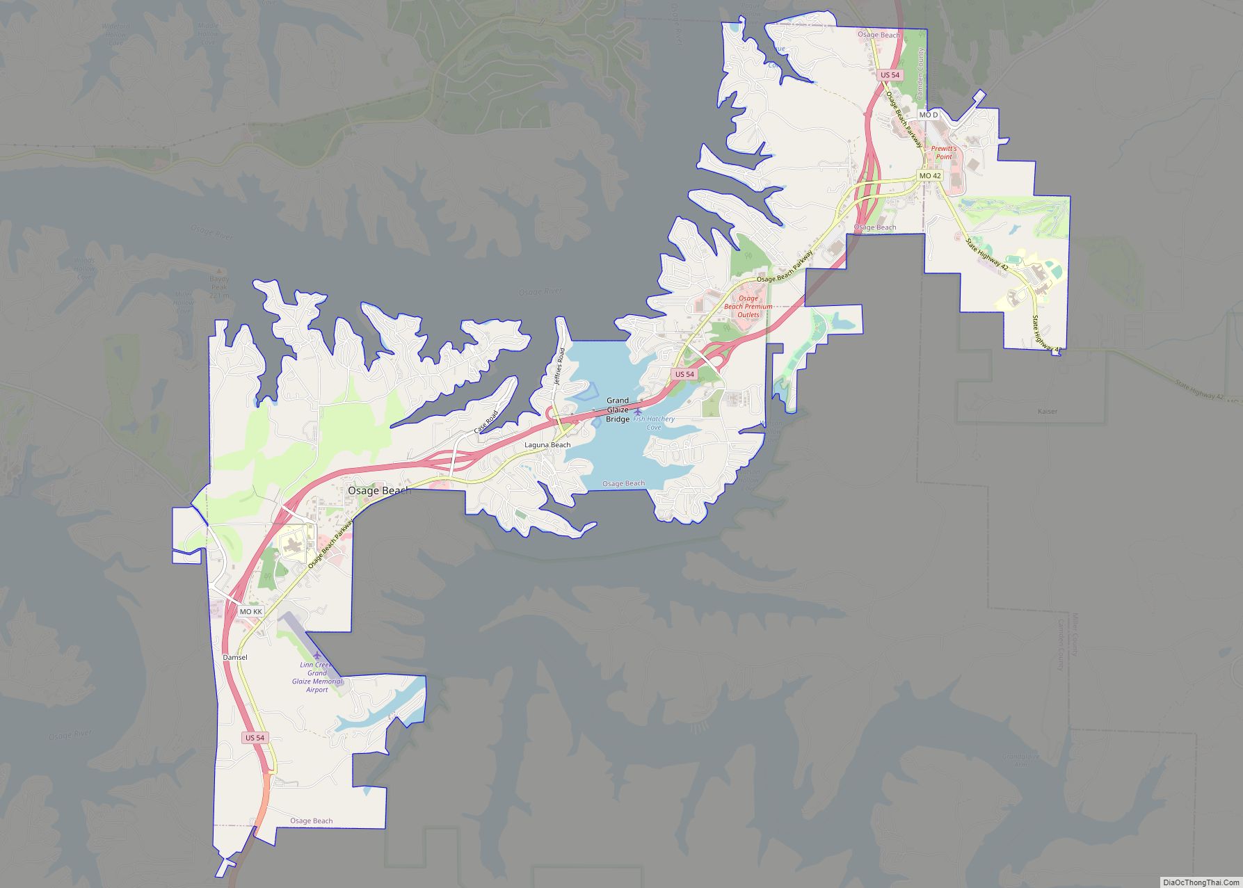
Online Interactive Map
Click on ![]() to view map in "full screen" mode.
to view map in "full screen" mode.
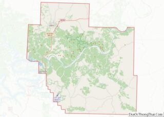
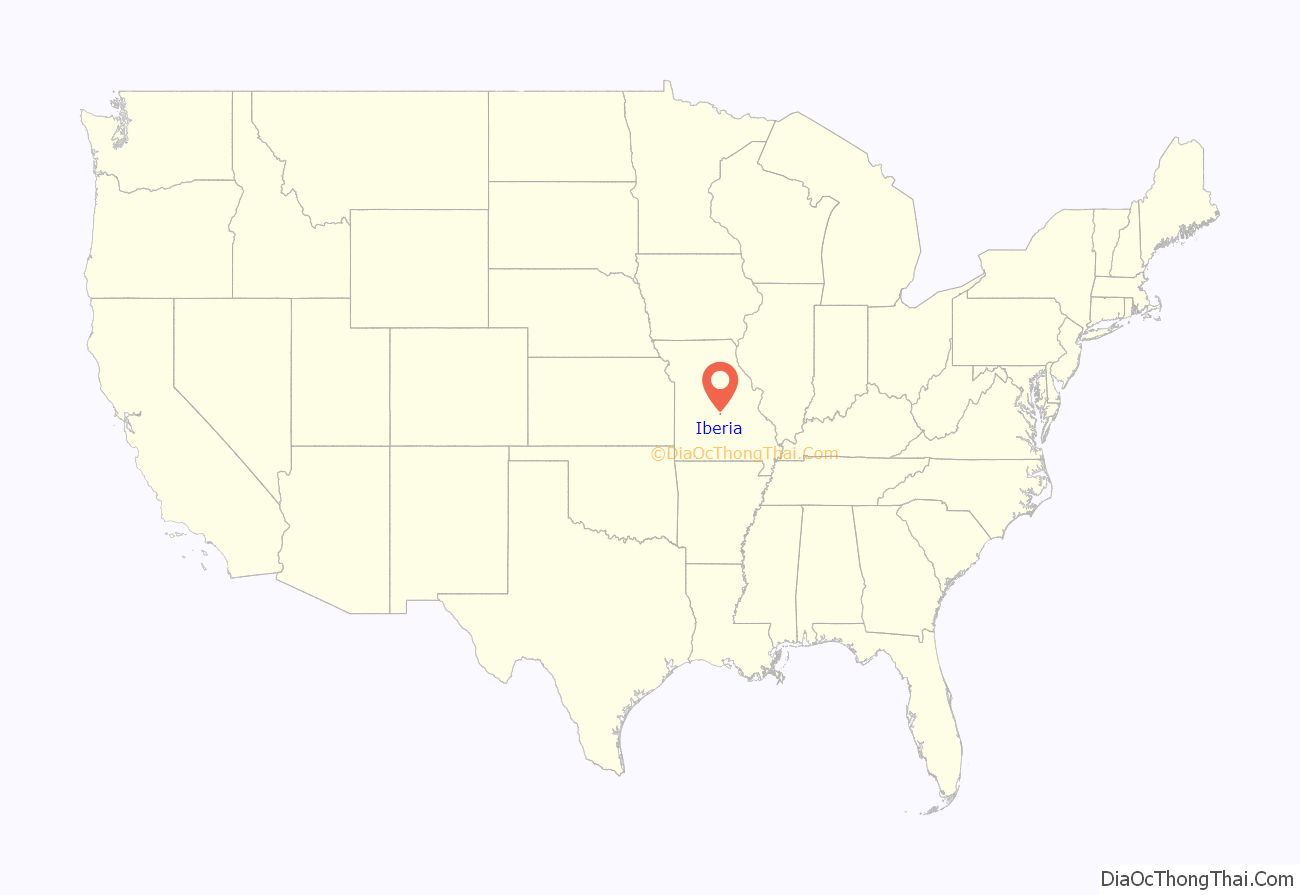
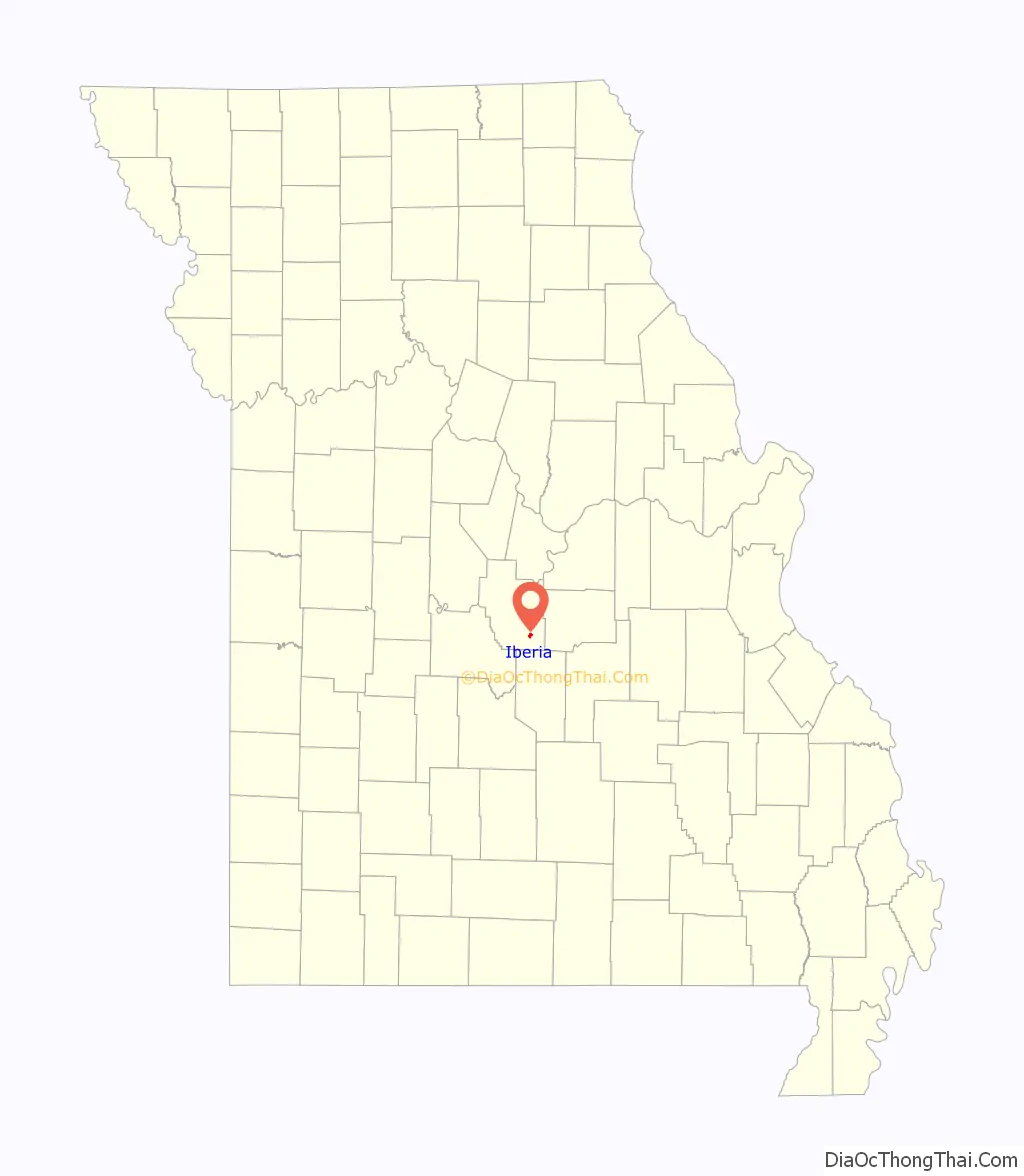
Iberia location map. Where is Iberia city?
History
A post office called Iberia has been in operation since 1838. The community derives its name from the Iberian Peninsula perhaps via New Iberia, Louisiana.
Iberia Academy and Junior College was added to the National Register of Historic Places in 1980.
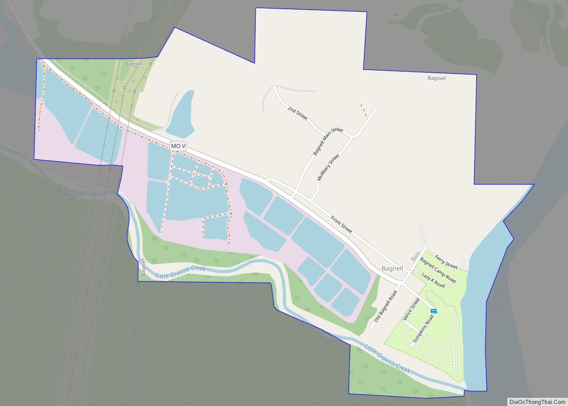
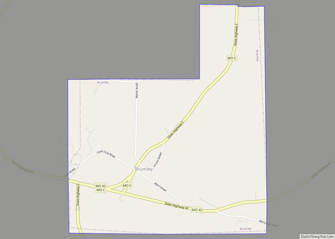
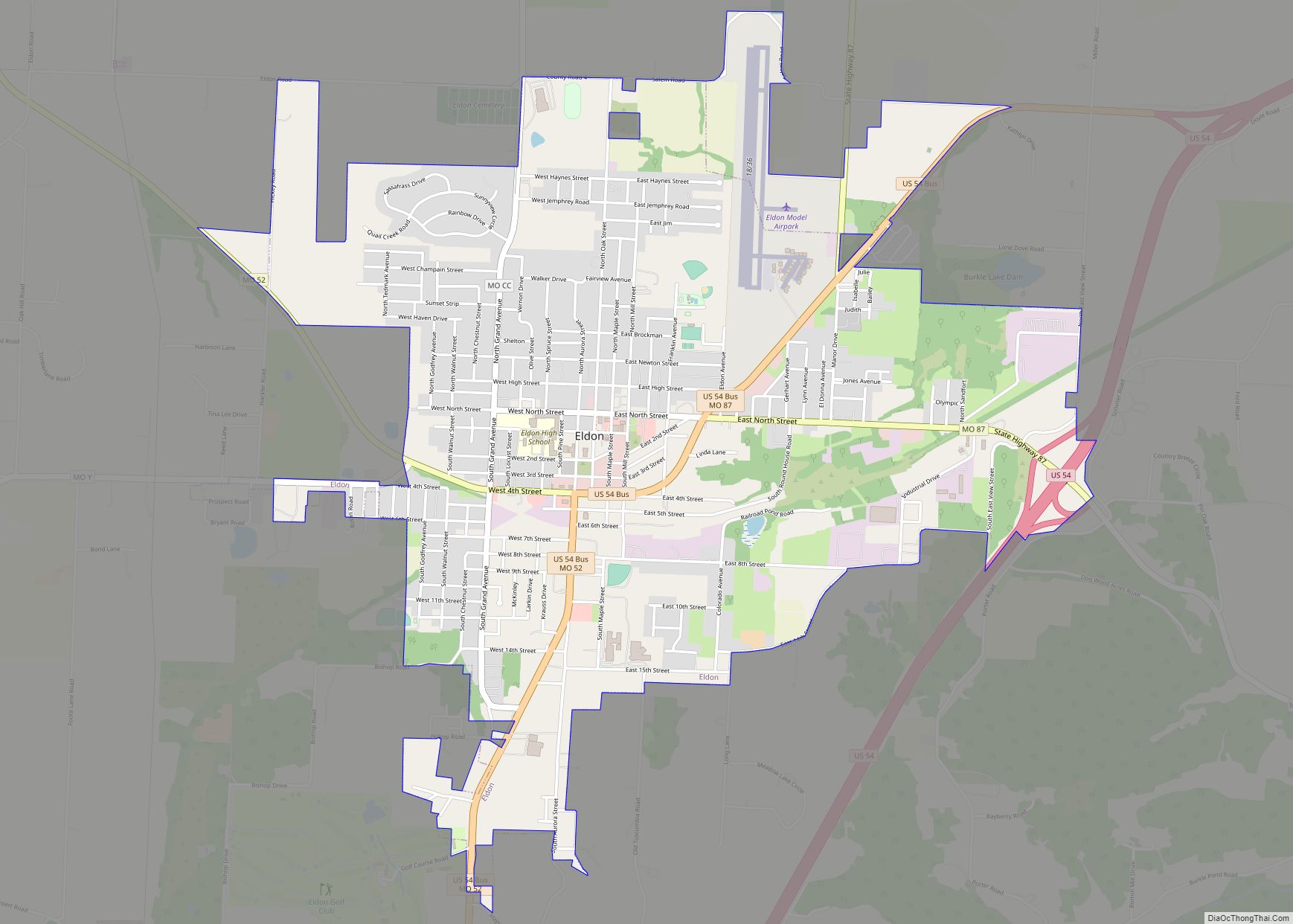
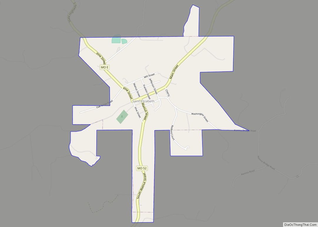
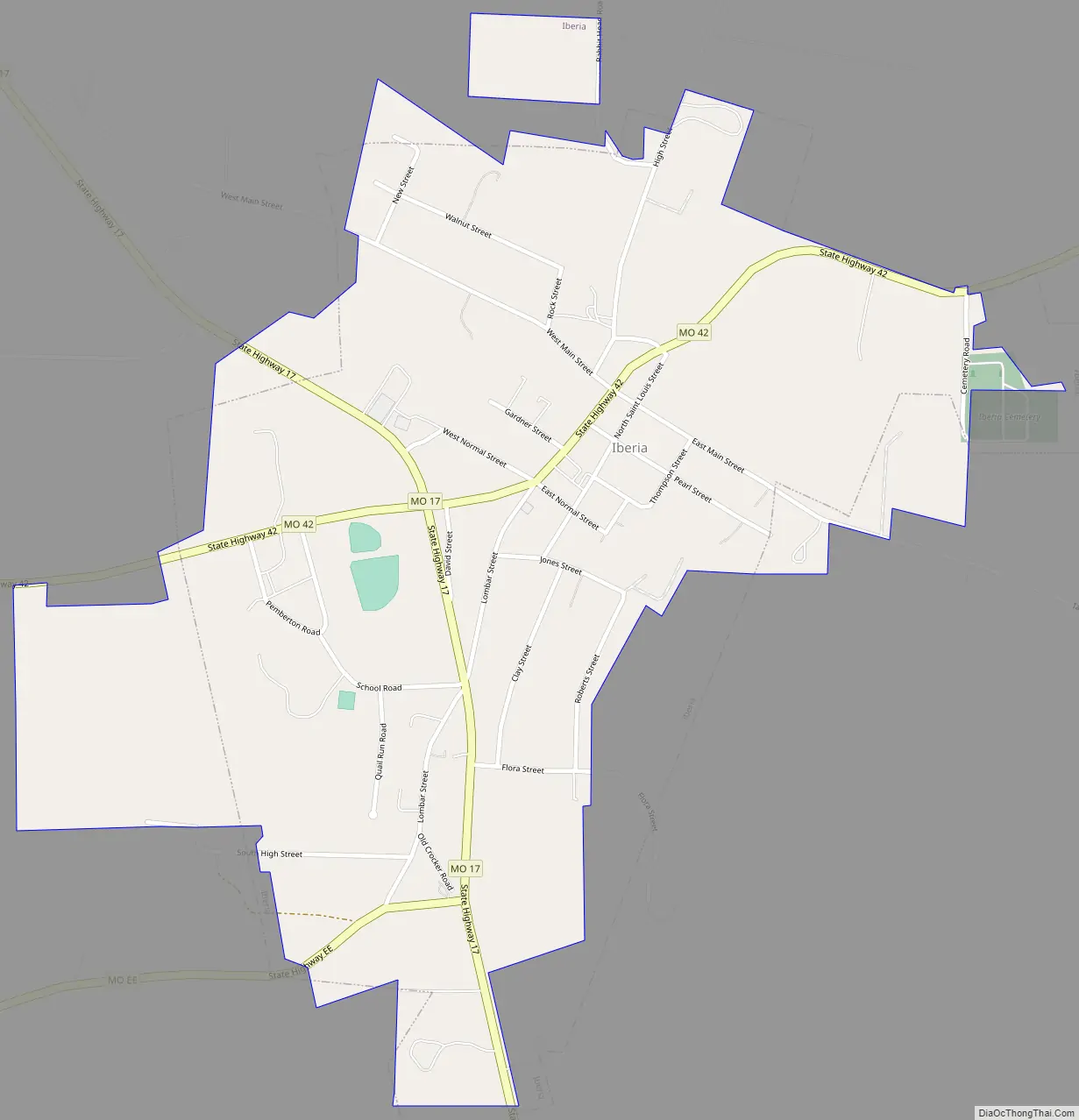
Iberia Road Map
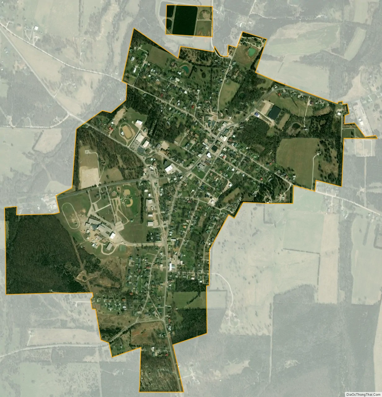
Iberia city Satellite Map
Geography
Iberia is located in southeastern Miller County in the Ozarks of Central Missouri. The city is at the intersection of routes 17 and 42. Lake of the Ozarks State Park is approximately 12 miles to the west on route 42.
According to the United States Census Bureau, the city has a total area of 0.88 square miles (2.28 km), all land.
See also
Map of Missouri State and its subdivision:- Adair
- Andrew
- Atchison
- Audrain
- Barry
- Barton
- Bates
- Benton
- Bollinger
- Boone
- Buchanan
- Butler
- Caldwell
- Callaway
- Camden
- Cape Girardeau
- Carroll
- Carter
- Cass
- Cedar
- Chariton
- Christian
- Clark
- Clay
- Clinton
- Cole
- Cooper
- Crawford
- Dade
- Dallas
- Daviess
- De Kalb
- Dent
- Douglas
- Dunklin
- Franklin
- Gasconade
- Gentry
- Greene
- Grundy
- Harrison
- Henry
- Hickory
- Holt
- Howard
- Howell
- Iron
- Jackson
- Jasper
- Jefferson
- Johnson
- Knox
- Laclede
- Lafayette
- Lawrence
- Lewis
- Lincoln
- Linn
- Livingston
- Macon
- Madison
- Maries
- Marion
- McDonald
- Mercer
- Miller
- Mississippi
- Moniteau
- Monroe
- Montgomery
- Morgan
- New Madrid
- Newton
- Nodaway
- Oregon
- Osage
- Ozark
- Pemiscot
- Perry
- Pettis
- Phelps
- Pike
- Platte
- Polk
- Pulaski
- Putnam
- Ralls
- Randolph
- Ray
- Reynolds
- Ripley
- Saint Charles
- Saint Clair
- Saint Francois
- Saint Louis
- Sainte Genevieve
- Saline
- Schuyler
- Scotland
- Scott
- Shannon
- Shelby
- Stoddard
- Stone
- Sullivan
- Taney
- Texas
- Vernon
- Warren
- Washington
- Wayne
- Webster
- Worth
- Wright
- Alabama
- Alaska
- Arizona
- Arkansas
- California
- Colorado
- Connecticut
- Delaware
- District of Columbia
- Florida
- Georgia
- Hawaii
- Idaho
- Illinois
- Indiana
- Iowa
- Kansas
- Kentucky
- Louisiana
- Maine
- Maryland
- Massachusetts
- Michigan
- Minnesota
- Mississippi
- Missouri
- Montana
- Nebraska
- Nevada
- New Hampshire
- New Jersey
- New Mexico
- New York
- North Carolina
- North Dakota
- Ohio
- Oklahoma
- Oregon
- Pennsylvania
- Rhode Island
- South Carolina
- South Dakota
- Tennessee
- Texas
- Utah
- Vermont
- Virginia
- Washington
- West Virginia
- Wisconsin
- Wyoming