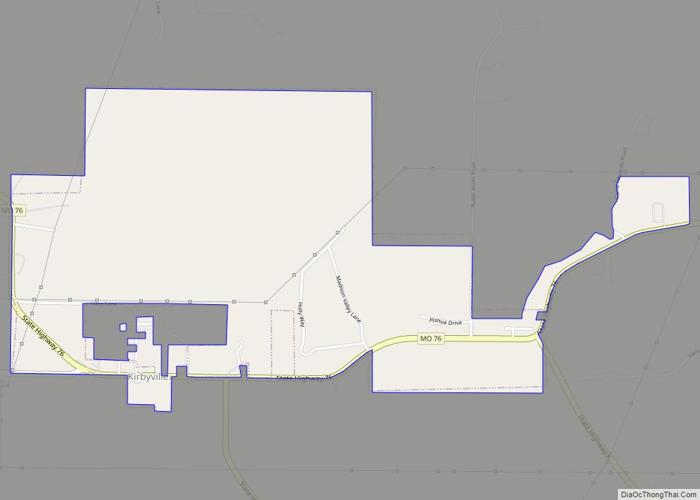
Kirbyville is a village in Taney County, Missouri, United States. The population was 195 at the 2020 census. It is part of the Branson, Missouri Micropolitan Statistical Area.
| Name: | Kirbyville village |
|---|---|
| LSAD Code: | 47 |
| LSAD Description: | village (suffix) |
| State: | Missouri |
| County: | Taney County |
| Incorporated: | June 4, 2001 |
| Elevation: | 1,004 ft (306 m) |
| Total Area: | 1.40 sq mi (3.63 km²) |
| Land Area: | 1.40 sq mi (3.63 km²) |
| Water Area: | 0.00 sq mi (0.00 km²) |
| Total Population: | 195 |
| Population Density: | 138.99/sq mi (53.66/km²) |
| ZIP code: | 65679 |
| Area code: | 417 |
| FIPS code: | 2939008 |
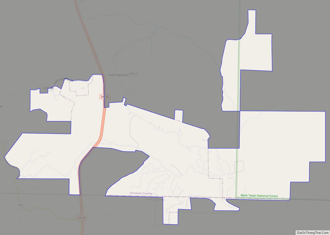
Online Interactive Map
Click on ![]() to view map in "full screen" mode.
to view map in "full screen" mode.
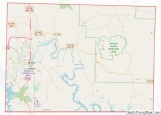
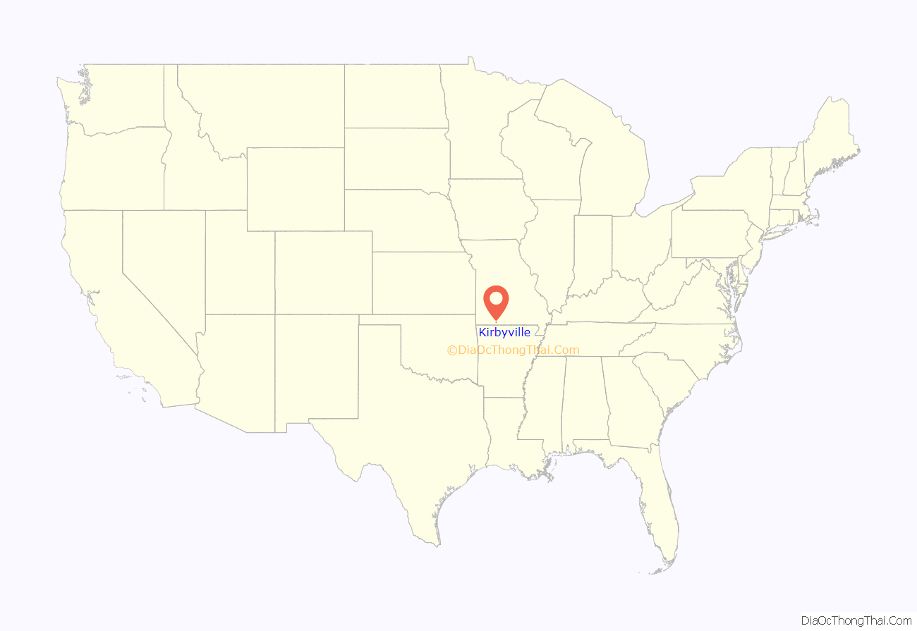
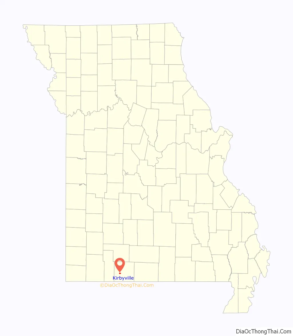
Kirbyville location map. Where is Kirbyville village?
History
A post office called Kirbyville has been in operation since 1871. One Mr. Kirby, an early postmaster, gave the community his last name.
The Snap Balds where the Bald Knobbers were organized in 1883 are located just to the northwest of the village.
Kirbyville incorporated on June 4, 2001.
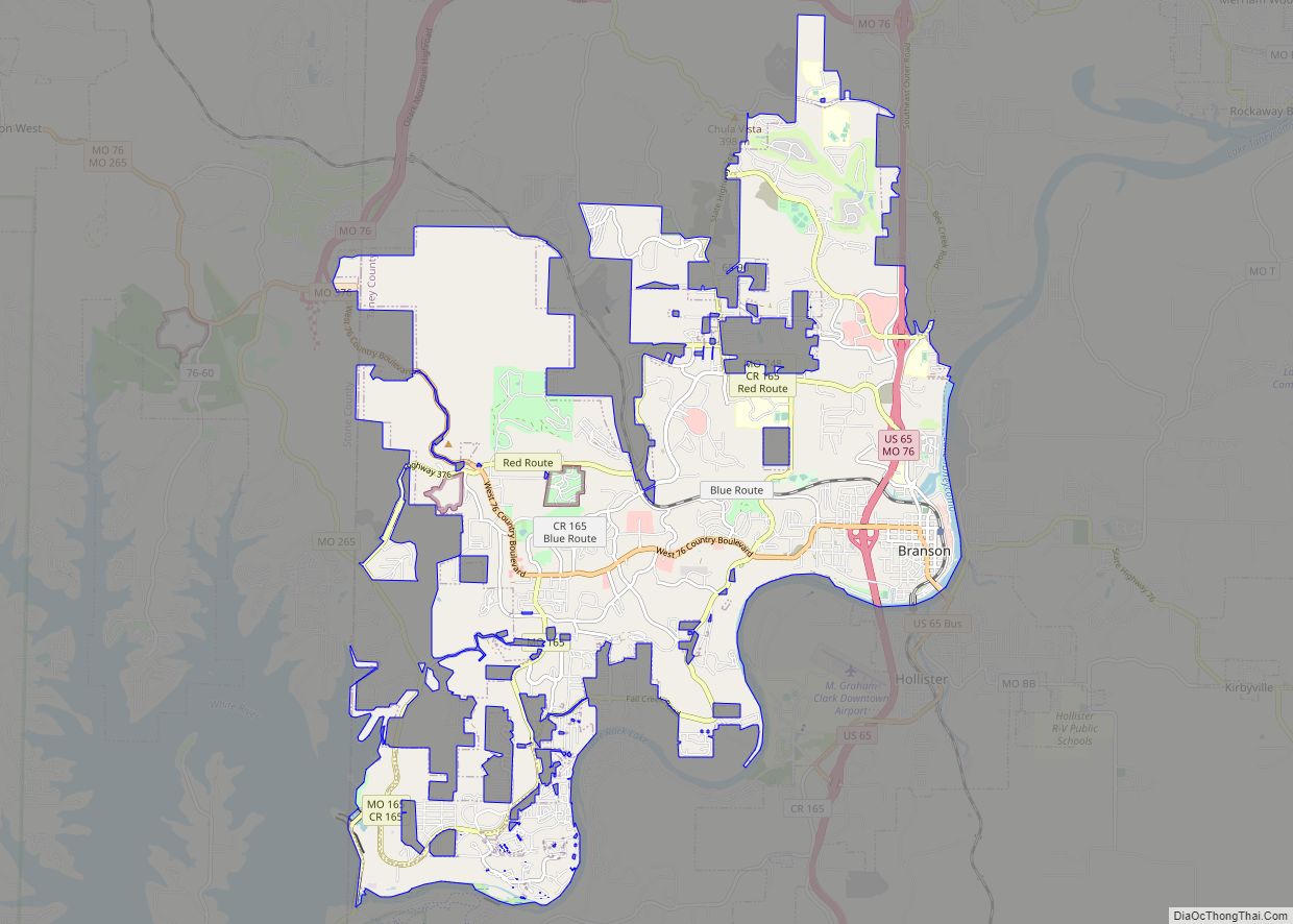
Kirbyville Road Map
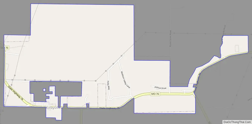
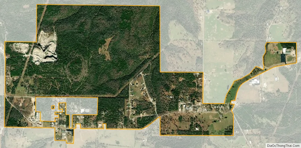
Kirbyville city Satellite Map
Geography
Kirbyville is located approximately seven miles east of Branson on Route 76 at the intersection of Route 76 and Missouri Route J. The farming and residential community is part of the Branson Micropolitan Statistical Area. Kirbyville’s has the ZIP code 65679.
According to the United States Census Bureau, the village has a total area of 1.34 square miles (3.47 km), all land.
See also
Map of Missouri State and its subdivision:- Adair
- Andrew
- Atchison
- Audrain
- Barry
- Barton
- Bates
- Benton
- Bollinger
- Boone
- Buchanan
- Butler
- Caldwell
- Callaway
- Camden
- Cape Girardeau
- Carroll
- Carter
- Cass
- Cedar
- Chariton
- Christian
- Clark
- Clay
- Clinton
- Cole
- Cooper
- Crawford
- Dade
- Dallas
- Daviess
- De Kalb
- Dent
- Douglas
- Dunklin
- Franklin
- Gasconade
- Gentry
- Greene
- Grundy
- Harrison
- Henry
- Hickory
- Holt
- Howard
- Howell
- Iron
- Jackson
- Jasper
- Jefferson
- Johnson
- Knox
- Laclede
- Lafayette
- Lawrence
- Lewis
- Lincoln
- Linn
- Livingston
- Macon
- Madison
- Maries
- Marion
- McDonald
- Mercer
- Miller
- Mississippi
- Moniteau
- Monroe
- Montgomery
- Morgan
- New Madrid
- Newton
- Nodaway
- Oregon
- Osage
- Ozark
- Pemiscot
- Perry
- Pettis
- Phelps
- Pike
- Platte
- Polk
- Pulaski
- Putnam
- Ralls
- Randolph
- Ray
- Reynolds
- Ripley
- Saint Charles
- Saint Clair
- Saint Francois
- Saint Louis
- Sainte Genevieve
- Saline
- Schuyler
- Scotland
- Scott
- Shannon
- Shelby
- Stoddard
- Stone
- Sullivan
- Taney
- Texas
- Vernon
- Warren
- Washington
- Wayne
- Webster
- Worth
- Wright
- Alabama
- Alaska
- Arizona
- Arkansas
- California
- Colorado
- Connecticut
- Delaware
- District of Columbia
- Florida
- Georgia
- Hawaii
- Idaho
- Illinois
- Indiana
- Iowa
- Kansas
- Kentucky
- Louisiana
- Maine
- Maryland
- Massachusetts
- Michigan
- Minnesota
- Mississippi
- Missouri
- Montana
- Nebraska
- Nevada
- New Hampshire
- New Jersey
- New Mexico
- New York
- North Carolina
- North Dakota
- Ohio
- Oklahoma
- Oregon
- Pennsylvania
- Rhode Island
- South Carolina
- South Dakota
- Tennessee
- Texas
- Utah
- Vermont
- Virginia
- Washington
- West Virginia
- Wisconsin
- Wyoming