La Monte is a city in Pettis County, Missouri, United States. The population was 1,140 at the 2010 census.
| Name: | La Monte city |
|---|---|
| LSAD Code: | 25 |
| LSAD Description: | city (suffix) |
| State: | Missouri |
| County: | Pettis County |
| Elevation: | 846 ft (258 m) |
| Total Area: | 1.10 sq mi (2.84 km²) |
| Land Area: | 1.08 sq mi (2.81 km²) |
| Water Area: | 0.01 sq mi (0.03 km²) |
| Total Population: | 1,014 |
| Population Density: | 934.56/sq mi (360.85/km²) |
| ZIP code: | 65337 |
| Area code: | 660 |
| FIPS code: | 2940520 |
| GNISfeature ID: | 2395567 |
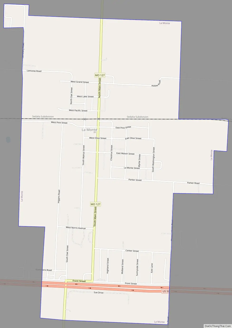
Online Interactive Map
Click on ![]() to view map in "full screen" mode.
to view map in "full screen" mode.
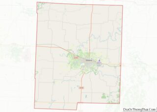
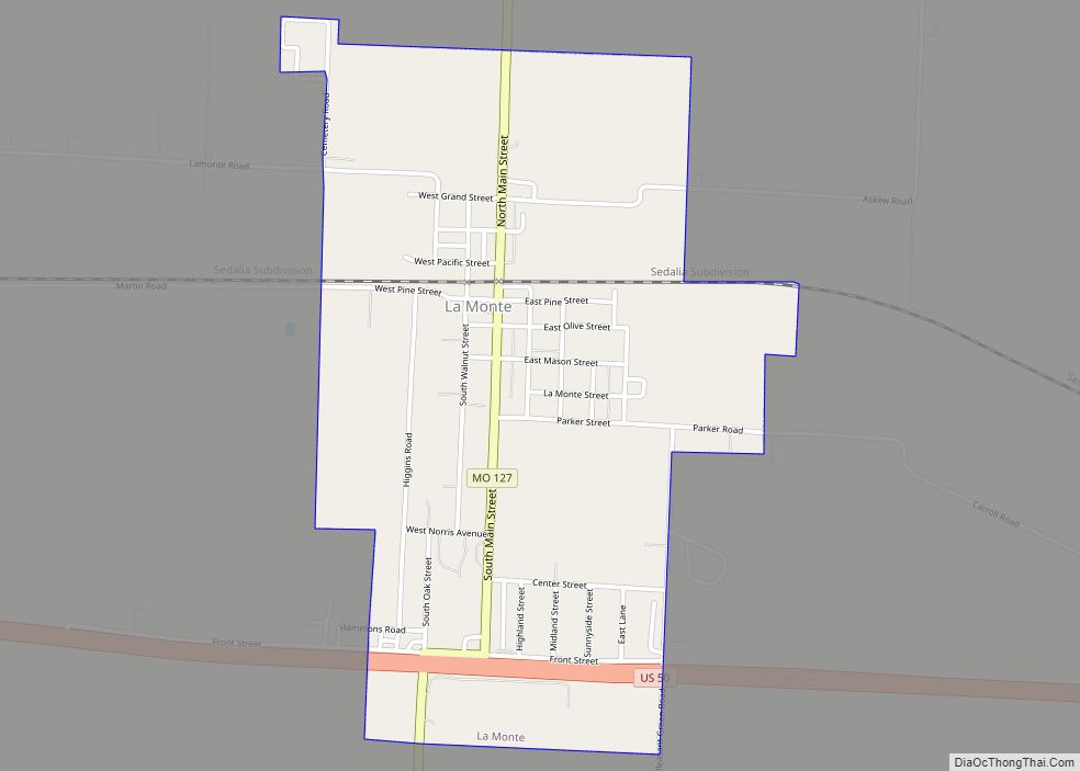
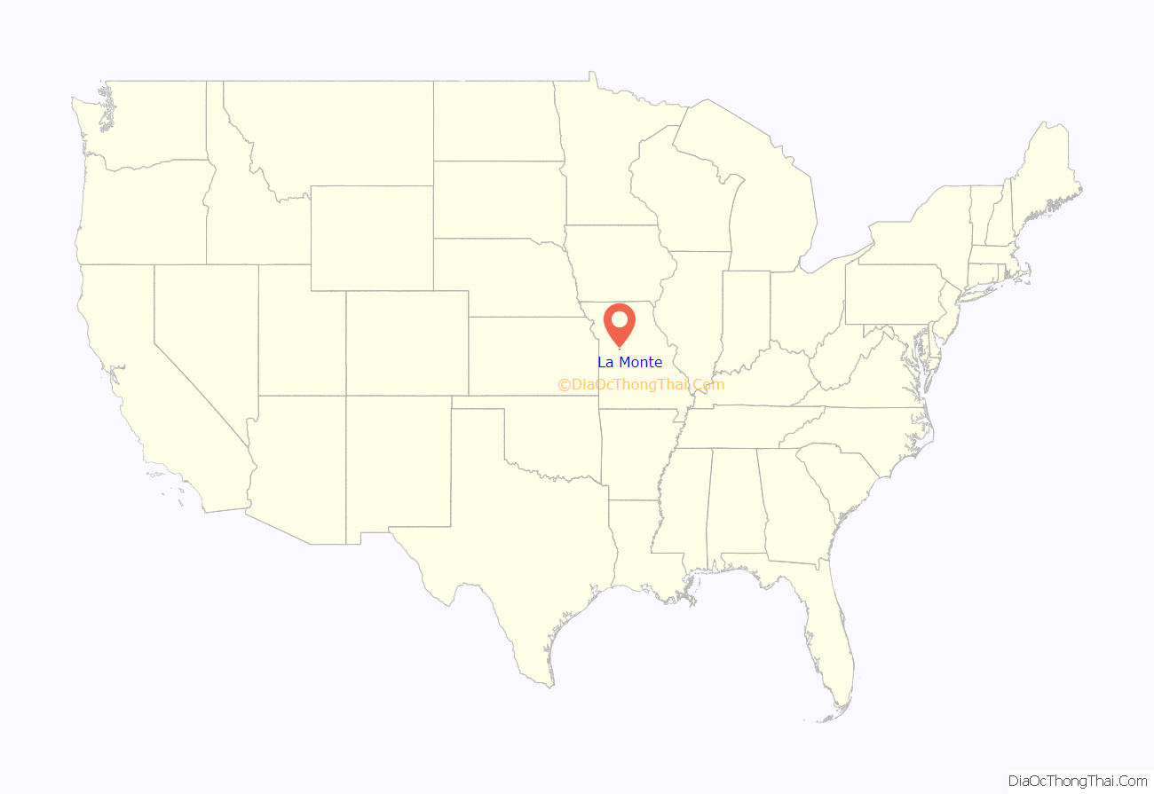
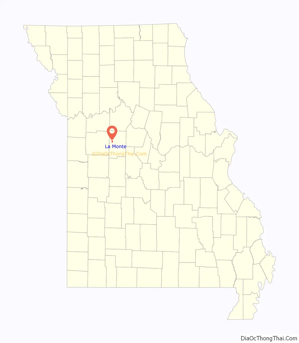
La Monte location map. Where is La Monte city?
History
La Monte was originally called Boomer, and under the latter name was platted in 1866. The present name of La Monte, after an acquaintance of an early postmaster, was adopted in 1870 when the railroad was extended through the neighborhood.
La Monte Road Map
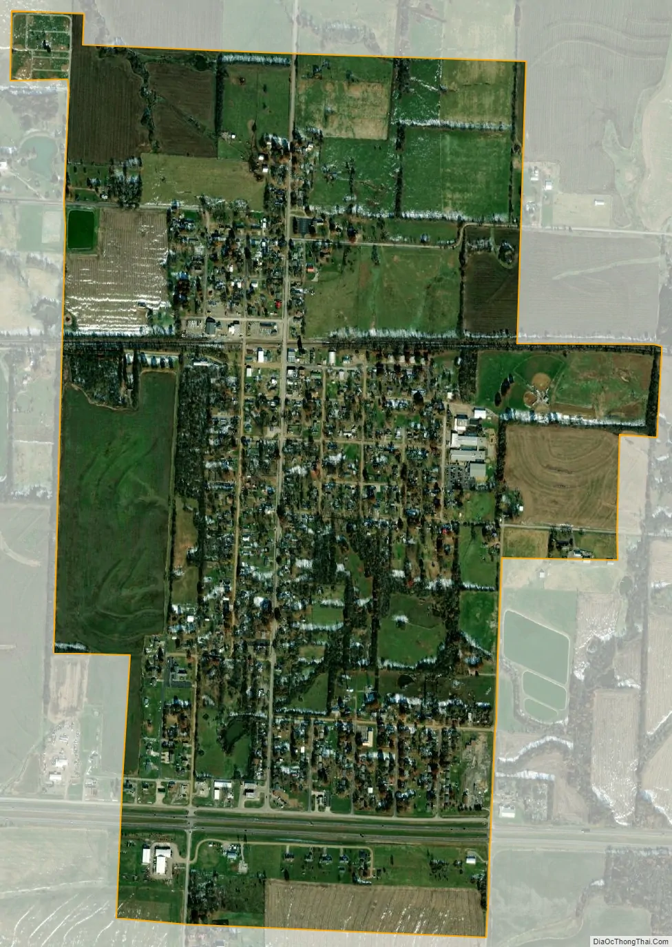
La Monte city Satellite Map
Geography
La Monte is located on Missouri Route 127 just north of US Route 50 eleven miles northwest of Sedalia. Knob Noster is six miles west in adjacent Johnson County.
According to the United States Census Bureau, the city has a total area of 1.14 square miles (2.95 km), of which 1.13 square miles (2.93 km) is land and 0.01 square miles (0.03 km) is water.
See also
Map of Missouri State and its subdivision:- Adair
- Andrew
- Atchison
- Audrain
- Barry
- Barton
- Bates
- Benton
- Bollinger
- Boone
- Buchanan
- Butler
- Caldwell
- Callaway
- Camden
- Cape Girardeau
- Carroll
- Carter
- Cass
- Cedar
- Chariton
- Christian
- Clark
- Clay
- Clinton
- Cole
- Cooper
- Crawford
- Dade
- Dallas
- Daviess
- De Kalb
- Dent
- Douglas
- Dunklin
- Franklin
- Gasconade
- Gentry
- Greene
- Grundy
- Harrison
- Henry
- Hickory
- Holt
- Howard
- Howell
- Iron
- Jackson
- Jasper
- Jefferson
- Johnson
- Knox
- Laclede
- Lafayette
- Lawrence
- Lewis
- Lincoln
- Linn
- Livingston
- Macon
- Madison
- Maries
- Marion
- McDonald
- Mercer
- Miller
- Mississippi
- Moniteau
- Monroe
- Montgomery
- Morgan
- New Madrid
- Newton
- Nodaway
- Oregon
- Osage
- Ozark
- Pemiscot
- Perry
- Pettis
- Phelps
- Pike
- Platte
- Polk
- Pulaski
- Putnam
- Ralls
- Randolph
- Ray
- Reynolds
- Ripley
- Saint Charles
- Saint Clair
- Saint Francois
- Saint Louis
- Sainte Genevieve
- Saline
- Schuyler
- Scotland
- Scott
- Shannon
- Shelby
- Stoddard
- Stone
- Sullivan
- Taney
- Texas
- Vernon
- Warren
- Washington
- Wayne
- Webster
- Worth
- Wright
- Alabama
- Alaska
- Arizona
- Arkansas
- California
- Colorado
- Connecticut
- Delaware
- District of Columbia
- Florida
- Georgia
- Hawaii
- Idaho
- Illinois
- Indiana
- Iowa
- Kansas
- Kentucky
- Louisiana
- Maine
- Maryland
- Massachusetts
- Michigan
- Minnesota
- Mississippi
- Missouri
- Montana
- Nebraska
- Nevada
- New Hampshire
- New Jersey
- New Mexico
- New York
- North Carolina
- North Dakota
- Ohio
- Oklahoma
- Oregon
- Pennsylvania
- Rhode Island
- South Carolina
- South Dakota
- Tennessee
- Texas
- Utah
- Vermont
- Virginia
- Washington
- West Virginia
- Wisconsin
- Wyoming