Newtonia is a village in Newton County, Missouri, United States. The population was 199 at the 2010 census. It is part of the Joplin, Missouri Metropolitan Statistical Area. Newtonia was the site of the Battles of Newtonia during the American Civil War. The village contains some Antebellum houses, such as the Mathew H. Ritchey House, as well as a cemetery for Civil War dead. It is a farming community and is immediately adjacent to Stark City, Missouri.
| Name: | Newtonia town |
|---|---|
| LSAD Code: | 43 |
| LSAD Description: | town (suffix) |
| State: | Missouri |
| County: | Newton County |
| Elevation: | 1,191 ft (363 m) |
| Total Area: | 0.33 sq mi (0.85 km²) |
| Land Area: | 0.33 sq mi (0.85 km²) |
| Water Area: | 0.00 sq mi (0.00 km²) |
| Total Population: | 204 |
| Population Density: | 625.77/sq mi (241.24/km²) |
| ZIP code: | 64853 |
| Area code: | 417 |
| FIPS code: | 2952292 |
| GNISfeature ID: | 2396814 |
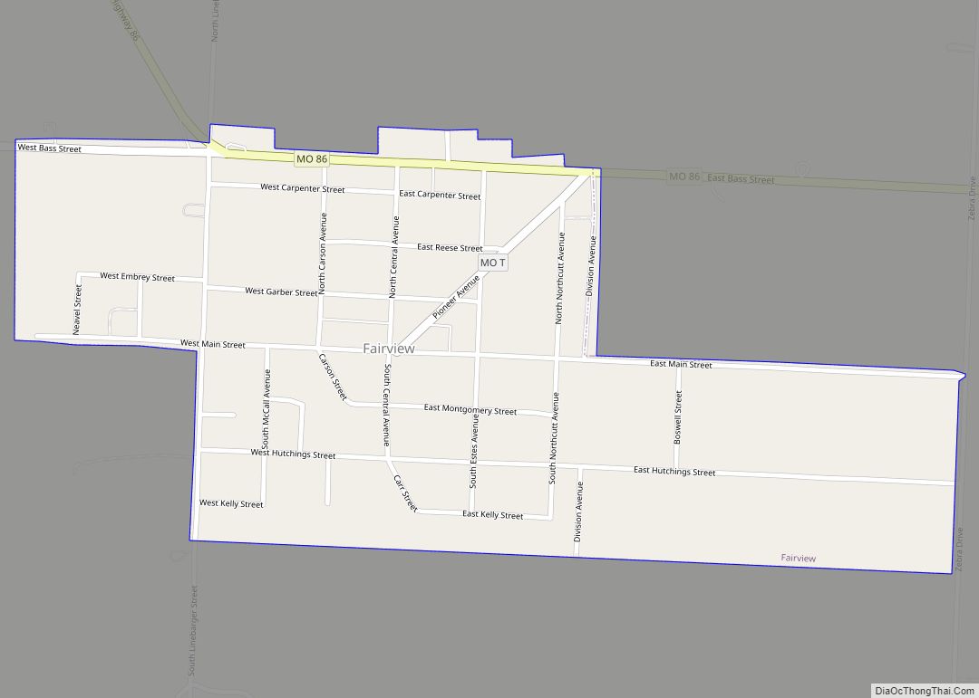
Online Interactive Map
Click on ![]() to view map in "full screen" mode.
to view map in "full screen" mode.
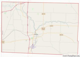
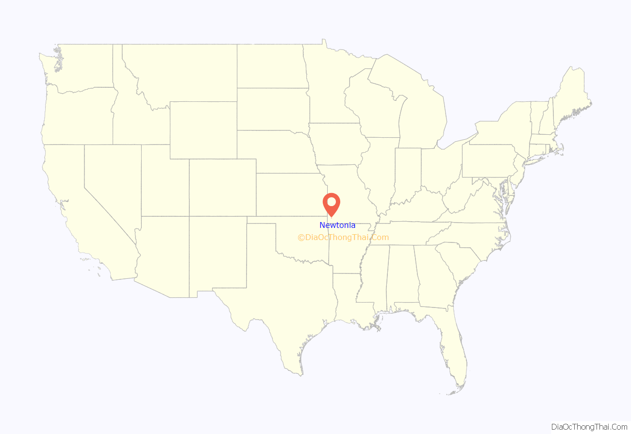
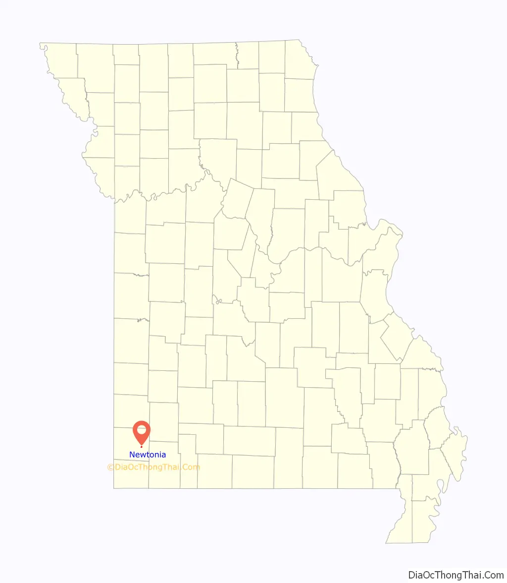
Newtonia location map. Where is Newtonia town?
History
Newtonia was laid out in 1857, taking its name from Newton County. A post office called Newtonia was established in 1858, and remained in operation until 1973.
The First Battle of Newtonia Historic District, Mathew H. Ritchey House, and Second Battle of Newtonia Site are listed on the National Register of Historic Places.
In 2008, a tornado struck the village, damaging many homes (including the Mathew H. Ritchey House).
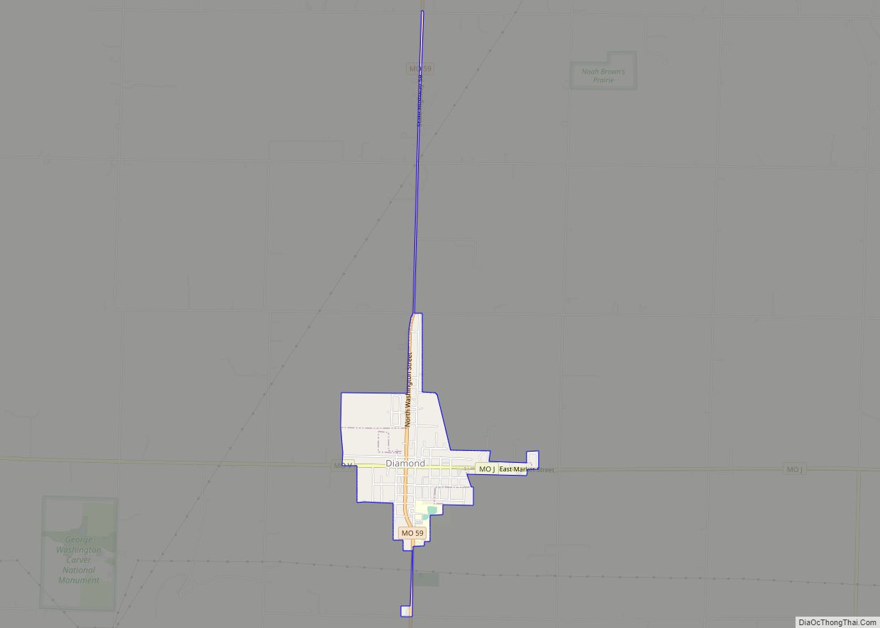
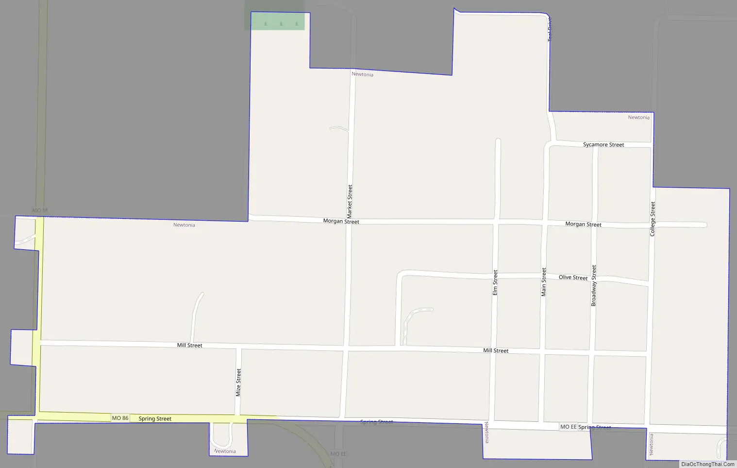
Newtonia Road Map
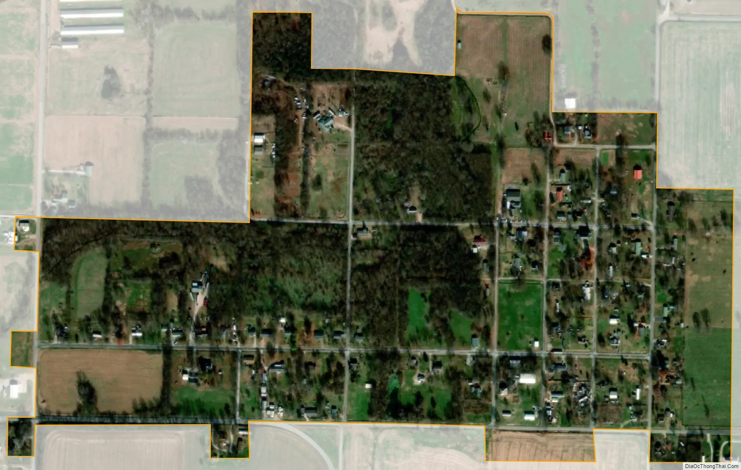
Newtonia city Satellite Map
Geography
Newtonia is located on Missouri Route 86, approximately nine miles east of Neosho. Stark City lies one mile south along Route 86. Granby is approximately 4.5 miles to the northwest on U.S. Route 60.
According to the United States Census Bureau, the village has a total area of 0.33 square miles (0.85 km), all land.
See also
Map of Missouri State and its subdivision:- Adair
- Andrew
- Atchison
- Audrain
- Barry
- Barton
- Bates
- Benton
- Bollinger
- Boone
- Buchanan
- Butler
- Caldwell
- Callaway
- Camden
- Cape Girardeau
- Carroll
- Carter
- Cass
- Cedar
- Chariton
- Christian
- Clark
- Clay
- Clinton
- Cole
- Cooper
- Crawford
- Dade
- Dallas
- Daviess
- De Kalb
- Dent
- Douglas
- Dunklin
- Franklin
- Gasconade
- Gentry
- Greene
- Grundy
- Harrison
- Henry
- Hickory
- Holt
- Howard
- Howell
- Iron
- Jackson
- Jasper
- Jefferson
- Johnson
- Knox
- Laclede
- Lafayette
- Lawrence
- Lewis
- Lincoln
- Linn
- Livingston
- Macon
- Madison
- Maries
- Marion
- McDonald
- Mercer
- Miller
- Mississippi
- Moniteau
- Monroe
- Montgomery
- Morgan
- New Madrid
- Newton
- Nodaway
- Oregon
- Osage
- Ozark
- Pemiscot
- Perry
- Pettis
- Phelps
- Pike
- Platte
- Polk
- Pulaski
- Putnam
- Ralls
- Randolph
- Ray
- Reynolds
- Ripley
- Saint Charles
- Saint Clair
- Saint Francois
- Saint Louis
- Sainte Genevieve
- Saline
- Schuyler
- Scotland
- Scott
- Shannon
- Shelby
- Stoddard
- Stone
- Sullivan
- Taney
- Texas
- Vernon
- Warren
- Washington
- Wayne
- Webster
- Worth
- Wright
- Alabama
- Alaska
- Arizona
- Arkansas
- California
- Colorado
- Connecticut
- Delaware
- District of Columbia
- Florida
- Georgia
- Hawaii
- Idaho
- Illinois
- Indiana
- Iowa
- Kansas
- Kentucky
- Louisiana
- Maine
- Maryland
- Massachusetts
- Michigan
- Minnesota
- Mississippi
- Missouri
- Montana
- Nebraska
- Nevada
- New Hampshire
- New Jersey
- New Mexico
- New York
- North Carolina
- North Dakota
- Ohio
- Oklahoma
- Oregon
- Pennsylvania
- Rhode Island
- South Carolina
- South Dakota
- Tennessee
- Texas
- Utah
- Vermont
- Virginia
- Washington
- West Virginia
- Wisconsin
- Wyoming