Ridgeway is a city in Harrison County, Missouri, United States. The population was 372 at the 2020 census.
| Name: | Ridgeway city |
|---|---|
| LSAD Code: | 25 |
| LSAD Description: | city (suffix) |
| State: | Missouri |
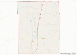
| County: | Harrison County |
| Elevation: | 1,056 ft (322 m) |
| Total Area: | 1.23 sq mi (3.17 km²) |
| Land Area: | 1.22 sq mi (3.15 km²) |
| Water Area: | 0.01 sq mi (0.02 km²) |
| Total Population: | 372 |
| Population Density: | 305.67/sq mi (118.04/km²) |
| Area code: | 660 |
| FIPS code: | 2961904 |
| GNISfeature ID: | 2396375 |
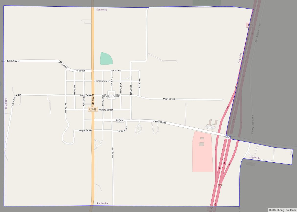
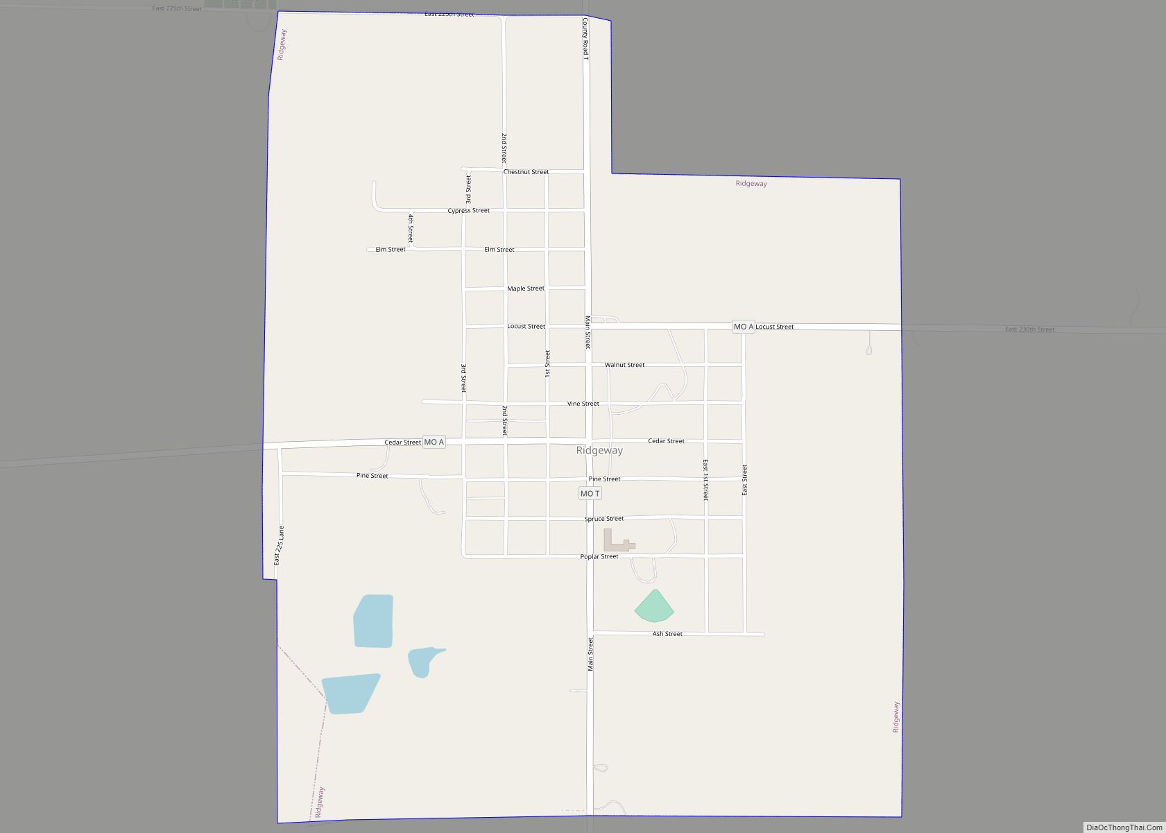
Online Interactive Map
Click on ![]() to view map in "full screen" mode.
to view map in "full screen" mode.
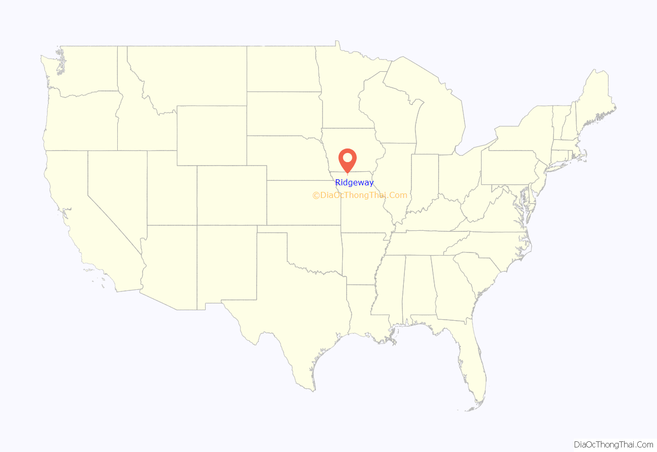
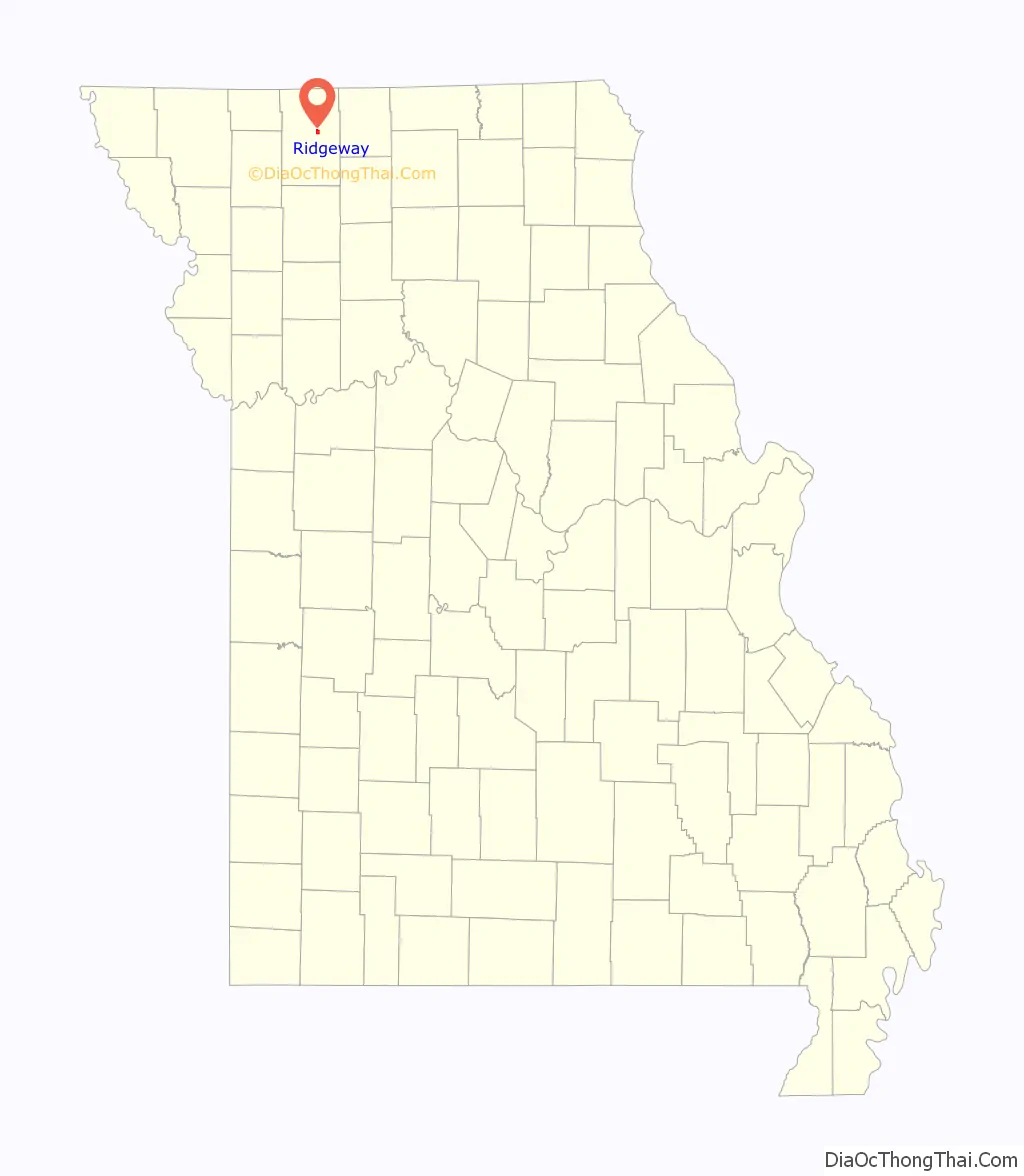
Ridgeway location map. Where is Ridgeway city?
History
Ridgeway was originally called “Yankee Ridge”. A post office called Yankee Ridge was established in 1872, and the name was changed to Ridgeway in 1880. The present name honors an employee of the Chicago, Burlington and Quincy Railroad.
Ridgeway Road Map
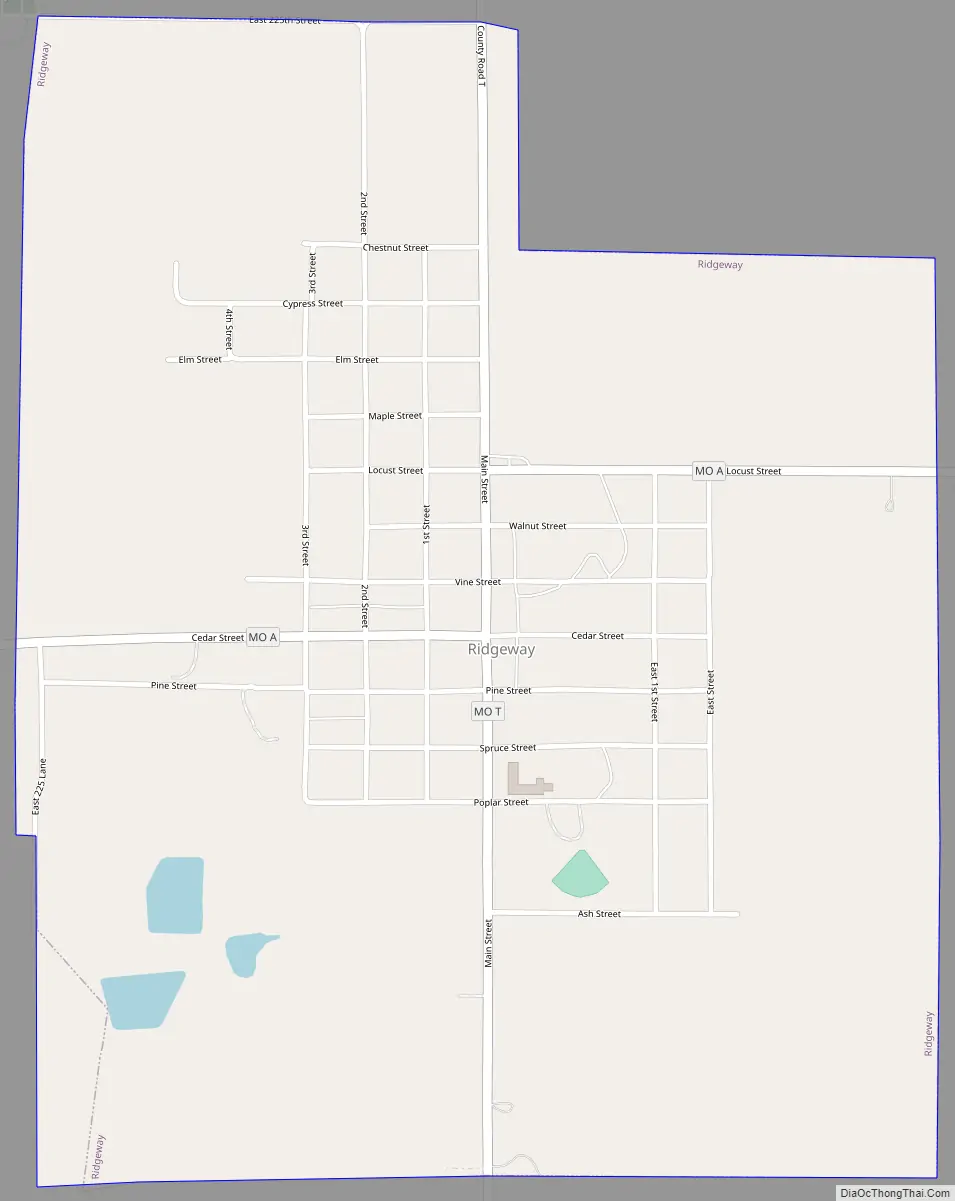
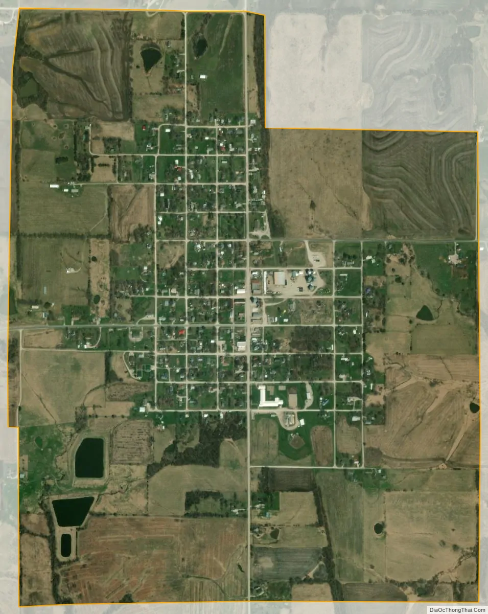
Ridgeway city Satellite Map
Geography
Ridgeway is located at the intersection of Missouri routes A and T 2.5 miles east of I-35. Bethany is approximately 7 miles to the south. The East Fork of Big Creek flows past about two miles west of the community.
According to the United States Census Bureau, the city has a total area of 1.23 square miles (3.19 km), of which 1.22 sq mi (3.16 km) is land and 0.01 sq mi (0.03 km) is water.
See also
Map of Missouri State and its subdivision:- Adair
- Andrew
- Atchison
- Audrain
- Barry
- Barton
- Bates
- Benton
- Bollinger
- Boone
- Buchanan
- Butler
- Caldwell
- Callaway
- Camden
- Cape Girardeau
- Carroll
- Carter
- Cass
- Cedar
- Chariton
- Christian
- Clark
- Clay
- Clinton
- Cole
- Cooper
- Crawford
- Dade
- Dallas
- Daviess
- De Kalb
- Dent
- Douglas
- Dunklin
- Franklin
- Gasconade
- Gentry
- Greene
- Grundy
- Harrison
- Henry
- Hickory
- Holt
- Howard
- Howell
- Iron
- Jackson
- Jasper
- Jefferson
- Johnson
- Knox
- Laclede
- Lafayette
- Lawrence
- Lewis
- Lincoln
- Linn
- Livingston
- Macon
- Madison
- Maries
- Marion
- McDonald
- Mercer
- Miller
- Mississippi
- Moniteau
- Monroe
- Montgomery
- Morgan
- New Madrid
- Newton
- Nodaway
- Oregon
- Osage
- Ozark
- Pemiscot
- Perry
- Pettis
- Phelps
- Pike
- Platte
- Polk
- Pulaski
- Putnam
- Ralls
- Randolph
- Ray
- Reynolds
- Ripley
- Saint Charles
- Saint Clair
- Saint Francois
- Saint Louis
- Sainte Genevieve
- Saline
- Schuyler
- Scotland
- Scott
- Shannon
- Shelby
- Stoddard
- Stone
- Sullivan
- Taney
- Texas
- Vernon
- Warren
- Washington
- Wayne
- Webster
- Worth
- Wright
- Alabama
- Alaska
- Arizona
- Arkansas
- California
- Colorado
- Connecticut
- Delaware
- District of Columbia
- Florida
- Georgia
- Hawaii
- Idaho
- Illinois
- Indiana
- Iowa
- Kansas
- Kentucky
- Louisiana
- Maine
- Maryland
- Massachusetts
- Michigan
- Minnesota
- Mississippi
- Missouri
- Montana
- Nebraska
- Nevada
- New Hampshire
- New Jersey
- New Mexico
- New York
- North Carolina
- North Dakota
- Ohio
- Oklahoma
- Oregon
- Pennsylvania
- Rhode Island
- South Carolina
- South Dakota
- Tennessee
- Texas
- Utah
- Vermont
- Virginia
- Washington
- West Virginia
- Wisconsin
- Wyoming