Bethany is a city in, and the county seat of, Harrison County, Missouri, United States, approximately midway between Kansas City and Des Moines on Interstate 35. The population was 2,915 at the 2020 census.
| Name: | Bethany city |
|---|---|
| LSAD Code: | 25 |
| LSAD Description: | city (suffix) |
| State: | Missouri |
| County: | Harrison County |
| Elevation: | 892 ft (272 m) |
| Total Area: | 4.48 sq mi (11.60 km²) |
| Land Area: | 4.44 sq mi (11.50 km²) |
| Water Area: | 0.04 sq mi (0.10 km²) |
| Total Population: | 2,915 |
| Population Density: | 656.38/sq mi (253.42/km²) |
| ZIP code: | 64424 |
| Area code: | 660 |
| FIPS code: | 2905068 |
| GNISfeature ID: | 2394155 |
| Website: | bethanymo.com |
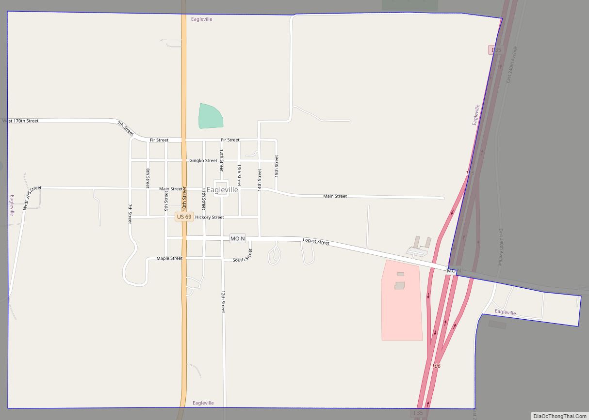
Online Interactive Map
Click on ![]() to view map in "full screen" mode.
to view map in "full screen" mode.
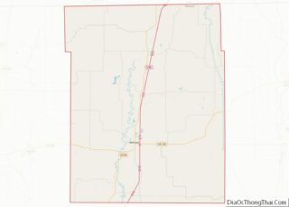
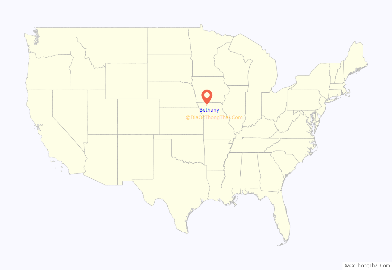
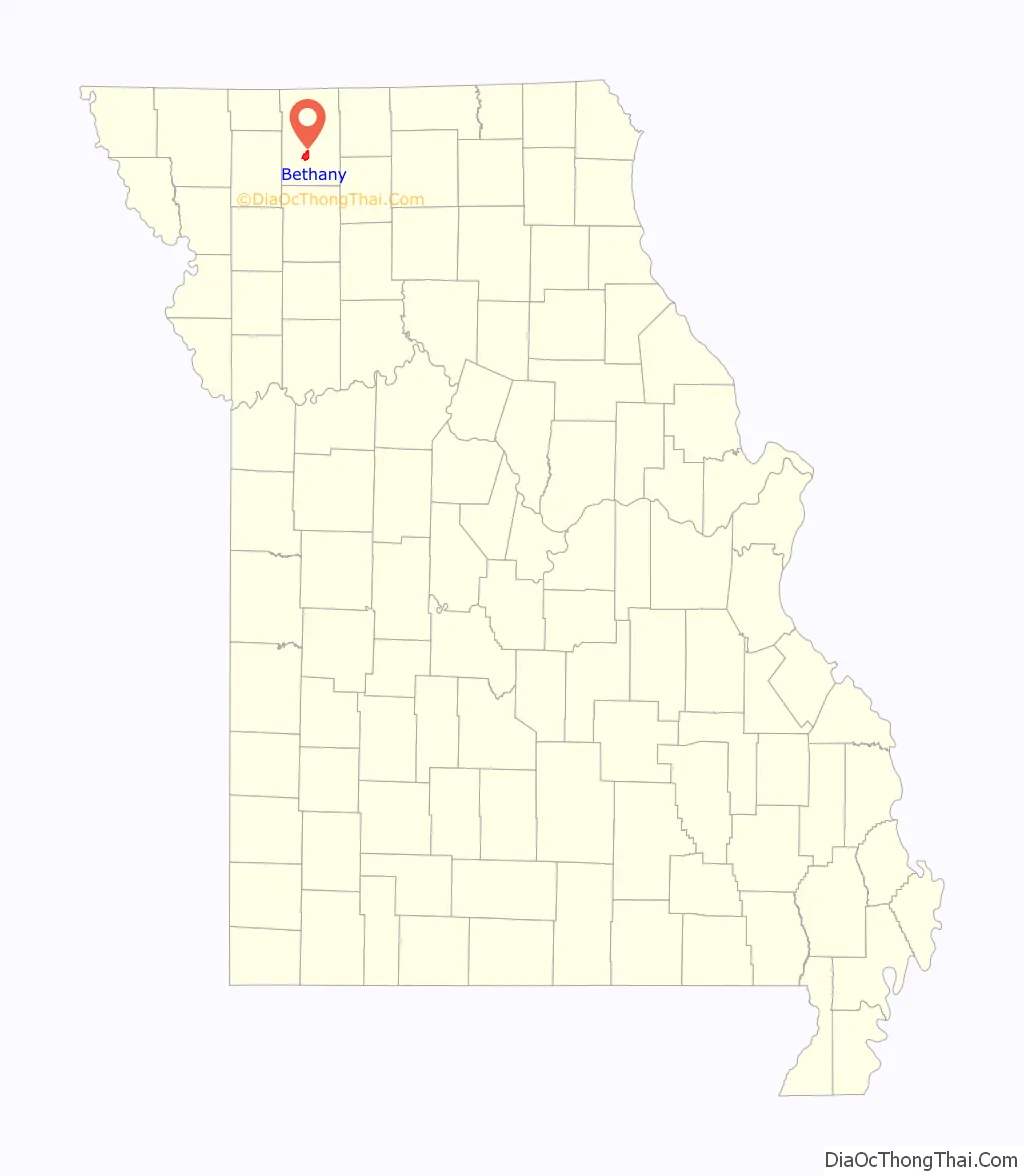
Bethany location map. Where is Bethany city?
History
The settlement of Harrison County began circa 1838, although the land was not surveyed and opened for entry until 1842. The county is named after Albert C. Harrison, a 19th-century Missouri political figure. Many of the early settlers to the area homesteaded along Sugar Creek and in the Bethany area. Three commissioners deliberated for several days to determine a site for the county seat, and voted to site it in the southern part of the county. The original name of the community was Dallas.
In June 1845, John S. Allen was appointed to survey the town into lots and offer the same for sale. The plat, covering 19 acres (7.7 hectare), was completed on June 27, 1845.
The first home constructed in the community was built by John S. Allen. Although built as a residence, it was primarily used to store the first stock of goods brought to the community. It was destroyed by fire in 1864.
The Chicago, Burlington and Quincy Railroad reached Bethany in 1880. Two other railroad lines were also later laid into the county. The railroad influenced the economy and environment of the community until the early 1980s, when the last train pulled out of the Bethany Depot and the tracks were removed. Transportation was an important industry to the community and the population grew to its greatest level around the turn of the century when over 24,000 persons lived in Harrison County.
Industry played a vital role in Bethany’s growth starting with Colonel C.L. Jennings who erected the first steam mill around 1854 in the northwest part of town; it produced both lumber and flour. Because the country was so new, little need for towns existed. For several years, only a few retail shops existed and development and growth of the town was slow but by 1855, Bethany was known as one of the best trading places in Northwest Missouri. An industrial park was established in the 1940s by the Harrison County Industrial Development Authority; the Bethany Memorial Airport was opened in 1944. The first tenant in the industrial park was Calhoun Manufacturing, making agriculture machinery. Lambert Manufacturing opened a facility in 1971 and Place’s Discount Stores also became a resident of the industrial park until 2001 when they sold to Pamida, with the distribution center remaining active in the park until its 2002 closure. The 120,000 square foot building was purchased by the home grown Bethany business Gumdrop Books following Pamida’s closure. Later additions to the park include Superior Waste, and Tri-State Carports, which opened for business in 2001. The 1990s were a period of aggressive growth, especially within the service industry with the addition of several motels and restaurants. There has been several million dollars investment each year during the 90’s and an increase of nearly 100 jobs annually.
Through the years, development continued and included the construction of a lake in 1935 to serve the water needs of the community. In 1960, a second lake was added so that Bethany could meet the increasing water needs. The Harrison County Lake was completed in 1994 and provides a third source of water for the community. In 1954, residents voted to issue bonds to build a municipal swimming pool. Numerous other utilities were upgraded from 1930 to 1970 including the construction of a water tower in 1989 to serve growth along the north side of town. In 1996, residents approved a sales tax to extend water lines from the new tower to the south side of town which resulted in a looping of the system and improved water pressure for many areas. The sales tax also funded the reconstruction of Main Street from Highway 69 to the square.
Transportation, which played an important role early in Bethany’s history, came to play an even bigger role in the 1960s when Interstate 35 was constructed. This north-south four-lane highway connects Canada with Mexico. The interstate ran along the east side of town and since the completion of the interstate in the early 1970s, the community’s growth has been in that direction.
The Hamilton House and Slatten House are listed on the National Register of Historic Places.
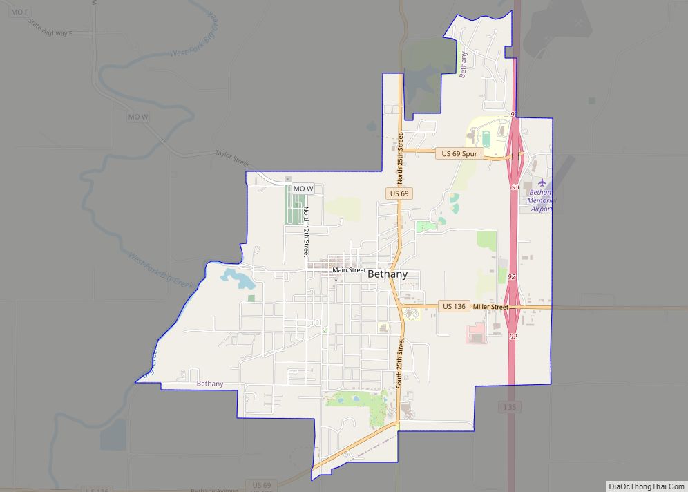
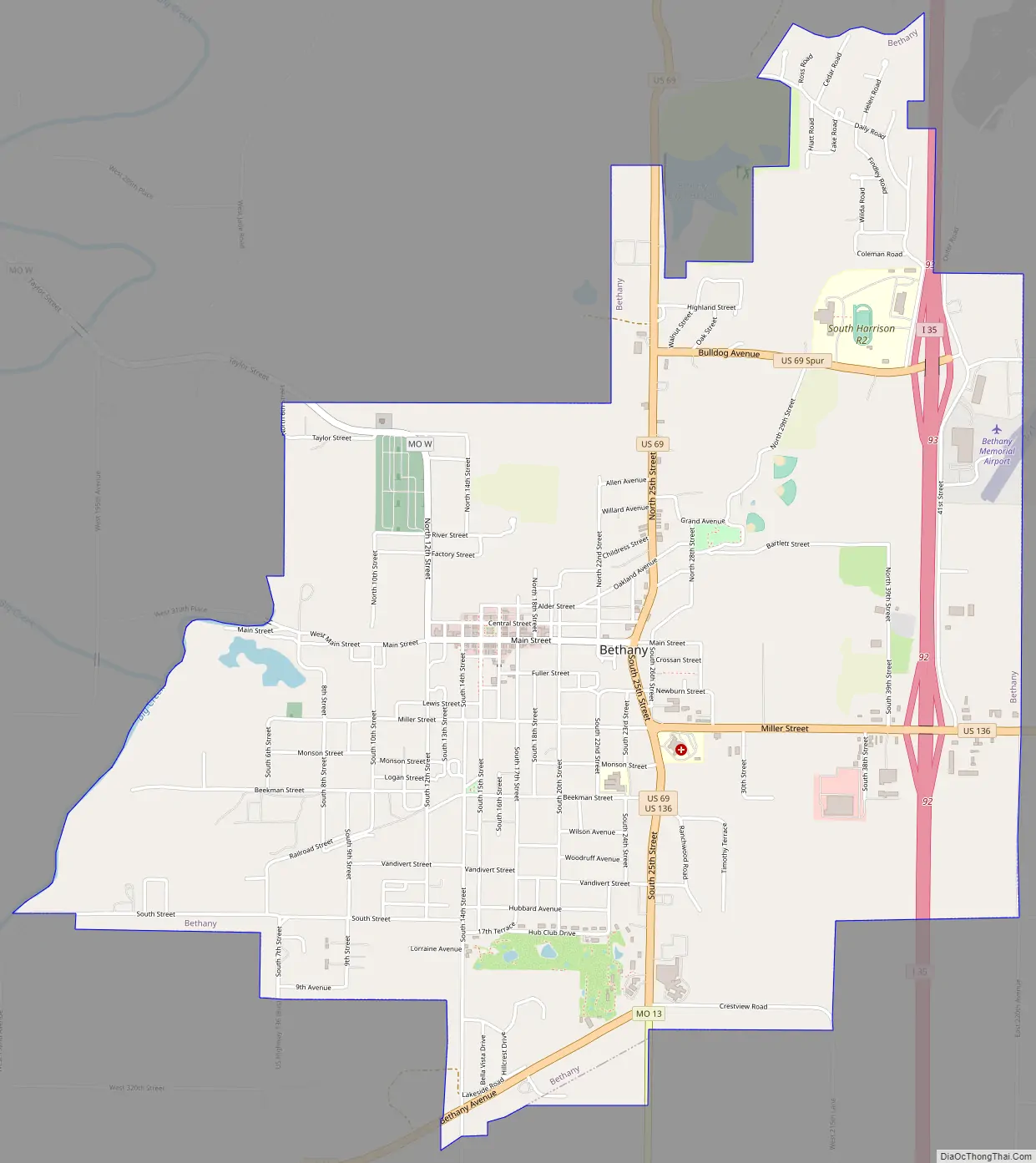
Bethany Road Map
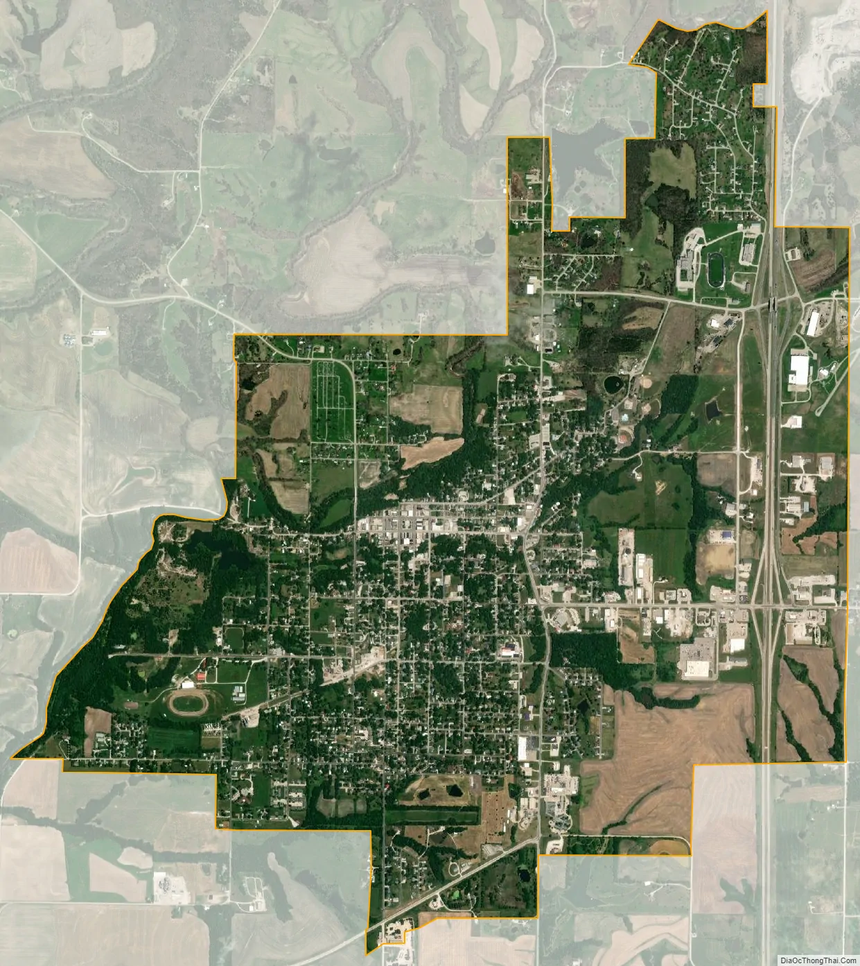
Bethany city Satellite Map
Geography
Bethany is located in west central Harrison County. Big Creek flows past the western portion of the city. The city is served by I-35, U.S. 136 and U.S. 69.
According to the United States Census Bureau, the city has a total area of 4.48 square miles (11.60 km), of which 4.44 square miles (11.50 km) is land and 0.04 square miles (0.10 km) is water.
Climate
Bethany’s climate is characterized as a humid continental climate with distinct influence from subtropical air masses in summer along with cold winters.
See also
Map of Missouri State and its subdivision:- Adair
- Andrew
- Atchison
- Audrain
- Barry
- Barton
- Bates
- Benton
- Bollinger
- Boone
- Buchanan
- Butler
- Caldwell
- Callaway
- Camden
- Cape Girardeau
- Carroll
- Carter
- Cass
- Cedar
- Chariton
- Christian
- Clark
- Clay
- Clinton
- Cole
- Cooper
- Crawford
- Dade
- Dallas
- Daviess
- De Kalb
- Dent
- Douglas
- Dunklin
- Franklin
- Gasconade
- Gentry
- Greene
- Grundy
- Harrison
- Henry
- Hickory
- Holt
- Howard
- Howell
- Iron
- Jackson
- Jasper
- Jefferson
- Johnson
- Knox
- Laclede
- Lafayette
- Lawrence
- Lewis
- Lincoln
- Linn
- Livingston
- Macon
- Madison
- Maries
- Marion
- McDonald
- Mercer
- Miller
- Mississippi
- Moniteau
- Monroe
- Montgomery
- Morgan
- New Madrid
- Newton
- Nodaway
- Oregon
- Osage
- Ozark
- Pemiscot
- Perry
- Pettis
- Phelps
- Pike
- Platte
- Polk
- Pulaski
- Putnam
- Ralls
- Randolph
- Ray
- Reynolds
- Ripley
- Saint Charles
- Saint Clair
- Saint Francois
- Saint Louis
- Sainte Genevieve
- Saline
- Schuyler
- Scotland
- Scott
- Shannon
- Shelby
- Stoddard
- Stone
- Sullivan
- Taney
- Texas
- Vernon
- Warren
- Washington
- Wayne
- Webster
- Worth
- Wright
- Alabama
- Alaska
- Arizona
- Arkansas
- California
- Colorado
- Connecticut
- Delaware
- District of Columbia
- Florida
- Georgia
- Hawaii
- Idaho
- Illinois
- Indiana
- Iowa
- Kansas
- Kentucky
- Louisiana
- Maine
- Maryland
- Massachusetts
- Michigan
- Minnesota
- Mississippi
- Missouri
- Montana
- Nebraska
- Nevada
- New Hampshire
- New Jersey
- New Mexico
- New York
- North Carolina
- North Dakota
- Ohio
- Oklahoma
- Oregon
- Pennsylvania
- Rhode Island
- South Carolina
- South Dakota
- Tennessee
- Texas
- Utah
- Vermont
- Virginia
- Washington
- West Virginia
- Wisconsin
- Wyoming